Page 2
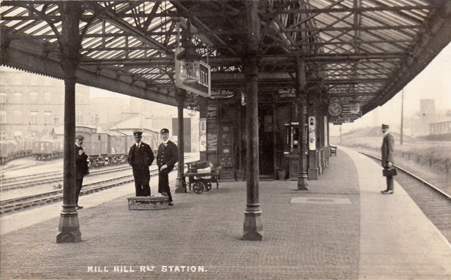
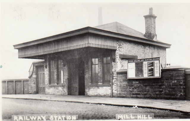
Mill Hill Railway Station Entrance and Booking Office
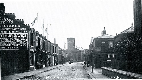
On Eccles Bridge New Chapel Street
Mill Hill Railway Station platforms With a View of The
Sidings And Engine House
The railway goods yard at Mill Hill was a great boost to the many central cotton mills,
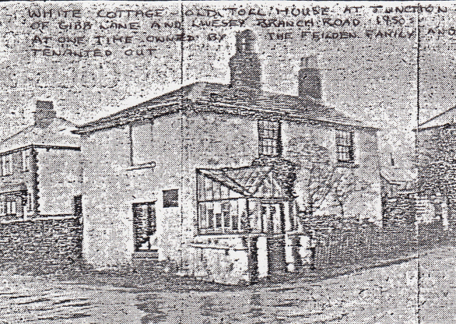
e.g. Mill Hill , Waterfall, Woodfold, Waterloo, Cardwell, Primrose and Griffin mills sited away from the canal making it easier for the movement of goods. Since 1848 the Turnpike Toll roads suffered due to the increased use of rail travel therefore roads became free of tolls due to the competition e.g. Livesey Branch Road toll ceased in 1873. White Cottage sited at the junction of Gibb Lane at one time owned by the Fielden Brothers and tenanted out was an old Toll House (see photo below).
White Cottage Toll House
The 1895 map shows a large increase in streets built to connect the many newly built mill terraced houses and shows a more well defined road network with Shorrock Lane, King’s Road and Moorgate Street providing good links from Livesey to Mill Hill and Mill Hill Bridge Street, Queen Victoria Street and Parkinson Street linking to New Chapel Street (central Mill Hill) from Spring Lane, Witton and Blackburn.

Spring Lane Linking Into Mill Hill From Witton
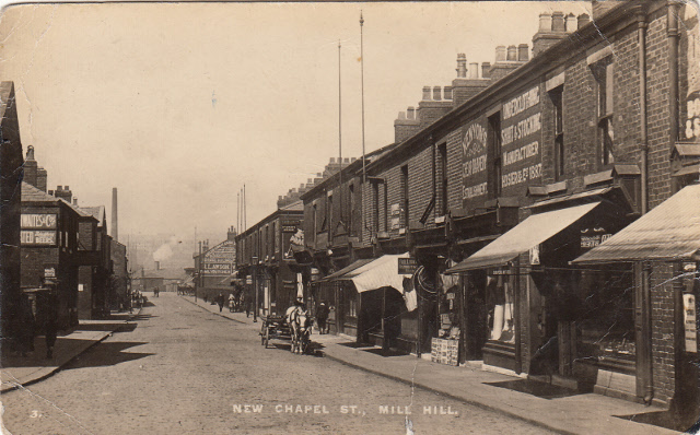
Between 1895-1900 Blackburn Rural District Council administered local government services in Mill Hill/Livesey as the area was now incorporated into Blackburn as the town grew steadily outwards and met this settlement. When Lancashire County Council was formed in 1888 it took over the repair of main roads, largely the old turnpike roads of the area with many of the streets originally being in private hands so street surfaces varied in quality from earth to cobble. New Chapel Street by 1895 had become a vibrant centre of Mill Hill (as today) lined with a great variety of shops offering all kinds of services and goods as Mill Hill was very much a self-contained community with an increased population who required a whole range of necessities without having to travel into Blackburn centre.

New Chapel Street Looking Towards The Railway Station 1900’s
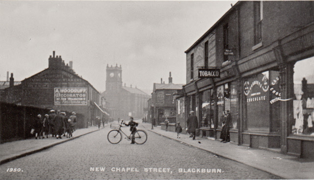
New Chapel Street Looking Towards Mill Hill
Congregational Church and Kings Road
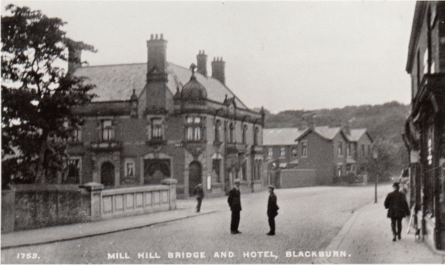
Alongside these developments many public houses were established offering mill workers and local inhabitants an outlet for their limited social time with Mill Hill Hotel on Mill Hill Bridge Street being a good example with its own bowling green as an added attraction
Mill Hill Hotel On Mill Hill Bridge Street 1900’s
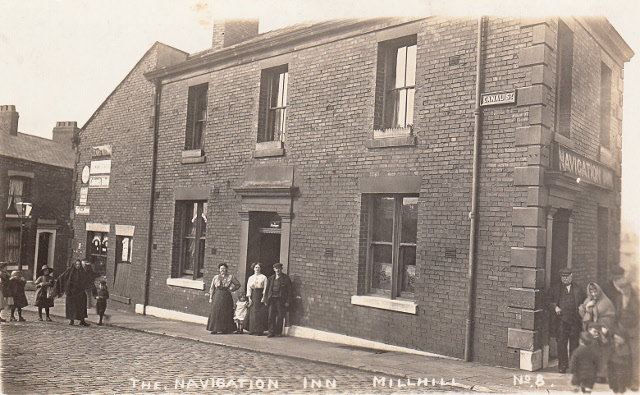
Alternatively the Navigation Inn on the banks of the Leeds Liverpool Canal off King’s Road was a more typical local inn but featured prominently as it was close to Angela Street where many canal bargees lived and had its own stables behind probably for bargees’ horses.
Navigation Inn With its Landlady Mrs Riding- 1900’s
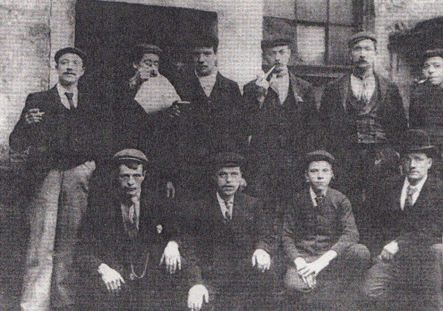
Bargees Posing At The Rear of Navigation Inn – 1900’s
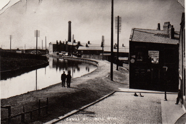
View From The Front Of The Navigation Inn With The Canal
And Victoria Mill In The background – 1910’s
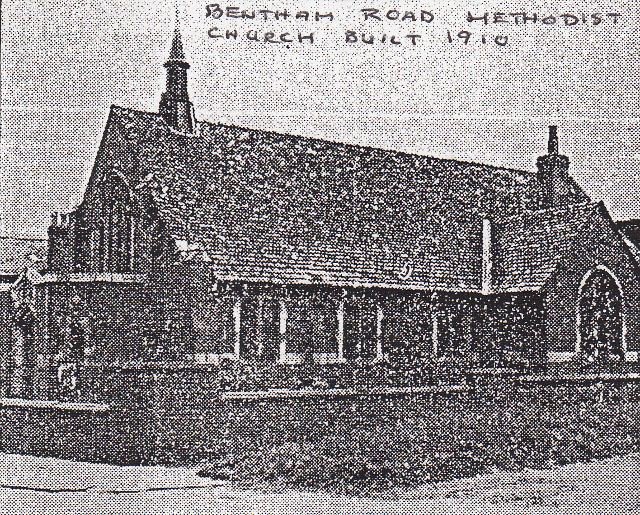
Mill Hill Council School had now grown much larger due to the increased number of children in the area and now had well equipped classrooms and play areas. In 1903 a new wing was added to the school with an Assembly hall on the second floor and a new infant’s school on the ground floor. Mill Hill St. Peters Catholic School had also been built and was now a large two storey church and school to meet the needs of the Mill Hill and Bower House areas with accommodation on the ground floor for over 600 children and on the upper floor seating for 750 people in the church area costing £5000 with father Kirwan raising £3500 towards this. Other than this Bentham Street Primitive Methodists had grown since 1822 starting in a small cottage, then moving to a corrugated iron structure on land by Bentham Street but by 1895 had a larger structure to meet its local needs but by 1899 had started to build a church and school which was completed in 1910 at a cost of £1500. The old iron corrugated building was moved to the rear as a Sunday school. The new church can accommodate over 200 people and is built of brick. The first minister of Bentham Road church was Thomas Maxwell who served from 1886 to 1889.

Bentham Road Methodist Church
St. Andrews school was erected in1849 on Livesey Branch Road helped by donations from the Feilden family (William and Joseph) with the school room built to meet the needs of children in the Moorgate/Livesey area and also operated as a church room for local worshippers. However it was too small for a church therefore funds were raised and the foundation stone laid for the new church on the opposite side of Livesey Branch Road close to Moorgate Street in 1866 by Mrs. Joseph Feilden. The Gothic styled church was then built by Messrs. Achwall and Broughton at a cost of £4500 rising to £6000 due to additional work. Once built the church could accommodate 652 people with the church land having been bought from the trustees of J. Eccles. George Whiteley who had his large cotton mill nearby at Ewood and who lived at Woodlands, Livesey contributed freely to the church building fund helped by the actions of Reverend T.C. Watson with his fund raising activities and a bazaar opened by Henry Feilden at the Town hall Blackburn. The church opening and consecration was conducted by the Bishop of Manchester on the 17th February 1877 and my great-great grandparents Mr. Eddleston and Miss Jane Howarth (or Lawson) were the first couple to be married at this church and were given a large bible in recognition.
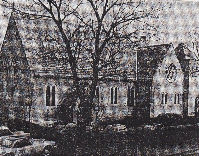
The Parish Church of St. Andrews, Livesey
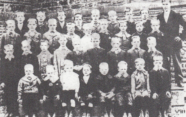
A Group of Pupils at St. Andrews Primary School
With Their Teacher 1905
The above picture taken in 1905 shows the teacher with a class of 34 boys and was taken in the playground to the rear of the school which also took on the role as a Sunday School for children of the area. St Andrew’s Church was closely connected to Immanuel Church at Feniscowles which was originally its parent church and part of the parish.
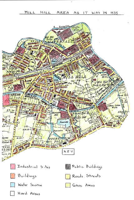
Ordnance Survey Map of Mill Hill and Livesey 1935
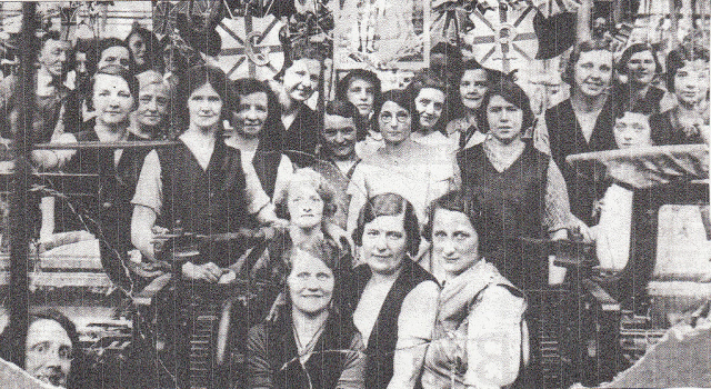
Weaving Operatives at Pioneer Mill Who Have Decorated The Weaving Shed With
Bunting to Celebrate The Coronation of George V1 In 1936
Malvern Mill was a large weaving mill built on the site of the old brick and tile works of the Orlando Brothers. Textile in the area was still surviving but had been through many boom and bust periods as companies changed hands or became empty due to the downturn and not helped by world wars. The other major changes shown on the map are the increase in terraced housing infilling open spaces and increasing urban sprawl especially in the Mill Hill, Bower House Fold and Waterfall areas with most of this housing built in the 10 years following 1895. The largest growth of the grid-like housing areas was west of New Chapel Street where streets such as Francis Street, St. Georges Avenue and Stephen Street were completely infilled around Mill Hill School. Another area of increased housing is a lateral development along Shorrock lane where semi-detached houses were first built. Blackburn Corporation also started to build new council housing from 1919 with a pilot scheme at Green Lane between Brothers Street, Shorrock Lane and Livesey Branch Road. These houses were semi-detached with bathrooms and inside toilets for the first time as facilities improved. The first houses were completed in 1920 and by 1935 houses had been completed around the edges of the area alongside Livesey Branch Road and Brothers Street. Evidence of increased brick and tile production to the east of New Chapel Street to meet the early house building from 1895 is shown but by 1935 this had decreased. Other changes in the area shown on the 1935 map are the increase in places of worship and schools to meet the needs of the growing population. St. Aidan’s Church of England School had its origins as a Sunday School where services were also run in a room at Stakes Hall unofficially dignified by the name Stakes Hall Cathedral. Later a foundation stone for a new school was laid by Sir John Rutherford Bart and over time with fund raising a school was built in the early 1900’s on Norfolk Street and additions added to it as it grew in size. However the school was difficult to use as a church as equipment had to be continually moved to create space for services. As a consequence although St. Aidans parish was announced on 22nd December 1925, it was a parish without a church which therefore became a priority for fund raising to build one. A new church and vicarage was built by 1932 with a large red brick chapel capable of holding 300 people and a grand vicarage built next to it.

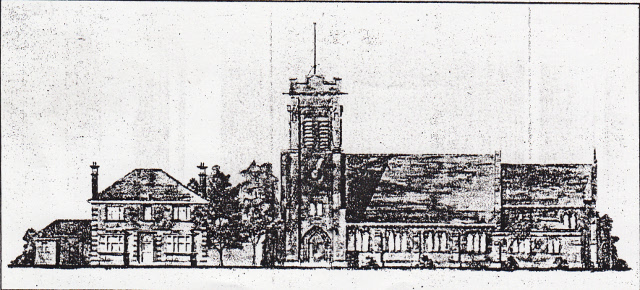
St. Aidan’s Church and Vicarage

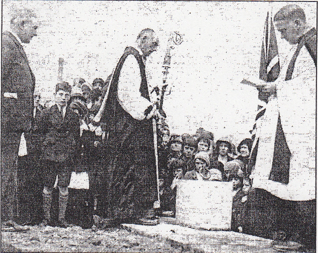
Laying of St. Aidan’s Foundation Stone 1931
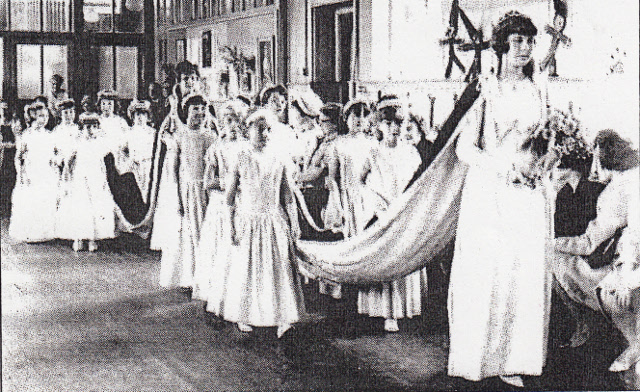
Rose Queen Coronation at St. Aidan’s Church
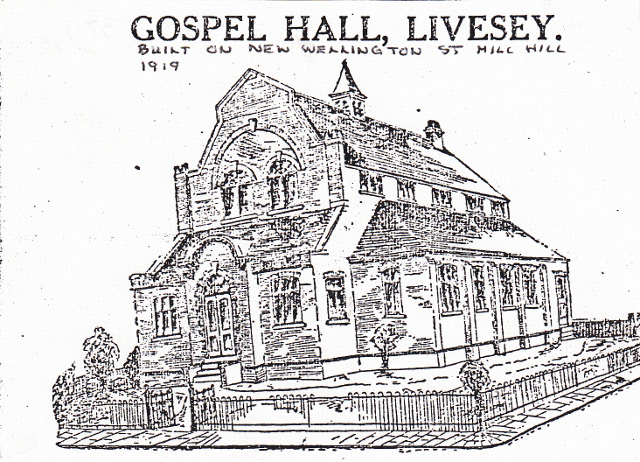
In 1890 a Gospel hall was established in Moorgate Street in a small building but as the population rose it was decided to build a new Hall on a suitable site alongside New Wellington Street with a central hall and classrooms, giving accommodation for 500 persons. The brick built Elim Gospel Hall was formerly opened on the 8th March 1913 at a cost of £1300 (see photo below). An additional church built in Mill Hill since 1895 was St. Georges Free Church built on St. Georges Avenue and opened in 1907founded by the Reverend Henry Sebay.
Elim Gospel Hall on New Wellington Street
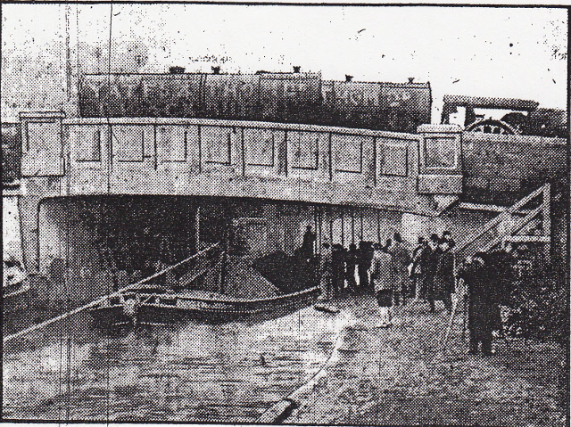
Another notable feature of the 1935 map is Green Park Recreation Ground that was established alongside the Leeds Liverpool Canal embankment south-east of Mill Hill Brick and Tile works. This had four bowling greens including two circular ones and established garden areas indicating the growing need for public leisure facilities being met here by the Local Authority Parks Department. At the same time football pitches had been established on both sides of Griffin Mills with Mill Hill St. Peter’s and Griffin Football pitches. By 1935 there was a much larger system of roads and streets and all major roads through the area had been upgraded by widening, better surfaces and improved bridges as motor transport was more evident especially bus services for the increased population use.
The Opening of Moorgate Street Bridge Over The Canal
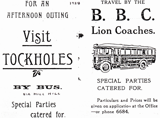
During this period of development there had been a significant increase in bus transport replacing earlier trams, first by the Blackburn Bus Company providing easier access into Mill Hill and Livesey from other areas of Blackburn.
Blackburn Bus Company Lion Coaches Advert 1928
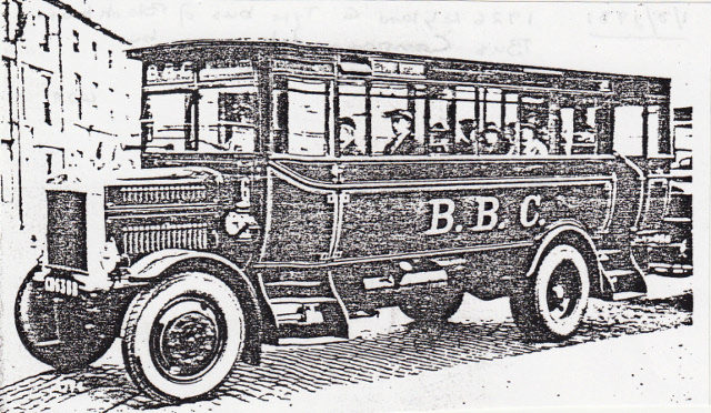
Blackburn Bus Company Leyland G Type Bus 1926 That
Was Taken Over by Blackburn Corporation Bus Company
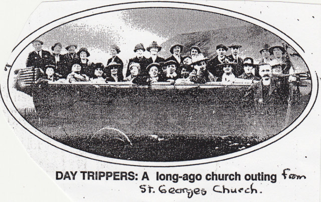
St. George’s Church Outing by Charabanc 1920/30’s
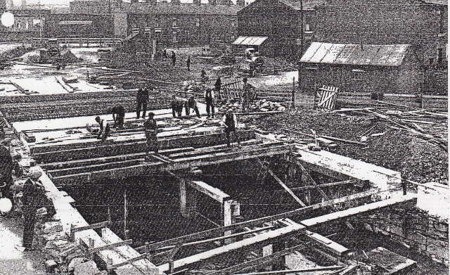
Blackburn Council had by now started a new orbital road route in the 1930’s to join Preston New Road via Buncer Lane, Spring Lane and Hollin Bridge Street to Bolton Road on the fringe of Mill Hill/Livesey which would significantly improve access into Mill Hill as motor traffic increased.
A Section of The New Orbital Road AQlong Hollin Bridge Street
where The River Darwen is Covered Over by The Road
At the time of the 1935 map all cotton mills operating in the area were now using electric power rather than the earlier steam power to operate machinery.
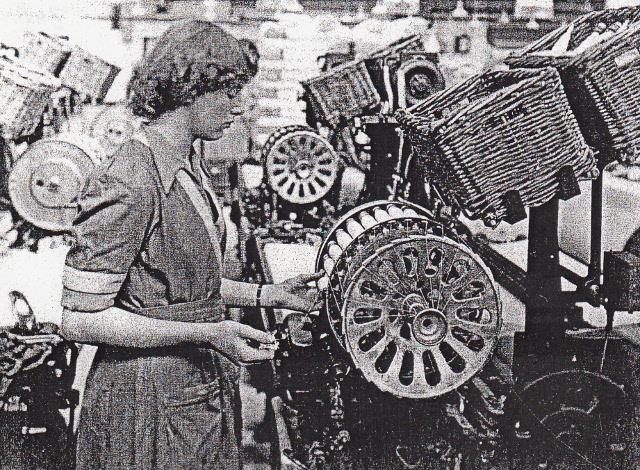
A Battery Filling of Shuttles For an Automatic Lom at Waterfall Mill
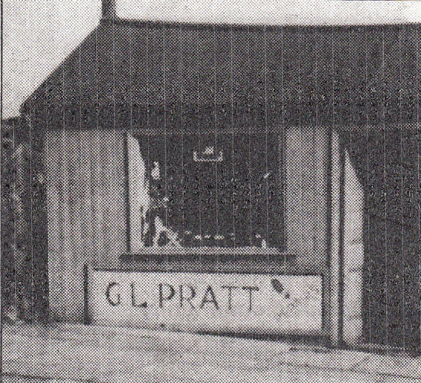
During this period local business premises grew further along Mill Hill Street, New Chapel Street and New Wellington Street and along streets off them to meet the growing population’s needs e.g. G. L. Pratt’s Cobblers Shop at the top of Parkinson Street a family business that continues to today after it evolved from shoes to sports equipment.
George Pratt’s Shoe Repair Shed on Parkinson Street-1950’s
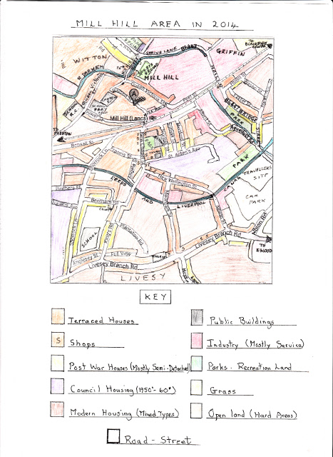
Map of Mill Hill And Livesey Area 2014
The above map shows that over the last 79 years from 1935 the area has gone through the largest changes in its history as the area has become completely urbanised and is now an extension of Blackburn Borough and no longer independent. There have been huge changes to the industry of the area as many of the former textile mills have been demolished or changed into units for other work. This was due to the textile industry in Lancashire almost going out of existence due to foreign competition and the old sites being redeveloped into new service industry centres or sub-divided into smaller units that are rented out. Mills that have been demolished include Mill Hill, Woodfold, Waterloo, Cardwell, Albert, Primrose, Malvern, Moorgate, Bridge and Albion mills. Surviving mills include parts of Waterfall, Pioneer, Griffin and Spring Bank mills. The effects of these developments are summarised below:-
1. Mill Hill Cotton Mill: Demolished and the site used by Neilds Scrap Metal but presently unused.
2. Woodfold Mill: Demolished and a workshop for the blind built on the site but more recently used for the disabled.
3. Waterfall Mills: A large section has been demolished, another large section used by MDA storage with the remainder sub-divided into smaller service industry units.
4. Waterloo Mill: Both mills have been demolished and both sites redeveloped
Cardwell Mill: Into a huge new storage building for MDA storage.
5. Albert Mill: Demolished and a small private housing estate built on the site of mixed types.
6. Primrose Mill: Demolished with part of the site developed into St. Peters Primary School and the rest as recreation facilities.
7. Victoria Mill: Both mills demolished and their sites redeveloped into a new
Malvern Mill: Private housing area and the rest with new service industry
units.
8. Moorgate Mill: Demolished with the site used for a new private housing
estate of mixed types.
9. Bridge Mill: Demolished with new industrial buildings built on the site now
used to produce medical supplies.
10. Pioneer Mill: Taken over by Netlon who produce a wide variety of netting but
recently taken over by another service industry user.
11. Griffin Mills: Was taken over by Dutton Carpets but more recently by another
service Industry user.
12. Spring Bank Mill: Taken over originally by Fenniger and Blackburn shoe
makers but now operated by a heavy engineering company
13. Albion Mill: Sub-divided into service industry users including leisure.
A new industrial estate was built in the 1990’s in the Waterfall area between Waterfall Mill and Hollin Bridge Street with a mixture of different sized units with a variety of service industry users. The old Stakes Hall farm buildings are still intact but now sub-divided into small industrial units mostly for motor vehicle service industries. At the Ewood end of Livesey Branch Road a small retail park was developed where Iceland and McDonalds are the main users. At the top end of Parkinson Street is sited Station Garage that deals in car repairs.
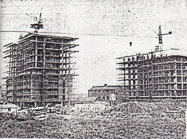
The largest changes however in the area has been the huge increase in modern housing infilling many former industrial brown-field sites and other unused land or farm land alongside large changes to the character of many existing traditional terraced housing. Since 1935 the large Green Lane Council Housing Estate was completed after the 2nd. World War in the early 1950’s and mostly consists of semi-detached housing with some shops to provide services. In more recent times the estate has been upgraded by council make-overs and many occupiers have bought their houses under Government Right to Buy Schemes. Another large council house development converted unused land on the former brick and tile works between New Wellington Street, St. Aidan’s Avenue and Albert Street in the early 1970’s which won an award for its design and facilities. This development included semi-detached, town houses and low level and high level flats together with innovative play areas and a social club.
View of The High Rise Flats Off St. Aidans Avenue Under Construction
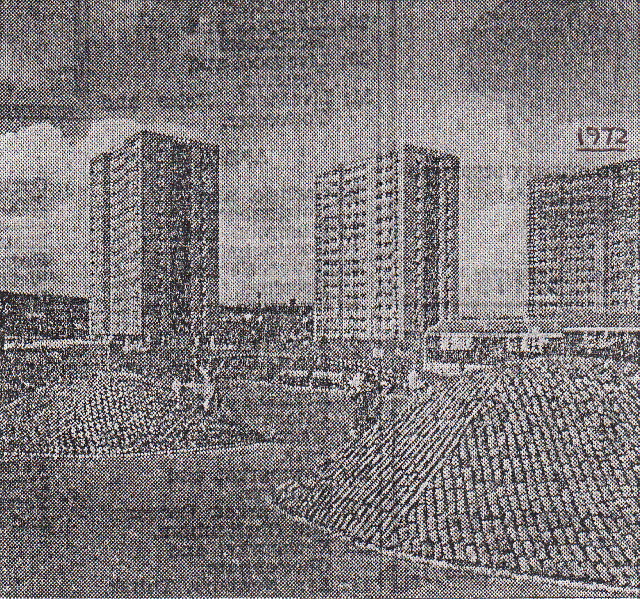
1972 View of The Three Completed High Rise Flats
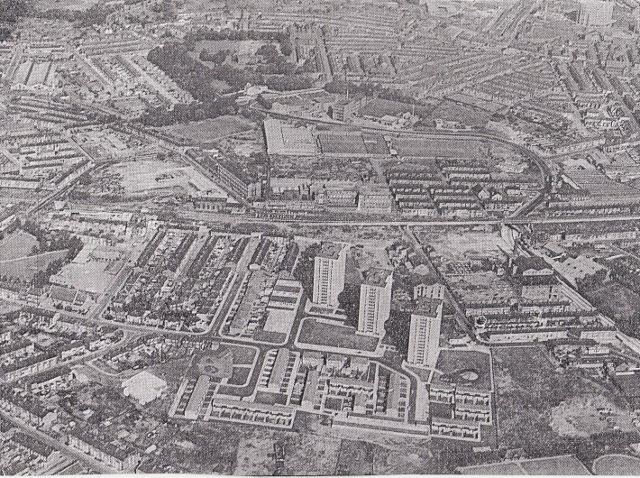
A 1973 Aerial View of The Mill Hill Area And The New Council Estate
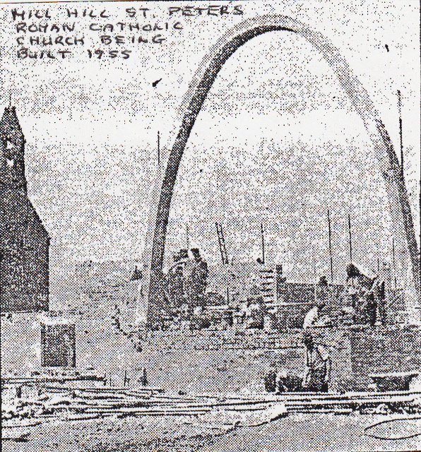
In more recent times the three high rise flats have been demolished and the cleared site used to build residential housing flats and a health centre. At an earlier period from the late 1960’s European funds have been used to radically upgrade large areas of existing terraced houses via renovation grants where whole rows were modernised with new external brick work, new roofs, new windows, new rear walls and new bathrooms with inside toilets. In other cases householders could apply individually for council grants to improve their buildings and as a result few original unchanged terraced houses now exist in Mill Hill, however in the upper Livesey area around Livesey Branch Road and Moorgate Street there have been fewer changes. Since the 1980’s huge areas of new modern housing as infilled many areas often with small private housing estates with semi-detached, town houses and detached dominating. The largest new housing area was developed between Kings Road and Moorgate Street and beyond towards Albion Street where larger housing estates have been created. In more recent times the whole area north of Livesey Branch Road has been developed with various housing estates significantly increasing the population of Livesey. This in turn has put pressure on existing services especially schools and led to new primary schools being built for St. Andrews and Meadowhead. During the 1950/60’s the ends of terraced housing streets off Parkinson Street were extended with semi-detached houses e.g. Norfolk, Suffolk and Hertford Streets. Finally over at Ewood open land near the Leeds Liverpool Canal was developed into car parks and a Traveller’s Site. Other changes in the area involved Mill Hill St Peters building a new church in the 1950’s and Mill Hill Chapel being demolished and the congregation relocating to a part of the old Mill Hill Primary School with other parts used by the Youth Service.

The New Mill Hill St. Peters Church Under Construction
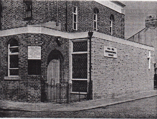
Mill Hill Congregational Church In Its New Location
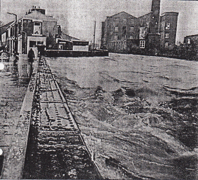
After numerous problems with flooding in the lowest parts of Mill Hill mainly in the Waterfall area where the River Darwen overflowed its banks considerable work was completed to create a new faster central river channel on its bed and repairs made to the brick walls of the banks to speed up the flow of water through the area with additional new concrete banks.
View of The River Darwen Over Flowing at Hollin Bridge Street
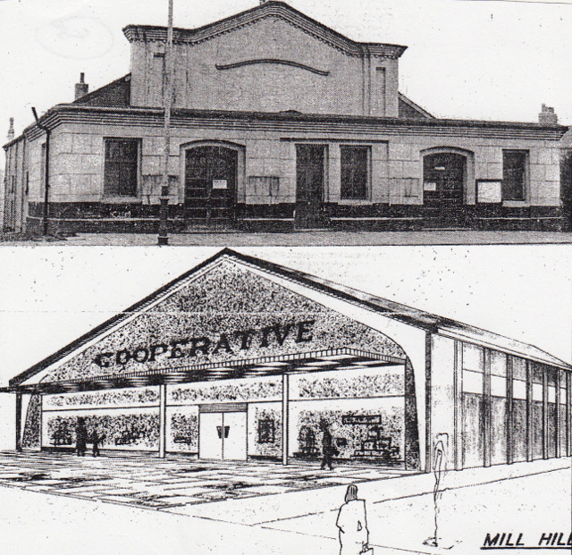
The original Palladium Cinema built in the Overlockshaw area of Mill Hill has been replace by a mini supermarket originally the Co-Operative society and now a Spar.
View of the Old Cinema And The New Supermarket Built In The 1960’s
Many changes have occurred to the areas road system due to the vast increase in motorised transport and have led parking restrictions on the main streets, speed bumps to slow traffic, increased traffic lights and pedestrian crossings and the removal of almost all the original cobbled street surfaces. Mill Hill Park has been upgraded and now includes a comprehensive children’s playground to add to the areas facilities. Mill Hill and Livesey are today a popular area to live with good local facilities and is well placed to meet the needs of the 21st century.
back to top
Mill Hill is quite small. The area is bounded by Witton, Ewood and Livesey. As the nineteenth century unfolded, Mill Hill acquired a church, school, canal, and railway with its own station. Of course, there were cotton mills with the never- ending rows of looms. This was where the money was made, with the majority of people forced to endure long arduous hours amidst deafening machinery. A strong community spirit developed.
Recently the area has lost one of its favourite buildings, the primary school [closed 1974]. I saw grown men and women with tears in their eyes as the school, which had been part of the fabric of their lives, was demolished. A single storey community centre has been built on the site.
The district formerly consisted of four isolated hamlets - Mill Hill, Overlockshaw, Bower House Fold and Stakes Hall. Stakes Hall, long since demolished, was reputed to be the home of the Astley family for nearly three hundred years.
The Astleys were once large landowners, and were former owners of Witton Hall. They may have fallen upon hard times for the family stone quarries at Billinge were sold off at about the same time as the Mill Hill estate was purchased by the Turner family.
Mill Hill printworks were established by Jonathan Haworth in the 1780s. Following the firm's bankruptcy the works eventually passed to Robert Turner's son William, who resided at Mill Hill House (which stood on the site of St. Peter's R.C. School).
William Turner- whose wife endowed the Turner alms-houses at Bank Top- was one of Blackburn's first MP’s, representing the town as a Whig from 1832-41. He was defeated by John Hornby, by only one vote. Turner died shortly afterwards in July 1842 and was interred in the family vault at St. John's Church, Blackburn.
The Mill Hill estate and printworks were sold in 1843 to Joseph Eccles. Most of the old print works were demolished as he erected the Mill Hill Cotton Mills on the site.
In 1847 New Chapel Street was merely a track running beside a tram road which linked Mill Hill Mill with the Leeds and Liverpool canal. The canal, completed in 1816, would have provided some work for the smithy at Overlockshaw. It also appears to have been a popular mooring, later census returns show that the area around Angela Street housed many bargees' families.
Joseph Eccles continued the role of philanthropist and benefactor. In 1847 he erected the original Congregational Chapel and school, which gave the street its name. The congregation soon outgrew the first floor chapel. In 1858 he donated £800 and provided the site for the Congregational Church. Other subscriptions increased the total to £1,500.
Mill Hill Congregational Church, seen in the distance, opened in September 1860. The exterior was renovated and the tower re-erected in 1912-13, the outlay was more than covered by the money raised at a successful bazaar.

The chimney on the left is that of the Pioneer Mill, erected in 1905, and controlled by the Mercers since the 1930s. Weaving ceased in 1964. The church was demolished in 1965, following the discovery of dry rot, to make way for the expansion of the works necessitated by the firms highly successful plastic mesh- Netlon. There is a reminder of the church today in Netlon's clock tower, provided by Brian Mercer to replace that of the church.
Services were held afterwards in the primary school, the frontage of which was extended. A replacement for the school was later built on Anglesea Street - Meadow Head Primary School. The old school building subsequently housed the library and community centre until it was closed and then demolished.
Although the Blackburn to Preston railway cut through Mill Hill in 1846, forty years were to elapse before the district developed to the extent to merit its own station. In 1859 Joseph Eccles built the Mill Hill Brickworks, which would presumably have supplied building materials for the district as it developed. Production continued until the 1890s when the buildings were demolished. A second brickworks operated nearby until the 1950s.
By the 1880s Mill Hill Cotton Works housed over 40,000 spindles and 900 looms, employing some 600 people. The business suffered during the depression of the 1920s. The mills were sold in 1933 and the waeving sheds were demolished. The mill lodge was filled in, and in May 1936 Mill Hill Gardens were formally opened. The four-storey spinning block survived until the fire of 1965 and was demolished in 1970.
As the cotton trade declined, so did the need for a goods yard, it closed in October 1958. The station survived the cuts of the 1960s. The waiting rooms were later demolished, and then in 1973 the ticket office, on Eccles Bridge, was ravaged by fire.
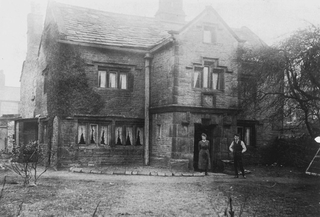
Another residence of the Astleys was Overlockshay, which had a datestone 1691. The initials "T A" and "R A" were possibly those of Thomas and Richard Astley.
The house, shown in the faded photograph above, survived into this century. In 1921 it was replaced by the Palladium cinema. In 1962 this building on New Chapel Street, was converted by the Blackburn Cooperative Society into what was then Blackburn's largest supermarket. It is now the Spar supermarket.
Today there are few reminders of the once prosperous Astleys in the somewhat run down Stakes area, apart from some farm buildings next to the Stakes Hall pub.
Parts of Mill Hill, however, have recently benefitted from a face lift; and in spite of all the demolition and change the strong community spirit has survived.
Sources used include :-
W A Abram; A History of Blackburn, 1877
G C Miller; Blackburn Worthies of Yesterday, 1959
M. Rothwell; Industrial Heritage, 2 Vols, 1985, 1986
Mill Hill School Bazaar Books, 1903-12
Various local newspapers, Blackburn Reference Library
Published July 2024
Transcribed by Shazia Kasim
Article first published in The Blackburn Local History Society Journal 1990. Pages 38-40.
Loading more