The Historical Development of The Wensley Fold Area in Blackburn
By
Mike Sumner
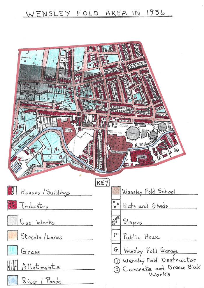
The Wensley Fold area originally fell marginally in the Witton Township because it was sited on the western edge of Blackburn’s Township. It is located on the lower valley sides falling from the Revidge ridge down to the valley floor which contains Bank Top, Griffin and Redlam. The southern boundary of Wensley Fold is close to the River Blakewater and its northern area below Preston New Road. Today, the area lies in the west of Blackburn, well within its current boundaries which have extended outward over time with its nearest Blackburn centre areas being Montague Street and St. Paul’s Ward. Its western boundary lies approximately at the Wensley Road/St. Mark’s Road junction and the whole Wensley Fold area is divided by the west to east Wensley Road an ancient route formerly called Wensley Street.
Early History
The area up to the 18th Century was predominantly a rural backwater with limited agricultural use other than grazing sheep with odd tenanted farmhouses tied to landowners. The section within the Witton Township was owned in early times by the De Chattertons dated around 1311, the Ratcliffes dated around 1346, the Standishes from 1468-1666 and the Astleys in the later 18th and early 19th.century who had an early textile printing business at Stakes Hall in Mill Hill and resided at Witton Old Hall close to what is now Buncer Lane (see Mill Hill articles on Cotton Town for details). As far as the Blackburn Manor is concerned ownership started in the Saxon Period with the Norman De Lacey family who held it till they were removed by Henry V11 in the 1490's. It was taken over by the Earl of Derby from the 1600's and later passed to Lord Fauconberg for £8650 until it was purchased by Henry Fielden, William Sudell and William Baldwin who were prominent citizens of the town. The Fieldens also built the Witton House mansion and developed the park around it together with
St. Marks Church which was a family chapel and was sited just west of the Wensley Fold area. The development of Blackburn's textile industry started with domestic spinning and hand loom weaving in local cottages including those in the Wensley Fold area. This can be substantiated because just outside the area, on the higher slopes, was Mile End Row consisting of late 18th century stone cottages, many of which had hand loom weaving rooms as did Manor Road cottages nearby, built as club houses.
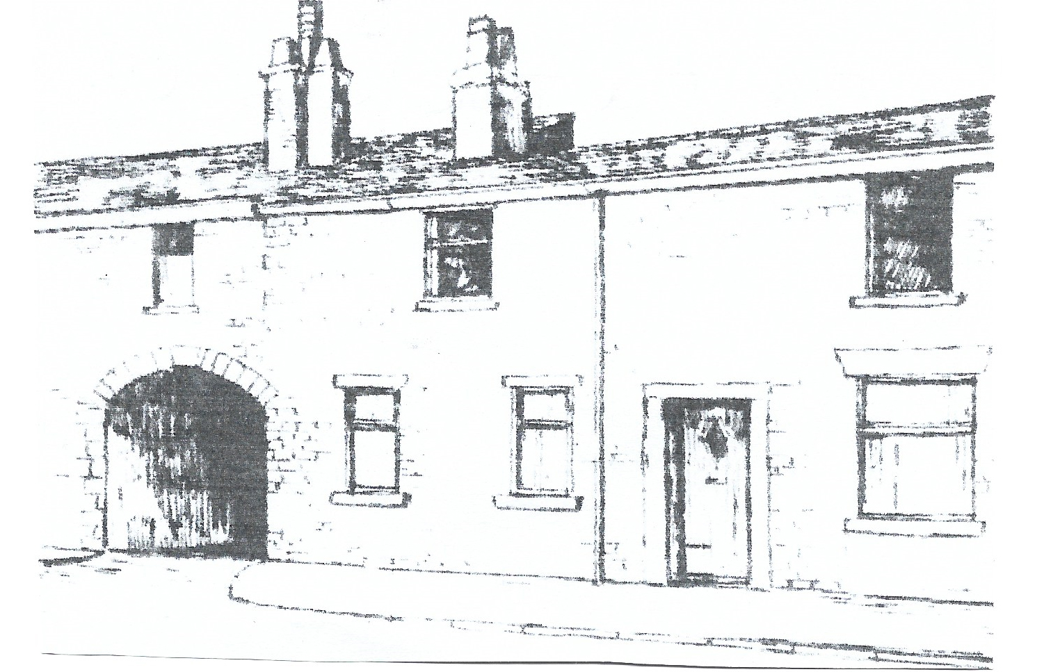
A sketch of the early stone cottages on Mile End Row where early domestic textiles occurred
Also on the northern edge of Wensley Fold was Miles Wife Hey, an ancient Jacobean farm, which probably had hand loom weaving apparatus within the low stone structure. Another feature that would have aided early domestic textiles in the Wensley Fold area was its proximity to King Street to the south. King Street was a centre of early textile production. Merchants or “putter outers” who had their warehouses sited there stored spun cotton from the early spinning mills and domestic sources which they supplied to the domestic hand loom weavers to convert into cotton/wool pieces which they then collected, had dyed and sold. Examples of such properties include –
39, King Street which was a three story building constructed in 1778 with cellars to store material owned by a calico merchant and later purchased by the Hornby family who later established Brookhouse Cotton Mills.
4, King Street was a three storey building and the home and business of Richard Cardwell a textile merchant.
2, King Street a similar building owned by William Leyland a textile merchant.
It was common for farmers and farm labourers in these early times to engage in domestic textiles particularly during the winter period in order to supplement their income and to supply the nearby “putter outers”. However, textile inventions in the 18th century such as the “Spinning Jenny” by James Hargreaves led to the development of the first textile mills and the start of the Industrial Revolution which contributed to the demise of the hand loom weaving trade.
The first textile spinning mill built in Blackburn was Spring Hill Mill, or, the “Factory Mill” built near the Railway Station and later built on by Dutton’s Brewery and operated by a primitive steam engine or “Puffin Billy”.
The second spinning mill to be built was Wensley Fold Mill. This was a water-powered “Throstle” spinning mill built in 1775 possibly by Joseph Lancaster. The early mill was destroyed in 1779 during the cotton riots caused by early mill building taking away the domestic textile work. However by 1793 Lancaster became bankrupt and the re-built mill was worked by various tenants including Needham Brothers of Macclesfield. The mill used throstle frames and spinning jennies to spin the cotton thread and soon added sheds for groups of hand loom machines with the spinning machines powered by a large water wheel on the River Blakewater. Early illumination in the mill was provided by gas brought to the site in huge leather balloons from Manchester as it was the first mill in Blackburn to be illuminated in the late 1790’s. By 1818, Blackburn’s original Gas Light Company had been established, and, by 1820, parts of the town had piped gas therefore demand grew and the town’s second gas works were established at Wensley Fold prior to 1848. These developments removed most domestic textile activity from the local homes, and, by 1815, a ‘Boulton and Watt’ steam powered engine powered mill spinning machines in the typical three storey spinning mills and mills changed from spinning jennies to “mule spinning” machines. By 1816, Lund and Foster took over Wensley Fold Mill and added large extensions between 1816 and 1822. In 1823 Wensley Fold Mill was named as one of Blackburn’s largest mill complexes with 330 workers which included 120 children, consequently, the mill developed a school roon and built considerable stone cottage properties for its workers nearby to rent out to its expanding work force such as in Spring Street.
Early stone cottages on Spring Street built by Wensley Fold Mill for its workers but now demolished.
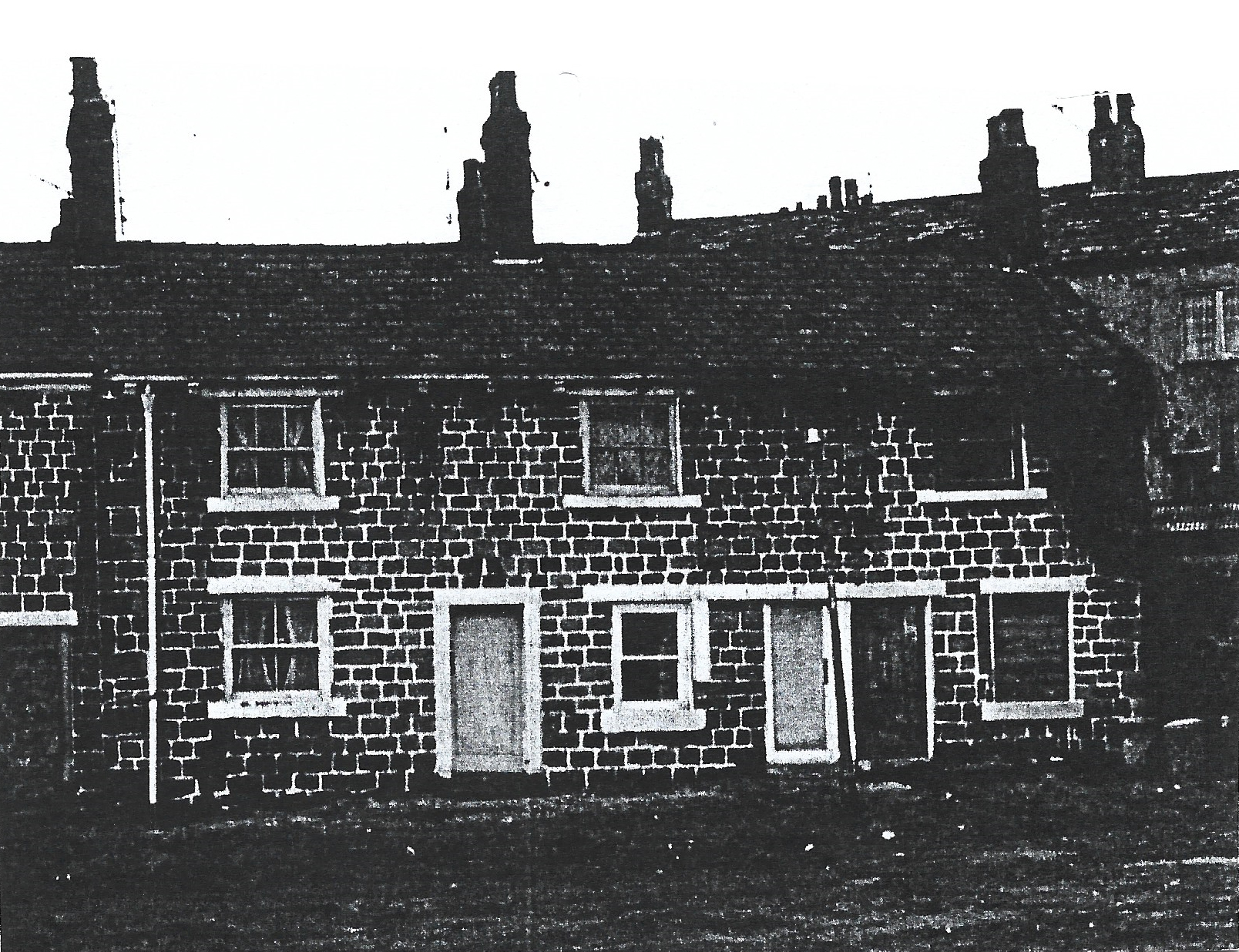
For many years most houses in the area were rented out by mill owners however some were acquired by other investors from the middle classes and let out to mill workers to obtain a regular return for their investment. In Blackburn co-operative ventures by a number of investors organised the building of streets of early houses. Lund Street running off Wensley Street named after a former owner of Wensley Fold Mill and running down past it was a good example of having stone cottages for mill workers to rent.
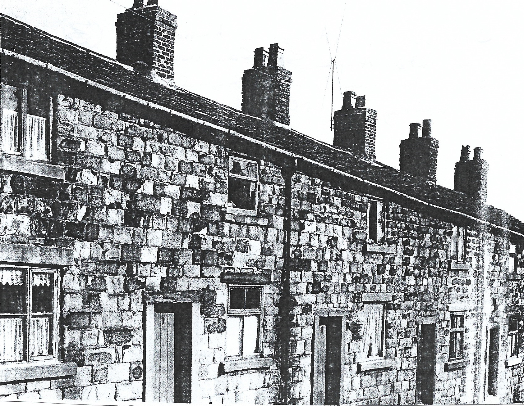
Old stone cottages on Lund Street which ran into Apple Street off the main Wensley Street.
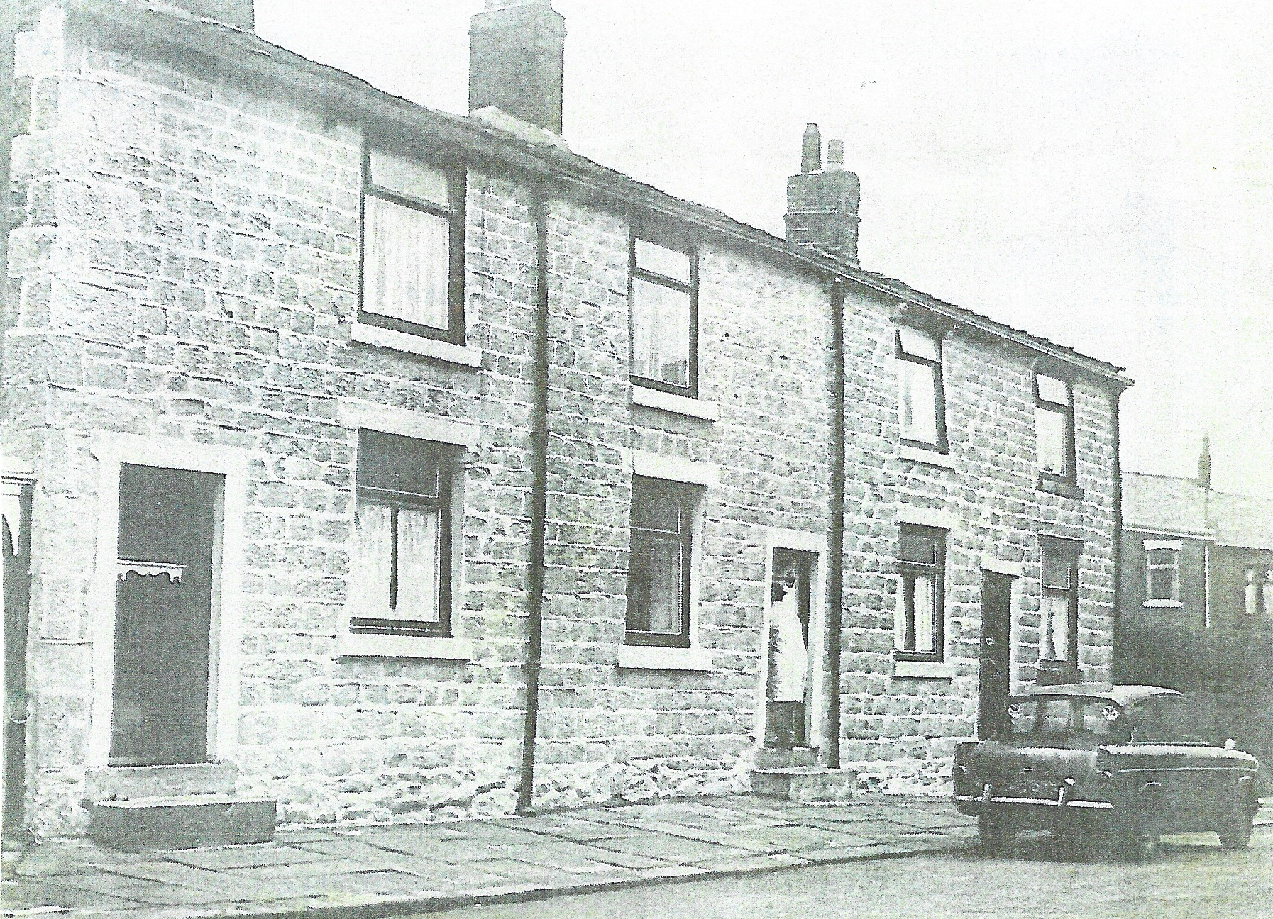
Most of these early cottages were built of sandstone obtained from quarries built into the higher sandstone ridge of Revidge and off the local Alder Bank area see 1848 map.
Original sandstone cottages built on Wensley Street and still present today.
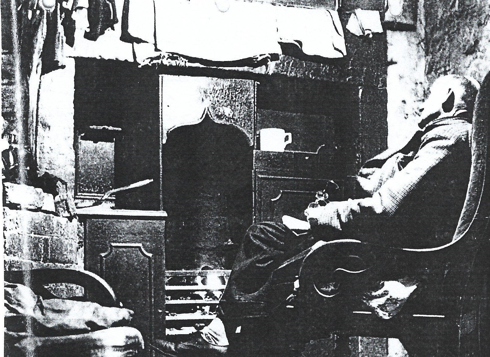
An interior view of one of the early stone cottages on Lund Street
showing an old man sitting in front of an original kitchen fire-range
which in the early days was used for heating water, cooking, heating kettles and drying washing.
The coal fire was usually kept alight for 24 hours.
By 1826 Blackburn mills, including Wensley fold, were introducing power looms into their weaving sheds. These looms were operated by steam power and Wensley Fold Mill, sited by the River Blakewater, was ideally placed to extract the water it required. Additionally, the mill was situated close to Bank Top railway sidings to receive the coal required to heat the water. However, the introduction of these new machines led to widespread unrest in the town as domestic handloom weavers lost their independence and work. Those hand loom weavers who managed to continue working concentrated on producing “fancy- good cloths” which mill looms couldn’t produce. By 1841, the number of handloom weavers in Blackburn had reduced from 15,000 in the early 1800’s to 1,000. By 1847, Robert Lund became bankrupt when a depression hit the cotton trade when Wensley Fold Mill had 22,812 mule spindles following a boom in spinning in 1845. A local man, William Eccles, a solicitor in Blackburn saw others investing in the textile trade such as Robert Hopwood who built Nova Scotia Mills, so, Eccles built Commercial Mills (“T Brick Factory”) nearby and became a large employer in the town. Eccles developed a reputation for looking after his workers and provided 60 to 70 garden plots for employees to grow their own vegetables. As he prospered, he extended his business by buying Wensley Fold Mill, and, by 1849, added a new mill with 11 weaving bays with new weaving looms. William Eccles and Sons held a great Tea Party for their extended workforce who marched to the party in procession headed by bands. Eccles continued to provide more cottages for his employees as well as a public swimming baths, which he opened for the benefit of locals to use as well as his workforce and a reading room for his workers. The movement from wooden to iron clad textile machinery especially the power looms was helped again by Wensley Fold Mills closeness to two iron foundries nearby, namely Bank Top Iron Foundry, established in 1836, which made horizontal engines for weaving mills and pumping engines. At the same time, Phoenix Foundry on Bank Top also manufactured looms, winding warping and sizing plant for textile mills and was owned by Dickinson and Dugdale.
A typical very early house in the area was Fox House. This was a small isolated farm situated north of Bent Gap Farm, just out of the area, below the later developed Preston New Road and close to the later site of St. Barnabas Church and school which was created close to Whitehead Street and Bromley Street, later becoming Davenport Road. Fox House was situated at the foot of a steep bank which carried Preston new Road and, it has been suggested, possibly acquired its name from fox hunting which had taken place in the area which may also explain why the ‘Fox and Grapes Inn’ on nearby Preston New Road acquired its name. Fox House, like nearby Bent Gap and Flash Gate, is shown on the 1818 and 1848 Ordnance Survey maps (see later). These farm buildings would, no doubt, have been involved in sheep farming.
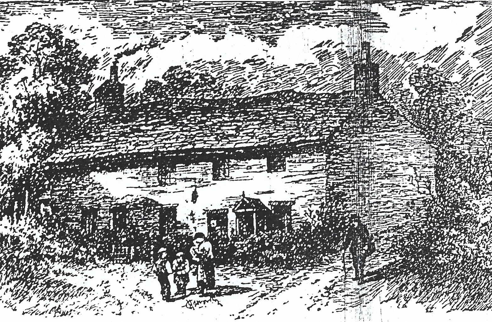 A sketch of Fox House farmhouse built of sandstone and both a long and low (two storey) building with a local footpath passing it which led to Blackburn and Wensley Fold areas.
During the first half of the 19th Century the general health of the inhabitants in the Blackburn area was poor with resultant regular outbreaks of infectious diseases in 1811,1825,1826,1832,1834,1852 and 1854. The main reason for this situation was the poor sanitary conditions which first led to effluent collections by pail from 1824. Other issues included overcrowding in existing housing, the lack of a clean water supply, lack of refuse collection and inadequate street and house drainage systems. By 1850, the River Blakewater which was controlled by stone walls and a central channel to speed up the water flow through the area in order to reduce flooding through the Wensley Fold area was described as an elongated cesspool. This was a result of the original sewage outlets being on the banks of the river at Wensley Fold as they discharged straight into the water and were taken to its junction with the nearby River Darwen which also became polluted. When Blackburn eventually became an official borough in 1851 the new town council embarked on remedial work to the sewage system.
The early population of Blackburn grew slowly until the mid-1800’s however the industrial revolution in textiles saw a rapid expansion due to people moving into the area from surrounding rural areas in order to work in the newly created textile mills e.g: 1770: (5,000), 1783: (8000),1801: (11,980), 1811: (15,000), 1821: (21,940) and 1841: (36,629).
The Wensley Fold Area in the Period 1818 to 1848
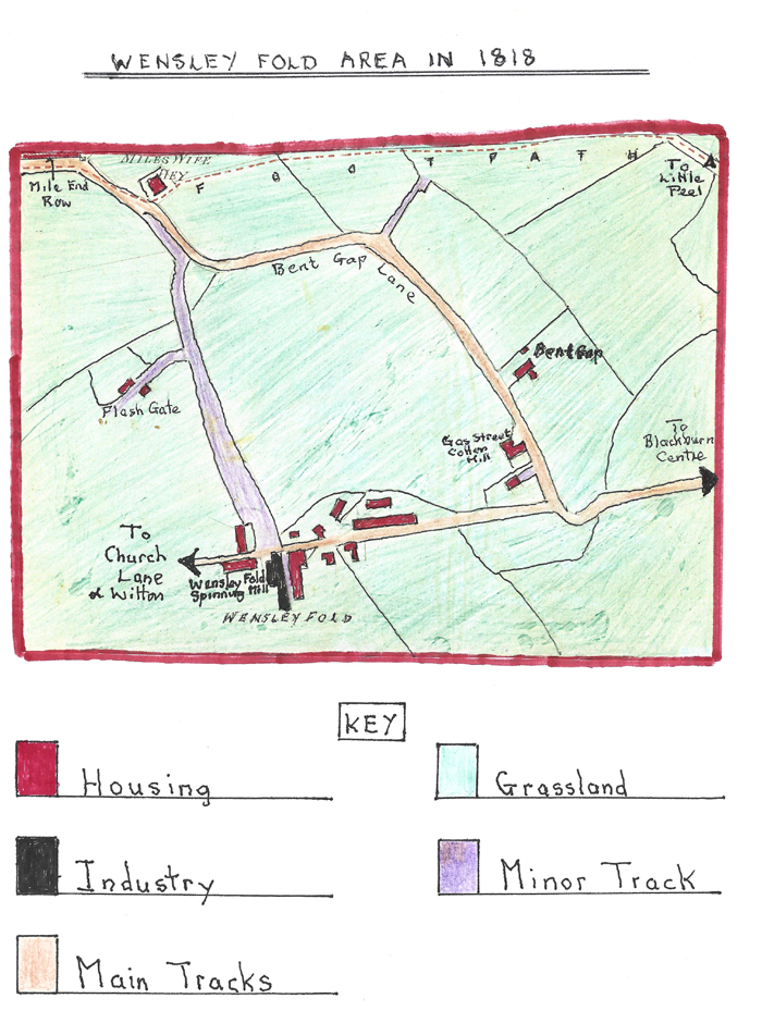
An early Sketch Map of the Wensley Fold Area in 1818
The 1818 map shows that Wensley Fold was an industrial hamlet centred on Wensley Fold Spinning Mill containing some early stone cottages built for the original textile workers and more ancient cottages and farms in more isolated situations. There was a second smaller textile works at Gas Street Cotton Spinning Mill on the eastern edge of the area nearer Blackburn centre. Large parts of the area were rural at this time with farmland on the sloping sides of the town’s valley offering mainly low grade grazing for sheep and some domesticated animals. The four main farms operating the land in this area were Miles Wife Hay, Flash Gate, Bent Gap and Fox House sited just north of the cinder footpath running from Miles Wife Hey to Little Peel on the outskirts of the town of Blackburn. During this period the two main tracks through the area were:
1. Running from Church Lane (later Buncer Lane) and St. Mark’s Church in the west within the Witton area through Wensley Fold to Little Peel and then Blakey Moor in central Blackburn.
2. Bent Gap Lane which ran from the Billinge area down through Mile End Row and Long Row passing hand loom weavers cottages and then down the slope to its junction with track 1.
These early routes would be used by foot traffic and horse dawn carts for the textile mills and farms but their surfaces suffered in bad weather due to their basic construction. The earliest church that locals could attend before 1848 was nearby St Paul’s sited near Blakey Moor. The Church was first built in 1791/2 and had four entrances; the main ones on the north and south sides. The graveyard for the church was originally on the south side.
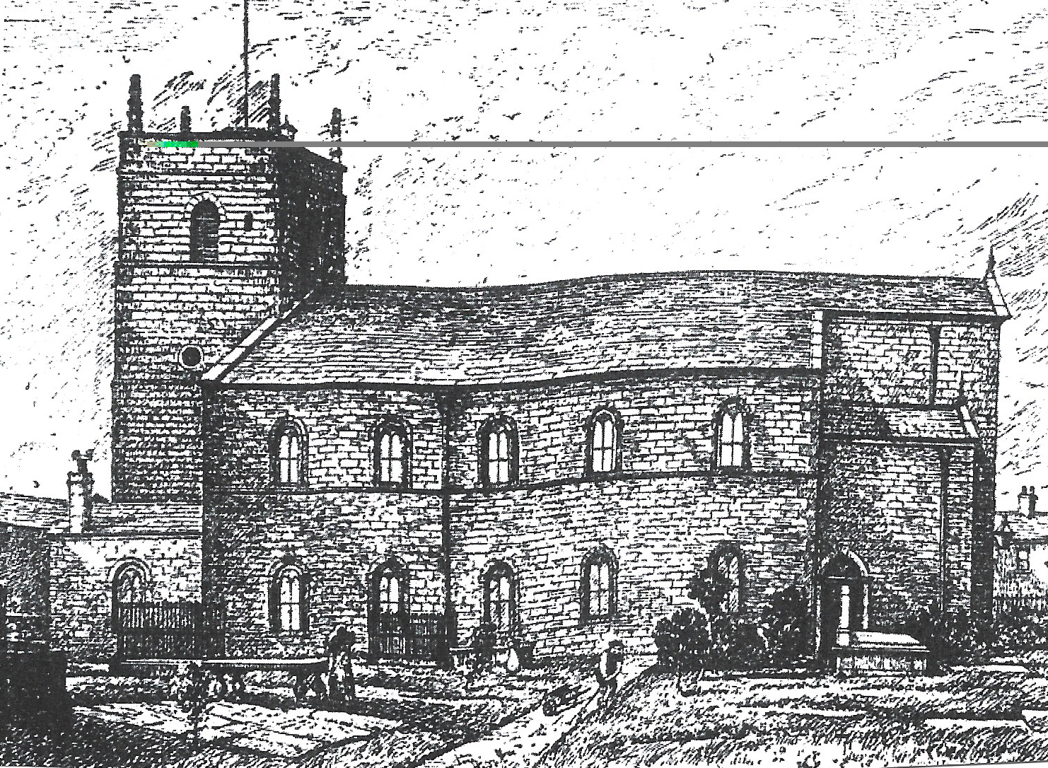 A sketch of St. Paul’s Church with the front footpath on view which ran from the churchyard to nearby Nab Lane and extended round the church itself to a gate on the other side in St. Paul’s Street whose houses can just be seen on the left and right of the church in the sketch. The church was extended in 1866/7 when a vestry, chancel and entrance halls were added.
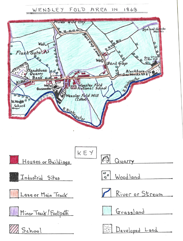
The Wensley Fold Area in 1848.
An Ordnance Survey Map of the Wensley Fold Area in 1848
The 1848 map shows a small increase in buildings as Wensley Fold cotton mill had been extended and now had its own gasometer providing lighting both for the mill and its local housing. More terraced cottages had been constructed at Alder Bank towards the end of track 1. Described earlier where a large sandstone quarry had been excavated out of the valley slope to provide stone for the construction of increased cottages and industrial buildings both in this area and those nearby. The cottages built at Alder Bank were probably built for the quarry workers who worked nearby. By now, in the extreme north-east of the area, just off the map, a Textile Dye Works had been built at Little Peel, close to Montague Street/Branch Road, which was used to dye cotton thread. Some domestic hand loom weaving was still in progress in this period but the trade was in decline. The other early textile mill called Gas Street was now sited near the second of Blackburn’s Gas Works which had opened in the 1830’s as No. 2 depot and had a short track from it called Gas Street. Gas Street Textile mill was a small establishment which was originally a shed containing a number of hand loom weaving machines, however, by 1843, had developed into a small weaving mill constructed by Henry Sharples with 140 looms.
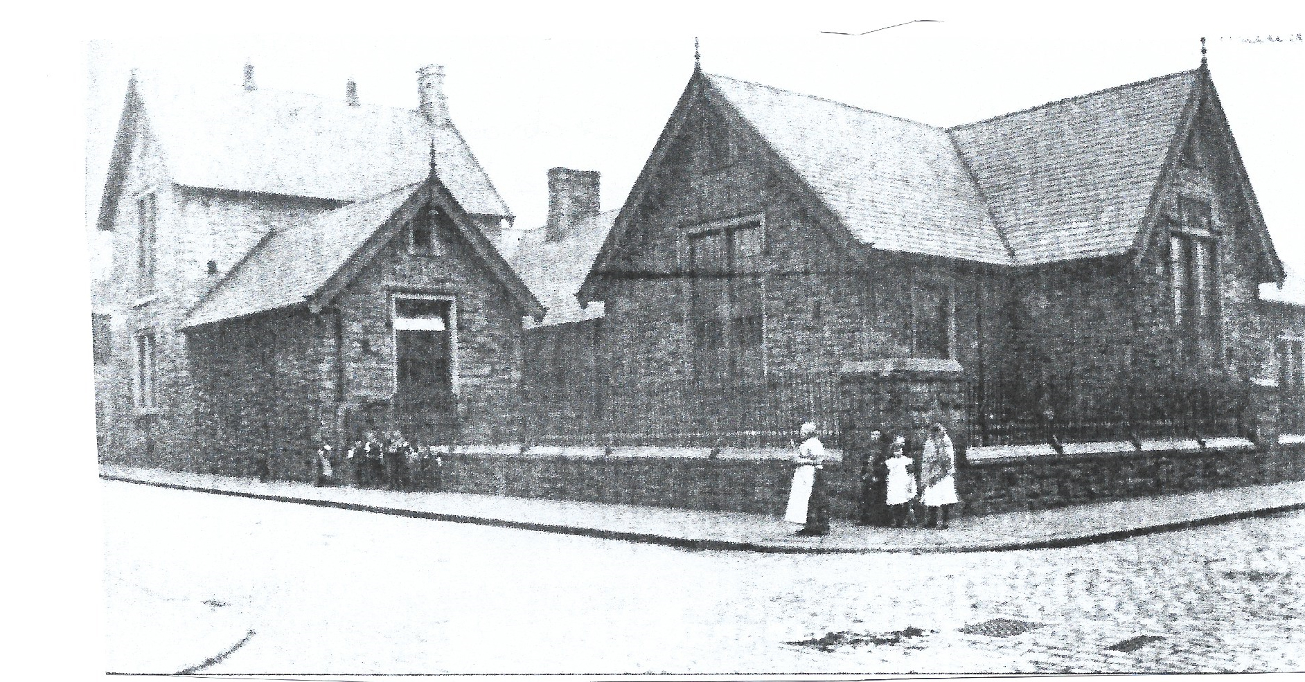
Early education in the area first took place in a room at Wensley Fold Mill for part timers working in the textile mill, or, for female mill workers’ small children. In 1845, however, the educational landscape changed when Wensley Fold National School opened as a small primary school aided by nearby St. Mark’s Church and so became a Church of England school. It was a low stone building on Apple Street just off Wensley Street. Its first scholars were mostly half-timers who worked in the Wensley Fold Mills complex, and, in time, its numbers rose to approximately 200 by the 1890’s. The school had two parallel play grounds that ran up to property on Wensley Street separated by stone walls.
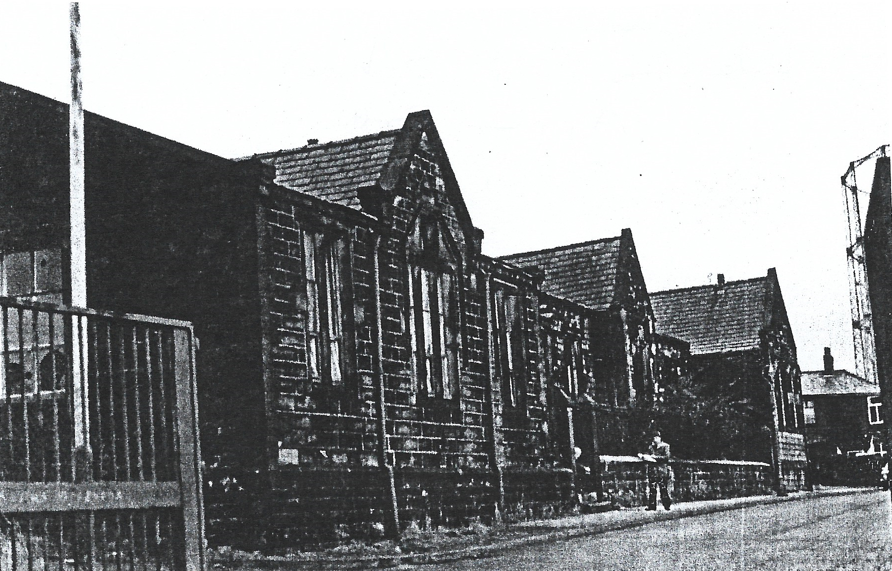
A view of the frontage of Wensley Fold School on Apple Street
Early religious centres at this time included:
1. St. Mark’s Church built by subscription with the largest contributor being Joseph Feilden. The Church opened on St. Mark’s Day, April 1838 with the Feilden family from Witton Hall providing extra pews to increase seating to 450 and beautiful stained glass windows.
2. St. Paul’s Church which had been erected in 1791 on St. Pauls Street off Blakey Moor just beyond Little Peel, consecrated in 1828 and enlarged in 1847.
Another feature visible on the map is Blackburn’s 2nd Gas Works on the extreme eastern end of the main track through Wensley Fold to Blackburn which shows that at this time the demand for gas had outstripped the first gas works capacity sited on Jubilee Street because the town’s population had increased. The map also shows the area had three wells because at this time there was no public water supply to most houses. During this period Wensley Fold Mill obtained water from the River Blakewater to generate steam power to run its machinery. Another visible small change was field boundaries; it can be seen that there are now more fields because the earlier larger ones had been sub-divided often using rows of trees as field boundaries.
The Wensley Fold Area in 1898
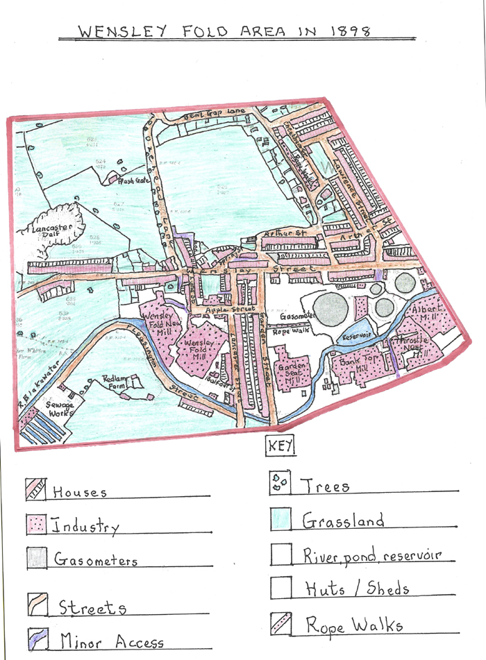
The Ordnance Survey map of the Wensley Fold Area in 1898
During the fifty-one years since 1848 the area had undergone large scale expansion to the east of the area due to the advancement of steam power and the establishment of new textile mills resulting in Blackburn centre encroaching into the Wensley Fold area which could now be described as an industrial village and suburb of Blackburn.
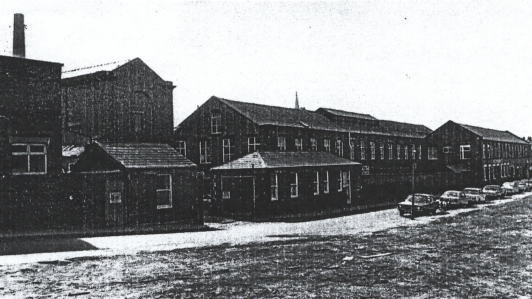
By now, Wensley Fold Mills (both old and new) had greatly expanded and the nearby gasometer had been removed. By 1861, Eccles and Son had 41,852 spinning spindles, 720 looms and 481 workers. At the same time, the firm was in dispute with Blackburn Corporation over compensation for flood damage to the side of the old mill caused by the River Blakewater in 1853 which meant that part of the mill could not be used. Eccles and Son were ruined by a combination of this litigation and the cotton famine in 1865 when the mills were put up for sale and remained closed for a period of years. In 1870, William Forrest bought the site and renovated the new mill, installing new looms to supply the Indian Dhooty trade and the old and new mills were run separately with a new shed added to the new mill for 600 looms. The old mill, containing 10,000 spindles and 300 looms remained closed for several years having been rebuilt in 1858 following the flood damage. Wareing and Hosier became its tenants and then J.H. Kenyon took over the two mills in 1878, who, in turn, put the old mill up for sale in 1886. It was bought by R & T Knowles who took over the weaving with a group of local men taking over the spinning, forming Wensley Fold Mill Company. Sadly, a fire in 1891 put this company out of business. The new mill was taken over in 1886 by Birtwistle Brothers (later Birtwistle & Feilding Ltd. of Great Harwood) for manufacturing cloth mostly for India with 700 looms in 1888. In 1900, they were fined for using impure water to create steam for humidifying the shed and for faulty ventilation.
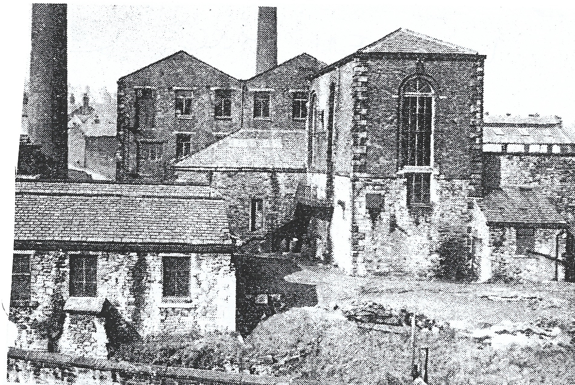
A view showing the buildings of Wensley Fold Mills
Gas Street Mill had been taken over by J. Longworth but the Mill struggled to find a tenant and in 1859 there was a lawsuit due to the poor condition of its machinery. By 1869 Brandwoods were running this small mill which they renamed Addison Street Mill because Gas Street had been extended to run up to Preston New Road and had been renamed Addison Street. Brandwoods were the last company to manufacture cotton as Rowland and Bagguley took it over and used it to make shuttles for spinning mills in the 1880’s.
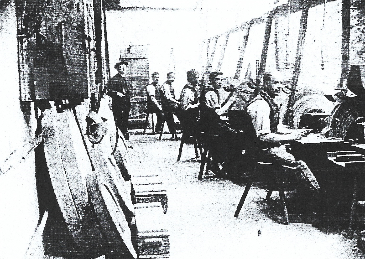 An interior picture of Rowland and Bagguley’s Addison Street Mill making shuttles
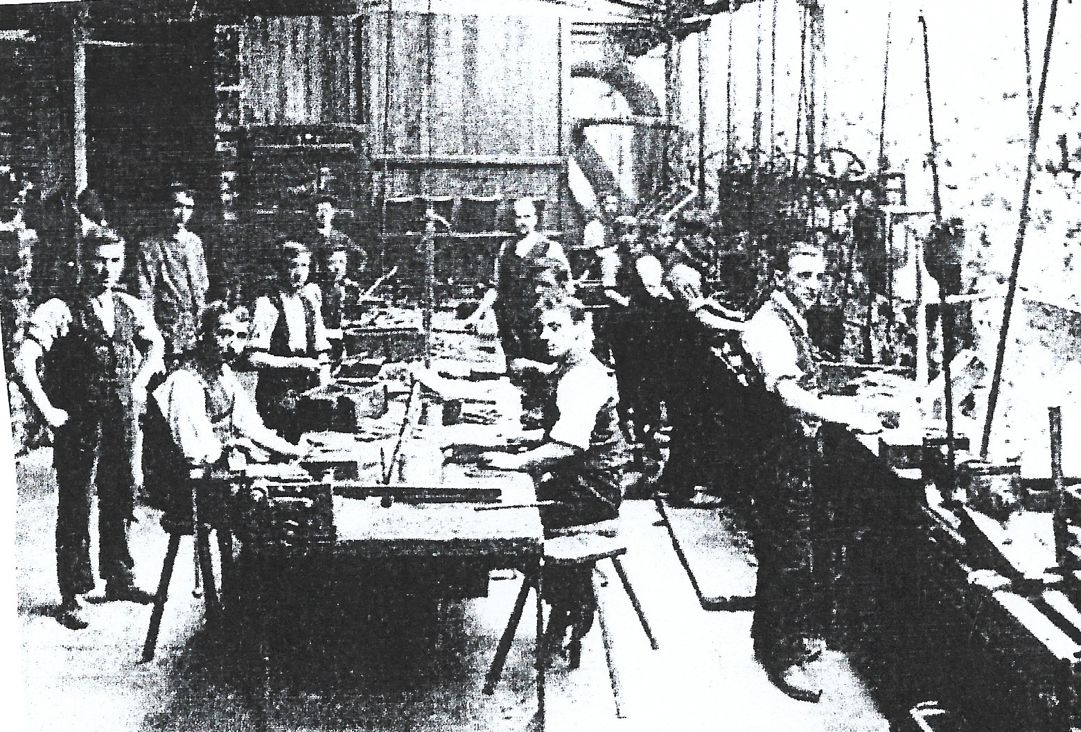 Another interior view of Rowland and Bagguley’s shuttle workshop
On the southern side of Wensley Fold along the banks of the river Blakewater several new textile mills were established. These were Bank Top Mill built in 1845/6 with W.H. Hornby becoming the owner in 1857 when it had 14,000 mule spindles, 242 looms, and, by 1861, 240 employees. In the 1890,s Hornby ceased operating the mill and the spinning machines were removed and the mill altered and expanded with a new weaving shed containing 563 looms. It was then taken over by Ainsworth & Co. for weaving dhotis for the Indian market and shirting in 1896. Its neighbours were Throstle Street and Royal Albert Mills which were both weaving mills. Royal Albert Mill was built in 1860, and, by 1861, Thomas Whalley & Co. had 240 looms and 131 employees. Later, after a number of changes established by Henry Green & Sons of Darwen, it had 657 looms weaving shirting’s and “T” cloths with 350 workers. Another mill in the area was Garden Street Mill built by John Carr in 1853/4 alongside the street of the same name being a weaving mill made up of two brick built weaving sheds and a two storey warehouse with 508 looms driven by a beam engine and by 1871 had 278 workers.
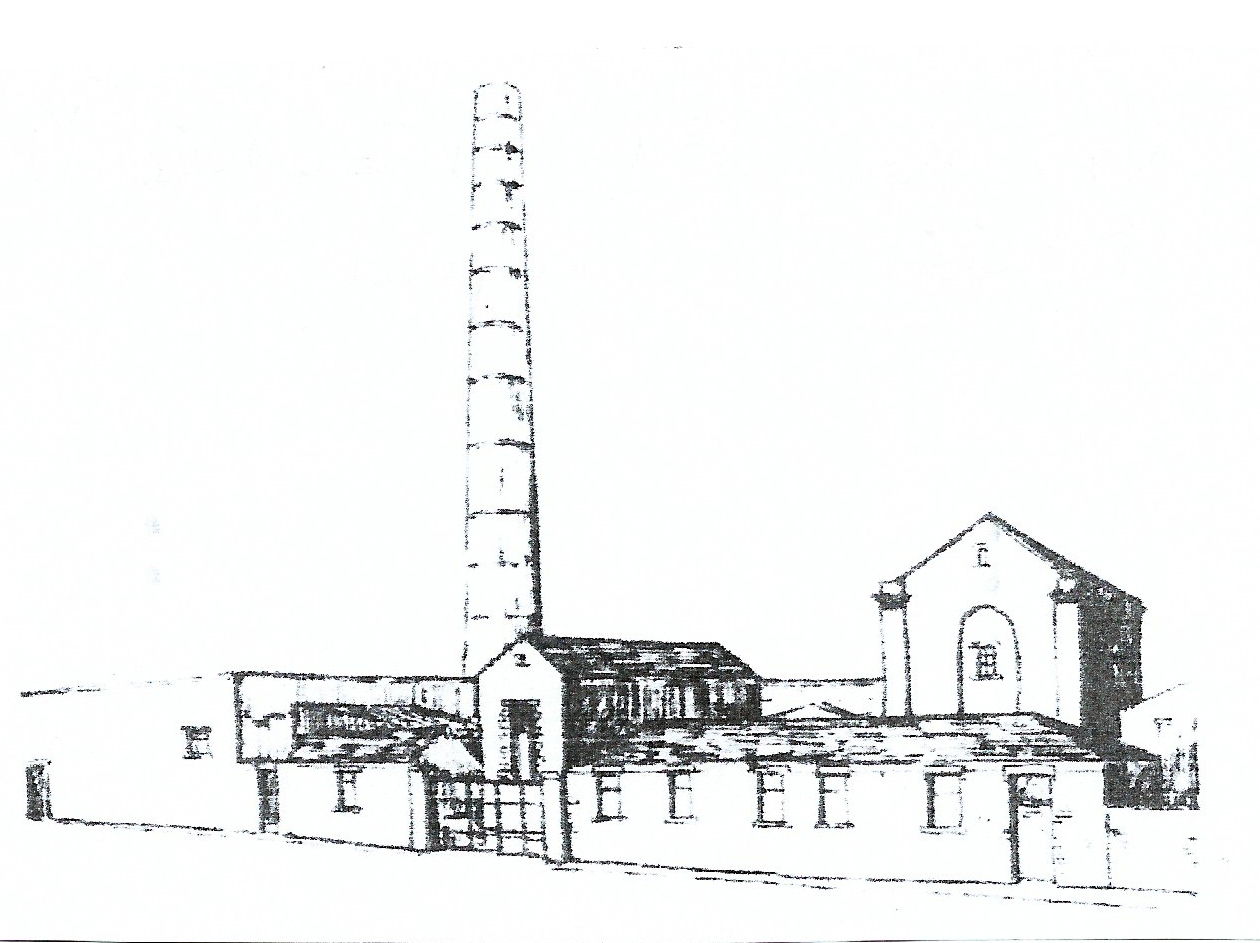
A sketch showing the original Garden Street Mill site
John Carr retired in 1874 leasing the mill to Smith Bowdler & Co. and then John Sharples & Co. who wove shirtings and cambrics. Sharples became insolvent in 1892 due to trade losses and put it up for sale but due to bad trade conditions the mill remained unsold at the time soup kitchens were operative for the unemployed. In 1895, the mill was bought by Cobden Manufacturing Co., and in 1901, Garden Street Mill Co. Ltd. was formed to take over the mill with large scale additions created resulting in an extra 270 looms operating, and, by 1902, it had 1375 looms.
An external view of the frontage of the altered Garden Street Mill
By 1868, Blackburn’s textile trade had greatly increased with the Borough now an important market for yarns as it had a total of 1,500,000 spindles and manufactured 150,000 cotton pieces weekly each being approximately 28 yards long. A dispute by textile workers regarding the weaving process, led to the 1874 increases in pay for producing dhotis due to the large markets for these goods in India and eastern markets. In 1887, another dispute rose due to “Bombay” headings as weavers felt they should be compensated for the number of headings they had to create in a piece; this resulted in a special "Dobby List" which lasted until a "Uniform List" was created for all pieces in 1892. These issues by workers show their increased influence over pay and conditions in the workplace previously not seen. Another example of this influence, was, after a long period of agitation by workers the introduction of ventilation in the weaving sheds and steam regulations in 1893 for mill work places.
In 1861, Blackburn Borough established sewage tanks at the sewage works on the south-west border of Wensley Fold and Witton by the side of the River Blakewater. This followed epidemic outbreaks in 1852 and 1854 in the town due to poor sanitation, street and house drainage. From 1854, the Borough had constructed 30 miles of sewage pipes in the town costing £100,000, and, by 1860, the work was still ongoing with up to 1,000 unemployed textile workers laid off in the cotton famine used as labour on the scheme. However, problems developed on discharge back into the River Blakewater so a three mile culvert was developed through Witton, Livesey and Pleasington to Hoghton Bottoms to a sewage farm built there in 1875; when that was overrun a larger sewage farm was constructed at Salmesbury.
The 1898 map shows a large increase in brick built terraced housing in the central and eastern sections of Wensley Fold and along with the new textile mill building. The huge expansion in the gas works site removed large sections of former rural farmland. The typical terraced housing streets had a variety of house styles with individual back yards; many houses having front doors opening directly onto pavements and some especially in the north of the area having small front gardens. The houses were now built of brick just as the new textile mills were at this time; brick manufacture was now well established with brick fields available in nearby Mill Hill. By 1868, Garden Street, Wensley Fold/Street, Addison St., Johnston St, Bombay St., Oozehead Lane, Spring St., Lawrence St., John St., Holden St., Higson St., Turner St., and George St., were all established housing areas as the increased textile mills now employed large numbers of operatives. Most of the streets were cobbled, and over time, had obtained pavements allowing greater movement for the locals.
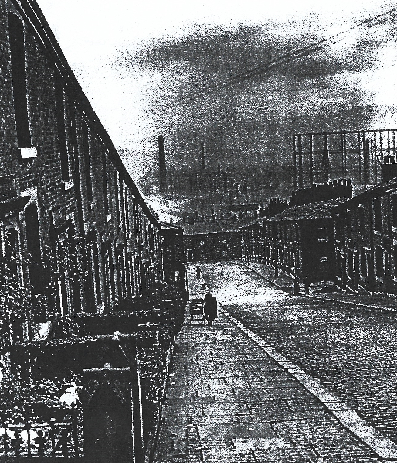 A view down Bombay Street running down to Belle View Street above Johnston Street with the cobbled road and flagged pavement also with terraced brick built houses on the left having small front gardens and those on the right having doors opening directly onto the pavement (probably built earlier). Also in view are textile mill chimneys and the large gasometer off Wensley Road.
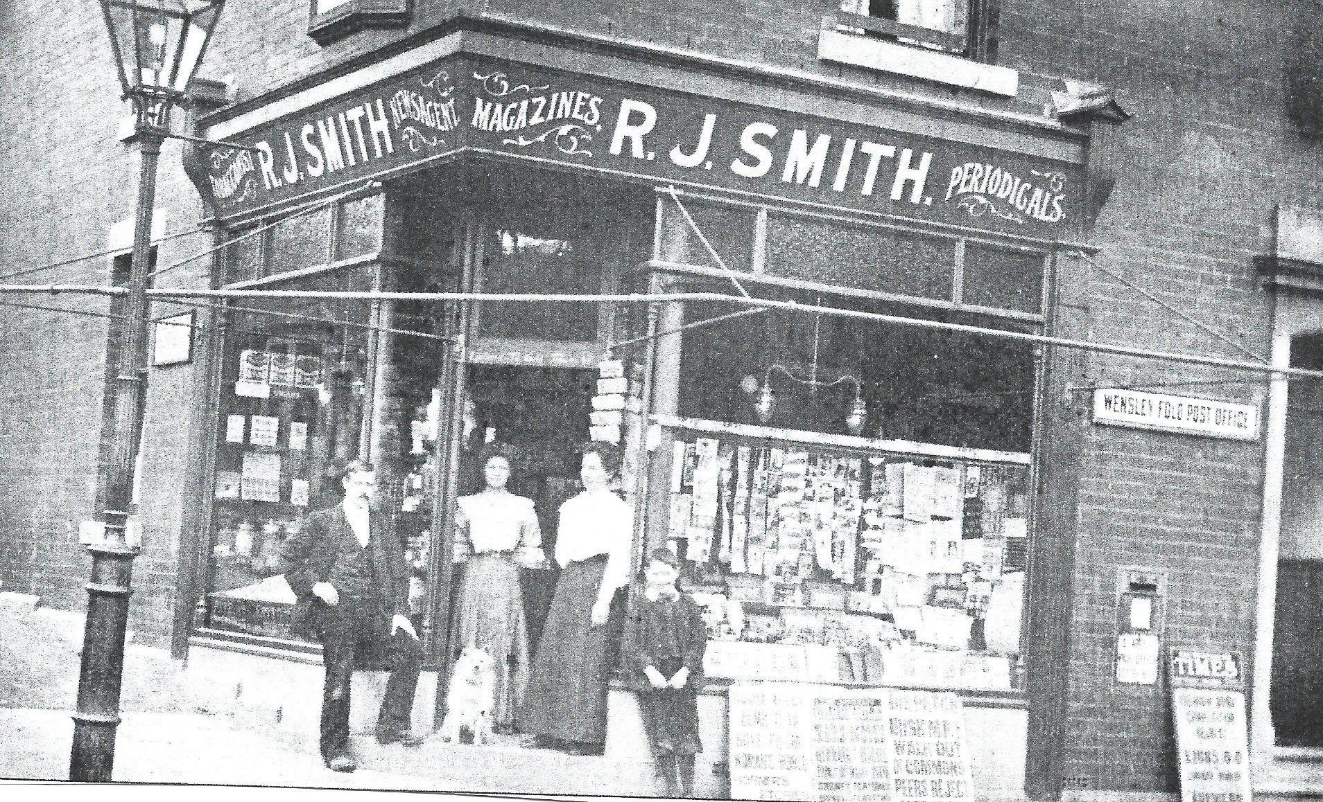
A view of the newsagents from Garden Street junction with the owner and
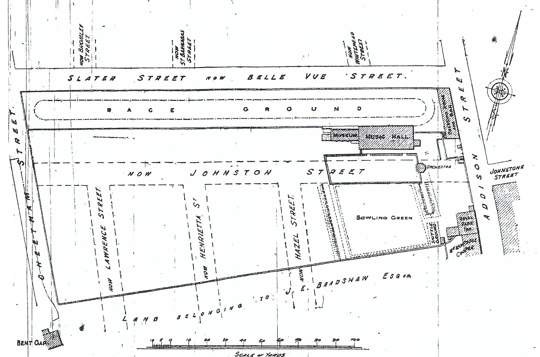
On Whit Monday 1857, John Slater opened public gardens often referred to as Belle View or California or Royal Gardens in the north-east of Wensley Fold in St. Paul's ward stretching from Cheetham Street to Addison Street and residing where St. Barnabas Church and School were later built shown on the diagram below.
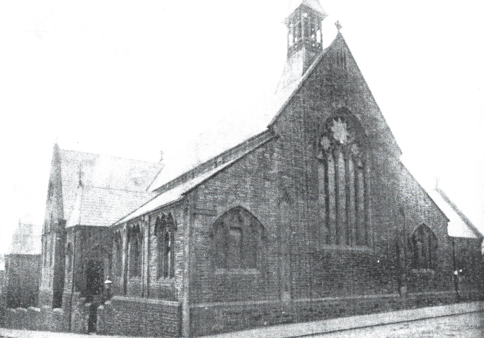
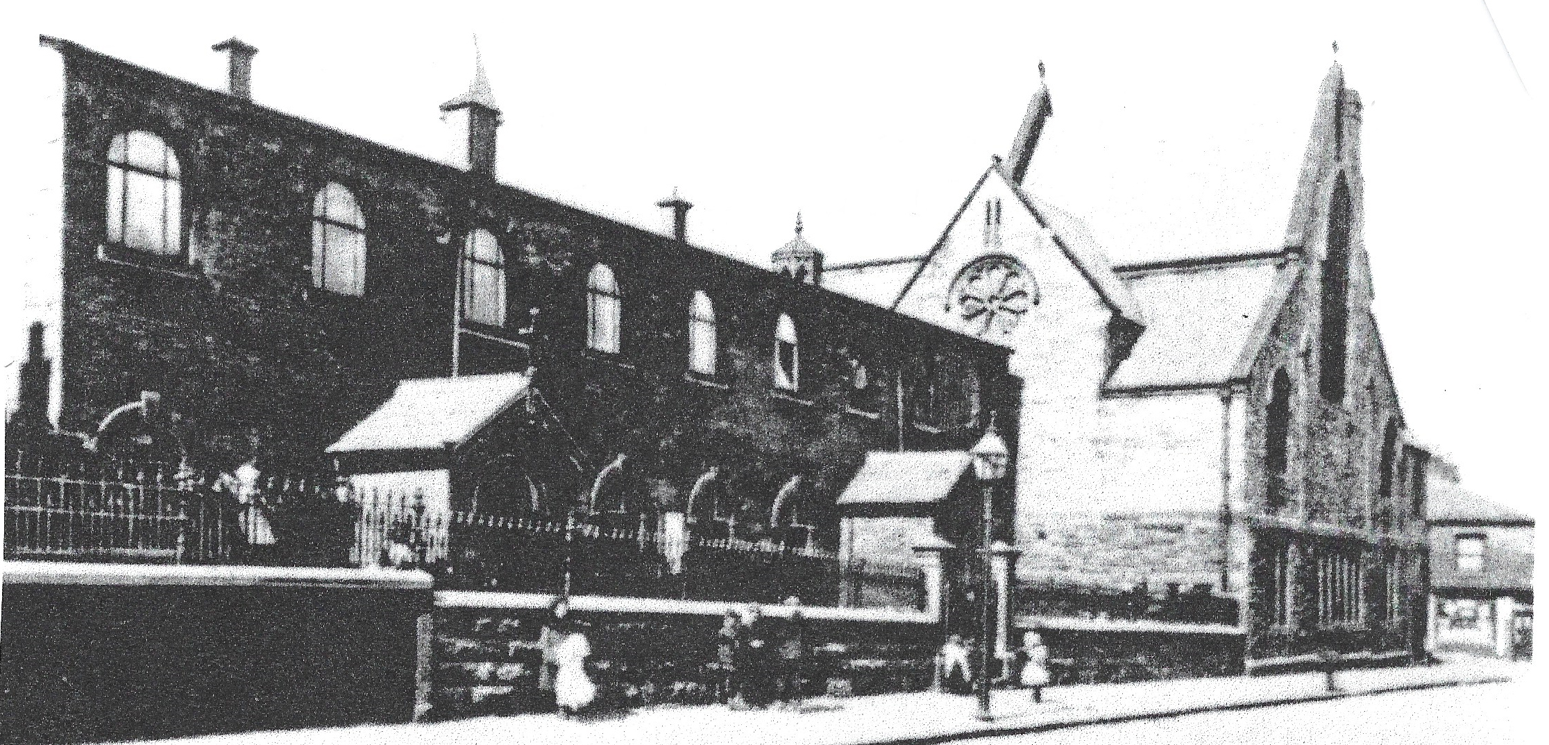
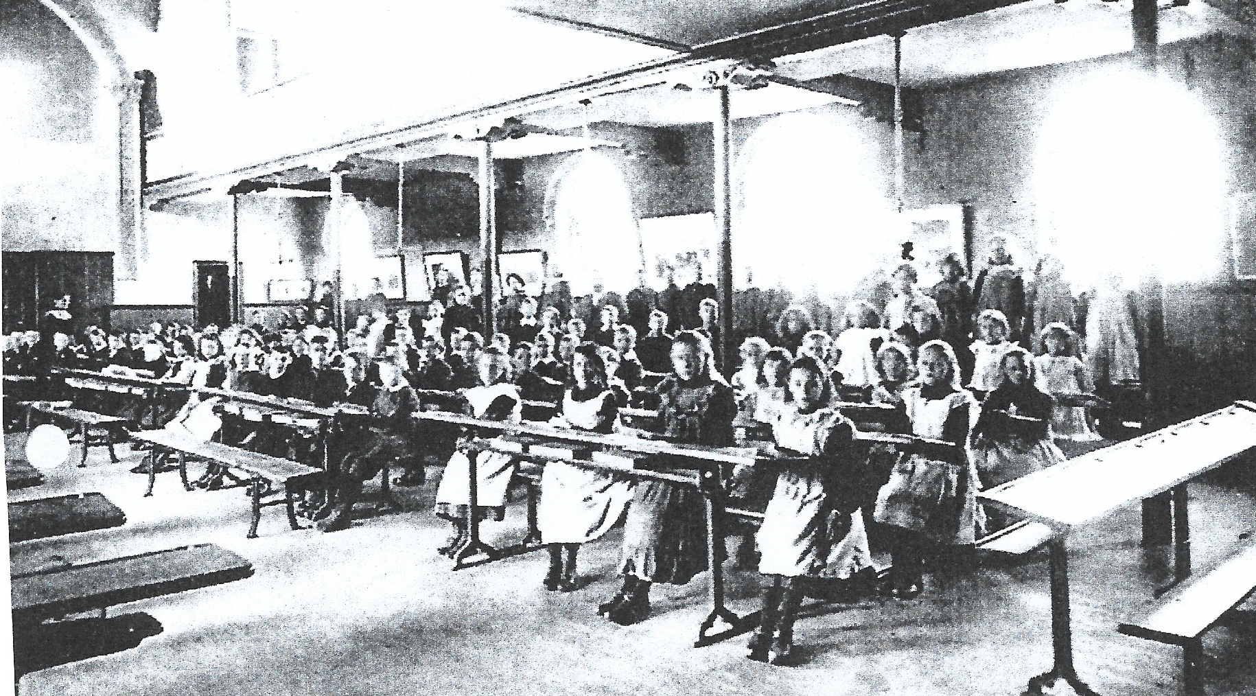
John Slater was an enterprising townsman who was a cotton spinner and believed to be the first person in Blackburn to come up with the idea of hot pea booths which he opened on the market. He established a large number of very popular social events at the gardens including open air dancing on Tuesday and Saturday nights. Other attractions were added from time to time including a museum, monkey house and musical hall. After he died the gardens passed onto a company who encouraged more sporting events including foot races, dog races and also a bowling green, but, over time, these encouraged rowdies and an 'evil' reputation due to the Royal Park Inn and bar in the dancing room. As a result, it became the favourite haunt of pigeon flyers, rabbit coursers and gamblers and a meeting place for the town's trouble makers with sports witnessed from the flat roof of the Music Hall. By 1868, the site was put up for sale and sold on for new housing developments as the Wensley Fold area grew westwards and merged eastwards with the central Blackburn area. As the population of the area continued to grow there became a need for more places to worship and schools. As a result, the existing St. Mark's church and school was joined additionally by St. Barnabas Church which was erected in 1885/6 in the eastern section of Wensley Fold, off Johnson Street, followed a few years later by its primary school; a two storey stone building like the church. The school had large open classrooms and long desks.
Other nearby churches opened within easy walking distance of the area, these included St. Luke’s, sited on Bank Top, opened in 1877 with seating for 702, and, the even larger St. Silas’s on Preston New Road in 1897. Both Churches opened their own primary schools. St. Philips’ church at Griffin started in its primary school in 1870 with the church added in the 1880’s with seating for 600. It was built from subscriptions but mostly from the Dugdale family who had textile mills at Griffin.
In the 1880s and 1890s local terraced residents who were mostly textile workers often had properties without gardens which resulted in a number renting land for plots to grow their own vegetables and flowers. These are visible on the map to the west and north sides of Bent Gap Lane taking a small section of the previous grassland. This helped to supplement their meagre wages and provide a more varied diet. At this time, there was one new and one remaining farm in the area; the new farm called Redland Farm situated close to the sewage works and River Blakewater with some outbuildings but clearly only a small farm probably growing some vegetables on the more loamy soil and flatter land of the valley floor. The remaining farm, Flash Gate, was on the more rural western side of Wensley Fold and lands opposite the sewage works owned by Higher Witton Farm sited just outside of the area. Overall, the land involved in agriculture had halved as it was eaten up by housing and new textile mill developments.
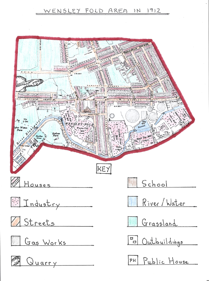
The Ordnance Survey map above shows many new building developments caused by the growth of both textile mills and their attendant terraced housing areas with local rural land eaten into further with increased streets.
Wensley Fold Gas Works had expanded, yet again, to meet the greater output of gas required with an extra smaller gasometer and more gas work buildings. Garden Street textile mill had more than doubled in size taking up most of the open land to its junction with the gas works. The expansion was caused by increased weaving operations although this was temporarily halted in November 1901 during floods caused by the River Blakewater overflowing its banks. In November 1901 a new limited company was established creating Garden Street Mill Co. with £100,000 capital, and, by 1902, there were 1375 looms operating in the mill. Other local mills remained the same size but increased the number of looms they had which were also updated. Throstle Street Mill had closed and the site re-used for a number of new works run by Blackburn Council including a pumping station and a shop fitters. By 1904, Wensley Fold Old Mill was taken over by Eastwood & Sagar who increased the mills looms from 792 to 842 by 1906 with the manufactured products mainly dhotis for India and also shirtings. A small addition was added to Wensley Fold New Mill in the early 1900s at the western end. Royal Albert Mill saw some changes with a new horizontal steam engine installed in 1900, and, in 1902, the mill was leased to Thomas Marsden but he later fled to Canada in 1904, so, Richard Thompson and Frank Pearce, trading as the Blackburn Commercial Mill Co. took over the cotton weaving operations. Bank Top Mill had also seen changes by the early 1900s when the Magerison family were the main shareholders. In 1904/5 there was a further weaving shed enlargement with looms increased to 718 producing plain cloth, poplins and jacquard fabrics. A new works had been established on the west side of Cheetham Street probably providing products for the local textile mills such as bobbins and shuttles.
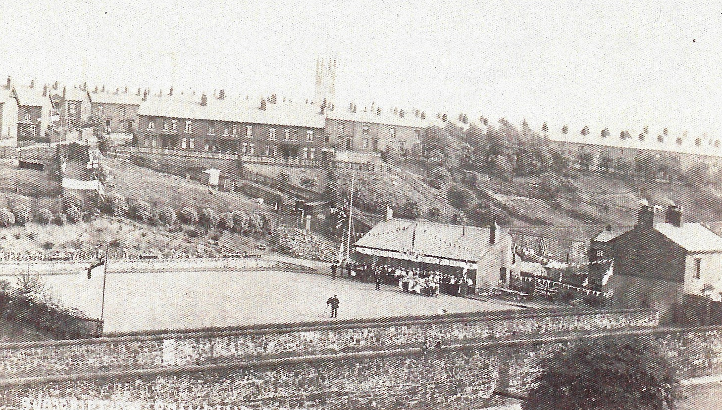
The large open grass area to the north of Wensley Street and Arthur Street bounded by Oozehead Lane to the west and Bent Gap Lane to the east and north in 1898 had now been eaten into by new rows of terraced houses. Arthur Street had changed its name to Rawstorne Street, Bent Gap Lane had disappeared leaving a small section running into Wensley Street. New streets with terraced houses established here included Downham Street running into a junction with Johnson Street with larger terraced houses with small front gardens and the new north to south Saunders Road running into Wensley Street. Oozehead Lane running down to Wensley Street had now lost its border of trees with new larger terraced houses with front gardens and bay windows built on its upper stretch. Chatburn Street was established off Saunders Road with additional terraced houses added as infill on the south side of Wensley Street up to the Boar’s Head public house with small front gardens. Other changes included Wensley Fold School expanded to the end of Apple Street and its junction with Lund Street. Redlam farm was now reduced to only one building with part of its farmland taken up on the west side by a new Crown Green Bowling Club called Witton Subscription Bowling Club; its new green bordered by trees and a new club house. The club was based along the side of Pleasington Street which had also seen more terraced houses added to it and highlighted the fact that mill workers now had better working conditions and more leisure time to indulge in sporting activities. The bowling club therefore was a much needed facility within the expanding urban area of Wensley Fold which was now akin to an industrial village in size.
The picture above shows the opening ceremony of Witton Subscription Bowling Club with club dignitaries lined up in front of the club house with the cameraman on the green and bunting hanging around the club house. At this time, the entrance down to the club can be seen to the left of the club house down the hill slope with Pleasington Street and the River Blakewater in the forefront and the terraced houses of Witton in the background.

 Loading more