
 Loading more
Page 2
During the past 42 years, since 1912, there had been two world wars and the area had changed markedly with increased housing. There was, however, a significant decrease in the importance of the textile industry and the loss of any remaining farmland.
On the industrial front, the Old Wensley Fold textile building had closed in 1930 and was demolished soon after due to the decline in the Indian market which by now was producing its own textiles often using weaving machinery obtained from the many textile mills that had closed down and the two world wars disturbing production. Wensley Fold New Mill continued with the Birtwistle Group having had automatic looms installed after the 2nd World War, and, by now, had diversified its products to meet the needs of new markets. At the outbreak of the 2nd World War, Garden Street Mill was taken over by the Government’s War Office and between 1939 and 1945 was used to manufacture gas masks for adults and children due to the fear of mustard gas attacks at the front and in Britain. School children were trained how to use the gas masks and had to carry them to and from school.
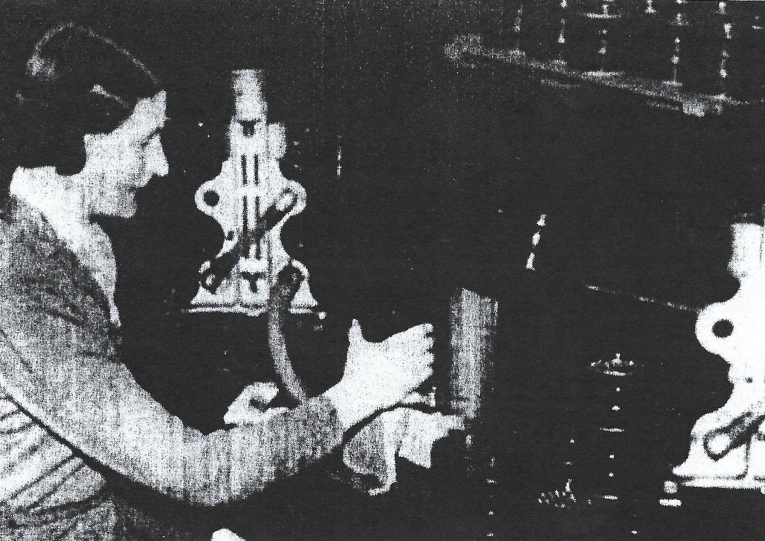
A picture showing an operative at Garden Street Mill creating gas masks for use in the 2nd. World War
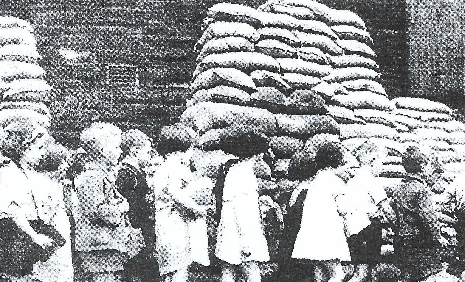
A view of a line of school children each with their gas masks under their arms
arriving for lessons at a sand-bagged primary school in 1939
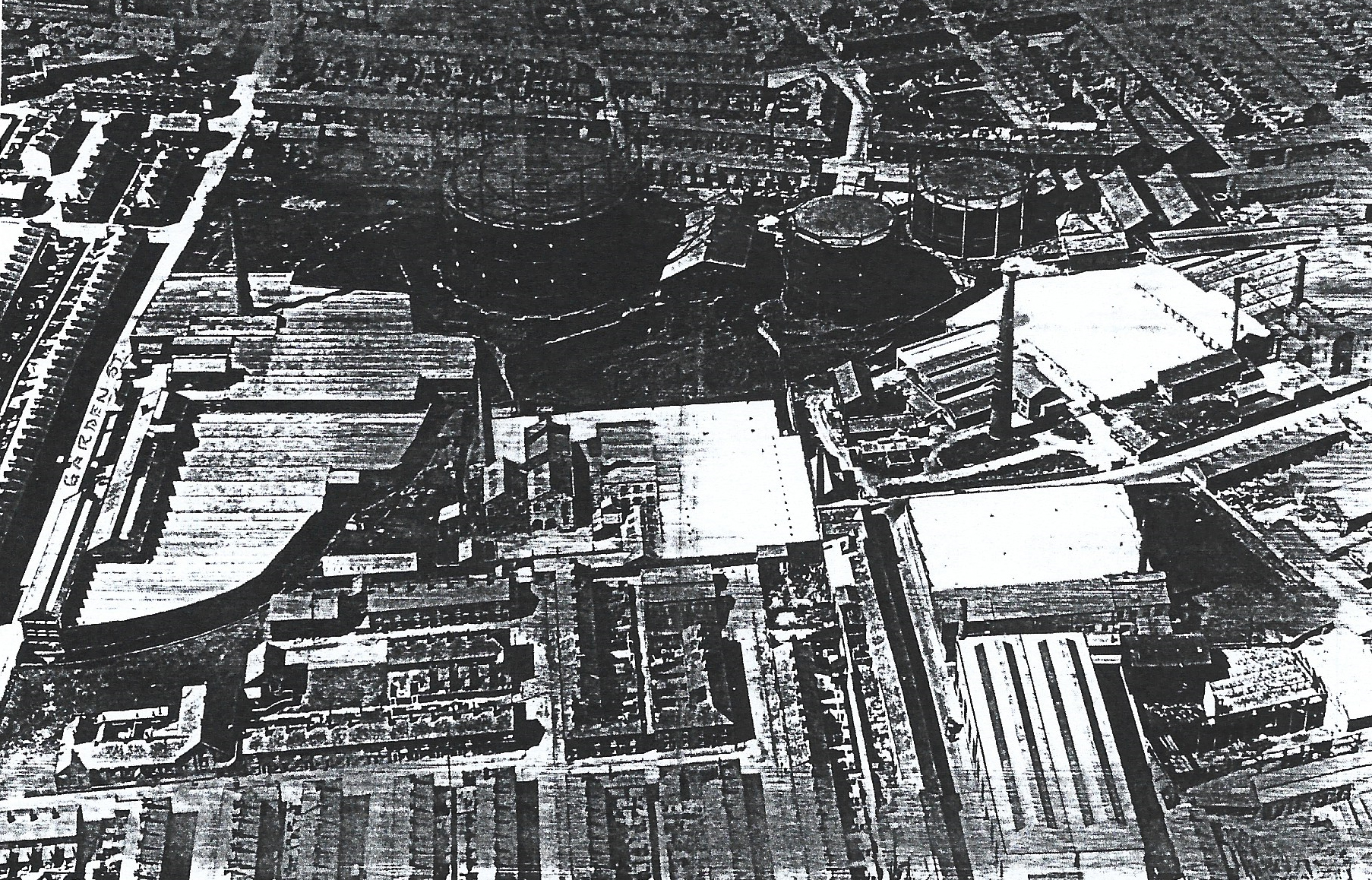
An aerial photograph of the Wensley Fold area with the Gas Works and Garden Street Mill
on the left with Bank Top Mill next to it, and, to the right, is Throstle Street Mill and Royal Albert Mills.
To the north of the Gas works can be seen both Wensley Street and large areas of terraced houses in the area during 1931
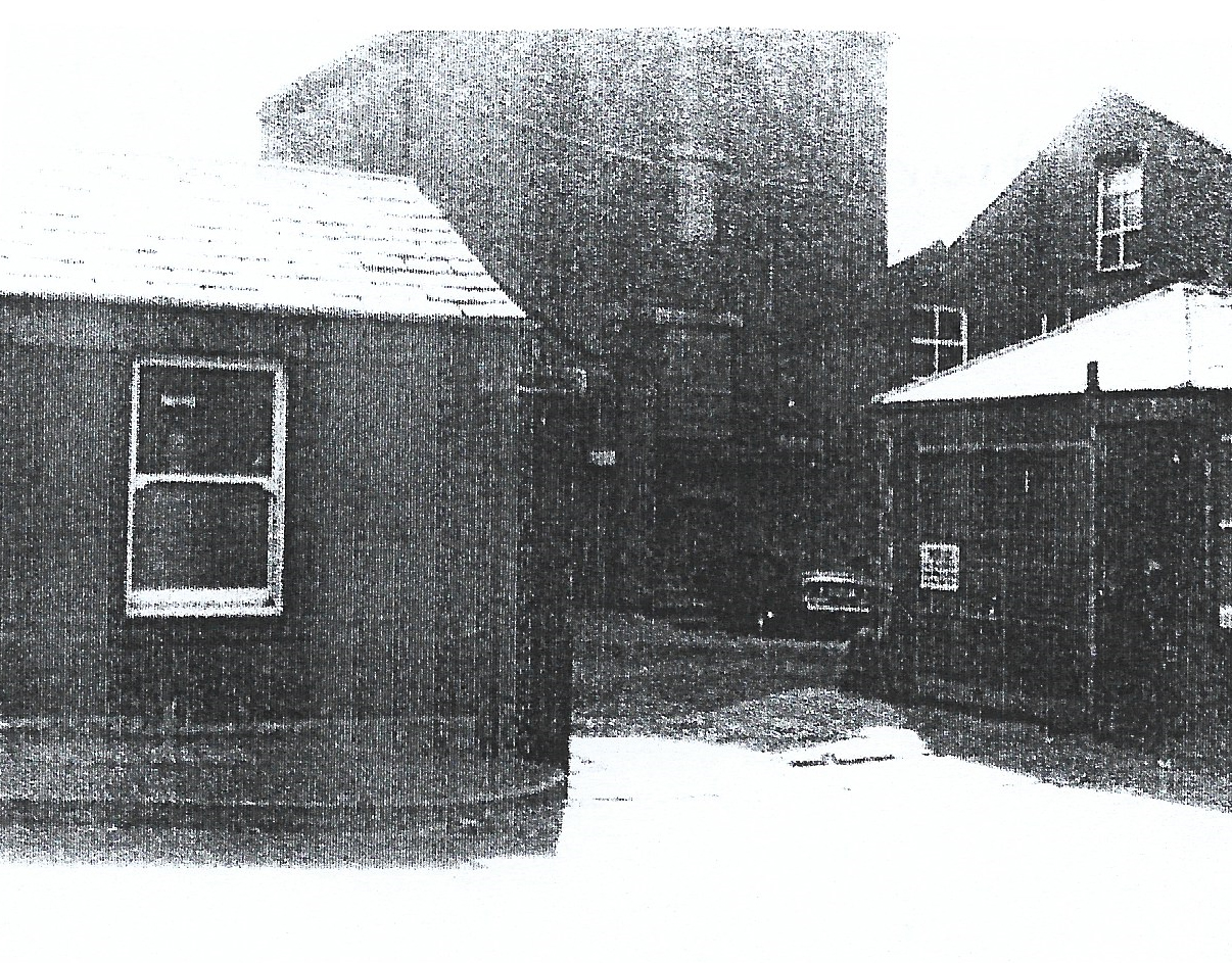
A view of the entrance to Garden Street Mill
After the 2nd World War Garden Street Mill was still used by the Home Office; shown on the map being used for a supplies and transport store. However, shortly after 1956, it was taken over by Newmans and converted for the manufacture of shoes, slippers and other footwear.
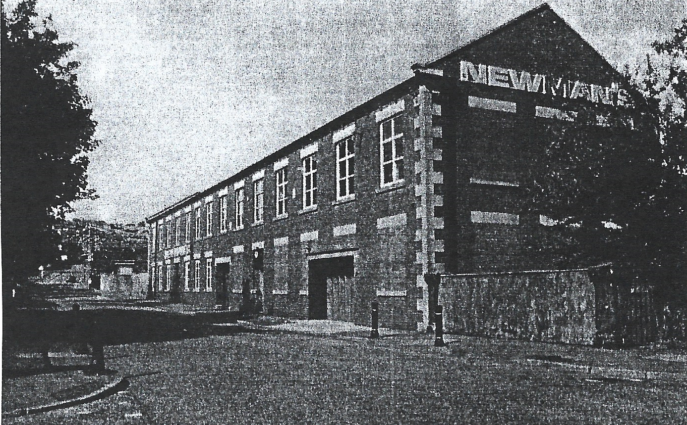
A picture of the frontage of Newman’s Shoe Warehouse on Garden Street
Royal Albert Mill continued weaving cotton goods till 1933, and, by 1956, was a brick and cement works before being demolished. Bank Top Mill, however, continued as a textile mill although it lost its reservoir as steam power was replaced by electrical power and the number of looms operated had reduced by the1960s. The works on Cheetham Street were unchanged but now produced non-textile products. By now, there had been a few minor changes to buildings on the gas works site which itself had little altered. The former quarry alongside Livingston Road had by now been abandoned and was mostly filled in. On the housing front there had been significant infill of the remaining open areas to the north and north-west of Wensley Street. Two areas above Rawstone Street were now completely developed with new pre-war terraced houses on both sides of Saunders Road and the area nearer Oozehead Lane infilled with more modern semi-detached houses. Another section of these modern semi-detached houses had been built on the other side of Oozehead Lane and along Livingston Road going towards Buncer Lane. All the post war semi-detached houses had significant garden areas unseen previously in the area. More terraced houses had been built on Livingston Road and the remaining open land north and west of these was now used for allotments for the locals as the majority had no gardens with their houses. On the west side of Wensley Road an estate of post war semi-detached houses had been built with access from Wensley Road via Higher Witton Road and from Buncer Lane. Wensley Fold School building had not changed but the curriculum offered to children had significantly altered. The allotments close to Wensley Fold New Mill, south of Wensley Road, had been extended showing the demand for growing food had increased during the two world wars. Redlam farm has virtually disappeared with only the outbuildings remaining although the land around has not been developed.
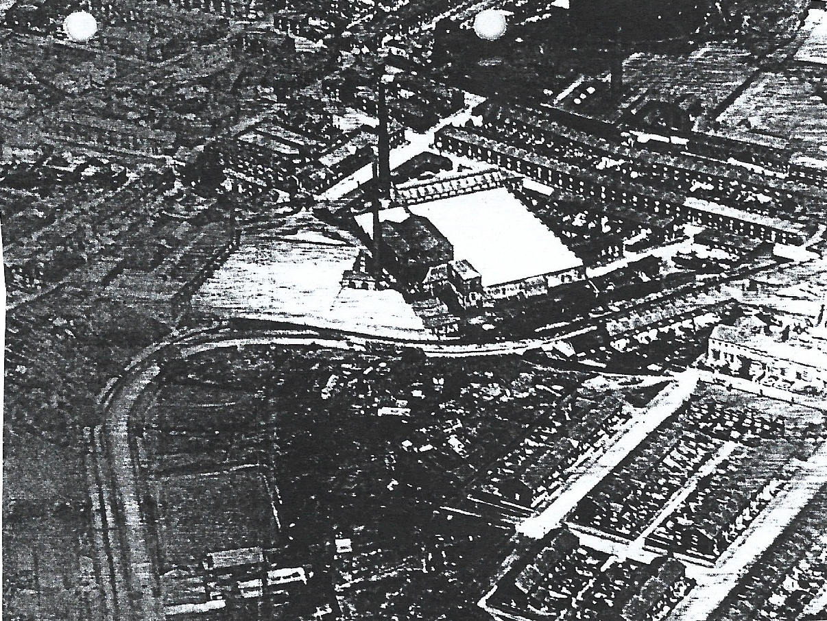
A 1930s aerial photo of Wensley Fold with Pleasington Street and the sewage works in the extreme
south-west cornerwith Wensley Fold Mill in the centre and Garden Street beyond
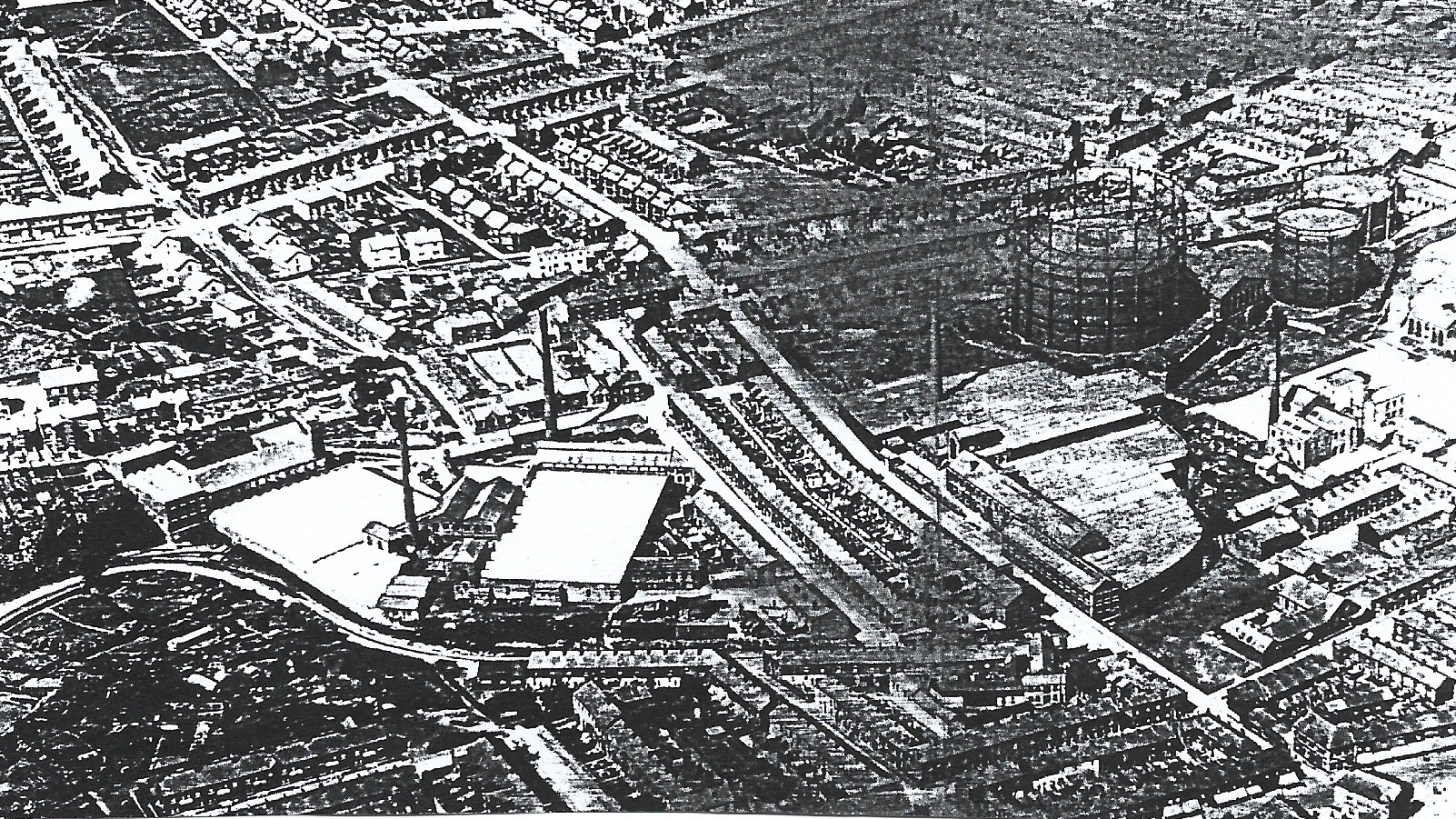
Another 1930s aerial photo showing Pleasington Street following the River Blakewater along the
south part of the view with Wensley Fold Mills above off centre and Garden Street and its mill
with the Gas Works rising beyond and all the terraced houses in Wensley Fold.
south part of the view with Wensley Fold Mills above off centre and Garden Street and its mill
with the Gas Works rising beyond and all the terraced houses in Wensley Fold.
By the 1940’s/50s the area’s population had a wide range of local shops providing all kinds of produce, services and material goods for locals with most terraced housing streets having corner shops with more extensive shops on Johnston Street and nearby Whalley Banks/Griffin areas with most shops having awnings to protect shoppers browsing. They also had local public houses to provide refreshments and a place for social gathering.
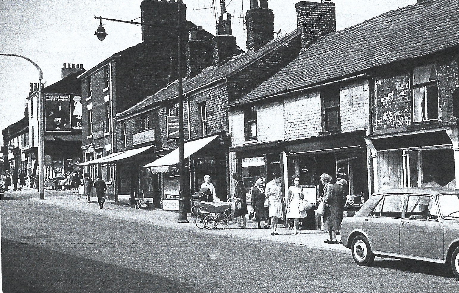
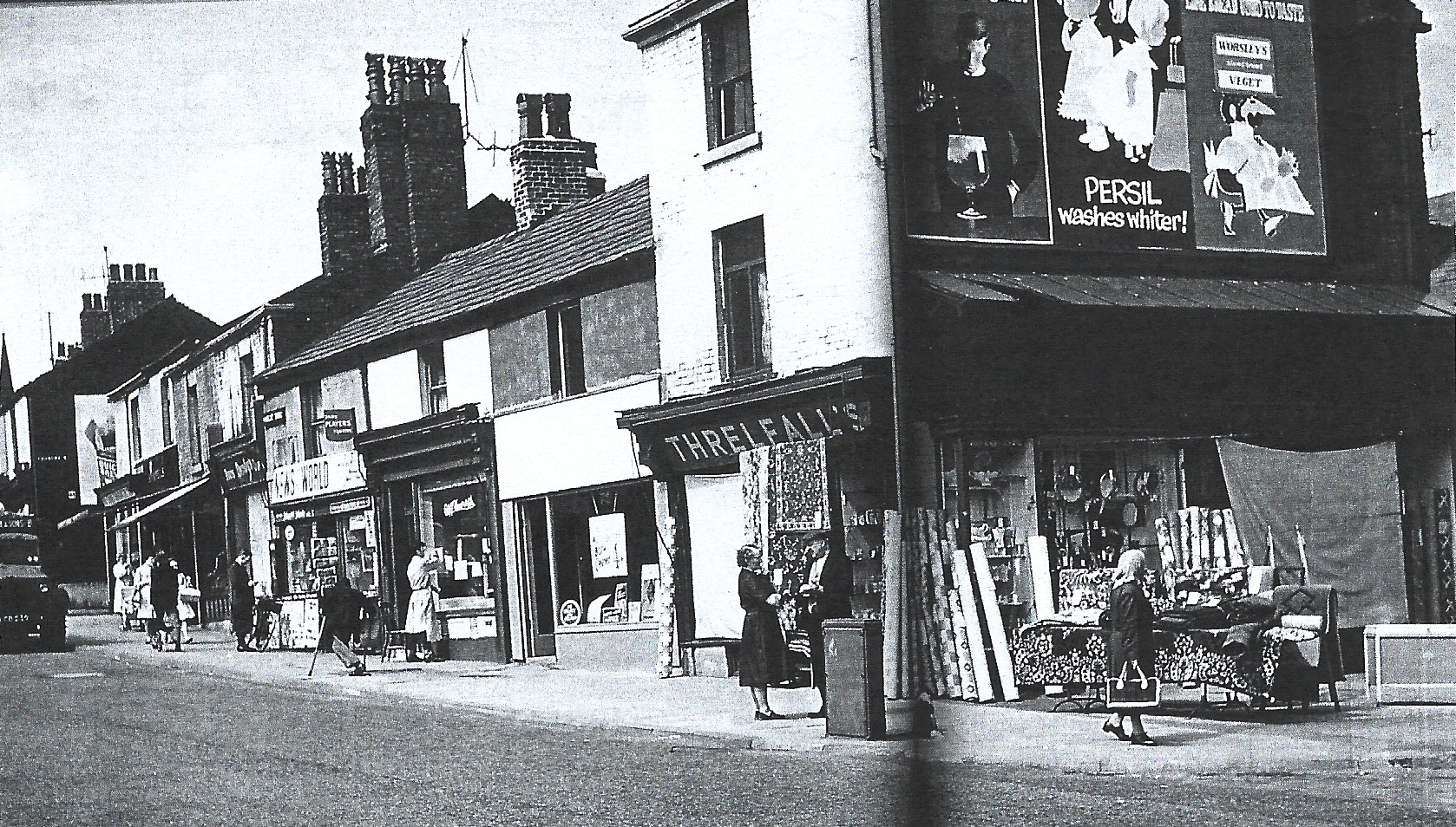
A view of Bank Top with a row of local shops offering a variety of goods
with a public house sited on the corner of an adjacent street
with a public house sited on the corner of an adjacent street
Another view higher up Bank Top looking towards the Griffin area in the distance
with more shops and wall adverts of the time in the 40s/50s
with more shops and wall adverts of the time in the 40s/50s
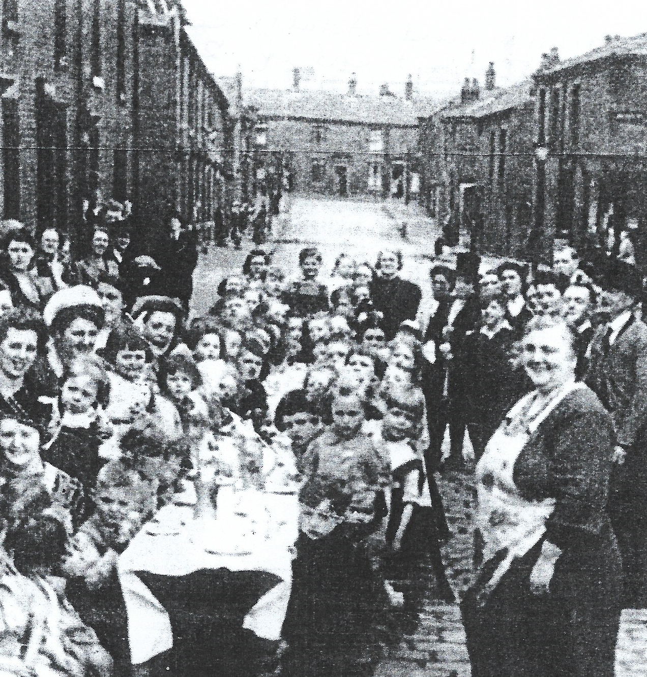
A view of children and adults celebrating V.E. Day to mark the end of the 2nd World War
with a street party on Arthur Street, Wensley fold
with a street party on Arthur Street, Wensley fold
The Wensley Fold Area in 2023
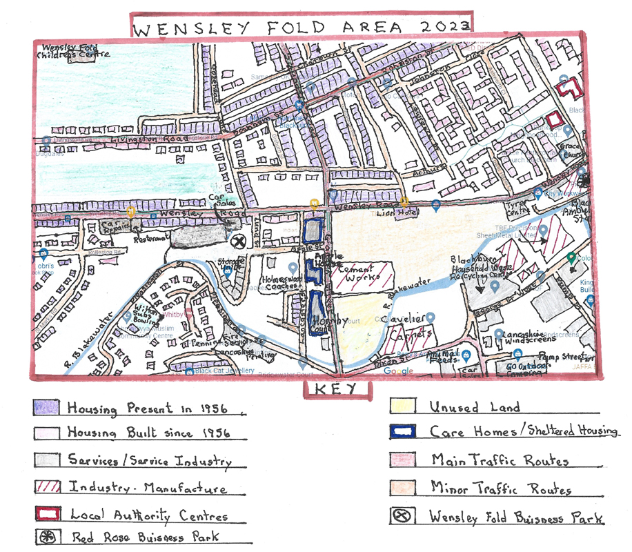
A Google Map of the Wensley Fold area in 2023
Over the sixty-seven years since 1956 there have been huge changes in the Wensley Fold area especially since the 1980s both with housing and industry. As a result, the landscape in the area has become much more modernised.
Many of the original terraced former textile mill houses north of Wensley road in the western and central areas have remained. However, of these a large proportion have been modernised many via European grants awarded to Blackburn which enabled them to upgrade the houses with new roofs, new outer brick walls, bathrooms and windows to create better quality homes. Others not included in the scheme particularly the later built terraced houses with small front gardens have been upgraded by the owners themselves often helped by grants. However, eastwards, north of Wensley road, huge swathes of original terraced housing were demolished and replaced with a modern council estate of mixed housing types, including modern linked town houses and apartments within cul-de-sacs off many existing streets. Livingston Road, in the west, has been completely filled with earlier semi-detached houses and later modern linked and detached houses. To the south of Wensley Road little of the original housing remains with all the terraced properties along Garden Street, Apple street and off Lancaster street having being demolished. Those round the former old Wensley Fold School which was demolished have been replaced by modern linked or semi-detached houses. The western end of Wensley Road, on the south side, has lost the terraced houses which were replaced by a garage and car sales area and additions made to the existing estate with semi-detached houses and apartments. All the remaining open land off Pleasington Street has now been developed by the building of modern estates of semi-detached and detached properties around various cul-de-sacs in the 2000s. All the open land off Pleasington Street where the former sewage works and Redlam Farm were sited is now taken up by modern private estates of semi-detached and mostly detached properties around various cul-de-sacs.
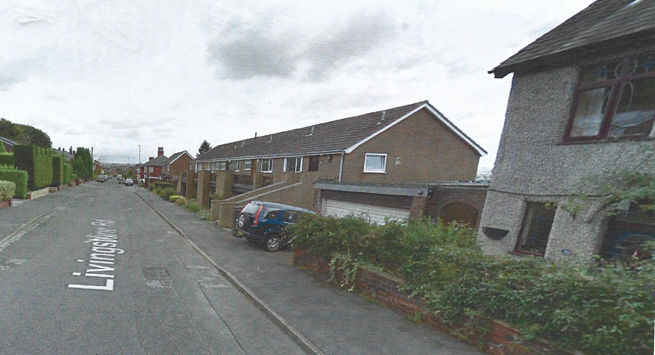
A view travelling down Livingston Road from the Buncer Lane end showing mixed housing
from post war semi-detached to modern linked houses with the ends of detached houses gardens on the left
from post war semi-detached to modern linked houses with the ends of detached houses gardens on the left
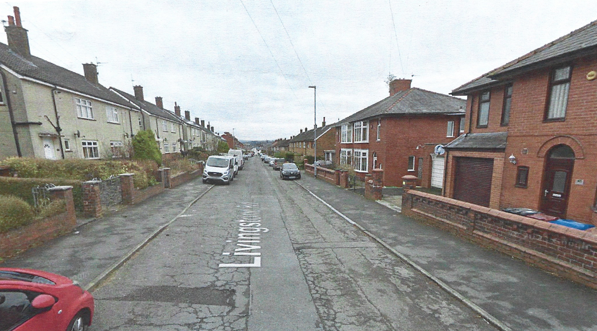
Further down Livingston Road can be seen Council semi-detached houses on the left and semi-detached on the right
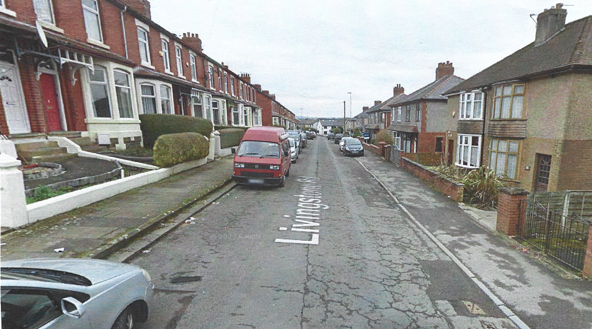
Another view on Livingston Road as it nears Oozehead Lane with former terraced houses to the left and semi-detached to the right
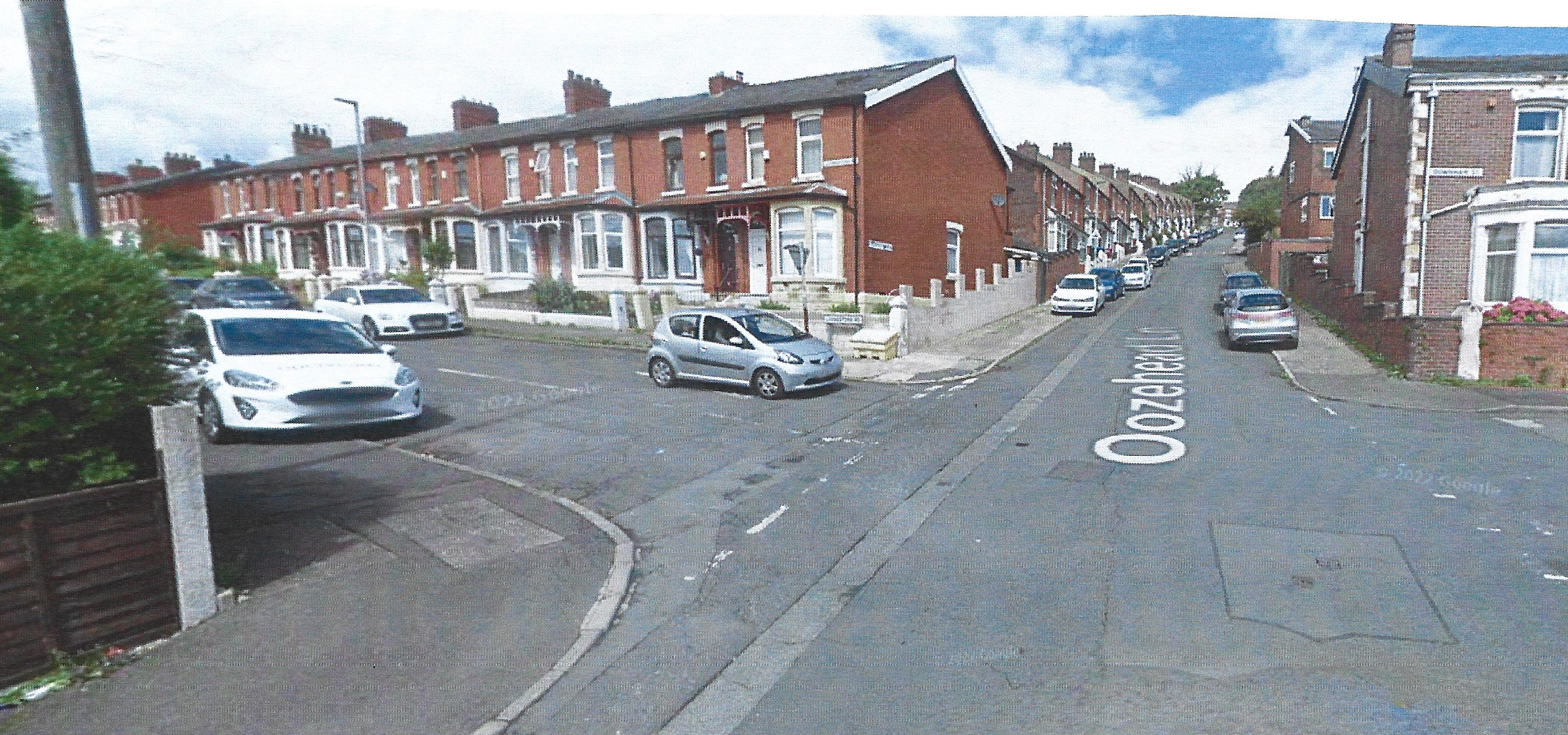
A view of the crossroads where Livingston Road from the left meets Oozehead Lane and crosses
into Downham Street showing an array of terraced properties all with bay windows i
ndicating they were mostly Edwardian rather than Victorian and with a larger lay-out
into Downham Street showing an array of terraced properties all with bay windows i
ndicating they were mostly Edwardian rather than Victorian and with a larger lay-out
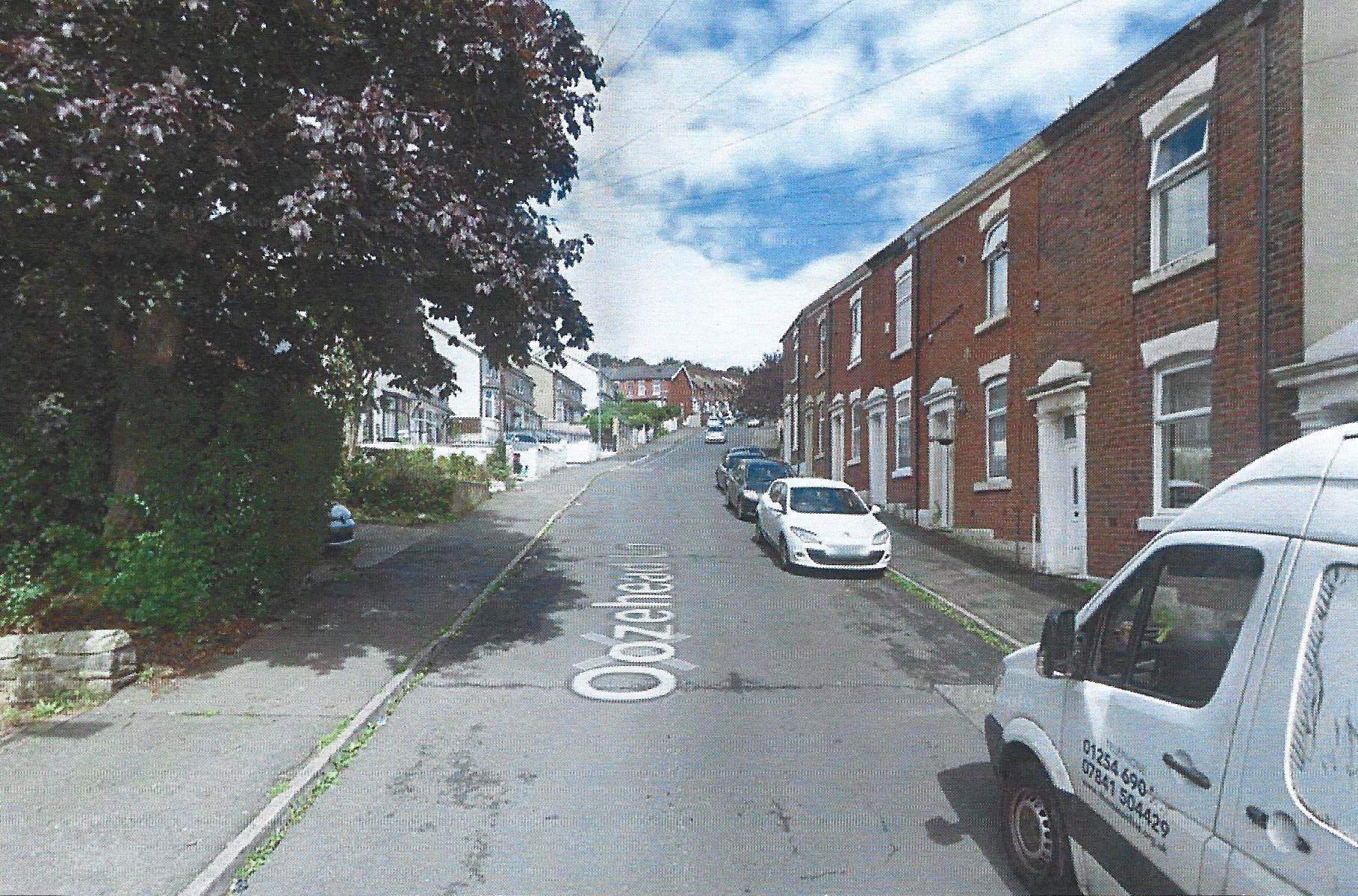
A view looking up Oozehead Lane from Wensley Road with older Victorian terraced houses
on the right with doors opening onto the pavement
on the right with doors opening onto the pavement
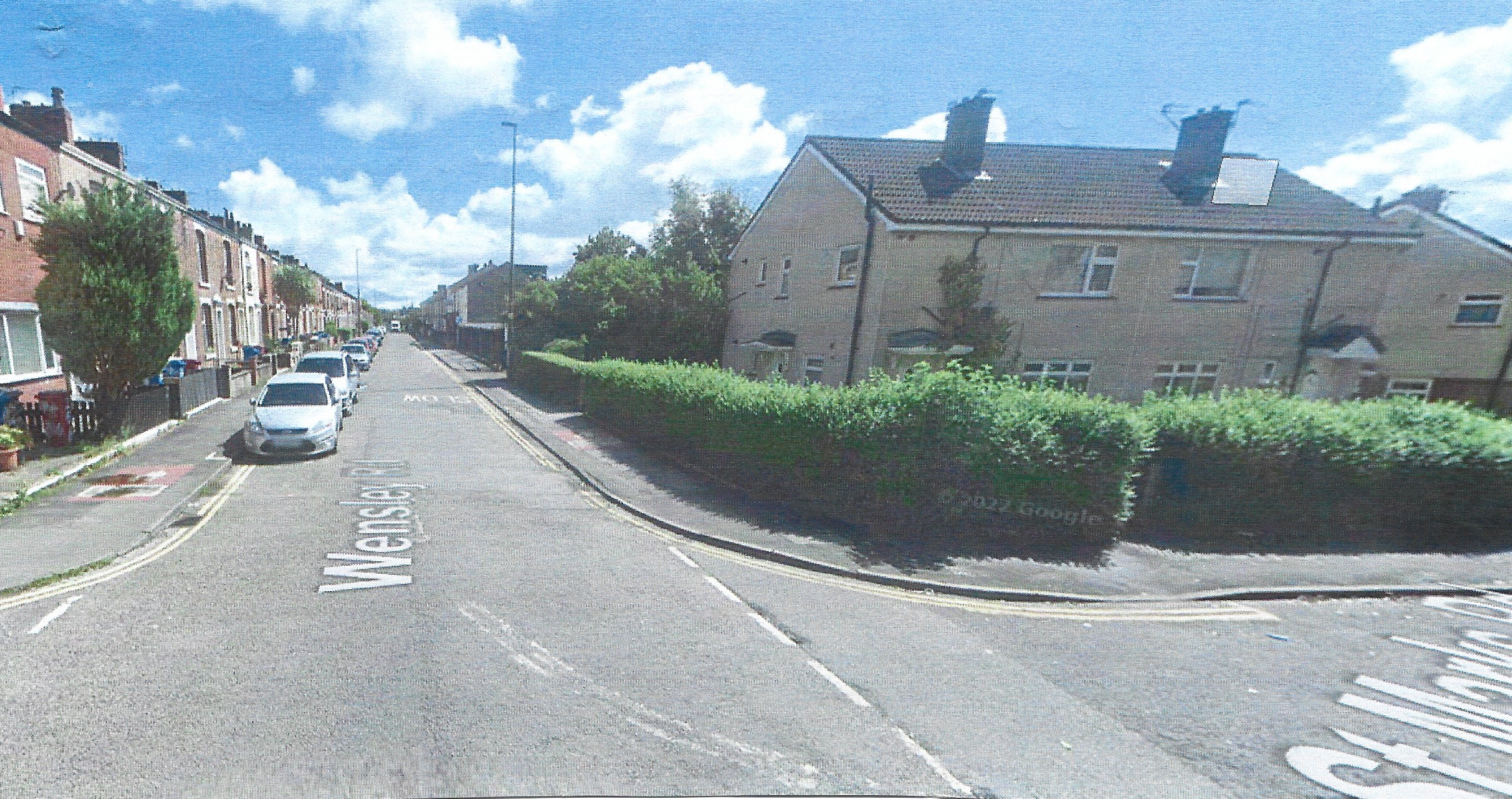
A view from the higher end of Wensley Road with its junction with Higher Witton Road on the right
leading into a post war estate of semi-detached houses with Wensley road
continuing into the distance with terraced properties
leading into a post war estate of semi-detached houses with Wensley road
continuing into the distance with terraced properties
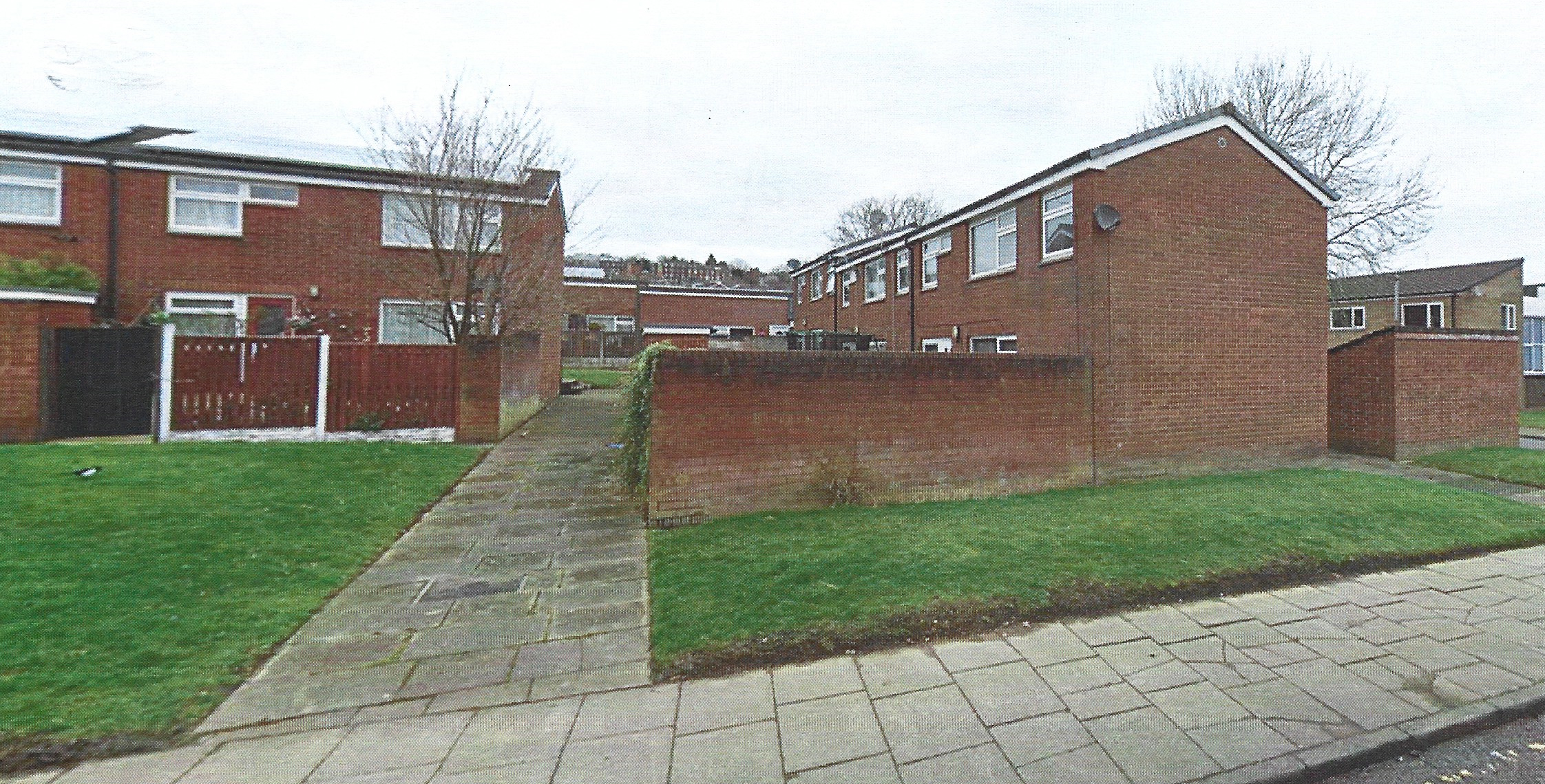
A view from the lower end of Wensley Road opposite the old gas works where the council cleared
all the former terraced houses to re-develop a large modern estate of mixed housing
around cul-de-sacs and squares with this view showing modern linked houses
all the former terraced houses to re-develop a large modern estate of mixed housing
around cul-de-sacs and squares with this view showing modern linked houses
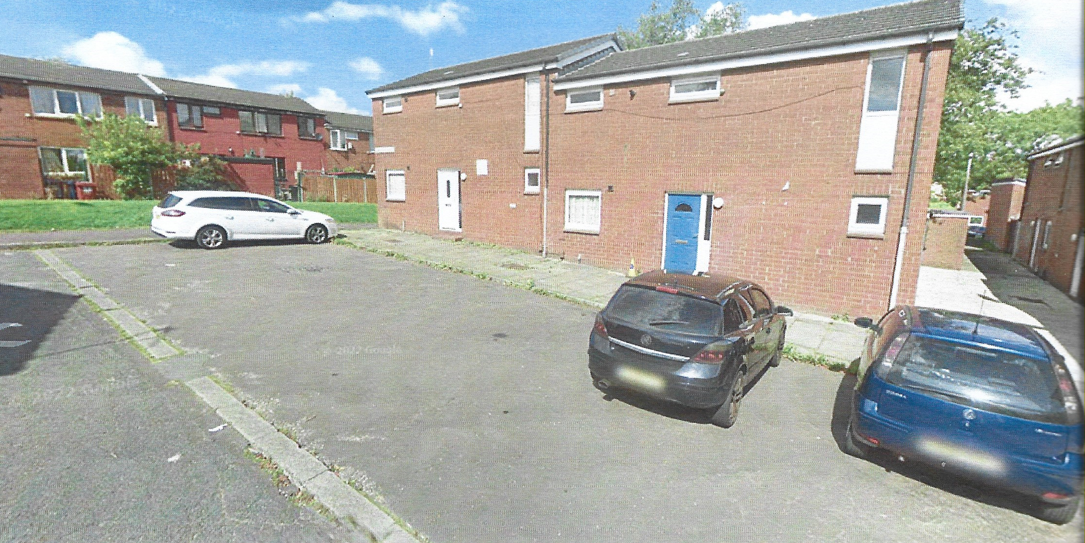
Another view inside the new estate with houses arranged round a square
On the industrial front there have been massive changes as the main emphasis has changed to service type industries rather than manufacturing and production. The textile industry having almost totally left the area. Wensley Fold New Mill closed its textile weaving in 1970 and the original mill buildings were greatly reduced. Now there are a variety of firms providing services with the rest of the site used for a large number of rental storage units. The whole site is now called Wensley Fold Business Centre. Bank Top Mill continued weaving a variety of fabrics until it closed in 1970. Since then, the mill has been used for carpet and underlay manufacture by Cavalier Carpets. In 1984, the mill was modernised externally, and, more recently, expanded and a modern loading bay added to meet the needs of today’s lorry transport. Garden Street Mill which had become Newman’s shoe and slipper works continued to the 2000s but then closed and was demolished; a recent cement works used the upper part of the site with the remainder presently unused. The Throstle Street Mill site has been developed into a Council Refuse site with all the original buildings demolished apart from the outer stone walls. Royal Albert Mill was demolished in the 1950s; the site is used for a variety of activities including Blackburn Group Training Centre and now forms a small business park with TBE Precision Sheet Metal Ltd fabricating various engineering and other products. Further down George Street West other textile properties were demolished and the site used by Blackburn Ambulance Service depot. On the other southern side of George Street West a whole host of modern units were created for various services including animal feed, car windscreens, out-door camping equipment and car sales rooms. Along Pleasington Street, new units were also developed including Pennine Fire Services and Lancashire Printing. On Wensley Road, the original Forrester’s Arms is now a plumbers merchants with car sales and repair sites developed. The Boar’s Head public house is now a restaurant, and, at the bottom of Saunders Road the newsagents has been modernised and now offers postal services. Beyond the Lion Hotel, a tyre centre has now opened and the huge site of the former gas works redeveloped with the removal of most buildings and gasometers and the eastern edge is now used by the council run Red Rose Business Park.
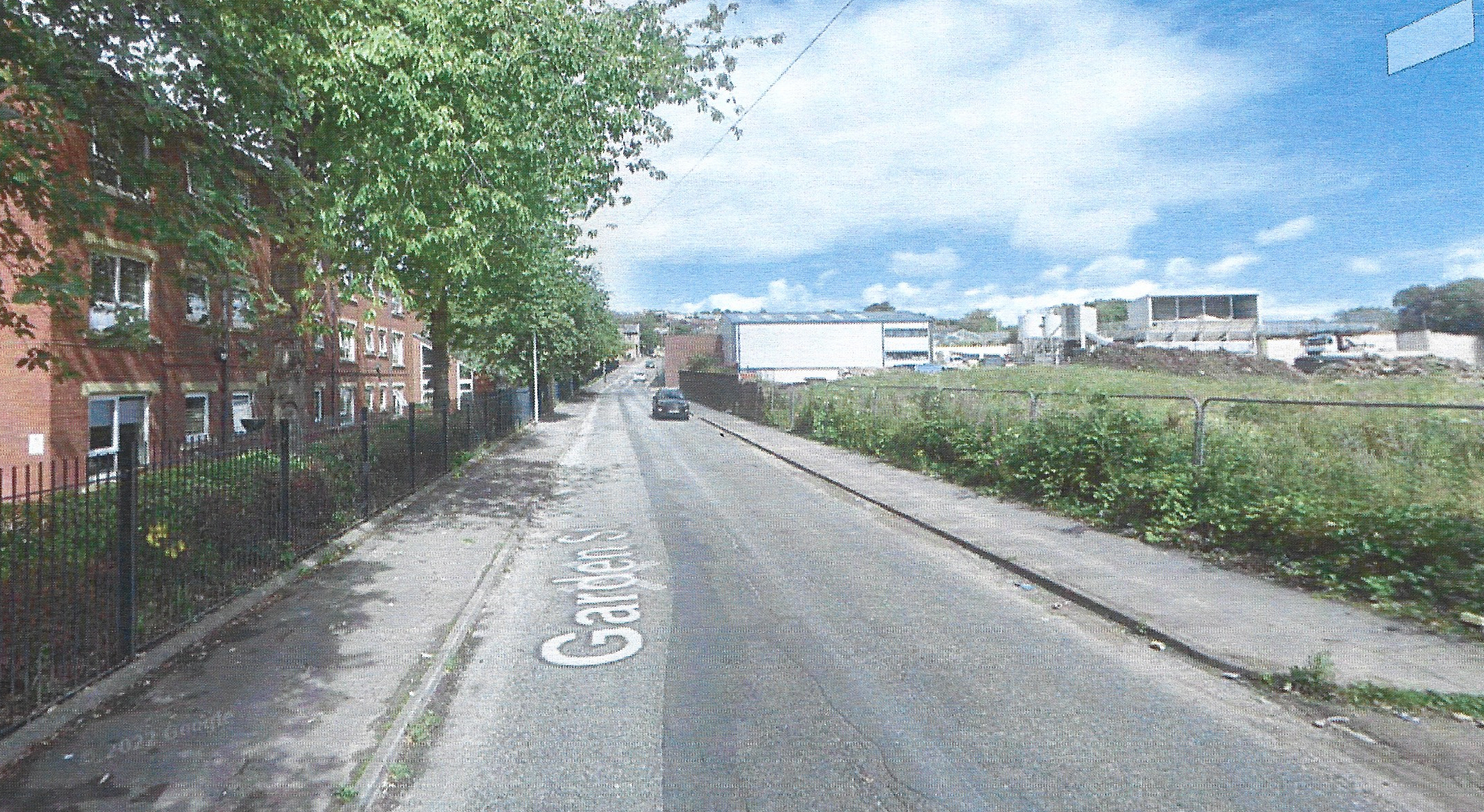
Modern view up Garden Street showing the vacant site of the former Newman’s Factory
with the new cement works beyond on the top part of Newman’s site and the clear skyline without a gasometer.
with the new cement works beyond on the top part of Newman’s site and the clear skyline without a gasometer.
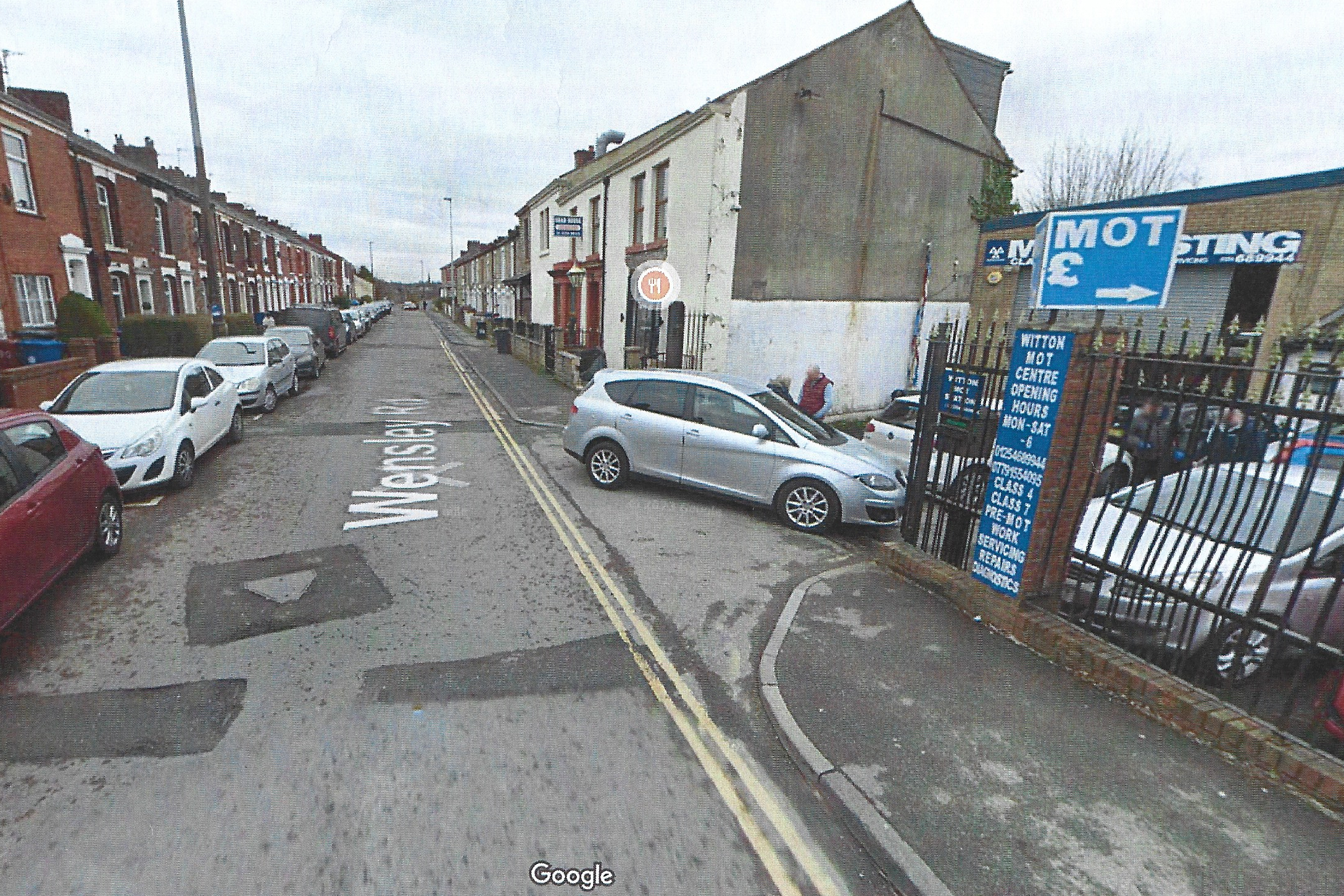
A view along Wensley road showing the garage and restaurant in the former
Boars Head and the long rows of terraced properties.
Boars Head and the long rows of terraced properties.
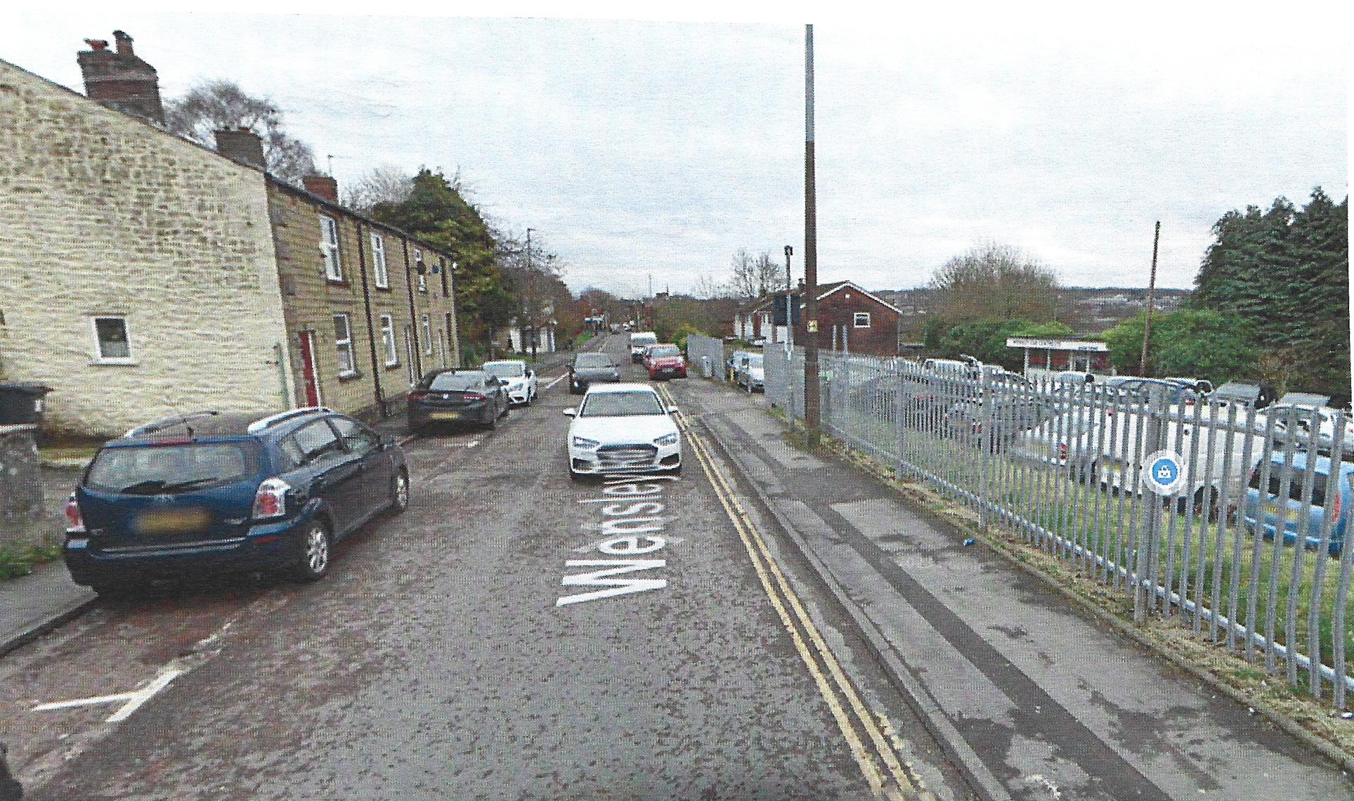
Another modern view lower down Wensley Road showing the fenced off car sales area
on the higher part of the former Wensley Fold Mills.
on the higher part of the former Wensley Fold Mills.
Today there are more local authority centres to provide services for the locals in the new council estate off Wensley Road, and, along Garden Street, a series of care homes/residential housing has been built in large blocks including Hornby Court and Apple House. Within the new private housing estate at the end of Pleasington Street can now be found Fountains Care Home run by Cygnet Health Care with car park and gardens, and, since first being built, has had an extension. All these developments reflect the needs for the growing number of older citizens in the area as modern health facilities and standards of living enable people to live longer lives.
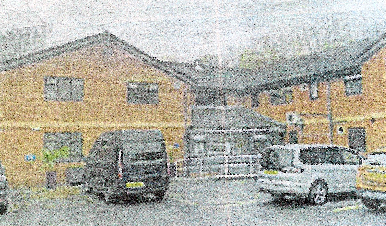
A view of Fountains Care home on Pleasington Close
Many of the churches that served the people of Wensley Fold have also changed. St. Mark’s on Buncer Lane has closed, St. Barnabas’s Church was demolished along with its school which moved to a new school site adjacent to the new council estate off Wensley Road and St. Luke’s still operates as does St Silas’s on Preston New Road. Most churches serve smaller congregations especially as the original terraced housing areas have become
multi-cultural. There are now local centres for varying faith groups and a huge, new mosque under construction off the northern end of Preston New Road. Within the outer edge of the new council estate, off Wensley Road, a Zion Pentecostal Church was opened in 1973 which today is known as Grace Pentecostal Church.
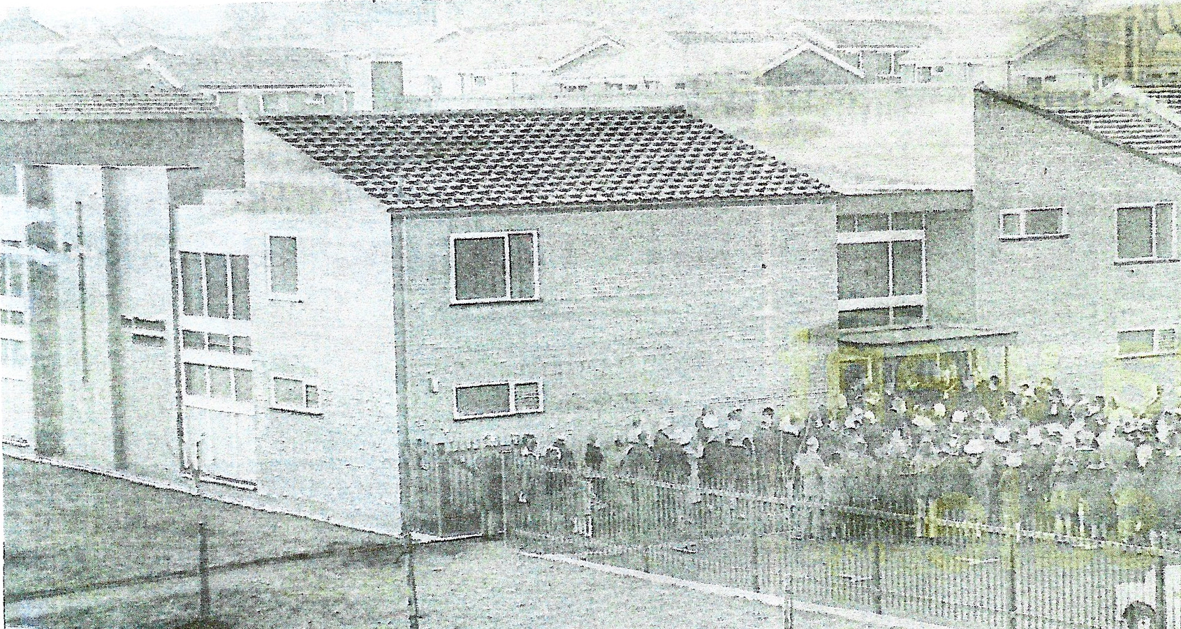
Grace Pentecostal Church in the new council estate off Wensley Road being opened in 1973
with a crowd of supporters at the entrance including Blackburn’s Mayor, Albert Lord
with a crowd of supporters at the entrance including Blackburn’s Mayor, Albert Lord
Any green open areas that now remain are no longer used for any form of agriculture with only a few allotments remaining. By 1976, the poor conditions at the old Wensley Fold School were finally recognised by the local authority which at that time was Lancashire County Council Education Authority. After an examination of its buildings dry rot was discovered and other problems which were deemed too terminal to waste money on upgrading and required regular inspection. The Church of England School had only just come out of its aided position two years earlier so there were arguments about transferring pupils to the nearby larger St. Barnabas School. However, by June 1979, a new Wensley Fold School had been created to the north of the area which was a dream come true for the staff and pupils and its Headmaster, Mr Ernest Kenyon, who had attended the original school himself as a child and had seen how crowded the former classrooms had been.
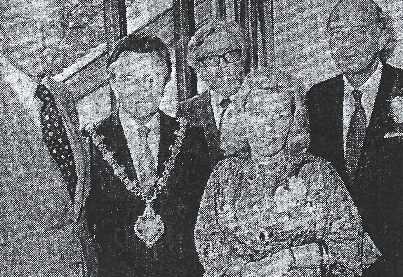
The image above shows the official opening of Wensley Fold’s new primary school in1979 with Lancashire’s Education chief Mr Conrad Rainbow on the right together with County Councillor Mr. Michael Fitzherbert (left), Blackburn Mayor, Mr. Frank Gorton ( 2nd left ), Mr. Ernest Kenyon Headmaster (centre) and Councillor Edna Arnold, chairman of the school governors. The new modern school had been opened a year before the official opening. Before the ceremony the school children held a “Maypole” celebration in the new school yard and the Headmaster praised the education department for all its support.
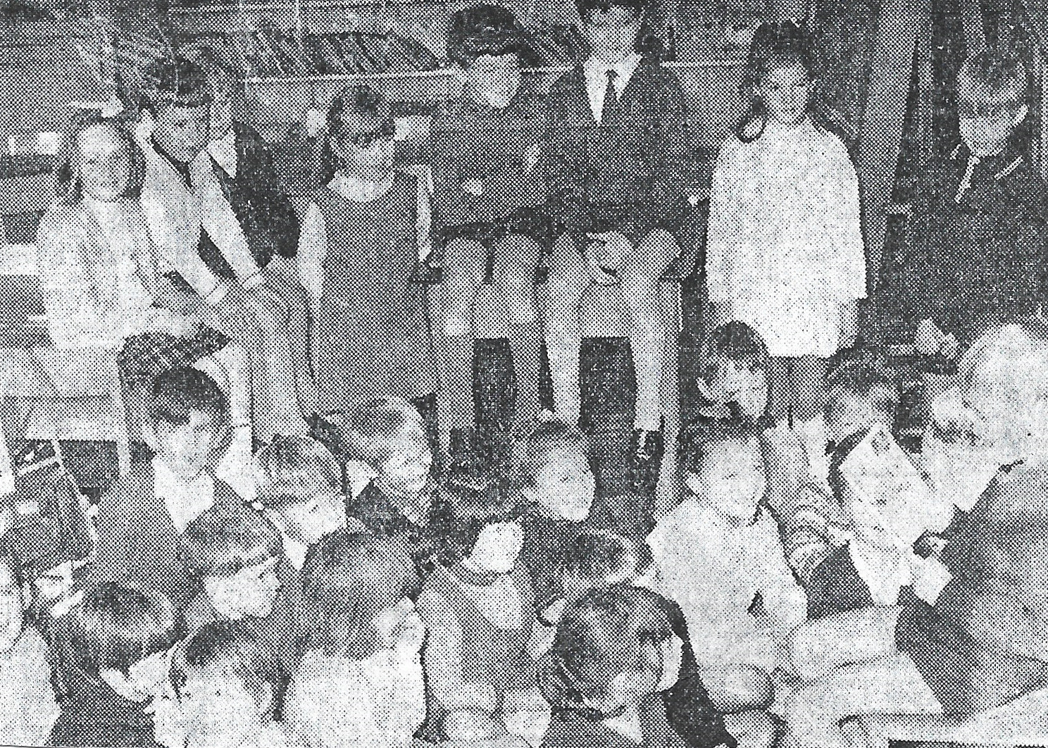
Wensley Fold pupils listen at story-time, a happy break from lessons at the new school
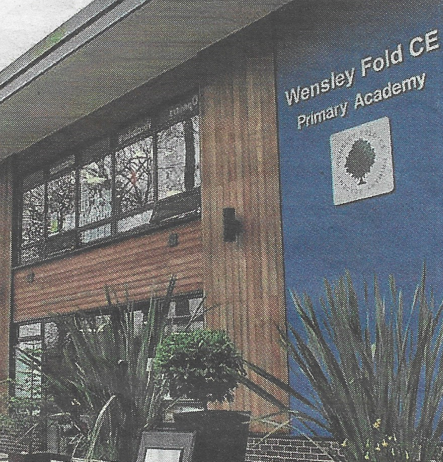
A view of the front of the new Wensley Fold CE Primary Academy
Today, the Wensley Fold area is a vibrant centre for a wide mix of nationalities and no longer a centre catering for the working class textile factory workers. It now offers a wide range of housing types and a workplace for a far wider diversified range of jobs servicing the needs of modern society.
Bibliography
The author’s own post-card and local history collection
The Victoria County History of Lancashire
Baines History of Lancashire Vol. 2
The Victoria County History of Lancashire
Baines History of Lancashire Vol. 2
Barrett’s Trade Directories – various years held in Blackburn Library
Abram, W. A., A History of Blackburn Town and Parish. 1877
County Borough of Blackburn, Medical Officer of Health Reports
Rothwell, Mike, Industrial Heritage: A Guide to The Industrial Archaeology of Blackburn. Part One: The textile Industry, Hyndburn Local History Society, 1985
Rothwell, Mike, Industrial Heritage: A Guide to The Industrial Archaeology of Blackburn. Part Two: Other Industries, Hyndburn Local History Society, 1968
Timmins, J.G. Handloom weaver’s cottages in central Lancashire (Occasional Paper), Centre for North West Regional Studies, University of Lancaster, 1977
Published September 2023