
 Loading more
Abrams Articles
Blackburn in 1793 By W A Abram Article 1 | Blackburn in 1793 By W A Abram Article 2
Blackburn in 1793 By W A Abram Article 3 | Blackburn in 1793 By W A Abram Article 4
Introduction
A short while ago I decided to write an article on Blackburn in the eighteenth century. The task was to be more difficult than I first envisaged. This period in the history of the town is a difficult one, there is very little written down. Abram mentions the eighteenth century in his book “The History of Blackburn” as does G.C. Miller in “Blackburn, The Evolution of a Cotton Town”, and “Bygone Blackburn” (see also Derek Beattie “Blackburn a History”), but these usually talk of events and the gentry of the place and not the town itself. Having searched through books and other material I decided that I could not get enough information to do the sort of article I wanted, however while looking through the newspapers of the late nineteenth century for another project I had in hand, I came across a set of articles written for The Blackburn Times in 1893 by Abram entitled “Blackburn in 1793, Centenary of Blackburn Newspaper Press”. Reading through these it seemed they were ideal for what I wanted. So I decided rather than write my own article I would transcribe these and give it as Abram wrote it. The articles can be a bit heavy in places but they do give a good insight into the town, its streets, alleys and buildings in the 1790’s.
Abram has as his starting point for the articles the year 1793, which was the year The Blackburn Mail, was established in the town. From that time until 1832 Blackburn had only this one newspaper, it is not unfair to say that at this early period of its life the newspaper printed very little about the town itself, concentrating more on news from the Parliament and world affairs with, perhaps adverts relating to the town, and this was to be the case right up into the early nineteenth century.
When reading the articles remember they were written in 1893, so when it refers to so many years ago it means from 1893.
There are four articles with the last one giving a list of people who lived and worked the town at that time, below is the first one. The articles appeared in The Blackburn Times as follows:
Part 1, Saturday July 16th 1893, p.6
Part 1, Saturday July 16th 1893, p.6
Part 2, Saturday July 22nd 1893, p.6
Part 3, Saturday July 29th 1893, p.6
Pary 4, Saturday August 5th, 1893, p.6
Enjoy. I would be delighted to hear any comments you may have, send them to: library@blackburn.gov.uk
Stephen Smith, Community History Volunteer
Blackburn in 1793 By W A Abram Article 1
A little while ago an old townsman writing in the Blackburn Times expressed a wish that I should write, for publication in this paper some account of the town of Blackburn as it was a hundred years since: and I now attempt to fulfil that request. If it be desired to describe the former state and appearance of a place, the choice of the particular time is open and is usually ruled by the possession of some kind of materials for a description relating to a certain date. There is a special reason why a view of Blackburn in the past, contrasting with Blackburn in the present, should just now be prepared and printed and why the period selected for such a view should be the year 1793. That reason is that this year 1893 is the centenary year of the Blackburn Newspaper Press. The first newspaper printed and published in Blackburn was the Blackburn Mail, and the first issue of that news-sheet appeared on Wednesday, the 29th of May 1793, these articles intended to commemorate the event. The Press does its share in signalising the centenaries, bi-centenaries, and so on, of other and not more important institutions, and it may becomingly celebrate its own centenary here or elsewhere. Blackburn has been without its own newspaper or newspapers during an interval, but a short one, since the origin of the oldest local journal in 1793. A few months elapsed, I think, between the discontinuance of the Blackburn Mail, after an existence of not far from forty years, and the appearance of three other papers which followed each other into the field in quick succession about 61 years ago, in 1832, namely the Blackburn Journal, Blackburn Alfred (which soon changed its name to the Blackburn Standard), and the Blackburn Gazette. The Blackburn Times has its peculiar claim to distinction in the fact that it was the first penny newspaper printed in the town (or in any town in North-East Lancashire), and it will within two years be forty years since this paper inaugurated the cheap Press in the district.
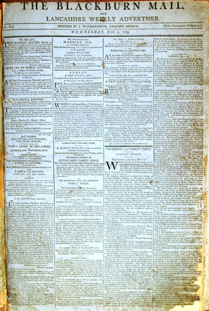
In another article I shall revert to the Blackburn Mail, and mention some things about its form at starting, and as to how it fared in its early years. The difference to a town, in the preservation for posterity of the events and occurrences which constitute its annals, between having its newspapers and being destitute of its own printed chronicle, is marked. Scanty as the items of towns news may be in the local newspaper of a century back, they are acceptable indeed after the almost total blank of the years which went before the establishment of such intelligencers. Of what transpired in Blackburn during, say, fifty years from 1743 to 1793, prior to the commencement of the Blackburn Mail, one can glean from any source only a very small amount of information, compared with the incidents to be gathered respecting Blackburn life in the thirty or thirty five years onward from 1793. Copies of old newspapers, indeed, were kept and bound up into volumes by hardly anybody, except the publisher, who filed his paper regularly and so far as I can learn there is but one nearly complete set of the Blackburn Mail from the first issue remaining, which was the printer’s bound file, and which has fortunately found its way to the public Reference Library of Blackburn. To the first fifty or sixty numbers of the Blackburn Mail I am beholden for a considerable proportion of the data for the account of the Blackburn of 1793 which I have compiled.
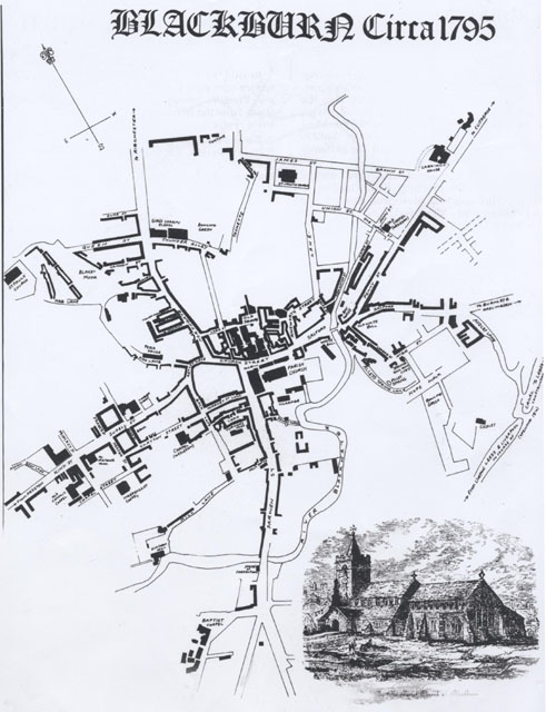
The plan of the town of Blackburn which illustrates the present article represents with tolerable accuracy the streets, lanes, courts, and interspaces of this town in 1793, and also indicates the situation of the public buildings, (churches and chapels chiefly) and principal inns, and detached old houses, the residences of leading townsmen. There is no contemporary map or plan of the whole town of that period. The oldest published map is that of Mr. Gillies, completed in 1822, thirty years later. But with the aid of old plans of several properties near the middle of the town and township, and by means of the knowledge obtained of the portions of the streets and structures built before 1793, Mr M’Callum, the borough Engineer, recently made out a plan upon a good large scale, in accordance with my suggestions of Blackburn in its extent as it stood about 1793 or 1794. The Plan has been reduced from that large one, and engraved for our use in the paper by Messrs. Hare & Co., of London. It will enable the reader to realise better than he could from any verbal description alone the size of the town and the manner in which the buildings constituting it were disposed along or behind its five main thoroughfares, namely, Church-street, in the centre and North-gate, King-street (or Sudell-street as it was formerly named), with Astley-gate connecting it with Church-street and North-gate, Darwen-street, Salford and Penny-street.
The remainder of my space in this introductory article I must occupy by topographical notes on the town of Blackburn in 1793, including its Streets Lanes, Courts, Squares, Crofts, Outlying Hamlets, &c.
Let us begin with a statement, affording an idea of its size that Blackburn a hundred years since was. A Town of about 9,000 inhabitants, but not more than perhaps 7,000 of them would be domiciled in the closely-built portions of the town itself; the balance lived in the detached hamlets scattered over the area of the township at distance of from less than half a mile to more than a mile from what was considered the town. The town of Clitheroe as we know it was larger by a couple of thousands in population, and probably covers considerably more ground than Blackburn in1793. But Clitheroe has its castle in the midst to dignify it, and Blackburn has no such feature. As surveyed from their heights around from Whinney Edge or the top of Brandy House Brow on the south-east, from Revidge on the north or Billinge Hill on the north-west, it would present the appearance of a collection of tenements, mostly built of red brick surrounding an old church; and from that compact nucleus straggling on the lines of the roads which branched from the town in different directions. The length of the town east and west from Salford to King-street and, somewhere on this side of the bridge over the brook at Whalley Banks, might be three quarters of a mile and the breadth north and south from the top of Northgate to the bridge at the bottom of Darwen-street about half a mile. There was a good deal of open ground in the angles between these four main streets; there being no cross streets directly leading from one chief thoroughfare to another. The older portions of the town where the buildings stood thick upon the ground were Church-street, and the blocks of property projected behind that street to the northward, as far as Lord-street and the old Square between North-gate and Holme-street, near the Blakewater brook. These properties were chiefly workshops and warehouses, at the rear of the houses, shops and other places of business fronting to Church-street, to which they were respectively attached. Narrow alleys afforded passage between these back buildings, but only one of these has been left by the modern improvements and street openings (King William-street, Thwates’s Arcade, and Victoria-street); I refer to the passage from Church-street through Shorrock Fold, to Lord-street. Shorrock Fold is itself one of the ancient courts of Church-street, once flanked by two old taverns, the “Star” and the “Black Lion.” The present buildings on the west side of the passage are considerably older than the century. The “Old Square” opened out at the lower end of Lord-street, and was surrounded on the west, north, and east sides by brick houses, which must have been erected before 1793. At the north east angle of the Old Square was a passage extended towards the “Tackets,” an ancient footway between hedges or walls, terminating at the north end, at the foot of Richmond hill—a Cul de sac of Tenements, the name given to the site of which was at a later date given to Richmond terrace when it was opened out, west of Richmond hill. From the middle of the way known as “Tackets,” branched on the west side, “Thunder Alley,” which opened at the other end into Northgate, and gave communication by Queen-street to the lower corner of Blakey Moor. Thunder Alley existed before 1745, for in that year a building was erected for a private house at the corner of Northgate and Thunder Alley, and extending some thirty yards on the south side of Thunder Alley, which for not less than 100 years has been an inn with the sign of the “Masons’ Arms.” On the opposite side of Thunder Alley, the girls’ Charity School, and the house for the mistress were built in 1764. The National School too was erected in Thunder Alley towards the end of the century. For more than thirty years this street has been renamed Town Hall-street, but the old natives still think of it as “Thunder Alley”
Returning to the vicinity of Church-street, our plan of Blackburn in 1793 shows, separated from the “old Square” by two blocks of houses, a court of irregular shape dignified by the name of “Haworth Square.” It was reached from the outer bend of Ainsworth-street and had no other exit except a narrow passage beyond which was the “Bull Meadow,” where, tradition says bulls were baited for popular sport in the days of yore. That field and other enclosures occupied the whole space between “Tackets” and a lane but recently opened in 1793, continuing Ainsworth-street north to join James-street, then also a new street beginning to be built up on the north side. St. John’s Church and churchyard, erected and laid out four years previously, occupied (as marked on the plan) the angle between James-street and the lane going down to Ainsworth-street, which, until not long prior to 1793 was but a very short street starting from the bottom of Church-street and curving round to join with Holme-street at the other end. The lane shown on our plan, which had recently been opened and odd buildings erected on either side of as far as Union-street, abutted upon garden-grounds, occupying both banks of the Blakewater above Water-street, of a house called Cable House the property and residence of a gentleman named Mr. Joseph Ainsworth. It was after him that Ainsworth-street was named. The two parts of the garden divided by the brook were connected by a rustic bridge. Mr Henry Sudell erected a warehouse—the largest in the town when it was reared—on the side of the lane in extension of Ainsworth-street next to the river, but I am not sure that it was built before 1793; if not it rose very shortly after. It is still standing, and now is Messrs. Smith’s furniture warehouse. The old theatre at the turn of Ainsworth-street did not exist in 1793, nor until 1816.
The Houses in Union-street, with the bridge over the river, and in Old Chapel-street, which extends from Union-street bridge to Penny-street, are of evident age, and some of them no doubt were there in 1793. Union-street at first was laid out for a quiet respectable, residential street in the outskirt of the town in that direction, as were likewise John-street and James-street, opened out about the same time. Old Chapel-street existed rather earlier, for it was named from the first Wesleyan chapel, on the north of the street, original the “Calendar House,” converted into a chapel in 1780, and opened by John Wesley, June 23rd 1781. Water-street runs from Salford-bridge end to Old Chapel-street, and in its lower part it has houses on the east side only; the Blakewater, running on the west side, gave the street its name. The small low tenements of which the street consists are older than a hundred years. The Blackburn Mail office was at the lower end of Water-street, behind the Bay Horse Inn.
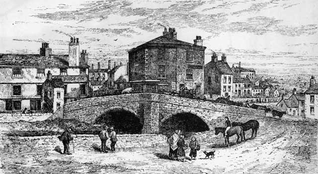
Salford Bridge, in 1793 was ancient, and hardily wide enough for two carts, wagons, or coaches to pass each other upon it. The street at either end of the bridge and Eanam higher up, forming the eastward road out of town was named Salford as long back as we can trace the thoroughfare. Its name means the ford of sallows, or willows, which, being descriptive for willow grew beside the brook near the bridge and the ford that must have been used for crossing when as yet there was no bridge, is an ancient name, and not adopted at second hand, as some might suppose, from another Salford, on the Irwell near Manchester. Penny-street being at the entrance of the Whalley high road into the town, meeting Salford at the bridge, is an old street, but its line until 100 years since was not so straight as it is now at the Larkhill end where it formerly surmounted the brow more steeply by the natural rise, on a line with a few old tenements not yet pulled down, which stand above the present street on the left. They are the last marked on our plan on that road, just beyond Larkhill House, a large brick mansion, built by Christopher Baron Esq., the then owner of the Larkhill freehold, in 1762. Beyond Larkhill there were, in 1793, no more houses on the Whalley Road, except the farmstead at Derrikins, a little of the road, where Hornby’s mill now stand until Cob Wall was reached.
Between Penny Street and Salford, at the time of our survey, there were no streets; only old structures forming the backs of property fronting to these main avenues. The streets which cover that portion of the Vicar’s Glebe land, named Vicar street, Starkie-street, (after Vicar Starkie), Cleaver-street, Syke-street and Moor-street, shabby and dilapidated as they now look were not constructed far from ten to fifteen years after 1793. South of Salford, I should mention the brick tenements demolished a few years since to open High-street to Station-road, and some others still standing existed a hundred years since, and occupied ground from Salford-bridge to Spring Gardens, at the side of Hallows Springs-lane, as well as on both sides of Calendar-street. Anderton’s Factory, the oldest in the heart of the town, stood on Spring Hill, just above the ancient town’s wells called Hallows Springs; this building has hitherto escaped destruction. The Blackburn Subscription Bowling Green, in 1793 occupied it original situation amongst gardens above Hallows Springs, and at the foot of the steep bank where stood the Tenement with the singular name of Cicely Hole. The construction of the canal along the contour of the same bank was then about to be commenced. It had been planned more than twenty years previously. Audley Lane was an occupation road from the high road at the upper end of Salford to Audley Hall, the ancient farm house on the Rectory Glebe, good part of a mile from the town.
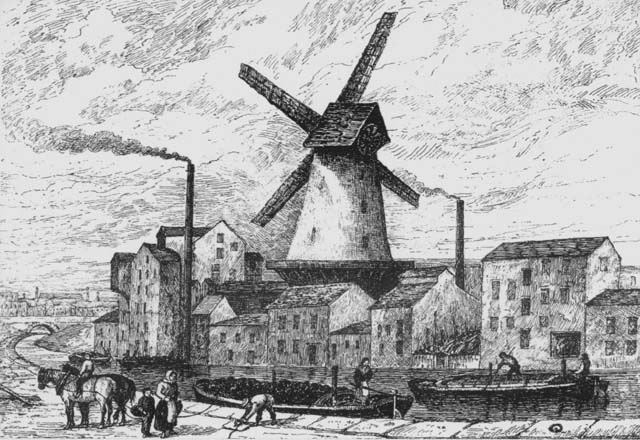
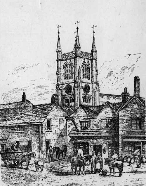
The old Parish Church, a centaury since stood in its sacred enclosure on the south side of Church-street, within a few feet of the backs of the row of antique houses forming streets seen in the painted picture of “Old Blackburn” at the Free Library. The Church yard, in its original area, extended south of the Church to somewhere about the north line of the position of the new Church, and in it, besides the Church, was the Vicarage and Grammar School. The Blakewater, with a sharp bend, approached the back of the Vicarage. The bed of the river was straightened to its present course when the Church was rebuilt and the Church yard extended.
© BwD - terms and conditions
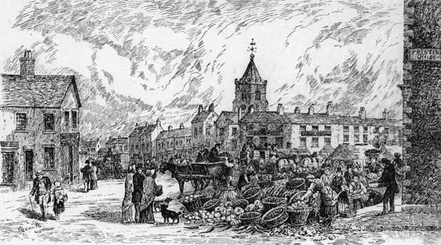
The upper end of Darwen-street, up to the “Cross” at the junction with Church-street, was the old Market Place. That is why Darwen-street was the wide street it always has been. Full half its width was covered with stalls on market days. The oblong block at the top of Darwen-street on the east side between the street and the Church indicated on the Plan, is the Old Black Bull Inn, the most ancient hostelry, and the best accustomed, in 1793. The fall of Darwen-street was much greater formerly than now from the “Cross” to the opening of “Mill Gate,” and beyond to the Ship Inn; then it rose to the centre of the old arched stone bridge. The town may be said to have finished at Darwen-street Bridge, or the block of houses beyond it on the west side. From Darwen-street, Mill Gate, a narrow street, opened to back lane, and continued by Mill Lane, to the water corn-mill on the river banks—a relic of hoary antiquity, for this, no doubt, was the site of the Lord’s “Mill”, of Blackburn Manor, mentioned in charters from 600 to 700 years ago. The Blakewater was dammed by a weir from Darwen-street to the Mill, to furnish water to turn the mill-wheel. Market-street Lane connected Darwen-street and Back-lane, but in 1793 there was no other cross street from Astley Gate to Mill Gate. West of Back-Lane Clayton-street opened, in the roar of King-street, and south of Clayton-street were good sized gardens and crofts. The second Wesleyan Chapel, built in 1785, was in Clayton-street, and the gardens of two or three of the largest houses in King-street were bounded by Clayton-street.
King-street was at first (perhaps 130 to 150 years since) an extension of the town westward, on the Preston Old Road, in order to afford sites, with convenient access to the centre, for more residences of the opulent merchants and people of competent means unconnected with trade. Down to 1793, King-street as a continuous street of buildings, reached not further than the point where a lane from Wensley Fold, called Askew Bent Lane, connected with it, nearly where the modern Montague-street or Branch-road joins King-street. But there were disconnected houses or blocks of two or three, on to Whalley Banks. In another article I shall notice the principal residents in King-street (and other streets) in 1793. Blakewater-street, Heaton-street, and Freckleton-street were formed before that date, branching from King-street on the south; and Chapel-street parallel with King-street, was laid out soon after the Independent Chapel was built on a site there in1778, hence the name of the street. In the angle of King-street and Northgate, fish Lane, starting out of Astley Gate, proceeded a short way, to the house which Mr. Robert Peel dwelt in a few years in the middle of the last century; thence continued as a footway, between thorn hedge, to Blakey Moor, at the upper end of Nab Lane. North of Fish Lane and behind Northgate were the three “Cockcrofts”—“Upper, Middle, and Lower,”—but more like blind alleys than crofts they were and are, what portions of their structures remain. Blakey Moor was reached from Northgate by Cannon-street, Queen-street, and Duke-street. These streets were founded twenty years or more before the end of last century; so that the “Queen” who was thus honoured must have been Caroline, Queen of George the Third, who the “Duke” was who was commemorated by Duke-street, I cannot guess, though one of the Royal dukes of the period is likely to have been intended—maybe the Duke of York. St. Paul’s Church has been built and opened a couple of years before 1793, and is the last building on our Plan to the west ward, past Blakey Moor.
I have used up my space for this week and can barely mention the numerous outlying hamlets, folds, and detached houses which in 1793 dotted the area of the township from the town in the centre to the boundaries. We could not include them in the Plan without making the block take up to large a portion of this page of the paper. One of the hamlets appears in our illustration, namely “Islington,” south of Darwen-street Bridge, a cluster of houses and the old Baptist Chapel (the latter erected in 1764), on the western edge of the “Town’s Moor.” At the opposite end of the “Town’s Moor,” behind the old Workhouse, which was built on a plot appropriated from the moor, lay the hamlet of Grimshaw Park, a group of cottages planted on the slopes of the hill under the stone quarries; and not far off the south-west corner of the Town’s Moor began the more considerable village, as it might be termed of Nova Scotia In 1793, Nova Scotia consisted of rows of houses flanking the highroad, from the Weaver’s Arms to the tenements about Union-street on the other side of the road. West of the town were the hamlet of Snig Brook and Winter-street (the cottages in the latter are some years older than the century) Great and Little Peel, Bent Gap, and Wensley Fold, on the township boundary, which had increased since the first cotton spinning mill in or near Blackburn was built on the brook side close by the ancient “Fold,” in 1777. North-west of the town were Shear Bank Fold, the mansions and farm house at Bank, and groups of cottages at the top of Dukes Brow, on Revidge; and on the other slope, Beardwood, consisting of several old cottages besides the farm house at Beardwood Fold. North of the town, on the road to Ribchester, starting from the end of Northgate, were the hamlets of Limbrick, Little London with Stid Fold and Card Fold, Hole i’ th' Wall, and Pleckgate at the township boundary. North-eastward, on the Whalley Old Road, at the bridge over the brook, was the hamlet of Cob Wall. Eastward, on the Burnley Old Road, past Eanam, were the hamlets of Copy Nook, Bottomgate, Furthergate, and Whitebirk on the boundary of the township. All these names are preserved, but they now belong to populous suburbs of the town, which has spread until it has embraced all of them, except Pleckgate and Beardwood, that are still outlying.
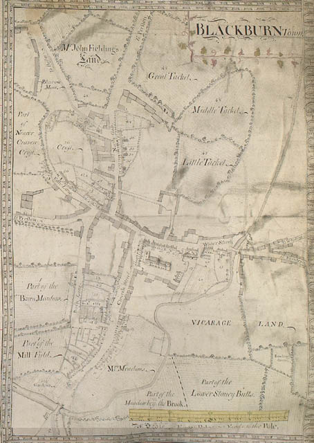
Part of the Glebe Map of Blackburn of 1753. Notice that what is now Darwen street was then called Church street. [By kind permission of The Trustees of Lambeth Palace Library]
DOCUMENTARY ILLUSTRATIONS OF THE TOPOGRAPHY; DOCTOR AIKIN'S DESCRIPTION; MARKETS, TRADES AND MECHANICAL INDUSTRIES &c.
Before going on to describe the markets, principal trades and industries, mercantile and banking establishments &c., of Blackburn town as they existed a hundred years since, it might be of interest to add an item or two illustrating its street plan and general topography in the latter end of the eighteenth century, which was dealt with in my first article printed in the Blackburn Times of last week.
From two old title-deeds, dated respectively 1772 and1780, I extract a few lines in which mention is made of certain streets, lanes and tenements in the town. That they were as described at the dates named is proof of their existence a few years later in 1793, and some of them had not changed tenants. In 1772, a dwelling-house, &c., situate in the street called Northgate, within Blackburn, in the holding of Thomas Haworth; other dwelling-houses in Northgate, in the holding of Margaret Bleasdale, widow. Other dwelling-houses situate in a street called Water-street, within Blackburn, with a barn outbuilding thereto belonging, situate in the Back Lane and several closes of land known by the names of nearer Askew Bent the further Askew Bent, the Black Hole, the Askew Bent Lane, the Larkfield, the Brookhouse, Lark-hill, the Wheat field, and the Little Mosses, in the holding of James Barlow, Innkeeper. A dwelling situate in Water-street the holding of Robert Ainsworth. A close of land called the Croft, in the holding of Mr Thomas Livesey.
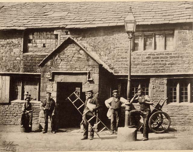
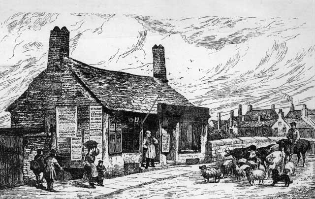
Site of Peel homestead, Fish Lane. Now known as Cardwell Place, the ancient Jacobean farmhouse was tenanted by the first Robert Peel about 1750. Here his son the famous statesman was born and here he made his first experiments in block printing.
© BwD - terms and conditions
In 1780—A dwelling-house, with the barn and stable, situate in and leading to the (old) Square in Blackburn, in the holding of Mr James Barlow, senr.; the beer house, garden, milk house, &c., at the south side of the road leading into (Old) Square, owned and occupied by Mr. Thomas Smalley; and the close of land and garden lying at the back of the same Square in the tenure of John Livesey Esq., A dwelling-house, shop, and beer house, situate in Northgate-street, in the tenure of Thomas Rae, linen draper. A dwelling-house, with the shop underneath, situate in Church-street, in the tenure of Mr. Thomas Holme. A Field, called the Brickfield, situate on the north side of the road from Blackburn to Clitheroe, in the tenure of Lawrence Whitaker, and another field held by the same tenant, on the south side of the same road called the Larkhill situate at the head of a street called penny-street. A field, situate on the north side of a street called Sudell-street (now called King-street), on the east side of Askew Bent Lane.
From another series of deeds dated 1780—A dwelling-house situate at the head of King-street, otherwise called Astley Gate, in Blackburn, adjoining a road leading from the top of Astley Gate into the yard of Mr. Hargreaves. In 1788, the land conveyed for the site of St. John’s Church is named “Tackett Bent.” In a deed dated 1781—A dwelling house, with the back buildings and croft, and the butchers shops and pen-houses adjoining, situated on the west side of a street in Blackburn called Darwen-street, the inheritance and in the possession of John Wareing. In 1779—Sale of a dwelling-house, warehouse, and gardens, situate in the Church-street, Blackburn, lately in the possession of Mr. William Kenyon.
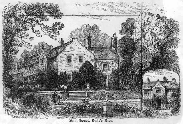
Bank House, Adelaide Terrace from the Haworth drawing, 1888-89
© LET - terms and conditions
In 1779—Was to let a large and commodious dwelling-house, near the (Old) Market Place, in Blackburn, four stories high, with a garden, house, yard, barn, stables, and shippon in the possession of Mr. Smalley. In 1784—For sale, two freehold messuages, with two large warehouses behind the same, situate in King-street. Also a dwelling-house, shop, &c., situate on the east side of Darwen-street, in the possession of Humphrey Crossdale, Watchmaker. In a deed dated 1788—Two thatched cottages in Fish Lane, which formerly belonged to Esther Hindle; a barn and shippon, a stable, “hovel,” and little garden behind the barn, and several closes and parcels of ground called the Nearer and Further Craven Crofts &c. The owner of these tenements yielded and performed suit of Mill, at the Water Corn Mill of Blackburn Rectory, being one moiety of the manor of Blackburn. In the above extracts are mentioned properties fronting or adjoining the Old Market Place, Church-street, Darwen-street, Back Lane, Astley Gate, King-street (or Sudell-street), Fish Lane, Northgate, Old Square, Water-street, Penny-street, Tackett Bent and Askew Bent Lane; or situate at the hamlets or folds of Brookhouse, Larkhill, Askew Bent, &c. and standing at different dates a few years preceding 1793. It is from such documentary references that we are able to indicate with certainty the portions of the town built previously to the date named, and to state the Character of the buildings and premises, and who formerly owned and tenanted them.
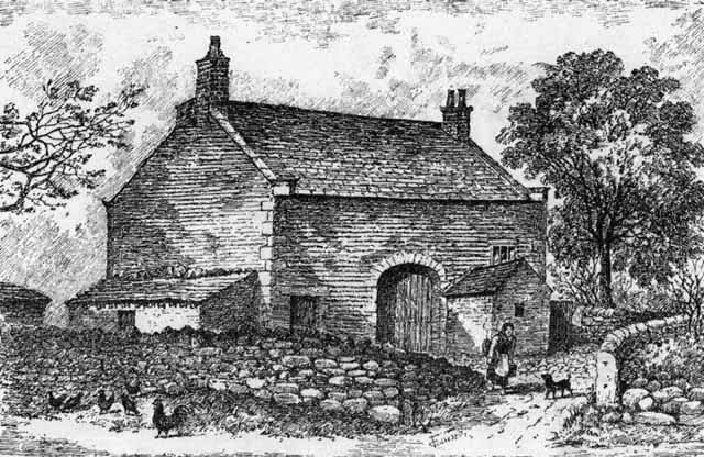
Miles Wife Hey, from a drawing by Charles Haworth
© BwD - terms and conditions
From another legal document I have met with, two or three material bits of information are obtained respecting the extension of the trade of the town, and the consequent improvement, or projected improvement, of the business, streets and places in the midst of Blackburn. It is a Case for counsel, dated September 1792. The statement of the facts of the Case includes the following particulars—“The Inhabitants of Blackburn, who are become very opulent , have several schemes in contemplation for the Improvement of the Town, and frequently propose different buildings upon the Waste Grounds, regardless of the idea of control from the lords of the manor. In the year 1783, one John Barlow erected a Butcher’s Shop with a room above upon a parcel of Waste Ground adjoining to a rivulet which passes through the town,” &c. “The inhabitants have now [1792] entered into a resolution to alter the (Old) Market Place, and by making an Arch over the River (Blakewater) they mean to form a very commodious situation to make a Meal-house, and to make many other conveniences which will comprise a very considerable part of Waste Ground, and particularly that whereon Barlow’s Building was erected, which they talk of taking down without the least scruples.” The piece of waste ground here referred to would be, I think, situate near Salford Bridge in the direction of Hallows Springs, when it was proposed to create a site for all Town’s Meal-house by arching over the bed of the Blakewater, as was afterwards done. Also it was stated that the Waste Lands near the middle of the township and town were “of considerable value, being well adapted for building ground, yet a clear title to them cannot be made with out an act of Parliament, because the Archbishop (life owner of the Rectory lands) cannot bind his successors; they (the waste grounds) are not object of such importance at present as would induce the lords of the manor to oppose any measure conducive to the interest of the town.
© BwD - terms and conditions
In the bulky quarto, The Description of the Country Round Manchester, by Dr. J. Aikin, published by John Stockdale in 1795, is a short account of Blackburn as it then appeared. The author must have visited this and other portions of the county at least a year or two before his book was written and printed, so that it would be in or very near the year 1793 that Dr. Aikin made on the spot his notes on Blackburn, several sentences of which are worth extracting after a century has elapsed since they were penned. Dr. Aikin wrote;
“The Town of Blackburn is seated in a bottom surrounded with hills. It has long been known as a manufacturing place, but within the memory of man the population was very inconsiderable to what it has lately been. [The memory of a man in 1793 would extend back to 1720 or 30.] It was formerly the centre of the fabrics sent to London for printing, called Blackburn Greys, which are plains [or plain cloths] of linen warp shot with cotton. Since so much of the printing has been done near Manchester, the Blackburn manufacturers have gone more into making of calicoes. The fields around the town are whitened with the materials lying to bleach. The town itself consists of several streets, irregularly laid out, but intermixed with good houses, the consequences [and tokens] of commercial wealth. Besides the Parish Church, there is a newly erected chapel of the establishment, [St. John’s Church], and five places of worship for different persuasions of Dissenters. There is a Free School founded by Queen Elizabeth, and a very good Poor House, with land appropriated to the use of the poor, where cattle may be pastured, [i.e., the Town’s Moor]. Blackburn has a Market on Mondays, but its chief supply of provisions is from Preston [this was so, if at all to a very limited extent], particularly in the articles of butchers’ meat and shelled groats*. The latter are bought by the townspeople about Michaelmas, ground to meal and stowed in arks [large oak meal-chests], where they are trodden down hard, while new and warm, to serve for the year’s bread, which is chiefly oat-cakes. It has an annual fair, on Monday, and a fortnightly fair for cattle.” “Half of the site of this town belongs to the rector, who lets it [the farm land], on leases for 21 years.” “The value of land and price of provisions are increased here within the last 50 years in as great proportion as in most parts of the kingdom. To the east of Blackburn is Foregate [now called Furthergate, but the old people still call the road Foryale], where are some good new buildings.” (I wonder what has become of the good buildings at Furthergate which Dr. Aikin observed as being new when he came. There are no good buildings to be seen thereabouts now, of a century’s age.) “The new road to Haslingden, Bury, and Manchester passes this way. A little to the south is a capital brewery, close by which the new canal from Leeds to Liverpool takes its course.” (it was not then more than just being dug.) “A mile on the Preston (Old) Road is a large printing ground [Mill Hill Print Works] and a factory [at Wensley fold] for spinning cotton twist. On the south of the town lies Hoadley [Audley] Hall, which, with its land, belongs to the Rectory. The land about Blackburn is generally barren and much of it sandy. Coal is found in plenty in the southern end of the parish, and in several parts much stone slate is got, which is used for covering the houses."
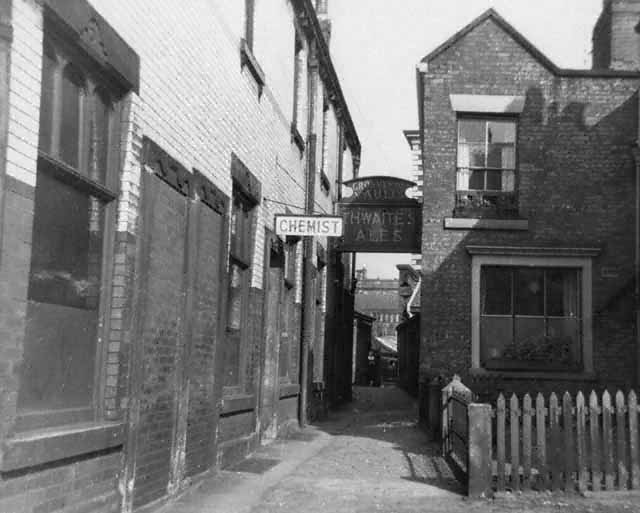
Shorrock Fold. An old right of way leading through old Haworth Square towards the Tacketts. There were two inns in the Fold, the Star, used as a lock-up and the Black Lion. The sexton of the parish church formerly resided in the house on the right
© BwD - terms and conditions
These notices by a contemporary topographical writer, who saw the Blackburn of a hundred years ago, and set down those features of the town and its situation which brought his attention, scanty though they be, are of service to us in recalling the town’s salient marks and conspicuous characteristics at that period. After the old Church there were the newly erected houses, warehouses, and gardens of the prosperous merchant manufacturers of the special local textile fabrics; the fields around the town white with the grey calicoes spread out to bleach; the recently erected cotton spinning mill, and the older print works, in the valley, a mile or so below the town; the new brewery; the Canal about to be cut through the township, on the east and south sides of the town; the Poor-house (Old Workhouse), then considered a “very good” one for a provincial town of the size of Blackburn, standing on a corner of the ancient Town Common; the Free Grammar School; the new Chapel-of-ease, Dissenting Chapels, then of recent formation; with an interesting remark on the staple food of the bulk of the town’s people, and their method of storing it for the winter. Dr. Aikin added a table of the number of Christenings, burials, and marriages in Blackburn for the years 1790 to 1795 inclusive, compiled from the Parish Registers. In 1793 the Baptisms were 493; the burials , 400; and the marriages 225; but these figures related to the surrounding rural townships in the parish , whose people came to the Parish Church to christen their children to marry and to bury, as well as the inhabitants of the town of Blackburn.
Blackburn was a noted market town hundreds of years ere it became a very populous manufacturing town; and in 1795 it had a large and important weekly market for agricultural produce and other wares, as well as a fortnightly Fair for cattle. Dr. Aikin was, therefore inaccurate in stating that the town was dependent upon Preston for farm produce, The mistake, no doubt, arose from the fact that the greater quantities of such produce came to Blackburn market in 1793 as it does in 1893, from the country districts around and beyond Preston. In fact Dr. Aikin himself says that the same districts, especially the Fylde, supplied Preston market with “great quantities of meat and shelled groats,” one of the two articles he spoke of as coming to Blackburn from Preston. The Blackburn Produce market had undergone about this time a process of severe regulation in order to root out abuses, of forestalling and selling deficient measures, from which it had for years suffered and the townspeople had been aggrieved against the producers who frequented the market. The authorities of the town, supported, by the resident magistrates, had thoroughly overhauled the system of traffic in the market, and had adopted vigorous means to suppress illicit practices found to prevail; and in a short time the market, which had been for a time discredited and prejudiced by the unfair dealings of the farmers out of West Lancashire, recovered its briskness. Mr. Justice Whalley, on several occasions in 1795, interposed to protect the townspeople from extortion and petty frauds in their own market at the hands of vendors of produce coming from a distance. He ordered overlookers of the market to seize and publicly burn all deficient measures of which there were many in use, detected by them in the market and the offenders were prosecuted. The frequent references to these occurrences in short paragraphs published in the Blackburn Mail denote how seriously the matter was regarded by the inhabitants. In a local article which appeared in the Blackburn Mail about the middle of 1795, on the market question and the recent measures to purge it from the abuses to which I have alluded, the writer goes on to review the increase of the town of Blackburn and of its trade and population, during several years preceding that date. The article furnishes an interesting view of the condition and circumstances of the town of Blackburn in the last decade of the eighteenth century. I have estimated the population of the township in 1793 as about 9,000, and it was then increasing at the rate of 400 or 500 a year. The editor of the Blackburn Mail gives the population in1795 as 10,000; I quote the most Material portions of the article as follows;
“The resolutions latterly passed by the Magistrates and Gentlemen of this great manufacturing town, for regulating the Market, have been attended with effects satisfactory both to the seller and buyer; and the Market continues to be plentifully supplied (nearly 80 carts loaded with different kinds of provisions having been at the Market last Wednesday). Blackburn now continues upwards of 10,000 inhabitants, who must be fed daily from supplies of the farmers around.”…”When we take a view of Blackburn some years back, then containing 300 or 600 indifferently built houses, and not more than 3,000 or 4,000 inhabitants, it is matter for surprise and admiration to every well-wisher to its prosperity to know that it now contains not fewer than 6,000 houses, some of which would be an ornament to any city in the kingdom; three Churches, a dissenting (Independent) Meeting-house, a Baptist Preaching house, a Methodist Chapel, a Roman Catholic Chapel, and some 10,000 inhabitants. Some idea of the trade of the town may be formed from the number of wagons constantly employed in bringing wares to and taking them from it. By the list of them lately published for the use of the warehouses, public-houses, and shops, it appears that there are thirteen carriers’ wagons employed in that business, some of which run daily, some once some twice, and others of them three times in the week, to the various towns in the connection, seldom without being fully laden.”
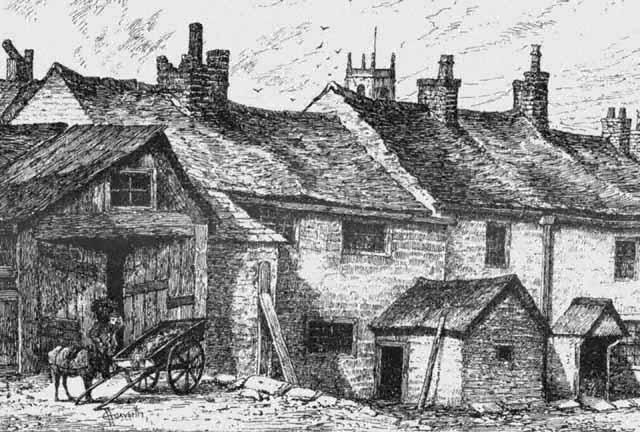
Blakey Moor sketch by Charles Haworth
© BwD - terms and conditions