THE HISTORICAL DEVELOPMENT OF THE LAMMACK AND PLECKGATE
AREAS OF BLACKBURN
By Mike Sumner
LOCATION – Both of these areas lie in the north of Blackburn Borough on its outer edges or suburbs and are linked from west to east. Lammack’s boundaries stretch from the Beardwood area in the west to Pleckgate in the east, and, from the Revidge ridge in the south to the Ramsgreave area in the north which covers the slopes of the ridge from Brownhill to Mellor. Pleckgate’s boundaries run from Four Lane Ends and St James Road leading in the south down to Ramsgreave and Brownhill in the north, merging with Lammack to the west and forming an eastern boundary with Roe Lee and Whalley New Road areas (see map below).
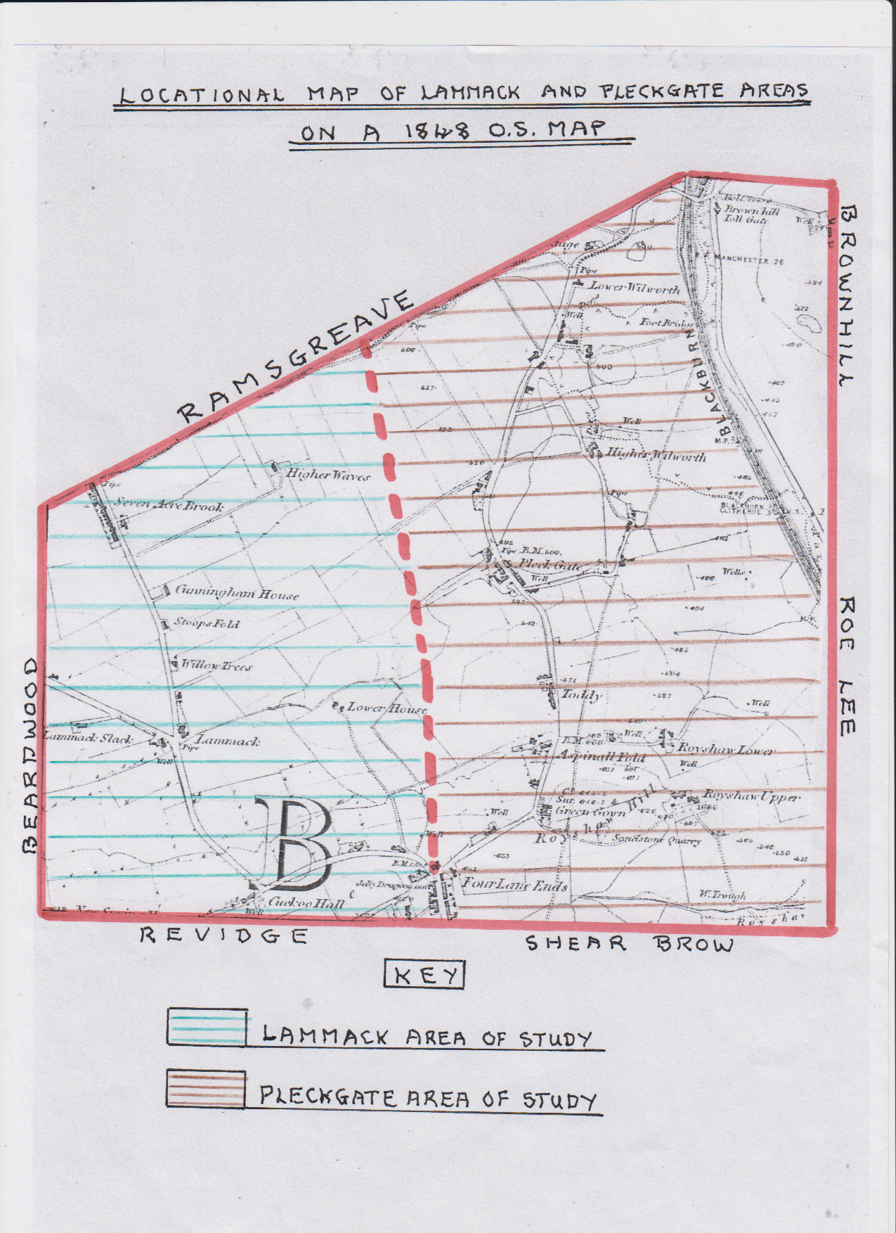 LOCATION MAP OF LAMMACK AND PLECKGATE AREAS BASED ON THE 1848 ORDNANCE SURVEY MAP
EARLY HISTORY OF THE AREAS
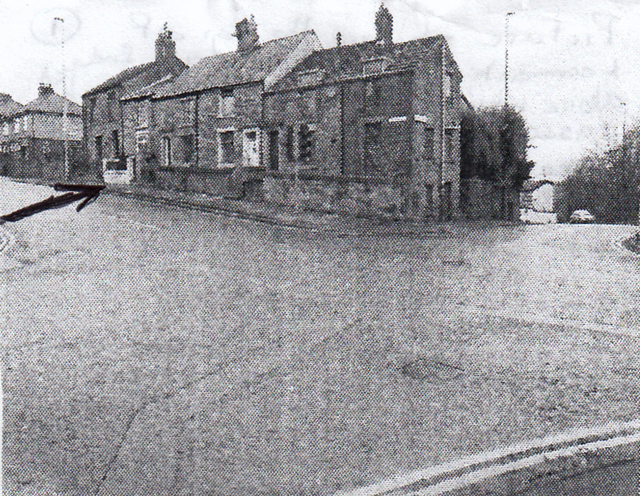
A Neolithic/ Bronze Age standing stone was located close to Cuckoo Hall in Lammack on the slope down from Revidge Ridge. These standing stones probably had some religious connection and can be aligned directionally with other stones and the sun in respect of sunrises and sunsets (see location map above for Cuckoo Hall). It is also known that the Manchester to Ribchester Roman Road ran through Four Lane Ends and Lammack on its way to the fort at Ribchester. The route ran up close to what is now Shear Brow from the Salford area of Blackburn to Four Lane Ends close to the Hole i’th Wall Inn originally located there and Four Lane Ends School both close to Revidge Road’s junction with Lammack Road (see photo below).
Photograph showing the direction of the Roman Road through Four Lane Ends area (see arrow)
Its route then continued down the slopes passing close to Cuckoo Hall to the lower Lammack area passing to the left of Higher Waves Farm and on to the summit of Ramsgreave Ridge (see location map). When the Romans first arrived in the Blackburn area it was probably occupied by the Satanti Tribe who were dwellers near the water (River Blakewater) and their priesthood consisted of Druids. Early settlers would be attracted to sites close to the Roman Road crossing of the River Blakewater in the Salford area of Blackburn.
In the early days, trackways were ridgeways following higher ground such as the Revidge and Ramsgreave/Mellor ridges on hard stony ground; avoiding the lower wetter/marshy low ground and used by travellers/drovers who carried goods by pack horse from settlement to settlement. As a result, early settlers would have first located sites on the ridges or their upper slopes and the sandstone ridges provided ideal building materials for early cottages after the earlier wooden constructions. As both areas of this study border Ramsgreave to the north, originally named Ramesgreve, which was a Kings Manor Chase or “Royal Chase” of dense woodland established by Edward the Confessor and recognised in the Domesday Book as part of a Royal Chase that extended to Wilpshire, Little and Great Harwood; they were associated with its use as hunting grounds for Norman Barons. These woodlands provided ideal cover for wild boar and deer and became the hunting grounds for the powerful De Lacy family and the Dukes of Lancaster who owned it. In 1311, the rental to the Earl de Lacy included herbitage from the forest and profit from wood made in to charcoal and sold to iron forges. During a
176 year period, from 1361 – 1537, it passed on to the Cistercian Monks of Whalley who leased out half of it to obtain revenues. At the same time, they cleared much of the woodland and wetlands to allow livestock, especially sheep, to be reared there with some fodder crops. Due to this early activity there would have been early dwellings in the Lammack/Pleckgate areas closest to the Ramsgreave woodland which would provide wood for early buildings and fuel together with some food sources. These early settlers could also have been farmers as the monks leased out cleared land for farming purposes. After the dissolution of the Abbey’s estates, Ramsgreave was sequested by the crown who sold it to the Barton's of Smithells who were Lords of the Blackburn Manor and took over existing tenants, one of which, was John Hey. He had a house and garden together with arable and pasture land which he farmed called Broadhead. His cottage can just be seen on the 1848 Pleckgate Map (see later) called Hey’s Cottage in the Lower Wilworth area. At the same time, Four Lane Ends at the junction of early tracks from both Lammack and Pleckgate together from those of Revidge and Blackburn would also have attracted early settlers and certainly created a rural community from early times.
Early place names in the two areas give indications of historical developments:
(a) PLECKGATE – a name derived from the roots PLK meaning “to divide”, or, a brook/stream that formed a boundary and GAETH meaning a rising up a hill for example a hamlet sited at the foot of a steep hill or ridge where a stream separated Blackburn from Wilpshire Township. Originally, it was spelt PLECK GATE (two words) and a gate meant a thoroughfare not a barrier. The word derived from a Saxon word “Geat” meaning a way or road and similar to Northgate in Blackburn leading to Shear Brow and Four Lane Ends.
(b) LAMMACK – the word ACK indicates oak trees.
(c) CUNNINGHAM – the word ING indicates a tribe (Scandinavian – Norse/Viking).
Blackburn’s annual cattle and local produce fair was held on May Day (1st. May) from 1583. Fairs/local markets had developed at the top of Church Street by 1774; bi-weekly markets were held on Wednesday and Saturday. The cattle and horse fairs were held at Blakey Moor on a patch of common ground to the rear of Northgate and close to Astley Gate for several hundred years. All these would have been essential points of sale for the early farmers of Lammack and Pleckgate areas as they had easy access down the Shear Brow track to Northgate.
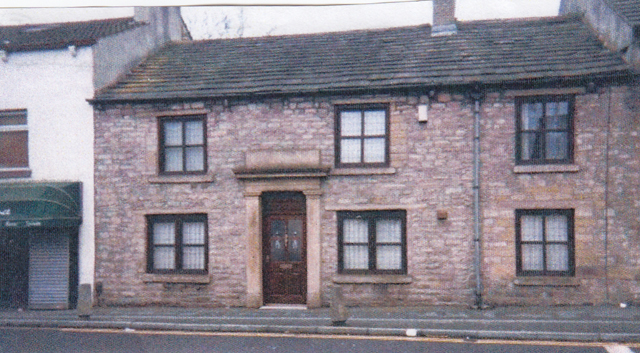
Blackburn’s history of textile manufacturing dates back to the middle of the 18th Century, initially based on wool produced by local sheep farmers and first spun and then woven in local cottages (Domestic Textiles). Flemish weavers settled here in the 14th Century and helped develop a local industry. Clothiers or chapmen sold surplus cloth to neighbouring markets and also collected local wool and distributed it to local cottages not involved in farming who worked all year, or, were farm labourers who worked on domestic textiles in winter to supplement their wages. The wool was spun in their cottages on spinning wheels and woven on wooden handlooms set up in back rooms. The chapmen would then come to collect the woven wool or linen cloth pieces and pay the going rate for set pieces. Linen had arrived in the Elizabethan period when Irish flax was imported as it could be woven into finer textiles. Cotton use came into the area via refugees arriving from the Netherlands in the late 16th Century, and, by the time of the Stuarts, cotton was used with linen warps. During the 18th Century cotton became more important than wool in the area. The first piece of Calico woven from cotton in Blackburn was in 1776. As Lammack and Pleckgate were rural areas based on cleared land from the Middle-Ages with predominantly pastoral farmers living in isolated farming communities who had been introduced into sheep farming when the monks of Whalley cleared forest areas in Ramsgreave they were, therefore, available for domestic textile production. By the late 18th Century and early 19th Century almost every farm, smallholding and farm cottages had a loom shop where one or more handlooms had been installed in work shops, or, in farmers barns where they combined farming and weaving as by now the spinning process had left the domestic scene and been introduced into the first factory systems. As in other areas, handloom weavers in the Lammack and Pleckgate areas could produce their own style of cotton pieces which were collected by local chapmen who rode out into the areas at set times and paid for the pieces by weight at the going price until cotton weaving moved entirely into factories after the power loom was invented leading to the slow decline of the handloom weaver. The textile factory system developed from the 1840’s, first with spinning mills after the local Hargreaves Spinning Jenny invention, and, by the 1860’s, power looms were introduced to the factory system. Both Lammack and Pleckgate Roads have good examples of old stone cottages linked to the domestic textile system e.g. Lammack formerly known as LAMBOCK had many weavers cottages sited on the old track/road to Ramsgreave/Mellor, for example, numbers 213 – 255 Lammack Road at Seven Acre Brook. These cottages (indications are there were 19 original dwellings) were built as a terrace of “Club Houses” built by a terminating Building Society where handloom weaving of cotton/linen persisted till at least 1887.
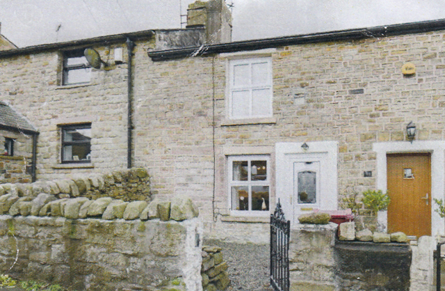
Picture of Seven Tree Cottages on lower Lammack Road leading to Barker Lane that were
typical handloom weaver’s cottages.
Equally, Pleckgate Road had a number of small cottage enclaves where some cottages had been erected for farm workers, however, most if not all, had provision at one time for handloom weaving which was confirmed in the 1841 Blackburn Standard newspaper which reported that the majority of the inhabitants were handloom weavers.
Stone quarrying was an old established industry of the upper Pleckgate area, at Royshaw, where sandstone beds were exploited at the quarry and used extensively to build local stone cottages and farm buildings. At the end of the 19th century, Royshaw quarry also produced shale material for brick making.
The Aspinall family of Royshaw had a long history in the area with William Aspinall being taxed in a subsidy dated 1570 and Myles Aspinall. Myles was a governor of the Grammar School and died in 1595. During the enclosure of waste lands and commons in Blackburn township in 1618, Miles and James Aspinall were awarded plots of waste land for their parcels of freehold land at Royshaw where they farmed and continued by various later members of the family. Later, another Myles Aspinall became a chapman or clothier in 1757. The Wilkinson family also had origins in the Royshaw area; Richard Wilkinson married Mary Gillibrand in 1660 and Evan Wilkinson was a yeoman who became a governor of the Grammar School in 1675. Evan's son William was also a governor at the Grammar School, in 1706; he was described as a “Gent”.
In 1834, it was reported that the whole area, including Ramsgreave, was suffering poverty with 40% of deaths in Ramsgreave being aged under 20 years and especially under 10 years because of high rates of child birth deaths due to a lack of real health care. At the same time, farming families were often chosen as Overseers of the Poor in their parishes.
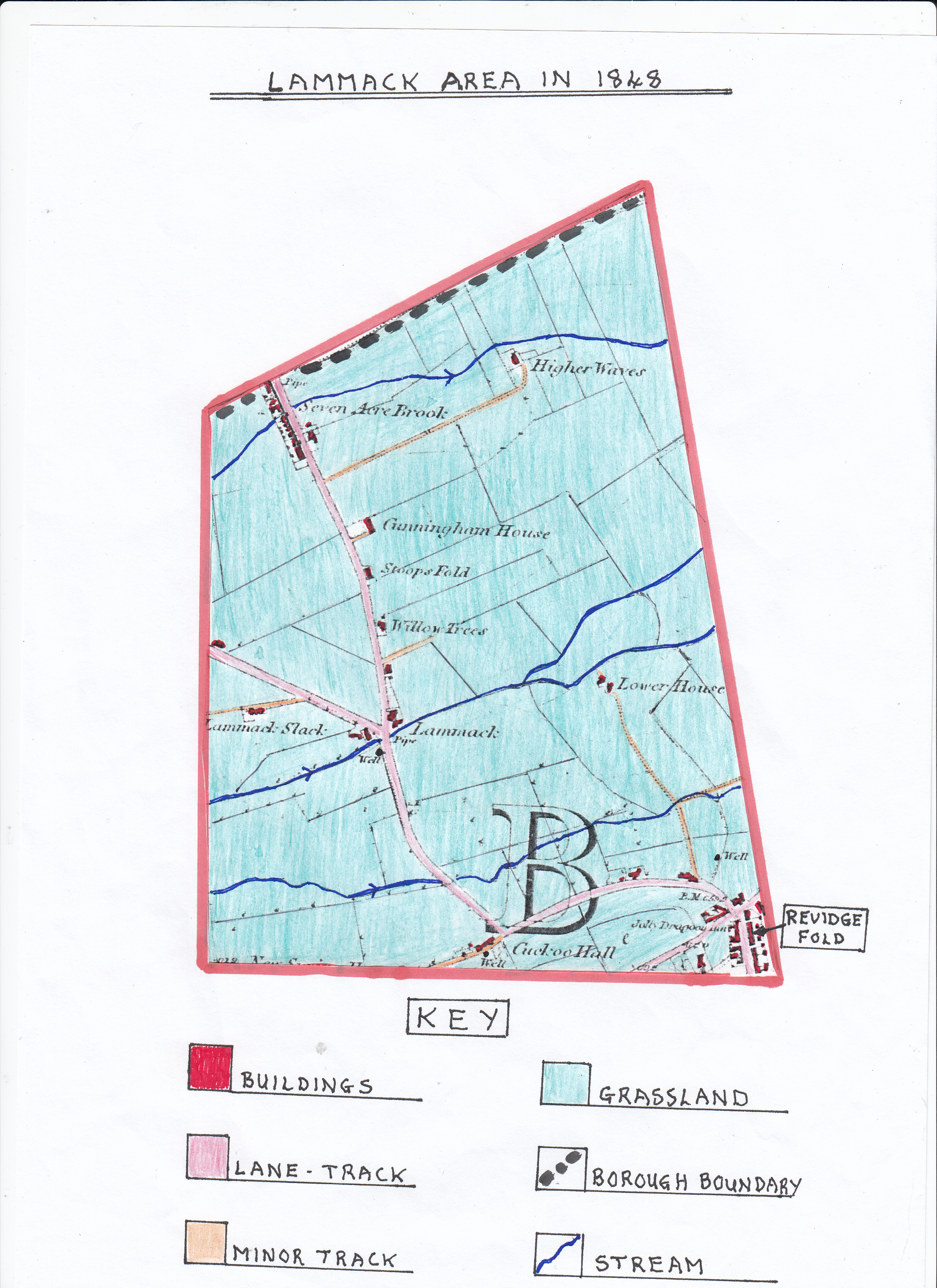
ORDNANCE SURVEY MAP OF THE LAMMACK AREA 1N 1848
The map shows that the area was dominated by the original trackway that was later to become Lammack Road, linking Four Lane Ends at Revidge down to Ramsgreave and Mellor areas with its branch track, later called Whinney Lane, leading to Beardwood and Mellor. Apart from two isolated farms at Higher Waves and Lower House, the very small isolated settlements form a linear pattern on or close to the two main early tracks but isolated from each other. Lammack area was a totally rural landscape which, by 1848, had been fully cleared of woodland and fully enclosed by a network of fields of various sizes because the original area of common land used by the inhabitants to graze their animals had been taken over by the late 18th Century and divided up by landowners supported by individual farmers who leased their farms from them. Often, the farmers who leased farms had restrictions on what they could grow originally, or, the amount of arable land they could use on the lower flatter land. However, the enclosure of land meant farming was more efficient and also allowed new methods of fertilizing land to be introduced. In this area, any arable crops would have been fodder crops such as oats and grass grown for hay with some potatoes but farming was predominantly pastoral with both sheep and cattle the main stay. After providing for themselves, farmers would sell extra produce in the local area especially in Blackburn Market and Whalley New Road, Lammack, Pleckgate and Revidge fold areas. Farms identified by the 1848 map included HIGHER WAVES, STOOPS FOLD, WILLOW TREES, LAMMACK SLACK, LOWER HOUSE, BULLION MOSS, HAWKSHAW BANK and CUCKOO HALL. Cuckoo Hall, built in approximately 1825, like Stoops Fold, had farm cottages attached for farm labourers to live in.
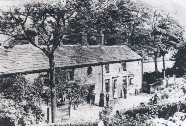 Cuckoo Hall
The image above shows a view of Cuckoo Hall, sited just off the Lammack Track to which it was connected by a farm track, was a long stone structure with a stone slated roof with the farm building to the left and the farm workers cottages to the right. The section of the building with the circular window where the workers are standing was probably a barn.
As mentioned in the early history, Domestic Textiles were dominant in the area by 1848, especially handloom weaving, often supported by Putters Out or Chapmen. In the Lammack area, Seven Acre Brook was an important handloom weaving centre. Other known places of interest were Higher Waves Farm which was a farmhouse with barn attached, Stoops Fold where handloom weaving was recorded by census which had adjoining farm cottages, Lammack Slack where there was a barn and farm cottages but no farmhouse. Along the Whinney Lane track was Rough Hey a large building converted into two dwellings which had a hand weaving loom shop, and, further on, Bullion Moss, a farmhouse just off the map, and Hawkshaw Bank at the top end of the Lammack Track. All these sites were involved in farming but supplemented incomes especially in the winter months by handloom weaving, although, over time, many farm labourers became full time weavers as they could achieve much higher wages. Later in the century, farm machinery inventions led to less labour being required. It is known that, in 1837, John and Martha Sefton lived at Lammack Slack, probably in a leased cottage and he worked as a farm labourer in summer and a weaver in winter. However, his wife left him and took their five children and moved to nearby Cunningham House, which, in the early 19th century, was occupied by handloom weavers and John left to settle at Lower Wilworth in Pleckgate where there was another handloom weaving cottages.
In 1848, settlement in the area was sparse with seven Acre Brook and Revidge Fold at the entrance/exit of the area having the only sizeable clusters of buildings. It is significant that Seven Acre Brook as its name signifies had a stream passing it, as did Lammack, where the track passed over a stream by a small bridge. In these earlier times, water supply, especially in rural areas, did not exist for dwellings, therefore, being sited near to a constant water supply was important. Also visible in the area are a number of wells which would also provide a water supply to farms and farm animals. Cunningham House, a large building alongside Lammack track, could possibly be linked to James Jenny Cunningham who lived from 1796 to 1876 and was a self-made man. He arrived in Blackburn in 1838 from Scotland as a butler for a wealthy landowner and later cotton magnate, namely, William Feilden of Feniscowles Hall, and later used his savings to buy a small brewery at Snig Brook alongside the later built Montague Street in Blackburn. James built a large house next to the brewery which later became St. Pauls Working Men’s Club. He became town mayor and could possibly have built Cunningham House as a retreat. By1807, Thomas Dutton realised the potential of opening tied public houses/inns with his first purchase being the Golden Ball on Blakey Moor where Blackburn Sessions House now stands and close to the original cattle and horse market site at Blakey Moor. His second purchase in the early 1800’s was the Hare and Hounds Inn at Lammack which still exists.
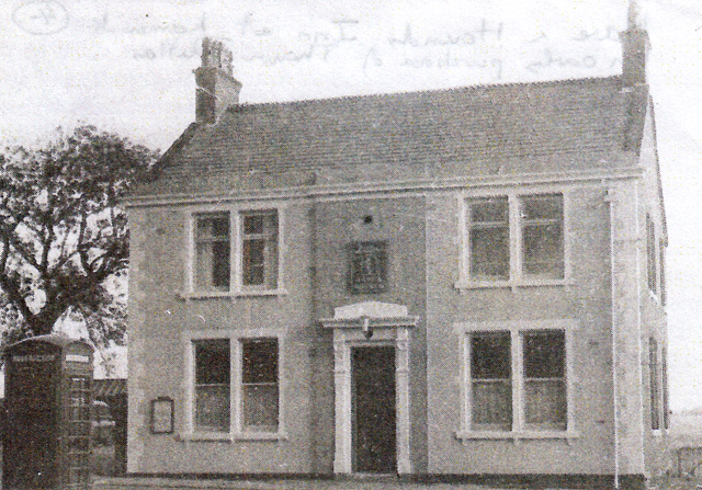
Hare and Hounds Inn at Lammack an early purchase of Thomas Dutton.
It is also known that there were some early Beer Houses in the Pleckgate area to supply the local handloom weavers together with an early inn built at Four Lane Ends close to the entrance to the Lammack Track called the Jolly Dragoon Inn (see 1848 map).
The Jolly Dragoon
The site of the Jolly Dragoon Inn at Four Lane Ends, Revidge Fold which was a low stone built inn well placed to supply the locals and later changed into two cottages. Revidge Road was originally an open country track called Pippen Street.
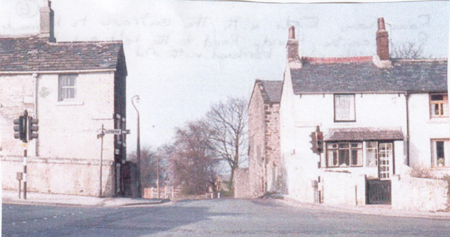
Four Lane Ends
This picture shows Four Land Ends today with the top of Lammack Road centre, Revidge Road to the left and Pleckgate Road to the right bordered with old stone cottages built before 1848 and still in existence with some alterations.
In 1814, a Joseph Ainsworth died; it was recorded that he owned two cottages at Four Lane Ends and three dwellings at Stoops Fold in the Lammack area (see map).
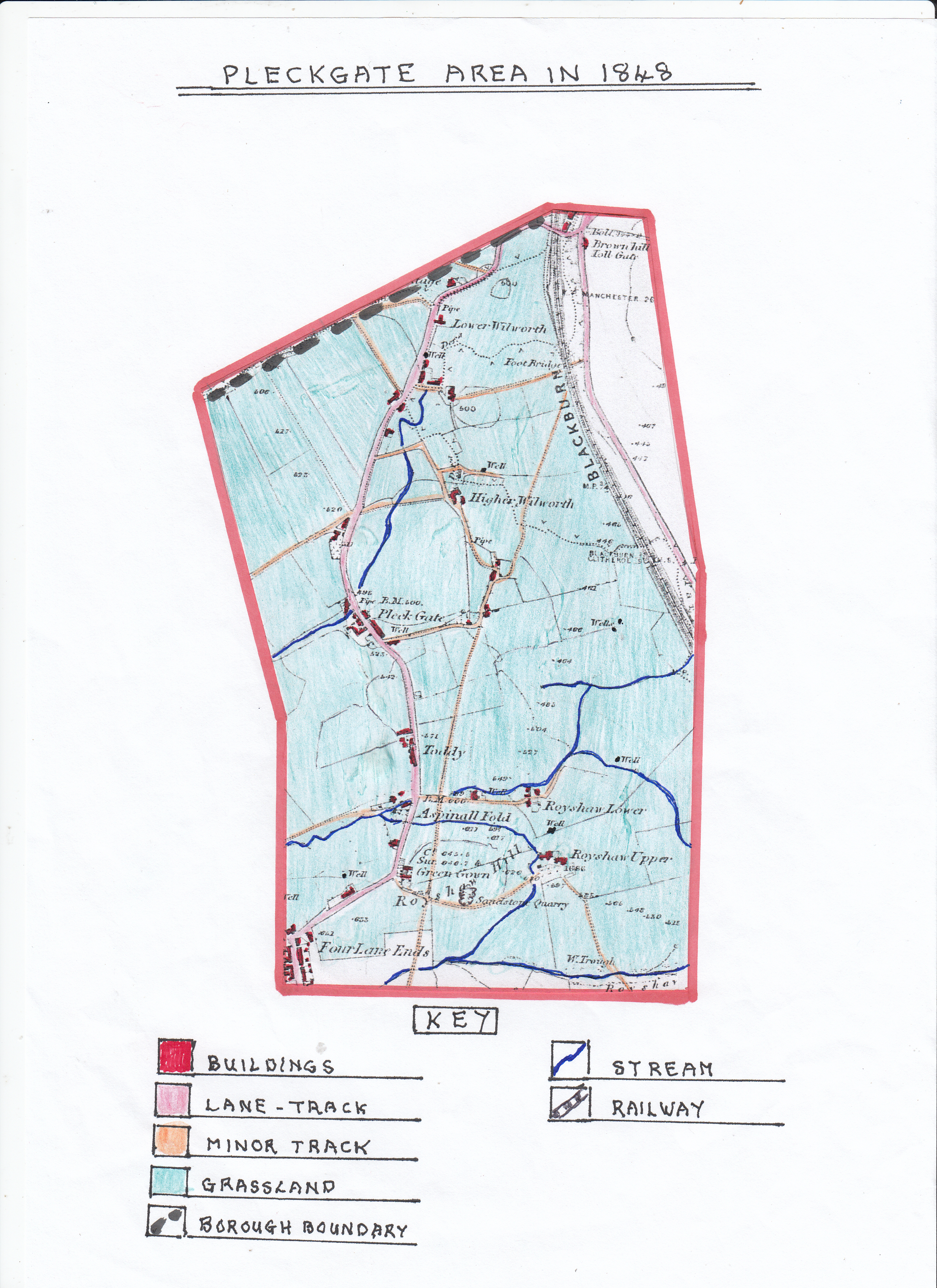
ORDNANCE SURVEY MAP OF THE PLECKGATE AREA IN 1848
The map shows this area was slightly larger than Lammack but similarly had a main trackway (later Pleckgate Road) running through it; starting from Four Lane Ends (Revidge Fold), down to Brownhill and Whalley New Road. However, this track had far more minor tracks running into it coming from various farms and the quarry and footpaths leading across to the Roe Lee area crossing the newly built railway from Blackburn to Whalley/Clitheroe areas. As in the Lammack area, the settlement at this time is small and scattered but there is a greater number of buildings than Lammack with the main groups of settlement close to the main track including Pleckgate, Toddy, Aspinall Fold, the Royshaw area and Four lane Ends. The buildings at this time consisted of stone cottages and farmhouses with the main cluster of buildings at Pleckgate where the track crosses the stream, a fact repeated at Aspinall Fold and Upper and Lower Royshaw, due to the importance of being close to a good water supply. There was an absence of a direct water supply to homes although there were numerous wells in the area, however, at the Pleckgate settlement, a pipe is indicated, so possibly, this meant some water was piped from the stream to a stand pipe in the area. The Pleckgate area at this time was predominantly farmland with a similar field pattern to Lammack with larger fields often on the ridge slopes where sheep would have been raised. Smaller fields around the Pleckgate settlement would probably have been utilised for fodder crops and some allocated for dairy cattle. As in Lammack, farmers and farm labourers formed a large handloom weaving community with many cottages along the main Pleckgate track being rented farm cottages built of local sandstone from Royshaw quarry.
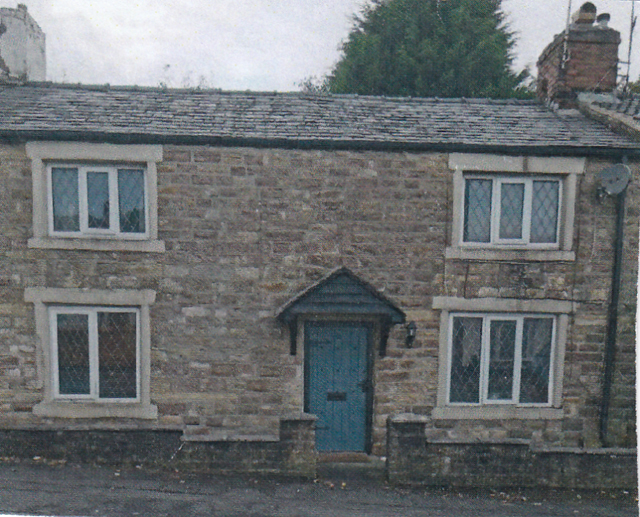 A typical early sandstone built cottage found alongside Pleckgate track (road)
By 1848, some cottage dwellers were totally operating as handloom weavers with converted back rooms or cellars to house the wooden looms and supplied with fibres from Blackburn based “Putters Out", many of whom were based in the King Street area. A good example of handloom weaver's cottages could be found in a group of cottages based round a courtyard at Lower Wilworth and on Pleckgate track itself at Pleckgate Fold, Toddy Fold, Aspinall Fold and Green Gowan.
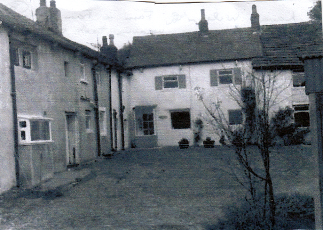
Lower Wilworth Farm
The above image shows Lower Wilworth Farm and its farm cottages as it is today based round a cobbled courtyard where handloom weaving occurred. The farmhouse is shown to the left with the stone cottages for labourers off to the right.
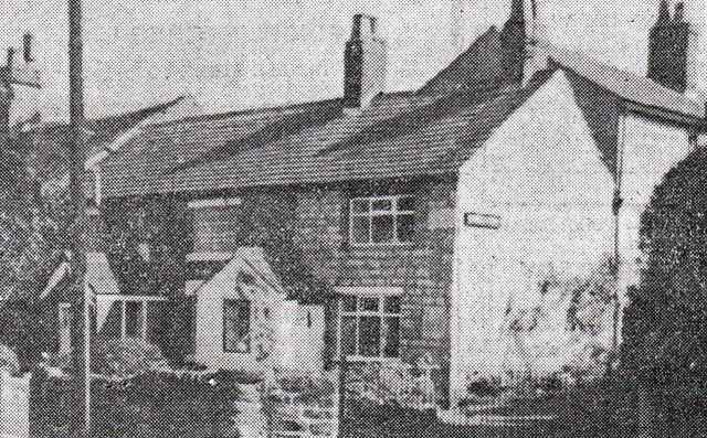
The stone cottage at Green Gowan on the Pleckgate track where handloom weaving took place
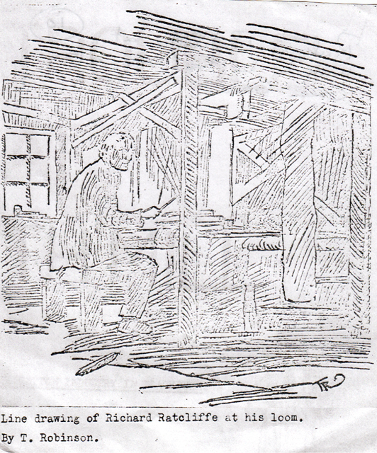
This line drawing is of RICHARD RATCLIFFE who was the last handloom weaver in the area
operating his loom at the cottage called Green Gowan
The main handloom weaving centres on Pleckgate Road itself were at Pleckgate Fold, Toddy Fold, Aspinall Fold and Green Gowan. However, it is known that in 1841-2 there was a widespread distress in both Lammack and Pleckgate areas where most cottages were involved in handloom weaving. Although generally employed, they received low incomes for their labour, and, when visited, they were found to be hard working, clean, managing and patient under great privations. Their main food was oatmeal porridge with either churned or sweet milk, stewed potatoes and onions but they rarely ate animal food of any sort. As a result, some inhabitants sold up and moved to nearby towns for work in the cotton mills. The 1845 rate book shows only two households out of nineteen paid rates at Aspinall Fold, no one, out of seventeen people paid rates at Pleckgate Fold out of thirty-seven, and, at Green Gowan, none of six families. At Four Lane Ends only seven families out of thirty-five paid rates. Therefore, all these handloom communities could rarely afford to pay the “Poor Rate”, some being excused by Magistrates whilst others had “no effects” on which to draw. The price of cotton pieces produced varied and increased lengths of woven material were required for the same price with soup kitchens opening in Blackburn for the poor people. However, although conditions at this time were not good, by 1848, textile spinning factories started to open in the Blackburn area which led initially for increased work for the domestic handloom weavers. By 1848, quarrying was still operating at Royshaw where sandstone was extracted for building purposes
Transport during this period relied upon horse and carts using the main Pleckgate, or minnow tracks, but many people had to walk, hence the number of footpaths visible on the map of 1848. The farmers would rely on the track system to take produce to Blackburn markets, or, to sell dairy produce locally. The recently completed railway from Blackburn to Whalley/Clitheroe would at this time have had little impact on the area; the nearest station was at Wilpshire.
An early inn found in the Lower Pleckgate area beyond Wilworth was a four roomed building made up of two cottages which had a chain on the outside wall for tethering horses. It had a tiny snug large enough to take eight drinkers on the bench seat that ran round a central table. Over time, this became the Knowles Arms which, at one time, had a bowling green behind it. This inn was also called 'The Folly' by locals but was officially called 'The Knowles' after a local landowning family.
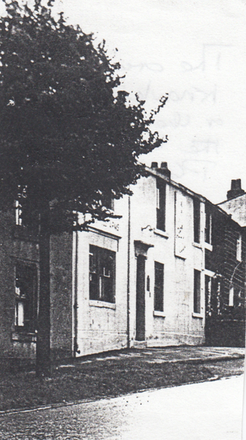 The original “Folly” or” Knowles” sited at the bottom of Pleckgate Road within a line of cottages
 ORDNANCE SURVEY MAP OF THE LAMMACK AREA IN 1894
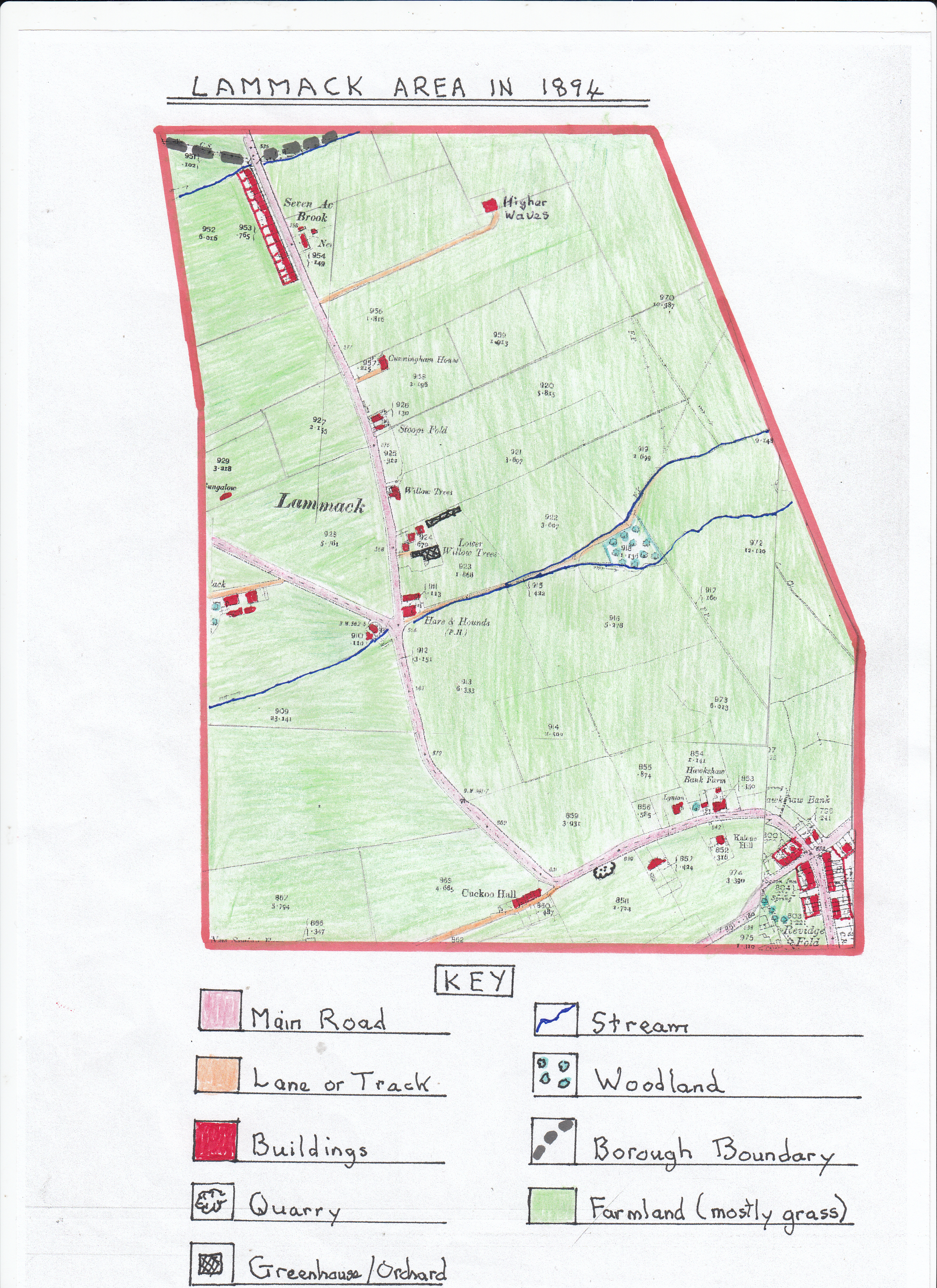
The map shows that in the 46 years, since 1848, there had been little change to the landscape. By now, the main Lammack track was a road although it was still not named Lammack Road. Taking account of the map scale there are few additional buildings shown except for the new settlement at Lower Willow Trees which was probably linked to the horticultural development where orchards or greenhouses were sited. This shows there was an increased demand for fruit, vegetables and shrubs for the larger houses with gardens. Lammack Slack depicts additional buildings and two detached large houses, or farmhouses, have appeared on the south side of the upper portion of Lammack Road, close to Four Lane Ends, one of which, appears next to Kalene Hill. At the same time, the former Lower House Farm properties have disappeared along with its track to the main road.
The area is still predominantly a rural one, dominated by farmland, but there are some changes to the field patterns with slightly less fields; some had been enlarged and a new area of woodland has grown. The Blackburn and Darwen Directory shows some details of people living in the Lammack area at this time namely:-
1. James Bradley – a farmer at Lammack Slack.
2. William Butterworth – a farmer at Lammack Slack.
3. Henry Richmond – a farmer and shop keeper at Four Lane Ends.
4. Thomas and William Pomfret – farmers at Hawkshaw Bank.
5. James Hayhurst – a retailer of beer at Four Lane Ends.
An 1871 census covering nearby Ramsgreave showed 20 heads of family who described themselves as farmers, mostly small tenanted farms. The Seven Acre Brook settlement was sited next to the Borough boundary and the Ramsgreave area but within the Lammack area. The only change to farming products by 1894 would have been the growth of poultry, pigs and dairy produce as diets had improved.
By now, after the distress caused to the domestic textile industry and early factory system by the American Civil War in the 1860’s which disrupted the supply of cotton to the industry and resulted in large numbers of locals having to claim relief from the Board of Guardians and having to pawn their furniture, the area had returned to calmer times. The farms by now would now have more mechanisation, although still horse drawn, following farm machinery inventions and therefore required less labour. Also, by now, domestic textiles, mainly handloom weaving, would have dwindled as the new factory spinning mills were well established and power looms introduced slowly to existing mills or new weaving sheds were built at some sites. As a result, the former farm labourers or handloom weavers would now travel to work in mills at the nearby Roe Lee, Carr and Florence textile mills along nearby Whalley New Road, or, travel down to those in the Brookhouse area.
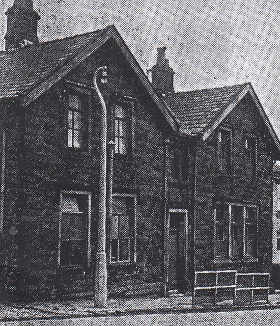
By 1868, there was an independent school at Four Lane Ends to cater for local pupils sited close to the junction with Lammack Road alongside Revidge Road.
Picture of the former Primary School at Four Lane Ends
In 1871, Blackburn’s School Board was formed with two existing elementary schools under its management, one of which was Four Lane Ends which, by 1897, had become a Congregational Mission School; a chapel had been added to the school. However, by 1915, it had become a Borough Council school.
ORDNANCE SURVEY MAP OF THE PLECKGATE AREA IN 1894
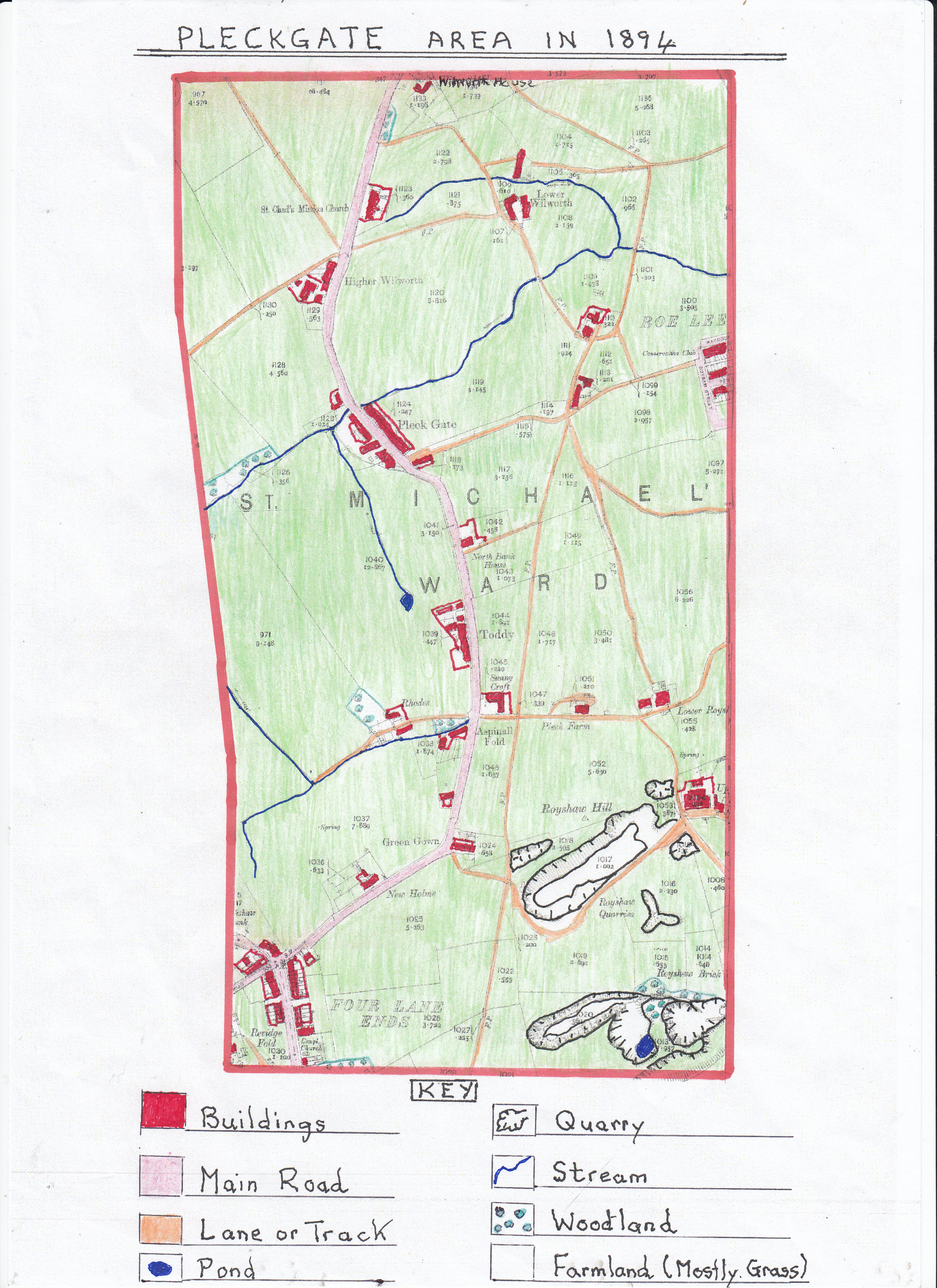
As in the Lammack area this large-scale map shows clearly that the field sizes have in places changed with less fields because a number have been enlarged due to the development of new farm machinery. This led to the reduction of farm labourers even though the farm machinery was still pulled by horses. Farm buildings had also increased in size with outbuildings erected to house the machinery.
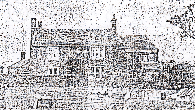
An early line drawing of Royshaw Farm in the area
Farms in the area were well placed to provide dairy produce, poultry and meat to the large new housing areas created off nearby Whalley New Road as these terraced streets were built to house many textile workers now working at the local textile mills such as Roe Lee and Florence mills.
A picture of the original Old Roe Lee Mill
The map shows part of the upper terraced streets sited above Roe Lee Old Mill including Pemberton Street named after the mills original owner who built the streets for the mills workers. As in Lammack, many former farm labourers and handloom weavers had moved to work in these new textile mills although some handloom weaving survived in small pockets. After the distress caused to textiles by the American Civil War there had been a growth in house building especially terraced streets close to the textile mills. Roe Lee Old Mill was built in 1856/7 by James Pemberton and Sons and contained 480 weaving looms, and, by 1861, employed 300 operatives increasing its looms by 1878 to 1008. James Pemberton originally worked a small shed in the King Street area and built Roe Lee Mill to increase the value of his estate which included land in Pleckgate and Wilworth areas but also to help unemployed handloom weavers in Lammack, Pleckgate and Ramsgreave. However, shortly after completing the mill he died, in 1887, with control passing to his sons. After two changes in ownership and latterly held by J.E. Sharples, it was then sold to Duckworth and Eddleston in 1902 with 815 looms. This and the nearby Carr Cottage mill they also owned together with the Skew Bridge Florence mill built by William Bertwistle in 1889 were all cotton weaving mills.
The 1894 map shows that the extensive quarries at Royshaw had greatly increased since 1848 as more sandstone had been removed to create local buildings and a larger quarry to the south had been created which operated a brick works using ground up sandstone to manufacture bricks which were now in great demand especially with the growth of terraced houses near the new textile mills and for some of the mills themselves.
Early education in the Pleckgate area was recorded in a newspaper (Blackburn Standard) article in 1863 when it was reported that the
Pleck Gate schools annual tea party held on New Year’s Day was attended by 230 people. It was addressed by the reverend J. Smith and the choir performed several pieces in very good voice with young men giving recitations. On the following day, 270 children were given tea with current bread after which Councillor H. Pemberton (son of James Pemberton of Roe Lee Mill) presented each pupil with an orange and a bun. The exact location of this early school was probably in the St. James Road area in the upper region of Pleckgate. The school site later became St James's Primary School after St James Church was built in 1874, and, in the same year money was raised for Church of England Schools and St James School gained an extension. However, it is known that building began in lower Pleckgate of a Pleckgate Mission Church in 1870 called St Chads Mission Church; this being a Mission attached to St John's Church on Victoria Street, Blackburn. This church was created to meet the needs of Pleckgate village and later developed into a thriving day school and Sunday school.
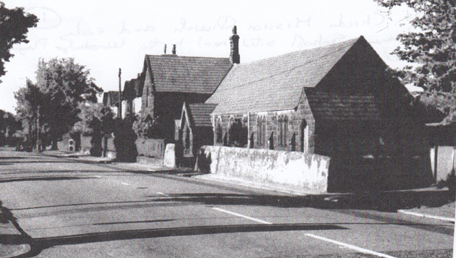
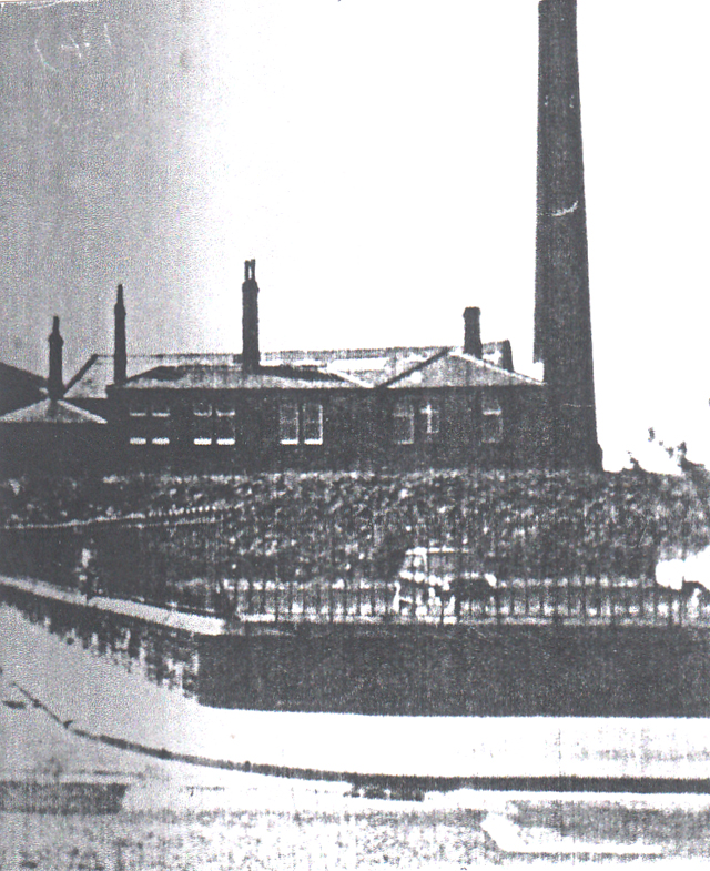
St. Chads Mission Church and early Primary
school sited next to the Woodridge Playing Fields
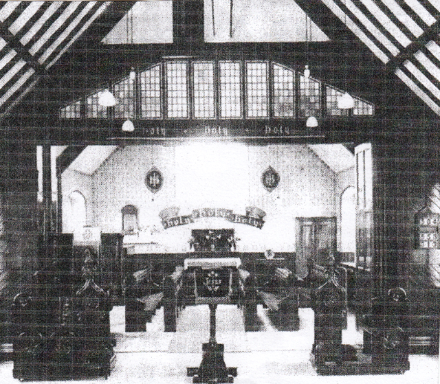
Internal view of St. Chads Church
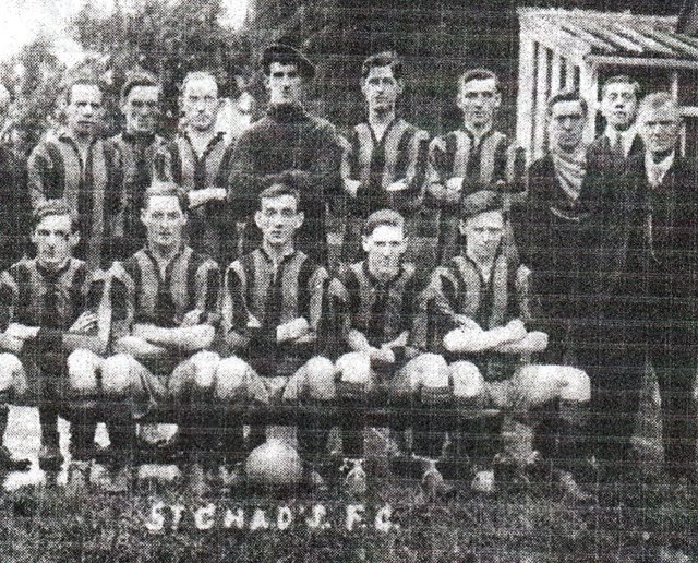
1920 St. Chads Church football team which played in a local league 1920's.
This demonstrates how church activities extended into providing sports for their parish
Around the same time, Four Lane Ends Board School had been improved and the curriculum remodelled to more modern requirements with a greater emphasis on providing pupils with better sanitary conditions by 1894.
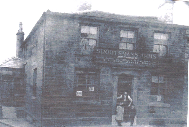
A new public house had now been built to serve the area at the top of Pleckgate Road where it met Four Lane Ends opposite the Jolly Dragon public house site. This was called the Sportsman’s Arms with its entrance on Four Lane Ends. The inn offered billiards and had a two stall stable to let.
The licensee JAMES THOMPSON KAY in the doorway of the Sportsman’s Arms
with his son and daughter in 1919
An 1870-71 Blackburn directory gives some indication of the occupations of local people living in the Pleckgate area at this time:-
1. Mary Briggs a shopkeeper living at Toddy Lane Ends.
2. Isaac Fawcett a farmer living at Higher Wilworth.
3. George Cook a farmer living at Lower Wilworth.
4. Richard Webster a farmer living at Wilworth
5. Mary Jane Hall a schoolmistress living at Pleckgate.
6. George Harwood a shopkeeper living at 37, Pemberton Street.
7. Henry Whewell a farmer living at White House Farm Pleckgate.
8. Thomas Gabott a beer retailer living at Pleckgate.
9. Richard Stones a quarry owner living at Back of the Hill.
10. Robert Bradley a master at St. John’s National School living at Pleckgate.
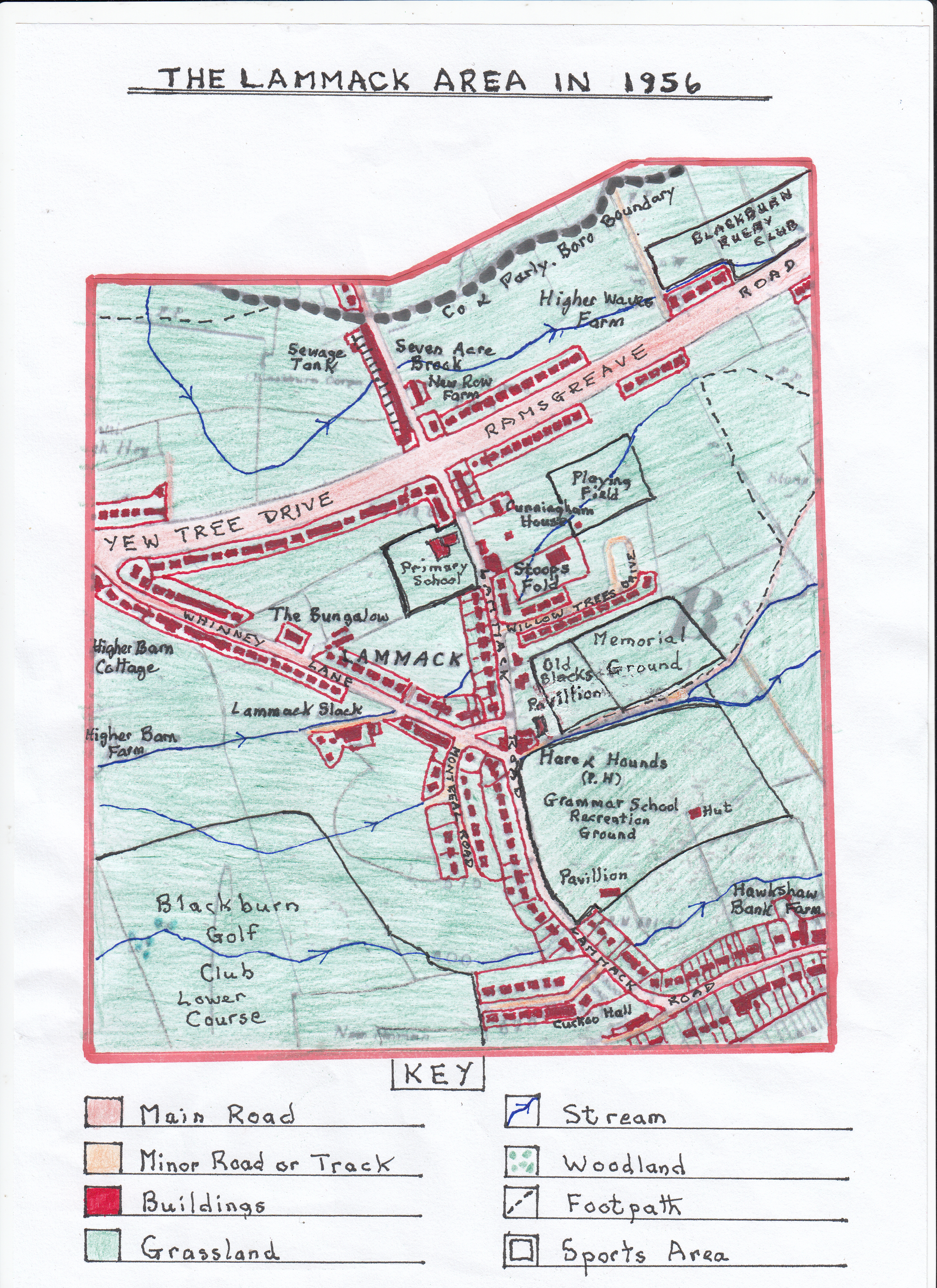
AN ORDNANCE SURVEY MAP OF THE LAMMACK AREA IN 1956
In the sixty-two years since 1894 there have been many changes in the Lammack area especially with the huge increase in housing and leisure activities. This upward trend was driven by increases in the general standard of living and the growth of the middle classes who migrated out of the central industrial areas of Blackburn to the greener and more rural sites, creating suburbs, where there were no new terraced houses. All the new growth of housing was in a linear pattern following the newly created Ramsgreave Drive/Yew Tree Drive orbital by-pass road and the upgraded Lammack Road/Whinney Lane links both of which were almost infilled. The new housing was mainly built between the two world wars with some new areas of growth created after the 2nd. World War; all privately owned and consisting mainly of semi-detached brick built properties often with a pebble dash finish and the odd detached house on the upper Lammack Road area with more recent semi-detached bungalows on Willow Trees Drive. Another new development was off Whinney Lane with the creation of Montreal Road which was the start of a much larger housing estate development. All the new housing had been created on former farm land with farming activities in the area reduced considerably, and, some farms, such as Willow Trees and Hawkshaw Bank disappeared. All the new housing was created with gardens front and back but varying in size as families demanded more space and gardening was popular. Garages were also added as car ownership grew.
On the transport side, the area is now dominated by the orbital by-pass road built to reduce traffic congestion in central Blackburn with links to both Lammack Road and Whinney/Barker lanes. Work started on building this orbital road in 1921 partially to relieve the heavy amount of unemployment in Blackburn after the Great War and was completed in 1927. All the work was completed by unemployed workers supplied by the local Labour Exchange. It was designed as a ring road around the northern edge of Blackburn running from Preston New Road through Brownhill to Whitebirk and the A678 Burnley to Blackburn road. Between Preston New Road and Whalley New Road at Brownhill the road was created 120 feet wide between fences and designed to eventually be upgraded into a dual carriageway each 30 feet wide with two footpaths, verges and central reservation. However, initially, it was one carriageway with the total length of the road being four and a half miles. The dual carriageway upgrade was completed in the early 1960’s.
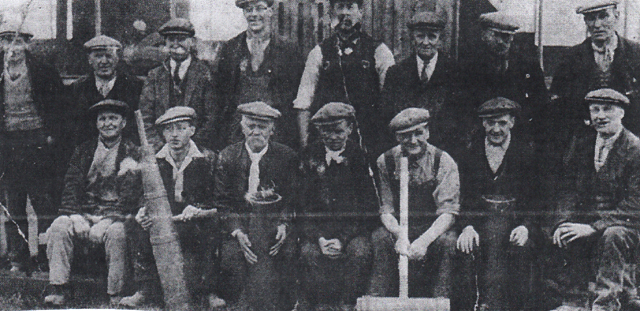
Blackburn Corporation workmen taking a break from building the orbital/arterial road

 Loading more