
 Loading more
Beardwood and Billinge Area
HISTORICAL DEVELOPMENT 0F THE WEST END AREA
OF BLACKBURN – BEARDWOOD AND BILLINGE
Beardwood and Billinge areas are sited in the north-west part of Blackburn stretching towards the Borough Boundary and the nearby Mellor area.
EARLY HISTORY
The historical development of these two areas stretches back over 700 years although its early history is sketchy. The early development of the area came about due to their proximity to the older larger Mellor settlement which was originally called “Malver", a Scandinavian name meaning “bare hill" suggesting a connection with the later stages of the Viking invasion. These Nordic settlers moved west over the Pennines and mixed more peaceably with the locals but as the name suggests the land was exposed due to its higher position and infertile soil on top of a ridge. As a result, these early agriculturalists began to look for better land on which to farm and the nearby Beardwood area offered more sheltered lower ground, although, like its neighbour Billinge, it was extensively covered by forest and served later as a Royal Chase but clearings were made and the wood was a useful building material.
The name Beardwood is derived from the old English word “Bearda" which has Celtic origins for the meaning “wooded hill area" and the old term “worth" meaning “ an enclosure, homestead or farm “ therefore “Beardasworth" was the start of an agricultural community. The earliest record of the word Beardwood is the name Simon de Berdwrthe in the 1255 Lancashire Inquests, and, it is probable that he was connected to Simon de Billinge mentioned earlier in 1212 in a service inquest when two thirds of Billinge was held by Amanda de Billinge and one third by Simon de Billinge. An Adam de Bullingh also crops up in the 1293 inquests. Further references occur in the Lancashire and Cheshire manor of Henry de Lacy the Earl of Lincoln with “Berdeworthe" and “Berdworthgrene" together with the mention of “Berdewurthgrave" and “Burdeswurthe" in 1305. As a consequence, these show that settlements were established and as communications with the growing settlements of Blackburn, Mellor and Samlesbury improved during the 14th and 15th centuries they themselves grew in importance and, in 1429, there was the first recorded reference to Billinge Hill. One of the earliest developments in the area was the creating of Beardwood Brow which probably started as a footpath, then a track, that linked to Dukes Brow helping to traverse the Revidge ridge and become one of Blackburn's earliest routes to Mellor and Samlesbury; (the earliest parts of Samlesbury Hall were built in the early 14th century) and, as this passed the Beardwood settlement, it helped it develop.
BEARDWOOD OLD HALL
had its origins in the 16th century; it had Tudor architecture in one section and is the oldest standing structure in the area. In 1845 it belonged together with BEARDWOOD FOLD FARM to the families of Peel and Mather. Later, along with many other buildings in the Beardwood area, it became the property of the Thwaites brewing family before being sold to the local authority and used as a residence for a series of employees. In the 19th and 20th centuries it was enlarged with stables and facilities for a chauffeur as befitting its residents. Today it is a renovated private property just off Beardwood Brow.
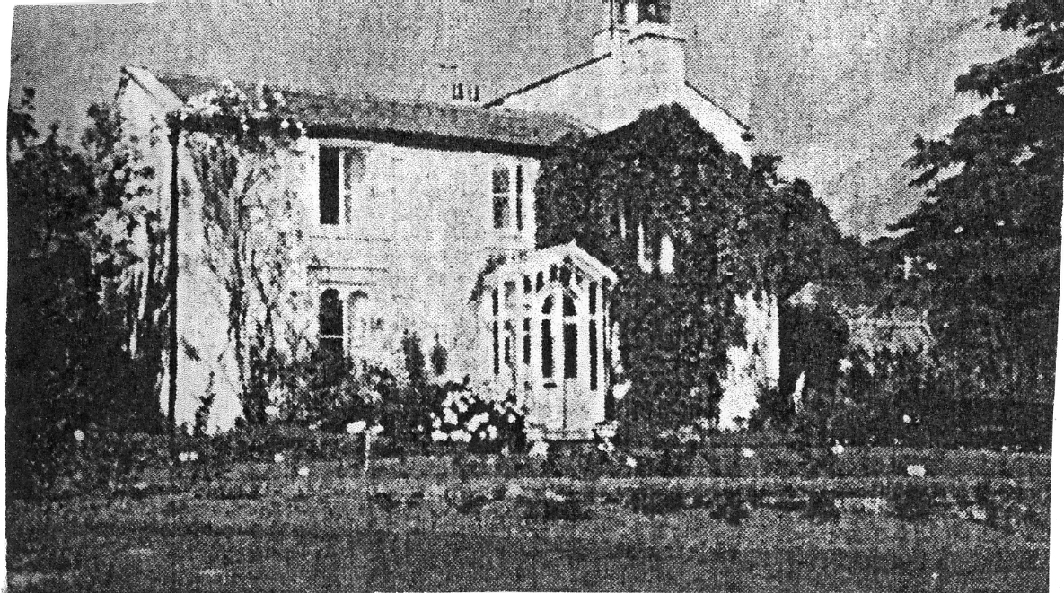
BEARDWOOD OLD HALL
Evidence of Beardwood's growth as a community during the late 16th and 17th centuries is found in parish registers e.g. between 1600 and 1680 there were at least 12 families some of whom had earlier origins. The largest groups included the Whalley's, Duckworth's and Haworth families together with the Dewhursts, Pickups and Cowpers of BILLINGE SCAR. Numerous other people crop up in these early registers e.g. Lawrence Hindley and John Gillibrand who often had brothers in other local residences and this indicated that in the 17th century the population would be between 50 and 100. The Dewhurst family of BEARDWOOD GREEN and BILLINGE CARR were copyholders in the Blackburn Township. William Dewhurst of BEARDWOOD GREEN was the first governor of Queen Elizabeth's Grammar School in 1567 and, in 1583/4, he held a messuage and 34 acres of land in Blackburn. His son John, during the enclosures of waste land in Blackburn in 1617, was awarded 17 acres of waste. A later relative, John Dewhurst of BILLINGE CARR was juror at the Parliamentary Survey of 1650. The Gillibrand family of Beardwood were a branch of the Chorley Gillibrand's. John Gillibrand of Beardwood was a Queen Elizabeth Grammar School Governor prior to 1590 and, in 1592, gave 20 shillings to the school finances. His son Roger was also a governor in 1630 and Trustee of the Poor of Blackburn and, his daughter Grace, married Lawrence Haworth of Highercroft passing him the Beardwood estate. Parish registers also indicate that Bearwood's status grew because properties on its periphery such as BILLINGE SCAR and TOAD HOLE were developed as a result of its growing population. Lawrence Haworth is listed in 1656 as a gentleman, so his residence at Beardwood must have been significant. When his daughter Ann was born in 1666 Beardwood is mentioned as a Township and Haworth's children were baptised at Beardwood rather than travelling to Blackburn Parish Church. The Sudell family have origins from the edge of the Beardwood/Billinge areas at Oozebooth as John Sudell held Chantry Lands at Oozebooth in the 1540's with William Sudell living during Queen Elizabeth's reign. Originally of yeoman stock, by 1650, Sudell was described as a “Chapman" which means he was linked to the supply of the early hand loom weavers. A later William Sudell jointly with Henry Feilden and William Baldwin bought the Manor of Blackburn. By 1785, Henry Sudell had become, via inheritance, a large textile merchant/manufacturer, dealing with over 6000 hand- loom weavers. In 1799, he purchased and enclosed the huge Woodfold Estate, parts of which stretched to Beardwood and built WOODFOLD HALL at Mellor. By 1827, however, his fortune waned due to the failure of speculations in Continental and American markets leading to bankruptcy and his departure from the area.
Close to BEARDWOOD OLD HALL in Beardwood Fold was “THE BARN" which dated from 1620 and signified the importance of farming in the area, and, in more recent times it has been converted into a modern house. BEARDWOOD COTTAGE situated at 12, Beardwood Fold was built about 1640 and was a farm workers cottage, until more recently, when it was used as a laundry by the Thwaites family.
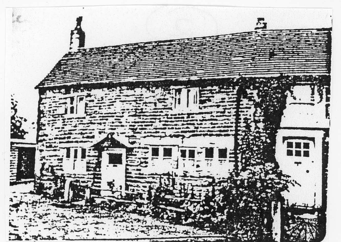
BEARDWOOD COTTAGE
BEARDWOOD FOLD FARM
whose workers lived at BEARDWOOD COTTAGE was sited nearby and had its origins in 1673. During the 18th Century, Beardwood expanded into non-agricultural uses with gentlemen's residencies and early hand loom weaving, e.g. no. 9 Beardwood Fold was built in the 1760's, and other buildings, including BEARDWOOD COTTAGE and BEARDWOOD FARM were also involved with hand loom weaving which continued into the 19th century and indicated the decline of agriculture as the sole occupation of the area.
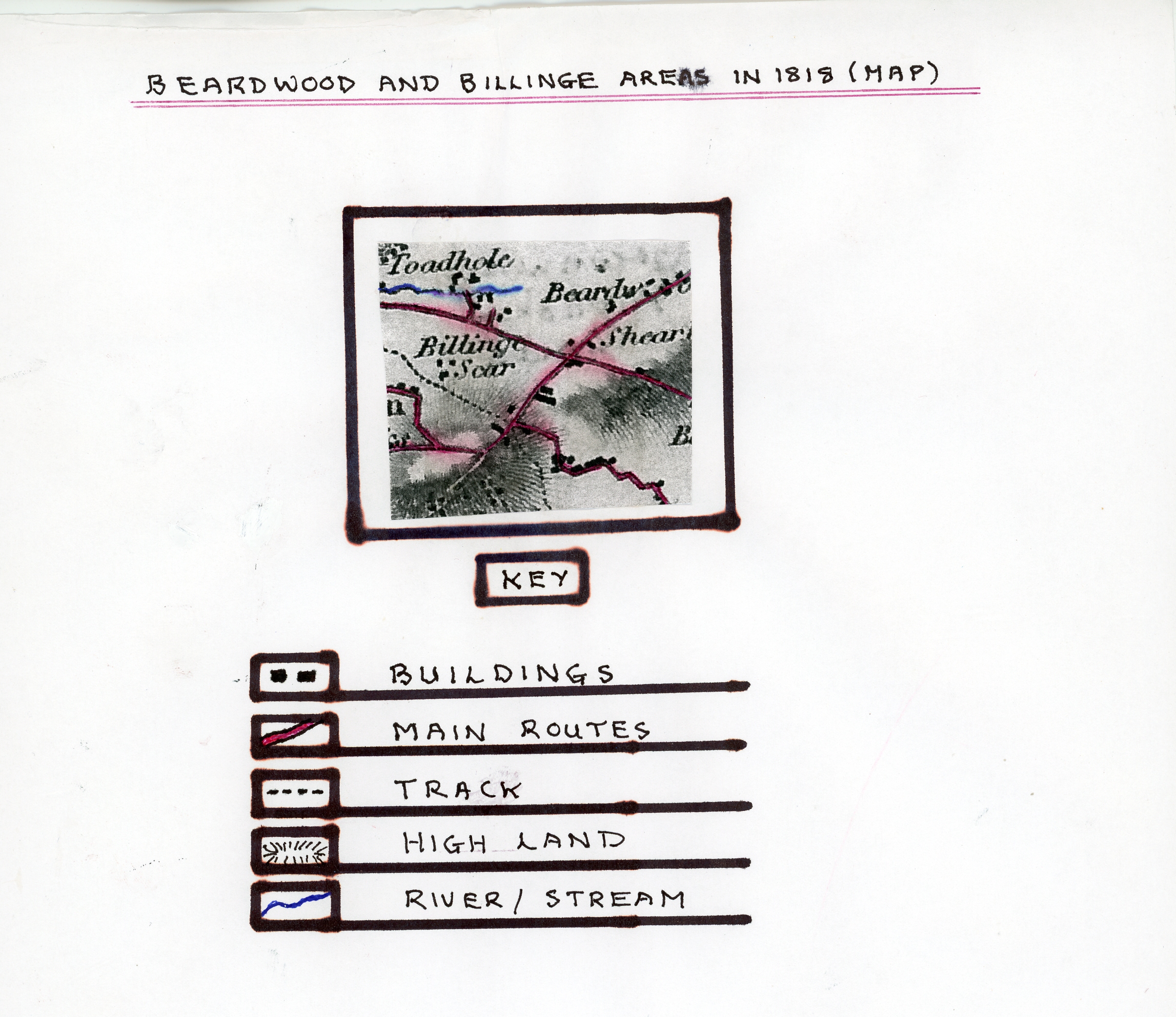
EARLY MAP OF THE BEARDWOOD BILLINGE AREAS IN 1818
This early map extract indicates with the closely grouped buildings of BILLINGE SCAR, TOAD HOLE and Beardwood Fold that the area was developing as were the original parts of Mile End with its hand loom weavers' cottages off Revidge. The map also shows Dukes Brow the main link route into Blackburn and the connecting Beardwood Brow which was the early route to Mellor, Samlesbury and Preston passing south of Toad Hole and the later route taken by Preston New Road. The rather winding lane running down the south-east of the map would be connecting to Witton. HIGHER TOAD HOLE built in 1797 is the present building off Preston New Road and originally had a dairy, pig sties, a hay barn and also operated as a public house /private house. During the early 1900's it had a wing facing the town partially demolished leaving the remnant as the present day private house.
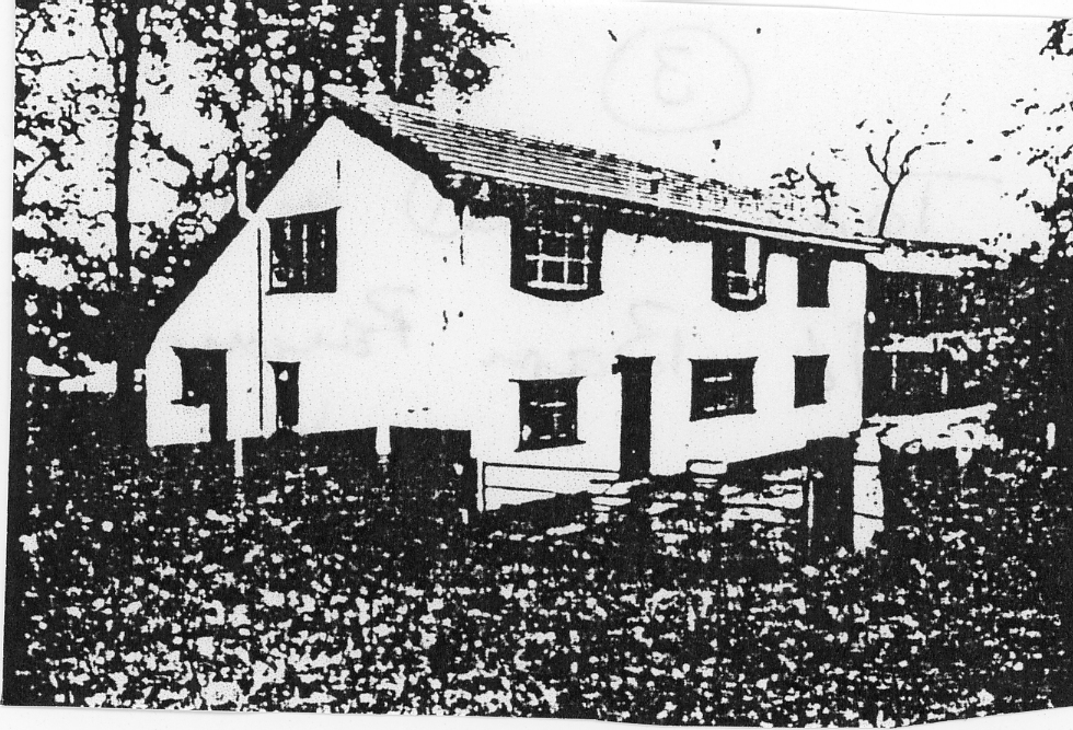
TOAD HALL (MODERNISED) WITH THE OLD BARN BEYOND
Old buildings found at the lower end of Beardwood Brow on the opposite side to the Old Hall and built before 1824 were of a very basic construction; some of the original walls were built of mud and clay with branches and mortar. A square hole found in the wall could have been linked to a hand loom and the original beams were of pegged oak. It was probably used as a farm workers house and, by 1870, housed Charles Lodge, a nurseryman; his success there led to him buying land opposite which was later used by Ferguson's Nursery. Lodge's nursery had 5 greenhouses, 2 boiler houses, a long shed and a well.
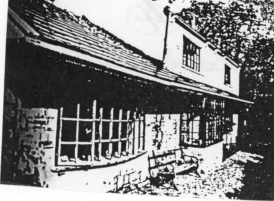
BEARDWOOD LODGE
Is of Georgian origin built about 1800 probably as a private dwelling but was used as a public house in the 1870's due to its proximity to Preston New Road and later became the home of landscape gardener Robert Ferguson who used the land connected for his nursery but later bought the land we know of as Ferguson's Nursery from the Lodge family in the early 1900's.
On land running down from MILE END COTTAGE and the WEST VIEW alongside Revidge there were in early times regular wrestling and fighting bouts when it was common for combatants to grease themselves to make it difficult for opponents to get hold of them. Cock fights were also common close to the WEST VIEW when birds were brought from many areas and large wagers placed on the outcome of the fights.
All the buildings mentioned to date were built before Preston New Road was constructed through the area. This new road was to prove the most important development for the growth of Beardwood and Billinge areas. During 1823, several meetings were held in Blackburn's Session House to promote the scheme for a new road to Preston. These meetings later involved landowners and others interested in promoting the new road via Mellor and Samlesbury crossing the River Ribble near Brockholes before entering Preston. The cost was expected to be £20,000 and, in time, £12,000 was raised by subscription with Henry Sudell donating the land crossing his estate at Mellor. Lord Stanley one of the country members introduced the bill for the road in Parliament to pass as law in 1824, forming the Blackburn to Preston Turnpike Road. The new road was to start from the middle of Northgate in Blackburn and skirt the hill under the bank (Dukes Brow area) and wind off at Oozehead towards Billinge/Beardwood and then pass north of STANLEY HOUSE on its way to Preston. This new road would supersede the old route which went from Northgate, along Blakey Moor, across Snig Brook then up Dukes Brow over Revidge and down Beardwood Brow passing south of TOAD HOLE and on passed STANLEY HOUSE to the Windmill before turning off to Mellor Brook and onwards to Preston. The new Blackburn to Preston Turnpike (Preston New Road) would have a tollgate at Shakerley, just beyond Toad Hole
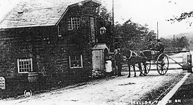
BLACKBURN TO PRESTON TURNPIKE ROAD
TOLL HOUSE AT SHAKERLEY
One of the promoters for the new Turnpike was Dr. Bradyll who was a large landowner in Samlesbury who had first had the route surveyed in 1822, arguing that as a landowner and tenant farmer, the main advantage for this more direct route would be the easier carriage of lime, manure and farm produce from Blackburn and Clitheroe without distressing horses or straining their carts and that there was ample materials for road building close at hand. It was also proposed that there would be two branches off the road, one at Dukes Brow to link to King Street called Branch Road (later Montague Street) and the other at Mellor Brook, to join the Cuerdale to Whalley Road (later the A59). Trustees for the new road were established in 1824 and the main landowners affected quickly settled on the use of their land, except Mrs. Whitehead, who owned the Bank Estate near Dukes Brow and its junction with the new link road, and, due to its importance to the scheme, could impose her own terms to the Trustees. Lady Whitehead originally owned the Gawthorpe section of the Bank Estate from FOXHOUSE to the top of Revidge which was run as a farm. FOXHOUSE was a small old cottage which originally had gardens round it and was sited close to Preston New Road and together with the FOX AND GRAPES Public House were the only buildings on that section of the road up to the 1890's.
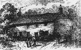
FOXHOUSE
Work started on the other sections of the road until Mrs. Whitehead finally settled, with work on the section from Miles Wife Hey (Mellor) to Billinge (beyond Mrs. Whitehead's land) starting in August 1824 and Messrs. Duckworth won the contract. By May 1825, the Duckworth's work was well underway when they started work on a culvert at Toad Hall (probably to take Arley Brook under the road) but TOAD HOLE caused problems for the Duckworths and they were accused of not fulfilling their contract because a large amount of earth needed moving to fill up the valley at Toad Hole meander, probably close to the old barn there, to ensure the gradient of the road was as gentle as possible. By 1825, after further subscriptions, the treasurers had enough money to pay for the construction of a Toll House at Billinge End with a gate on the main road and side roads from Revidge and Billinge End. The trustees decided to pay the toll collector a weekly wage, varied according to the amount collected, with the collected money being sent to the Treasurer once a fortnight. The usual tolls were for riders of horses, droves of sheep or cattle, wagons, coaches and farm carts with extras for heavy loads. Although construction of the new road proceeded well in 1826 there was an acute crisis in the cotton trade which slowed progress and, with interest on the debt growing, and landowners/subscribers struggling, the contractors themselves got into difficulties which led to problems completing Billinge Toll House. In 1827, Mr. John Loudon McAdam was invited to give his expert advice regarding the affairs of the road. This intervention also led to the construction of an extension to Revidge Road to Lammack via a relief measure, to help struggling weavers who were used to help build it, under the direction of John McAdam. During 1828, after further setbacks, the road was completed when the committee auctioned off the tolls. The road had finally cost £20,751; income from tolls in 1828 was £2,993 while the debt had risen to £41,775. By March 1834, the road had been measured for milestones at one mile intervals, one of which was next to Toad Hole close to Shakerley Brook. By 1841, the Blackburn Improvement Act made the town responsible for the upkeep of all roads in its boundary so all toll bars inside the boundary were removed and the one at Billinge End was re-sited at Shakerley on a plot of land opposite what is now Yew Tree Drive, just over the borough boundary. Toll money remained high during the 1830's and early 1840's but the opening of the local railway from Blackburn to Preston in June 1846 soon began to draw traffic away and receipts fell by 2/3rds. In 1848, this led to problems running and maintaining the turnpikes, paying debts and, by 1890, the Blackburn Preston Turnpike expired (the last in Blackburn to do so). Mr. William Coddington was the last person to pass through Shakerley Gate on October 31st 1890 just before midnight on his way home to WYCOLLAR. After this, the toll house would have been removed and the maintenance of the road there was taken over by Lancashire County Council.
During the 1820/30's two more buildings were built in the area, the first was next to BEARDWOOD OLD HALL called BEARDWOOD FOLD FARM which possibly stood on the site of an earlier building. This farm was operative till the 1970's and has since been modernised into a private dwelling. The second was the YEW TREE INN which stood opposite the old barn at TOAD HOLE and was originally a farm then operated as a farm and an Inn during much of the 19th century. In the 1870's, its occupant Thomas Parker, was listed as a farmer but in the 1841 Census it was shown as an Inn. The 1841 Census showed there were 12 farmers in the area including Revidge/Billinge and 383 cotton weavers and even allowing for the Mile End Row hand weaving centre there must have been weaving in the Beardwood and Billinge communities. The YEW TREE INN was owned by the Thwaites family and the building was bequeathed to Elma Yerburgh in 1885, remaining in the Woodfold Estate till its closure. Also in the 1830's BEARDWOOD MANSION was built which was located on steep land between Beardwood Brow and Preston New Road surrounded by a heavily wooded garden. Its driveway ran approximately on the route now taken by Beardwood Drive with another entrance on Beardwood Brow where there was a gate house. It became the home for many years of Sir John Rutherford Bart who became Darwen's M.P. and mayor of Blackburn in 1888. He also owned land around this building, had racehorses and played for the early Blackburn Rovers Team. The house was demolished in 1936 and replaced with large detached and semi-detached houses with gardens called “Garden City “on what is now Beardwood Drive". At the top of Beardwood Brow are a group of cottages with number 4 having evidence of a triple window at the back which would indicate it was used for hand loom weaving and they were probably old farm cottages. The first Blackburn Horse Racing Steeplechase was held in 1830 on a course that ran from Billinge End to Shorrock Hey (near Billinge Scar) then on to Woodfold Park Estate at Mellor and returning via Beardwood and Yew Tree.
The word Revidge signifies high land, derived from Norman/French languages and offered great views. The Mount Pleasant section of Revidge ridge consisted of huge rocks made of sandstone and shale creating very solid ground. It was therefore favoured from very early times as a dry route with evidence of pre-historic use with the Revidge Bronze Age burial site at Revidge Delph. During the “Cotton Distress" of 1826/7 the unemployed working classes were employed to cut a road through the rock between Dukes Brow and Four Lane Ends to create a link through to Whalley.
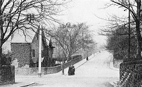
REVIDGE ROAD LOOKING FROM BILLINGE END
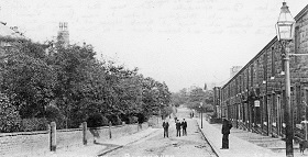
VIEW LOOKING DOWN DUKES BROW FROM ITS UPPER AREA
Leading off from Revidge Road was the Mile End Hand Loom Cottages where most of the cottages have stone gutters, water-shot masonry and keystone arched doors with straight line joints indicating different phases of construction. It is the most important colony of handloom weavers cottages in Blackburn built between 1817/1830 by the Mile End Subscription Building Club.
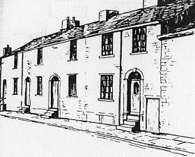
MILE END HANDLOOM WEAVERS COTTAGES SHOWING RAISED STEPS AND EVIDENCE
OF INFILLED BASEMENT HANDLOOM -SHOPS
Including the cottages on Revidge Road, there are over 60 dwellings and handloom weaving was still well established here in 1851 with isolated weavers continuing to the end of the 19th century. There is evidence of infilled cellar windows in at least 15 cottages on West View Place where the loom-shops were located and the lower houses had possible rear loom-shops as evidence with irregular window arrangements. A similar pattern was evident in Mile End Row (formerly called Dandy Row). In the yard of WEST VIEW PUBLIC HOUSE which dates from 1848 was an interesting survivor of a ruined cottage with an infilled triple window. These cottages would have been developed on land that originally belonged to OOZE HEAD HOUSE which was a farmhouse dating from the 18th century sited where Sacred Heart Church was built at a later date. Oozehead cottages on Manor Road (formerly Oozehead Lane) running from the top end of Buncer Lane together with Long Row cottages were of a similar age to Mile End Cottages and again had many handloom weavers working from loom-shops. They were built as Club Houses between 1803/1820, having many alterations made to them in Victorian times but with evidence of their former use with window types used by loom-shops especially triple windows.
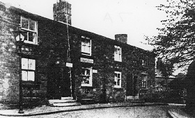
MANOR ROAD WEAVERS COTTAGES
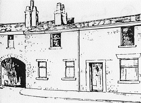
LONG ROW WEAVERS COTTAGES
Additionally Freezeland Row nos. 1-29 on Billinge End Road are again probably Club Houses dating from 1815 and by 1851 most residents were handloom weavers.
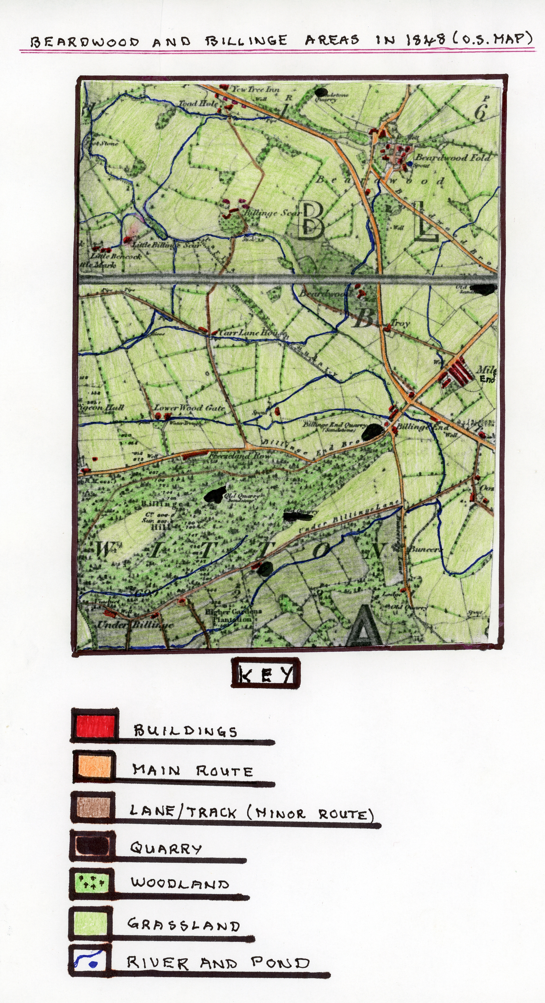
BEARDWOOD AND BILLINGE AREAS IN 1848 (O.S. MAP)
In the thirty years since the 1818 map there has been an increase in the settlement notably at Mile End, Beardwood Brow, Billinge Scar and Freezeland because handloom weaving in the area expanded along with farm expansions therefore there was a need for more cottages. Even so, settlement is still fairly sparse with the landscape showing a very rural aspect with farmland dominating, especially pastoral farms. Still present are large areas of woodland in both Beardwood and especially the high parts of Billinge round Billinge Hill. The new more direct route from Blackburn to Preston, namely Blackburn Preston Turnpike (Preston New Road) is visible crossing the area from south-east to north-west with the old Beardwood Brow now linking to it. There are now additional tracks and roads in the area e.g. from Beardwood Fold northwards (from Mile End to Beardwood), Buncer Lane and links off it including Billinge Lane running to Under Billinge, Billinge End Brow and Oozehead Lane leading off the map to Long Row which ran round to link with Preston New road. These routes reflect the increase in horse drawn traffic for moving goods and people and used for example by putters-out who supplied the handloom weavers from their Blackburn depots. The map also shows significant quarries mostly along the Revidge/Billinge Ridge e.g. Billinge End Quarry and two old quarries nearby, one off Beardwood Brow and one beyond Beardwood Fold. These would appear mostly to have been extracting sandstone, limestone and gritstone needed to construct the cottages in the two areas.
BEARDWOOD MANSION close to the link road to Beardwood Fold/Beardwood Brow, TROY alongside Preston New Road south-east of Beardwood and OOZEHEAD HOUSE close to Billinge End are evidence of the start to the building of large houses in the area for the gentry, professionals and industrialists who moved to the western fringe of Blackburn, away from the increasingly industrial centre of Blackburn, to more pleasant rural locations. Most of the other large houses visible are farmhouses e.g. LITTLE BILLINGE SCAR, LITTLE BOOCOCK, TOAD HOLE, BILLINGE SCAR AND CARR LANE HOUSE. Also visible in the extreme north and by the side of Preston New Road is the YEW TREE INN which combined some farming with running the tavern. In the south, off the original upper section of Buncer Lane can be seen the lodge house of the Fielden's Witton Park Estate. Another notable building on the map, although unnamed, is BILLINGE SUNDAY SCHOOL on Preston New Road, opposite the entrance to Billinge End Road, that ran round to Under Billinge Lane. This was built in 1834 due to the efforts of Rev. J.W. Whittaker, Vicar of Blackburn, who applied for aid in 1833 for a school room to accommodate boys and girls as the population in this area had risen considerably, with costs of £400, of which, £300, was raised by benefactors. The National Society donated a further £50 and the school opened in 1835 with the land donated by Mr. Joseph Feilden. Prior to this, a school had been run from the upper room of an old cottage at Mile End. The school was built of brick with stone flag floors (later boarded) and had two rooms to accommodate over 100 boys and 100 girls. It belonged to St. Paul's and, by 1838, was not licensed for church services so people of the area had to travel down to the mother church of St. Paul's. The school provided the only basic education that the children of the area received at this time and would be supported by voluntary annual subscriptions. However, by 1846, when the area's population totalled 2000, a licence was obtained for church services to be administered at BILLINGE SUNDAY SCHOOL. The Sunday school records date from1874 when there were 129 scholars and 11 teachers present in the morning and 220 scholars and 14 teachers present in the afternoon. In 1875, 12 males and 18 females from the school were confirmed at St. John's Church and, by now, the Sunday school was operating as a Day School with the school's accommodation being shown as 261. In winter times, when the weather was bad, Sunday School Teachers when weather bound prior to the evening service often had tea provided by near neighbours. The stone flag floors also created problems with the organist and choir master bringing coal wrapped in paper to provide some heat. In those days the choir paid for their own music and for singing lessons.
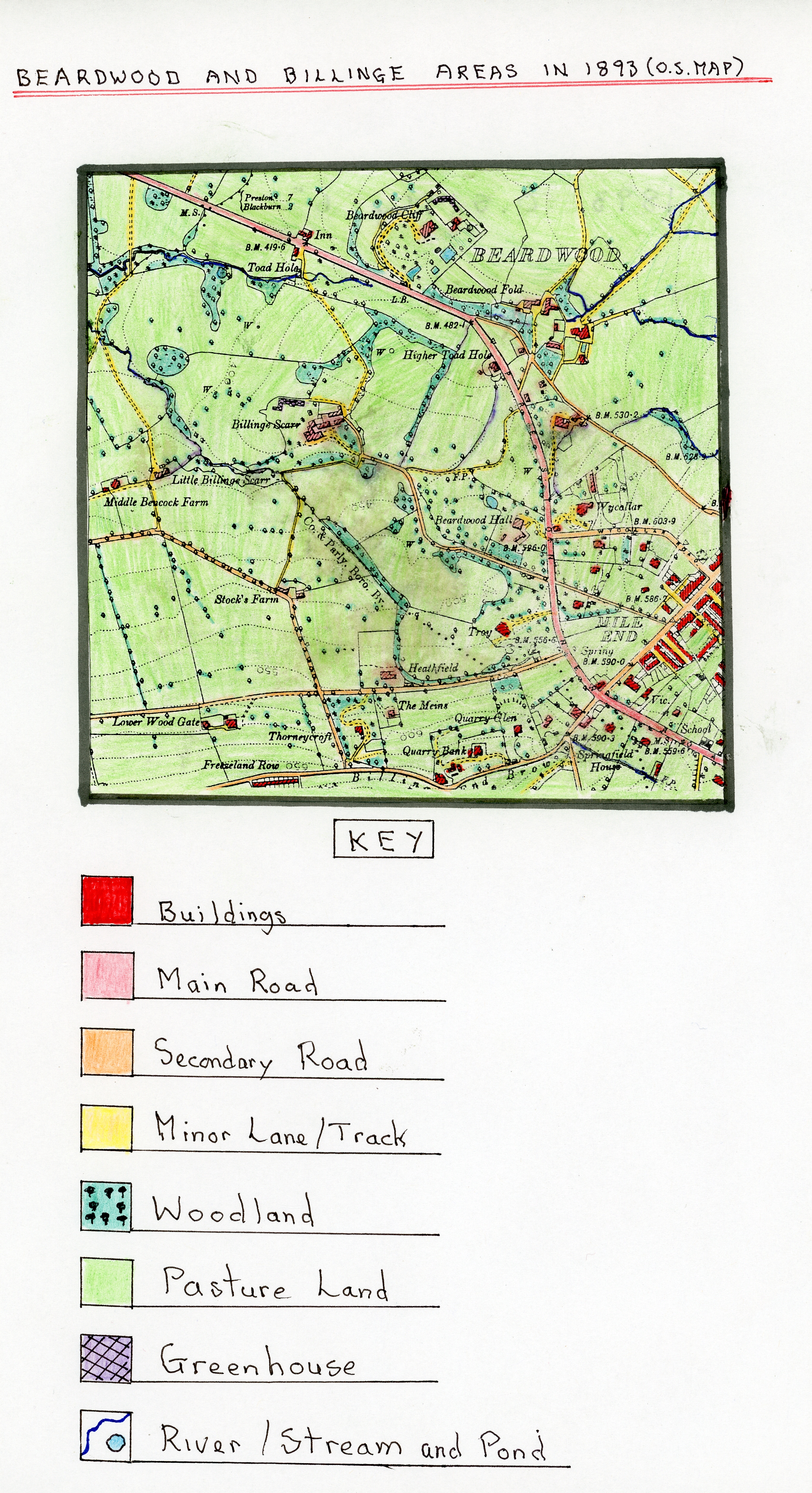
BEARDWOOD AND BILLINGE AREAS IN 1893 (O.S. MAPS)
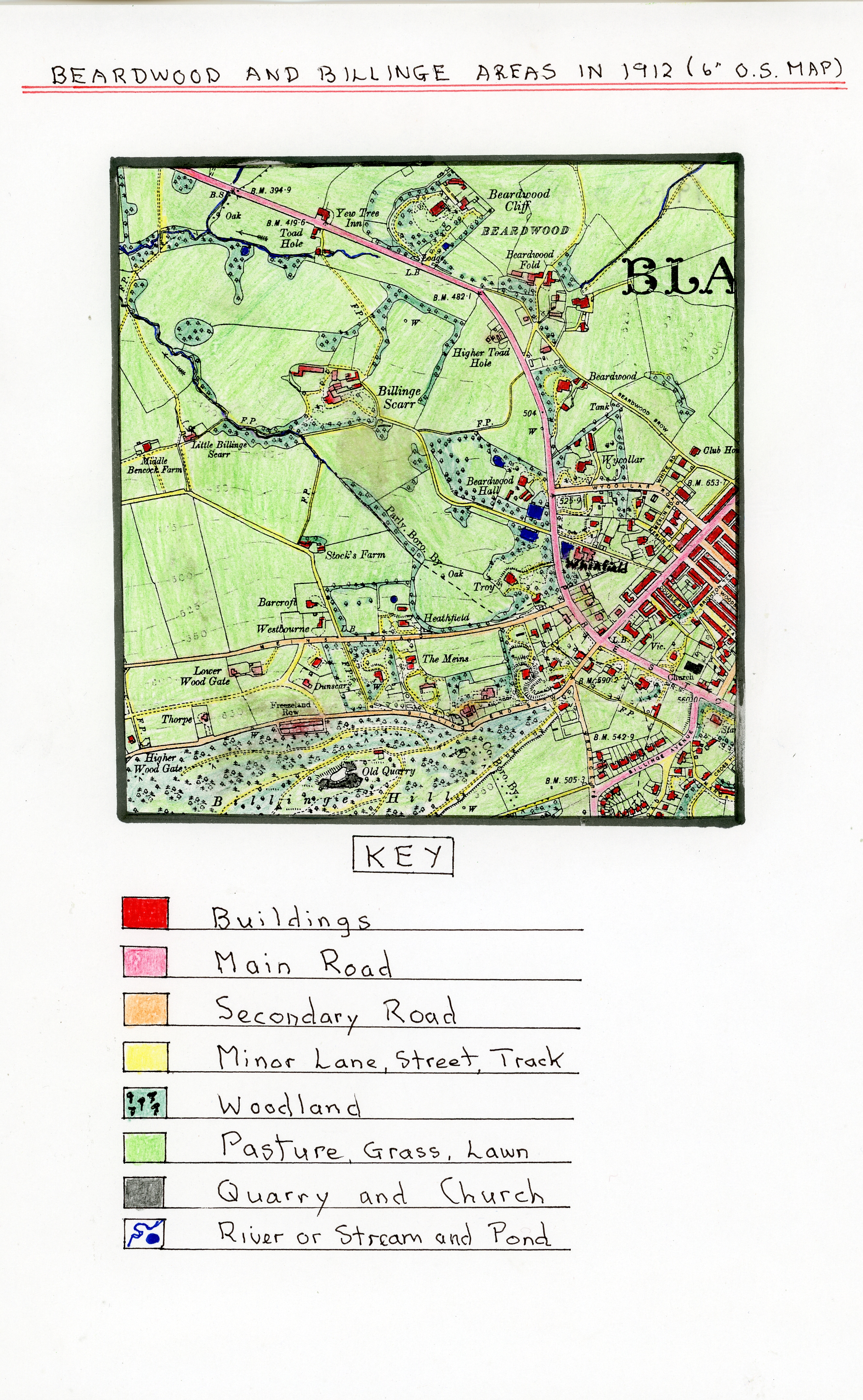
BEARDWOOD AND BILLINGE AREAS IN 1912 (O.S Maps)
Both maps show a significant increase in housing in the area especially along Preston New Road, Billinge End Brow and the lower sections of Revidge Road. The main pattern along Preston New Road and Billinge End Brow is the development of large plots of land each containing large detached houses as this western fringe of Blackburn became a more prestige, highly sought after area for living, helped by the horse drawn tram service (later steam powered) that now ran to Billinge End Terminus from Blackburn centre (see sketch below); this was run by Blackburn Corporation who, by 1895, had introduced electric trams.
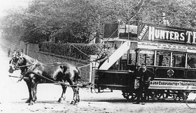
TRAM TERMINUS AT BILLINGE END
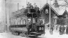
ELECTRIC TRAM AT BILLINGE TRAM TERMINUS WITH PASSENGERS DRIVER
AND TICKET COLLECTOR ALSO SHOWING THE GABLE END OF
A LARGE DETACHED HOUSE ON THE CORNER OF REVIDGE ROAD
WHERE BICYCLES COULD BE LEFT FOR A SMALL CHARGE.
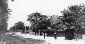
ELECTRIC TRAM ON PRESTON NEW ROAD ADJACENT TO
ST. SILAS ROAD AND BILLINGE SCHOOL
Successful manufacturing families together with professional people were now attracted to this semi-rural location which in turn led to the building of many grand houses including BEARDWOOD CLIFF, BEARDWOOD HALL, HIGHER TOAD HALL, WYCOLLAR, NEW TROY, HEATHFIELD, THE MEINS, QUARRY BANK, QUARRY GLEN, THORNYCROFT and SPRINGFIELD HOUSE. Also, BILLINGE SCAR AND BEARDWOOD FOLD houses had grown (replacing older ones) along with extensive glasshouses at BILLINGE SCAR. Each of these houses had large grounds which had been landscaped with drives to the houses, lawns, trees, and ponds, in some cases. Most of the farmhouses are little changed but some wooded areas have been cleared for farming especially south of Billinge End Brow and, in other areas, to develop the large houses grounds. Significant new property has now been built off Revidge Road with better Victorian terraced properties which had small front gardens and larger homes and gardens off the newly formed Wycollar Road linking Revidge to Preston New Road. QUARRY BANK AND QUARRY GLEN properties have clearly been developed in an old quarry site which no doubt provided protection/shelter. By now, the south-east of the area had the highest density of housing, and significantly, this was nearest to Billinge End and the tramway system and in the early 1900's attracted the new lower middle classes who could afford tram fares and encouraged suburban ribbon developments along roads feeding into Billinge End and Preston New Road. By now Blackburn's middle classes including mill managers, small factory owners and professionals favoured this north- west area away from Blackburn's centre's smoke and smells together with its industrial buildings and working class housing. The quality aspect of this west- end area was maintained by carefully worded covenants and restricted clauses in house leases/title deeds. In 1881, of the 184 heads of household along Preston New Road, 113 were mill owners, professional men or gentlemen with the remainder mainly high class tradesmen and widows with private incomes.
DETAILS OF GRAND HOUSES IN THE AREA
NEW BEARDWOOD HALL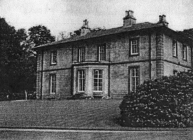
This was built in the 1880's and was first occupied by the Astley family who were successful due to their textile and grocery businesses and was later occupied by J.L. Irving, a descendant of the famous textile inventor Samuel Crompton and whose other relative, J. Lancaster, built Blackburn's first spinning mill at Wensley Fold in 1877. Irving also had one of the finest private collections of paintings and china in the country. After he died in 1917, the house was taken over by the Taylors, a cotton manufacturing family, and later, by the Woolley family who owned Cupal Pharmaceuticals. Today the house has been transformed into BEARDWOOD PRIVATE HOSPITAL.
BEARDWOOD CLIFF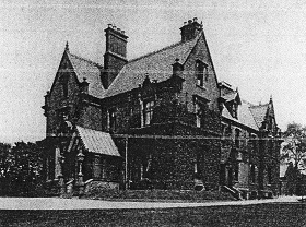
This was built in 1858 for the newly married Daniel Thwaites and his wife Eliza on the site of an old sandstone quarry close to Preston New Road and, it is probable, the quarry was used to provide rock for Preston New Road contractors and stone for some of Beardwood Fold's original houses. Its Italianate design matched that of his brother John's house, at Troy, further along Preston New Road. It contained ornate fireplaces, a billiards room, tennis courts, lawns, fountains, rock gardens amongst a wooded aspect and numerous out-buildings including extensive greenhouses and a lodge on Preston New Road, leading to a long drive up through wooded landscaped gardens to the house. When Daniel Thwaites moved to BILLINGE SCAR the house was bought by the Thompson family who were textile magnets. During the 1st World War the building was taken over by the Sisters of Nazareth (NAZARETH HOUSE) as a home for orphaned children later to become NAZERETH HOUSE OLD PEOPLES HOME. The house was demolished in 1988 and was replaced by NAZERETH HOUSE CARE HOME COMPLEX.
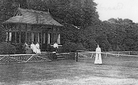
TENNIS COURT AND PAVILLION AT BEARDWOOD CLIFF
Lawn tennis came into vogue in the 1870's mainly as a game for the upper classes on a social basis and women could take part. No special dress was required as it was considered a genteel ladies game.
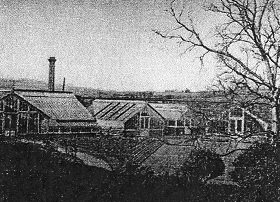
EXTENSIVE GREENHOUSES IN BEARDWOOD CLIFF GARDENS
USED TO GROW EXOTIC PLANTS
TROY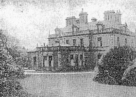
This 21 acre site was developed on the west side of Preston New Road between Meins Road and the old lane down to BILLINGE SCAR. It was built in the last quarter of the 19th. Century and later became the residence of the Thwaites family standing on the site later used by BLAKEY MOOR GIRLS SCHOOL and then BILLINGE GRAMMAR SCHOOL/TAUHEEDAL SCHOOL. It had extensive lawns; greenhouses and a driveway from Preston New Road with a lodge and separate entrance from Meins Road (see 1912 map).
WYCOLLAR HOUSE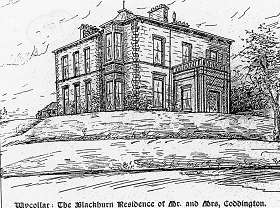
This house was sited next to BEARDWOOD MANSION on the east side of Preston New Road and Wycollar Road and had spectacular views to the coast. It had a lodge house on Preston New Road (only part now remains) with the house drive winding up through wooded and landscaped gardens with a large lawn. Behind the house were small greenhouses and out-buildings, probably stables. This was the home of Sir William Coddington who inherited it from his father along with three mills and the house was sometimes called Coddington Hall. Sir William became Mayor of Blackburn in 1875 and one of its M.P.'S from 1890-1906. In 1918, the house passed into the Eddleston family who were also textile magnates and was demolished in the 1930's.
WHINFIELD HOUSE
This was situated opposite BEARDWOOD MANSION on the east side of Preston New Road just beyond the tram terminus at the bottom of the lane leading down from Revidge to Preston New Road. It had a lodge on Preston New Road with a drive that led up to a brick built villa in the Italian style of architecture, turreted with its front door covered by a porch with coloured glass side panels. Behind the house were small greenhouses and to the front large lawns and wooded landscaping. This was the house of William Henry Hornby M.P. and textile magnate. The house was bought from William Dickinson, iron founder and machinist, of Bank Top Foundry who had it built. The Hornby's moved here from Brookhouse Lodge when it became surrounded by buildings. It is said that on the field where it was built, wrestling had regularly taken place and also real fighting.
QUARRY GLEN
This residence was built by T.P. Ritzema and named by his children; it was sited off Billinge End Road. Its site had been an unsightly disused quarry. Mr. Ritzema bought the quarry, drained it, blasted hundreds of tons of rock away and levelled the site with the debris and planted thousands of shrubs, flowering plants and banked up the sloping sides, forming a Delph for a tennis court and, on top of the rock, built his home overlooking the sweep of the Ribble Valley. He was the founder of both the Northern Daily Telegraph and Blackburn Weekly Telegraph in the late 19th Century. Additionally, a house was built next to QUARRY GLEN on the lower site within the old quarry workings called QUARRY BANK.
BEARDWOOD
This was an estate and mansion sited towards the bottom of Beardwood Brow and near to Preston new Road above and close to WYCOLLAR. It was occupied for many years by Sir John Rutherford Bart. It had large landscaped gardens and access to both Beardwood Brow and Preston New Road. The 1912 map shows a water storage tank between it and WYCOLLAR. The photograph below shows the house being demolished in 1936 to make way for 40 new houses.
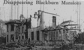
BEARDWOOD HOUSE BEING DEMOLISHED
BILLINGE SCAR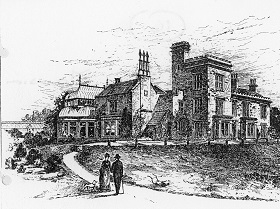
In this site there had been ancient house owned by local gentry who lived with servants from Elizabethan times, some families associated with the early property included the Dewhurst's (1600's), Fowlers, Dawson's, Pilkington's and Neville's (1700's /1800's). It was in 1876, when millionaire brewer Daniel Thwaites decided to move there, that he then built round the existing structure creating a huge mansion with an Elizabethan façade complete with battlements (see picture below). The new house had 12 bedrooms, a coachman's quarters, several rooms on the lower floor for entertaining, a library and a school room for daughter Elma. In later years, Elma married Robert Yerburgh (M.P. for Chester), in 1888, and they took over the property and added a large conservatory with an Italian mosaic floor. They later moved to WOODFOLD HALL and William Birtwistle, a cotton magnate in Blackburn, took residence. In 1921, the Birtwistles were said to control more looms than any other individual in the world. They had 8 full time servants who together with gardeners and mechanics for their cars made up their staff. The 5 acre estate now included tennis courts and an indoor swimming pool. Another Birtwistle (brother) lived at SPRINGFIELD HOUSE further up Preston New Road, scored Blackburn Rovers first goal in the F.A. Cup win in 1884 and, in his spare time, was director of Roe Lee Mills. The Birtwistles also showed considerable social responsibility, drawing staff from depressed industrial areas, welcomed an annual parade of children from Blackburn Ragged School and provided land at Mellor for the jobless between the World Wars. They were also supporters of James Street Congregational Church. When Arthur Birtwistle died in 1937, the property was put up for sale but found no buyers so the house was put to public use during the 2nd World War, used for various ministries, and, later sold for demolition and materials in 1947, which took two years and the removal of 2,500 tons of debris, Italian stone and more than 30,000 hand- made bricks, 100 tons of lead and 60 tons of girders.
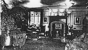
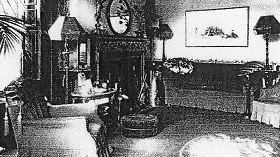
THE MORNING ROOM AT BILLINGE SCAR A BEDROOM AT BILLINGE SCAR
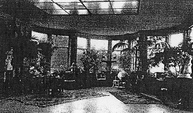
ROUNDED WINDOWS OF THE SUN LOUNGE AT BILLINGE SCAR
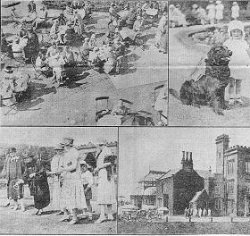
GARDEN PARTY AT BILLINGE SCAR IN JULY 1926 FOR THE LIFEBOAT ASSOCIATION HOSTED BY MR. AND MRS BIRTWISTLE BY THE LIFEBOAT LADIES COMMITTEE RAISING OVER £100 WITH QUOITS AND FOLK DANCING WITH RYTHMIC DANCES PERFORMED IN THE BALLROOM BY LOCAL PUPILS.
BISHOPS HOUSE
This was built in the Billinge area for the official residence of the Bishop of Blackburn and had a new wing added in 1928. It contained a secretary office, reception room and a small temporary Chapel separated from the residential section.
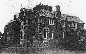
VIEW OF THE BISHOP'S HOUSE
SPRINGFIELD HOUSE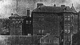
This was the home of Albert Birtwistle J.P. and had, at the time, a very modern interior. The house had extensive gardens with two lawns, a large number of trees and a large kitchen garden. The house also had a central conservatory and an extensive basement for domestic purposes. It also contained a spacious hall, dining and sitting rooms and a well -equipped nursery. In 1923, the house was purchased and adapted into a large Maternity Home under Blackburn Corporation Health Department.
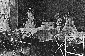
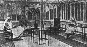
VIEW OF A MATERNITY WARD AT CONSERVATORY AT SPRINGFIELD HOUSE
SPRINGFIELD HOUSE
HEATHFIELD
This was a large detached Victorian House sited on Meins Road (Billinge) with well laid out gardens and large trees surrounding it. In 1945, it was purchased for use by Westholme Primary School for the pupils of Lower School.
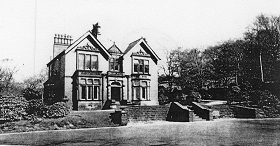
VIEW OF HEATHFIELD HOUSE
BILLINGE HOUSE
This was situated next to SPRINGFIELD HOUSE and was another sizeable Victorian detached house with large formal gardens protected by well- established trees. In the 1920's this became the lower school for Westholme Private School and is still there today.
BEARDWOOD BANK
This was another large Victorian detached home built on a large elevated site beyond Billinge End on Preston New Road close to WHINFIELD HOUSE. It had two acres of grounds with attractive shrubberies and lawns surrounded by trees. The house was connected to Preston New Road by a long sloping drive. This was taken over by Westholme Private School to accommodate its middle school which continues today.
BILLINGE VIEW
This was a large Victorian development at the corner of Revidge Road and Preston New Road but facing Preston New Road consisting of three adjoining houses with a large lawn to the front.
Other notable large detached houses built in the period include;
Meins Road – the Meins, Thornycroft, Lower Wood Gate, Dunscar, Westbourne and Barcroft.
Billinge End Road – Northwood, Thorpe and the cottage.
Preston New Road beyond St. Silas church towards Revidge – St. Silas Church Vicarage, Broomfield, Longfield and Ivy Cottage.
This huge development of grandiose private residences lasted for approximately 100 years but came to an end by the 1930's. What is significant from the Ordinance Survey Maps is that during its peak, the owners of these upmarket residential properties took great efforts to protect their properties and make them private by the large scale use of trees to screen them, in many cases, completely surrounding them, especially those sited alongside main roads. By 1912, Billinge Avenue was established, connecting and crossing the top end of Buncer Lane from which Gorse Road looped round to meet Buncer Lane lower down. Both of these were then used to site a mixture of large Victorian semi-detached and detached properties with large gardens but on a smaller scale than the mansions built earlier in the area as the West End became a more attractive area to the middle classes (see 1912 O.S. Map).
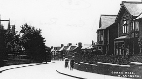
VIEW OF GORSE ROAD PROPERTIES IN EARLY 1900'S
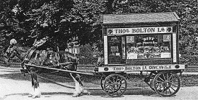
DELIVERIES BY HORSE AND CART BY THOMAS BOLTON
TO PROPERTIES IN BUNCER LANE AND
BILLINGE AVENUE AREAS
At the same time large numbers of better quality terraced properties were established off Revidge Road, down steep slopes towards Blackburn and Preston New Road beyond St. Silas Church, mostly with front bay windows and a small front garden and rear yards including: Woodbine Road, Azalea Road, St. Silas' Road, Granville Road, Brighton Terrace, New Bank Road and Lynwood Road to meet the growing population in the West End, encouraged by the development tram service to Blackburn centre.
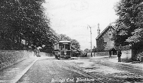
VIEW OF THE TRAM SERVICE LEAVING BILLINGE END
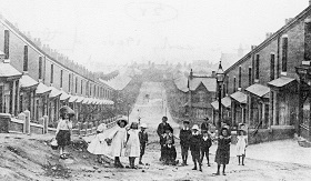
VIEW IN EARLY 1900'S OF THE DEVELOPMENT OF LYNWOOD ROAD PROPERTIES
WITH NO 57 BEHIND THE STREET LIGHT BEING THE HOME OF KATHLEEN FERRIER
WHO LATER GAINED AN INTERNATIONAL RECOGNITION FOR HER SINGING
ST. SILAS'S CHURCH
After its early growth in the Billinge Sunday School (Parish Rooms) on Preston New Road, it became clear a new church was required to meet the growing population needs within the West End, and, during the ministry of Reverend M. Shaw, a foundation stone was laid for the church in 1894. This was laid by Mrs. Tattersall of Quarry Bank on Billinge End Road who opened the subscription list for the new church with a donation of £1000 followed by another for £750. The last service in the old Billinge Sunday School was held on Sunday May 15th 1898 with the new church opening for Devine Service on the following Thursday, Ascension Day, May 19th. 1899. The total cost of the new church designed by Messrs. Paley and Austin of Lancaster was £10.000 which did not include the original idea of a tower; this was completed later between 1912-1918, costing £6000, along with a porch and baptistery. When the church opened it had a debt of £2000 which was not cleared until after the consecration of the church in 1900. The large detached house, FAIR ELMS to the left of the church was later demolished to make way for St. Silas's Vicarage.
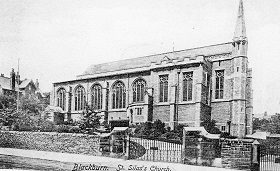
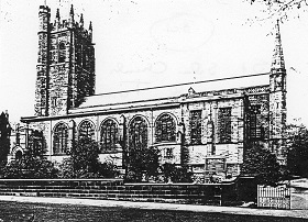
EARLY VIEW OF ST SILAS ST. SILAS CHURCH IN THE
CHURCH WITHOUT A TOWER 1960'S WITH TOWER
Since its erection, the church has received many significant gifts e.g. in 1900, the Communion Table was presented by Mrs. Moses Whewell; the Font was presented by Mr. John Slater and a new organ constructed in 1904 was paid for by Miss. M.A. Lund. In 1905, a large stained glass window at the east end was presented by Mr. J.E. Fielding. In 1908, Miss A. Riley donated the Four-Light Window, and in 1921, two stained glass windows in the Chancel Aisle were donated by the family of the late Mr. Henry Lewis and one in the south aisle by Mrs. Albert Birtwistle. In 1950, the large stained glass west window was provided by Robert Edward Hart and was designed by Mr. James Hogan, an artist with a world- wide reputation. A silver Alter Cross costing over £300 was provided by Dr. Ronald Riley in memory of his parents who were active at the church and, in the same year, the Lord Bishop of Lancaster dedicated the War Memorial Chapel which cost £3000; this was made of beautiful crafted stone and wood. These examples indicate that as the church was situated in the more affluent West End it consequently benefitted from the generosity of its members and grew significantly during its first 50 years, and, as a monument of architecture has no equal in Blackburn. The style of the church is known as Perpendicular because of its upward soaring lines and the beauty of its windows. The external church walls are built of local stone with fine Yorkshire dressings with pink tinged Runcorn stone used for the interior to give the church a warm appearance.
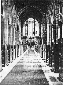
ST. SILAS CHURCH INTERIOR