
 Loading more
Page 2
Cherry Tree And Feniscliffe Areas From 1932
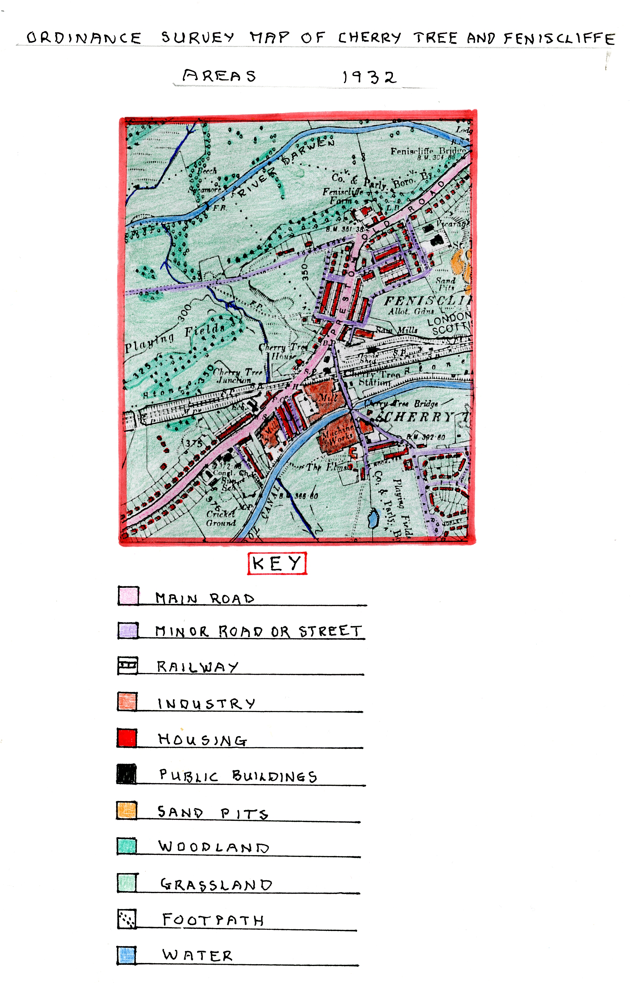
Ordnance
Survey Map of Cherry Tree and Feniscliffe Areas
in 1932
During the last 23 years, including the 1st World War period (1914-1918), the map indicates that many significant changes had occurred, with growth in all parts of the area due to a variety of new developments. The largest change is the growth of new housing especially in the Feniscliffe area where there was more room, leading to rows of new terraced housing built in the earlier 1910-1915 period alongside Cecilia Road, Willis Road and beyond the tram terminus northwards of the tram terminus.
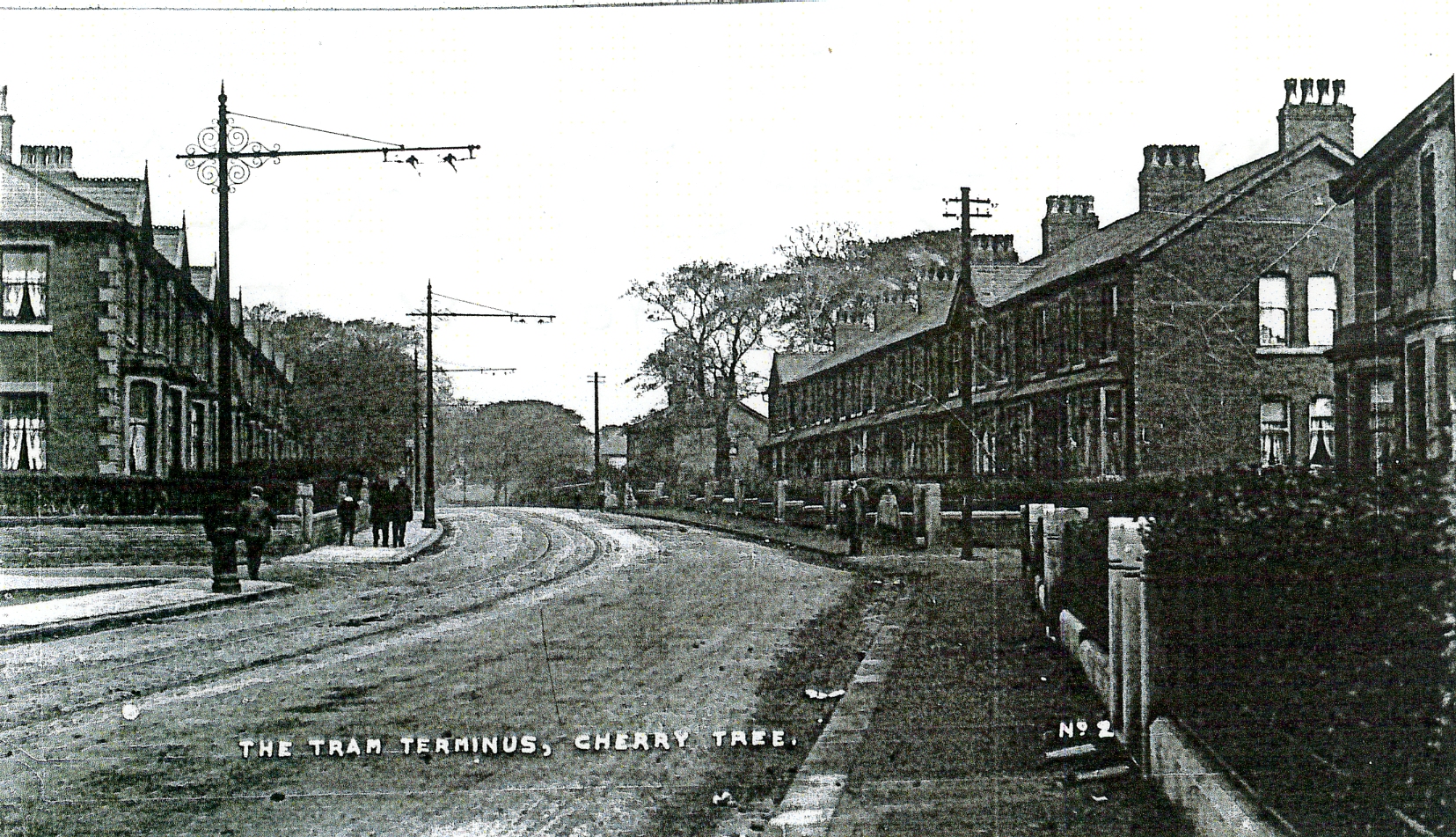
Early
Photograph of New Terraced Housing Built Alongside
Preston Old Road Beyond the Tram Terminus
Additionally, new rows of semi-detached houses were built in the late 1920’s to early 1930’s along St. Francis Road, Preston Old Road and Banes Street with others started along the top end of Tower Road which had been upgraded from a former track leading down to Pleasington Fields and beyond. On the other southern side of Cherry Tree, new, mostly semi-detached and odd detached houses had been built, stretching out in a linear fashion along both sides of Preston Old Road leading towards nearby Feniscowles. All these semi-detached properties had front and rear gardens providing new opportunities for gardeners
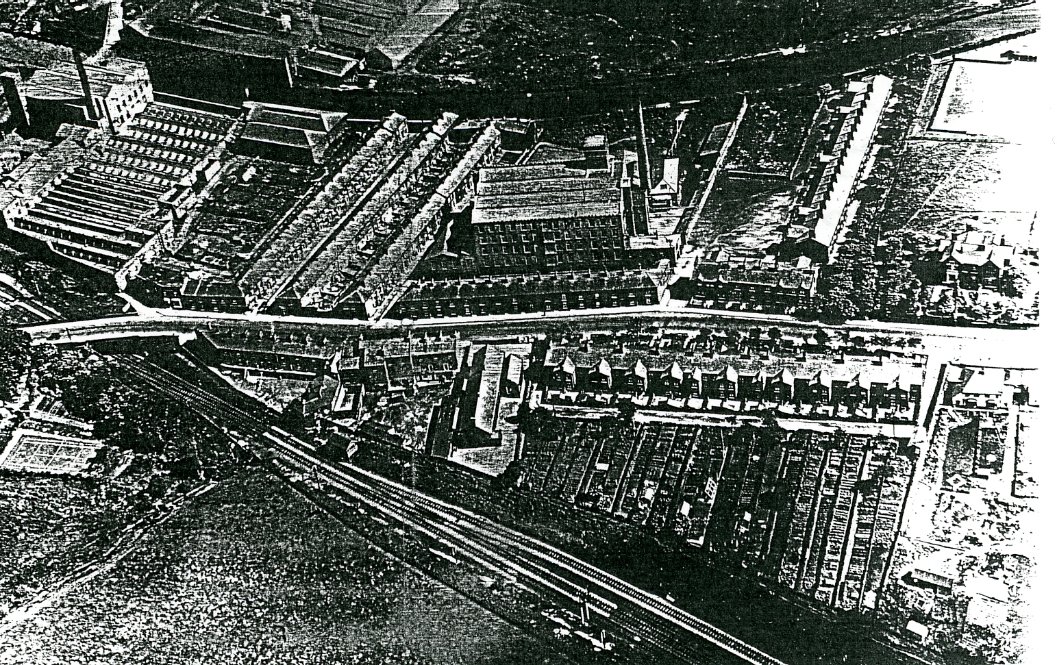
1930’s
Arial Photograph of Preston Old Road Passing Through Cherry Tree with Bank Mill
in the Centre and Cherry Tree Mill to its Left and the Railway Running Along
the Bottom of the Image. The Terraced Houses are Packed Close Bye with Those Sited
Next to Cherry Tree School Having Long Strips of Allotments Running Down to the
Railway.
Another new development was the building of a council estate in the south-east section of the area with its boundary with Mill Hill and Livesey. This was the first time the council entered the housing market in order to develop out of town sites to re-house people from former slum terraced housing areas demolished in Blackburn. Here, they were offered semi-detached houses with gardens on non-industrial sites which were a huge improvement and allowed them to rent more up-market housing. By now, Nook House, in this same area had been renamed “The Elms” probably because the original tannery had now closed although its name lives on with the terraced property along Nook Terrace. Existing large scale textile and laundry machinery production continued to develop on existing sites (see photographs below).
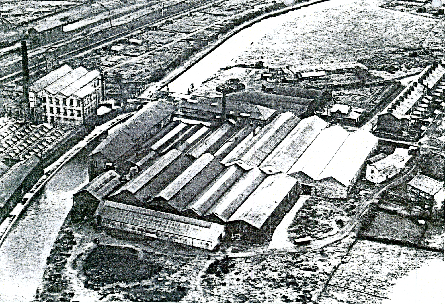
Photograph
of Cherry Tree Textile Mill to the Left of the Canal and Cherry Tree Machine
Co. to the Right with the Railway Line and Sidings in the Top Left and Nook
Terrace on the Right Opposite Cherry Tree Machine Co.
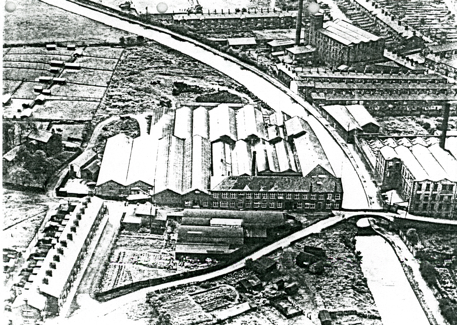
Photograph
Showing the Two Mills with Bank Mill at the Top of the Image with the Canal Bridge
Taking the Road to Livesey- Mill Hill Passing Nook Terrace.
A new industrial development in Feniscliffe was the development of a saw mill close to the railway sidings being an indication of the growing need for timber products for local house building in the area as was the development of the sand pits shown on the map.
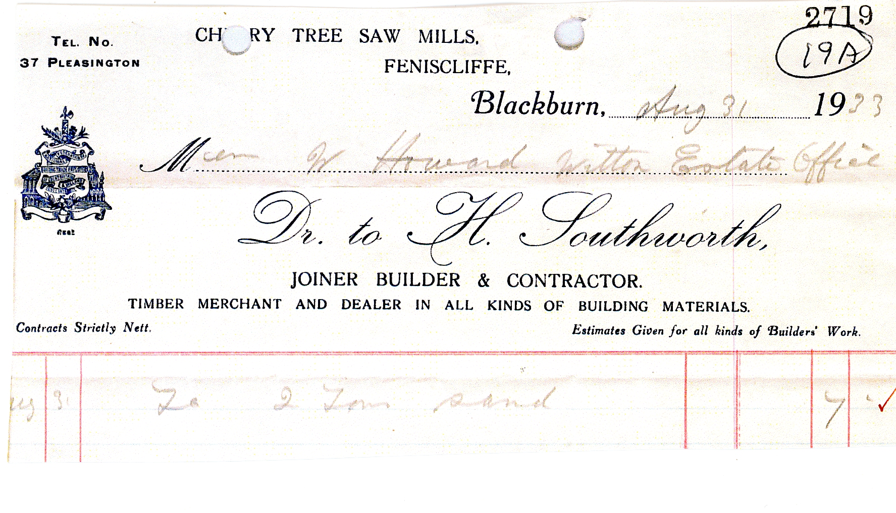
Bill
Head from Cherry Tree Saw Mills and its Owner H. Southworth
Sent to the Witton Estate in 1933.
By now Cherry Tree House had fewer outbuildings probably because it was no longer a working farm but a private house as it now had a tennis court.
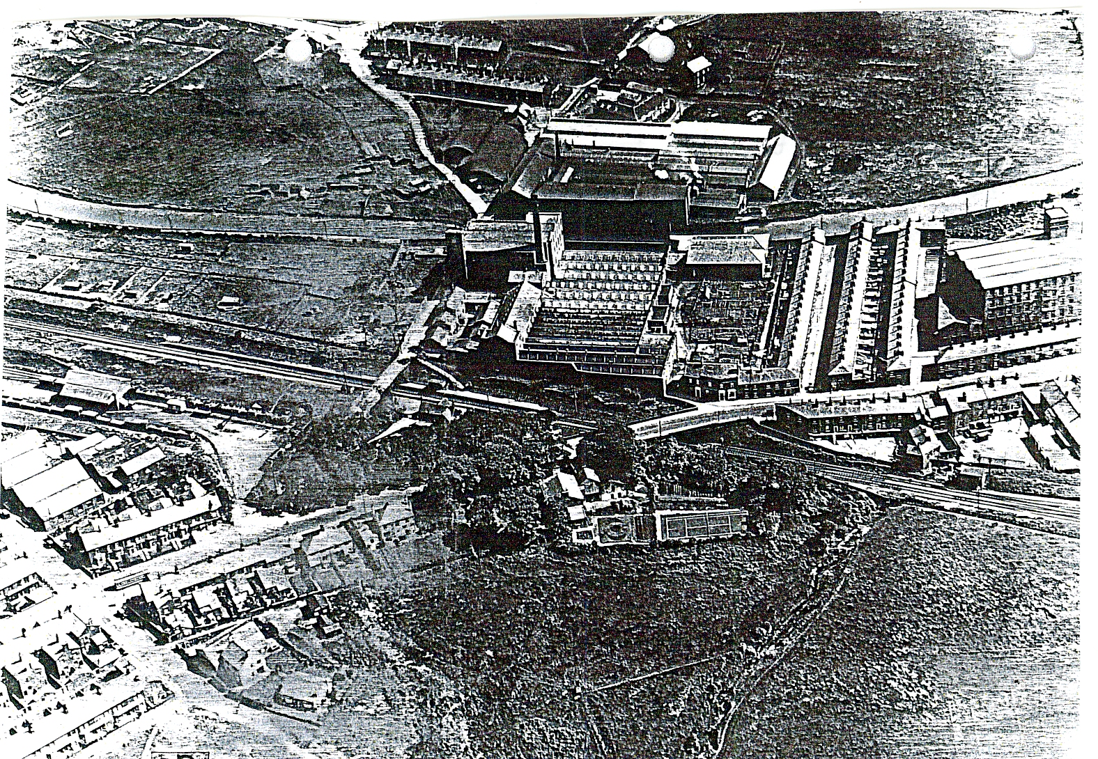
A
1930’s Photograph Which Shows Cherry Tree House in the Foreground and its Tennis
Court. To the Left of this Next to the Railway Sidings are the Saw Mills at the
Entrance to Feniscliffe Drive. At the Top of the Image is the Open Site Where Council
Housing was Built Later.
By now, alongside the tram terminus site, a row of shops had been built in the 1920’s to provide services for the ever growing population in the area and tram users.
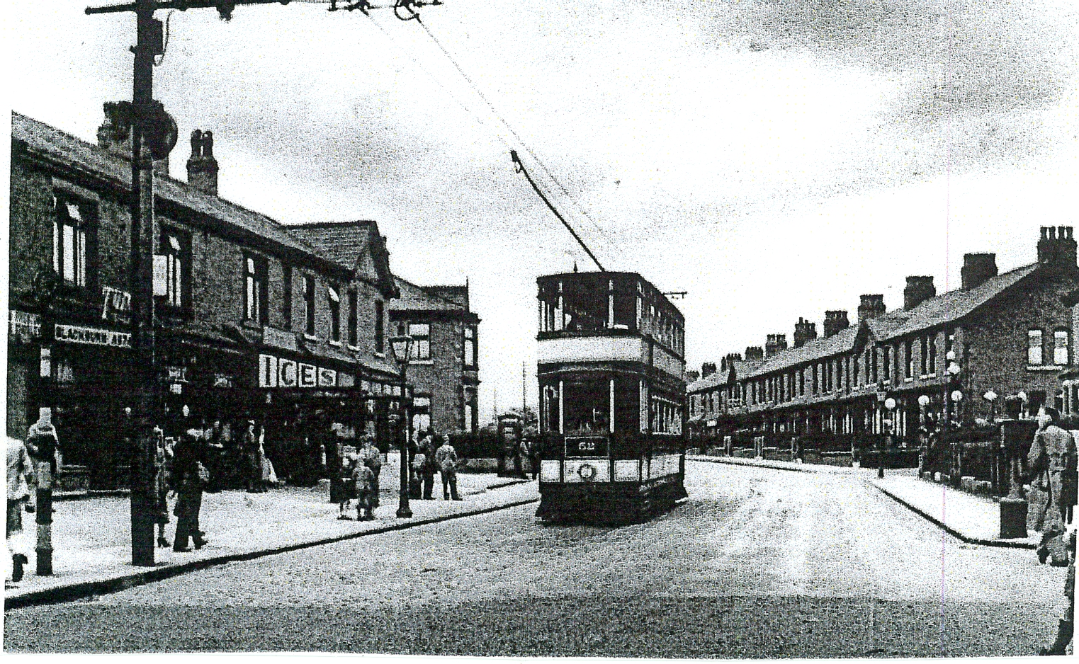
Photograph
of the New Shops Built Alongside the
Tram Terminus at Cherry Tree.
Further evidence of changing local facilities developed to meet the needs of the increasing population whose working lives had improved, due to a reduction in hours and more leisure time, was the development of Council Playing Fields. The playing fields were created next to the newly developed council estate and the extensive development of Pleasington Playing Fields with Tower Road providing easy access from Preston Old Road at Feniscliffe.
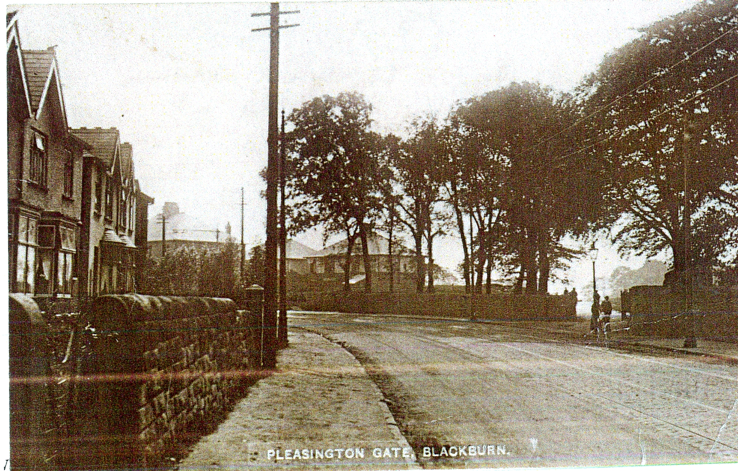
Photograph
Showing Pleasington Gate at the Access Point to Tower Road and
Pleasington
Playing Fields From Preston Old Road and
New Semi-Detached Homes Along Both Sides of the Main Road.
Both playing fields offered extensive facilities for football and cricket with both also having changing room facilities. Another new development shown on the map, created on former fields north of the railway sidings in order to meet the needs of locals living in terraced property without gardens was the Council owned allotment facility where people could rent strips of land to grow their own vegetables and flowers. Another sand pit development had been developed close by as increased building required more sand. Further evidence of developing local leisure facilities is the development of Cherry Tree Cricket Club and Crown Green Bowling Club; both shown on the map, and, developed around Cherry Tree Congregational Church to which they would have a close connection. Both facilities were developed on previous open land between Preston Old Road and the Leeds Liverpool Canal. The bowling green was opened on the 19th June, 1920 by Mr. W. Kay J.P. in the presence of a large local attendance; Mr Kay bowled the first set of woods. Mr. Joseph Dugdale J.P. of Cherry Tree donated the land to create the Bowling Club and he was the first President; the club gifted him an inscribed jack as their patron. Unfortunately, he could not attend the opening ceremony due to the recent bereavement of his son. It was declared at the opening ceremony that it was hoped that before long that ladies would be given an opportunity of becoming members of the club. Councillor W. Jenkins who had been responsible for excavating the land to form the green promised to donate a cup valued at £10. 10s. for a competition as did Mr.Kay. Attached to the green was a pavilion erected by the members following a subscription of approximately 60 members, at a cost of £200, which included the purchase of bowling woods. The origin of the bowling club dates back to the previous year when the secretary Mr. W. Wordsworth was approached by a number of gentlemen in the village as to whether it was possible to form a bowling club where men could meet, exchange views and enjoy bowling. After initial problems securing a site Mr.Dugdale was approached and he both gifted the land and paid for the green.
Cherry
Tree and Feniscliffe Areas From 1956
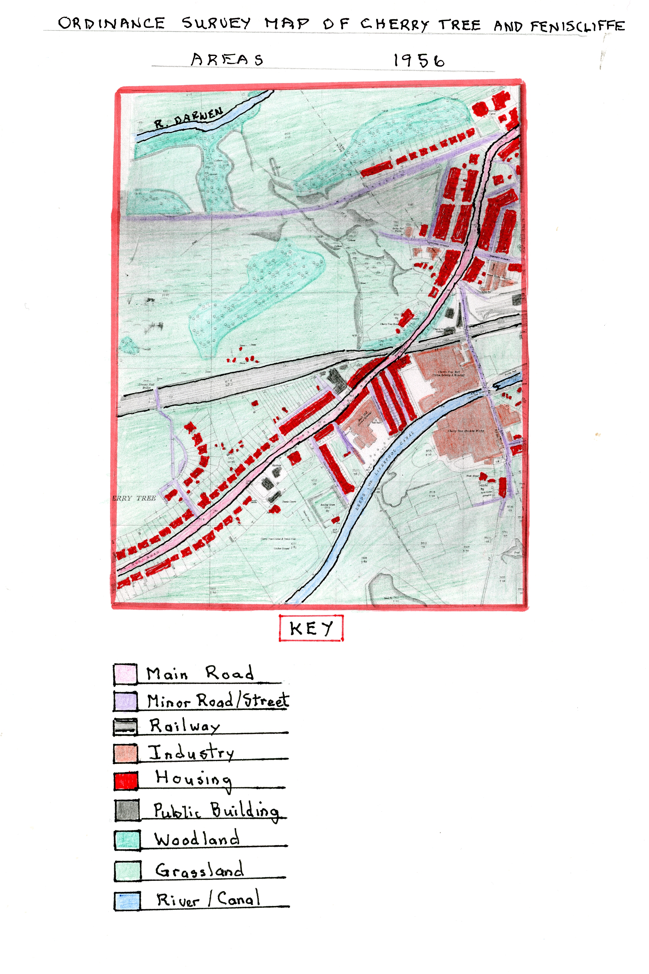
Ordnance Survey Map of Cherry Tree and Feniscliffe Areas in 1956
This larger scale Ordnance Survey Map shows, in the 24 years since 1932, through the 2nd World War Period (1939-1935), the new developments in both areas which were not as large as in previous periods. In Feniscliffe, further semi-detached properties had been built along Tower Road and new industrial units created off Preston Old Road behind the bus terminus shops, and also, by the existing saw mill including a garage with motor vehicles and waggons (now more prevalent), and trams replaced by buses. Public ownership of cars had by now increased significantly allowing local people to commute further to work places.
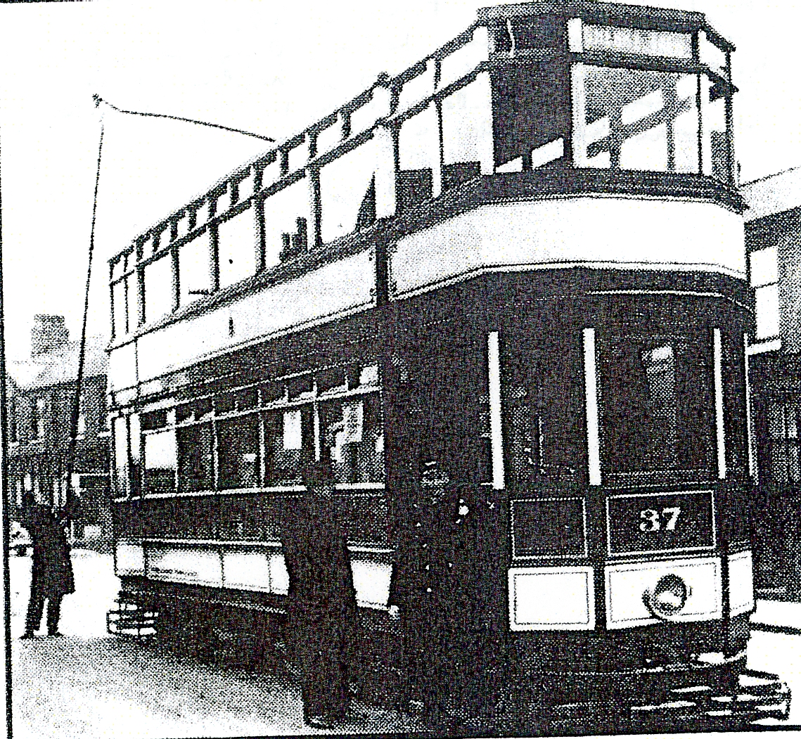
Photograph
of the last Tram Leaving Cherry Tree at 11.25pm Carrying
Members of the Transport Committee and Driven by the
Committee Chairman Councillor C.R. Davies
By now, the railway goods yard had been further developed and the railway station now had a platform on both sides of the railway and extra buildings sited by the engine house. Feniscliffe Drive, alongside the railway sidings, had now been extended round to meet St. Francis Road thereby increasing semi-detached property in the area and developing the land used for allotments earlier. On the far side of Cherry Tree, close to the Congregational church, a start had been made on a post war housing estate off Preston Old Road with The Crescent. The Council Estate, near Livesey, had grown much larger, extending to Livesey Branch Road and Shorrock Lane. The outward development of private mostly semi-detached along with Council Housing followed a trend in areas outside the Borough boundary in suburban areas like Feniscliffe and Cherry Tree. This showed the population movement out of Blackburn centre reversing the migration patterns of the rural to urban movement in the 19th century as small estates were created in more attractive areas with better quality housing. The Cherry Tree Cricket Club grounds are now more clearly defined along with a pavilion and the Bowling Club green now had a covered side for spectator protection. The cricket ground now had new tennis courts. Preston Old Road now had a much improved tarmac surface and well developed footpaths as road transport increased and pedestrian safety became more of an issue.
In 1955, Cherry Tree Congregation Church’s minister was the Reverend E. M. Williams who lived close by at the Manse, 336 Preston Old Road. At this time, the Church Men’s Group organised social events which were well attended; Fellowship Meeting attendances were also increasing with film shows and the use of visiting speakers.
Cherry Tree and Feniscliffe Areas up to 2018
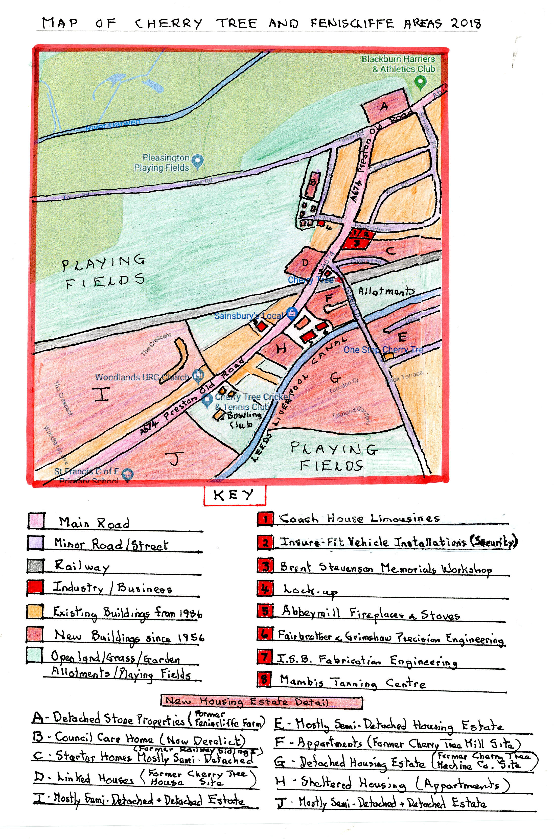
Map of Cherry Tree and Feniscliffe Areas in 2018
Over the sixty two years, since 1956, there have been huge changes in the area; probably the largest during the historical periods covered to date. The largest change has been the huge increase in housing and the comparable huge decrease in large industrial works. I have highlighted the new housing areas on the 2018 map which includes the Billinge House development on the old Feniscliffe Farm site with a large detached stone house using original materials and a new brick built apartment block developed since 2000. The original railway sidings close to Feniscliffe Drive have been removed and a small estate of modern starter houses developed and similarly where Cherry Tree House was sited there are now modern linked properties. Additionally, at the points where the three large industrial sites once stood there are now modern housing estates, all built since 2000. The largest of these is on the old site of Cherry Tree Machine Co. which is almost exclusively made up of various crescents of modern detached houses linked from Nook Lane. A similar but smaller estate has been built on the site of Cherry Tree Mill which contains apartment blocks and two detached houses. The site of Bank Mill now contains Hunters Lodge, a development of sheltered accommodation for the elderly in apartment blocks, and, on land between the Leeds Liverpool Canal and Brothers Street, another estate of semi-detached houses was built in the 1980’s around Dalby Crescent. Finally, large estates were developed behind the linear semi-detached housing on both sides of Preston Old Road towards Feniscowles mostly developed in the 1960/70s containing mostly semi-detached properties but with some detached and bungalow types. As part of these developments a church, library and a new St. Francis School were built to provide services for these new properties in contrast to the more modern estates built since 2000.
On the industrial side the two large textile mills lay dormant for many years after the decline of textiles in the 1950/60’s and more recently Cherry Tree Machine Company. On part of the site of the former Bank Mill two new units were built, one was taken up by Leo’s Carpets which has since been re-developed into a Sainsbury Local Store and an Air Ambulance Charity Shop and the other by ISA Engineering Ltd who complete fabrication work. To the rear of this Fairbrother and Grimshaw Engineering Ltd occupy an older stone building, a remnant of Cherry Tree Mill where they conduct a precision engineering business. When Cherry Tree Mill closed the factory was eventually re-used by Q.S. who acted as retailers for wholesale clothing and household goods before eventually closing prior to the site being redeveloped into a housing estate. Cherry Tree Machine Company left their site as trade declined and re-located to a smaller industrial unit at Greenbank in Blackburn close to the Tesco store as Cherry Tree Industrial Laundry Solutions servicing laundry machines. Other than these major industrial changes there are now a number of small industrial units occupied by a variety of small firms in the area (see 2018 map key for details) but overall today Cherry Tree and Feniscliffe are now a major suburban housing area. On the outskirts of Feniscliffe at its border with Witton an existing huge industrial operation in Witton formerly Scapa Driers and more recently Voiths developed a new industrial site on the Feniscliffe side of the River Darwen in 1962/3 at a cost of £300.000 as an extension for its paper making felts division using huge looms and also including a department for the research of new felts.
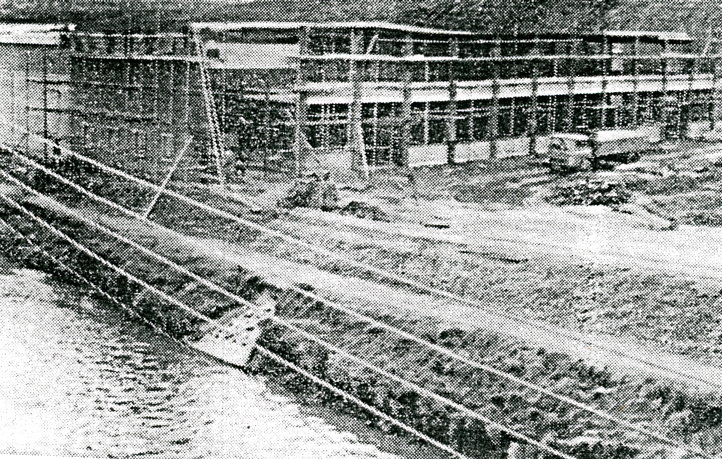
View
of the New Scapa Extension Being Constructed in 1962-3
by the Side of the River
The company has since left the site and this building is now occupied by M.K.Illumination.
Other developments have been the building of a council run care home on Hillcrest Road which in recent years has closed and at present is unused. St. Francis Church Hall in recent years is now occupied by Cherry Tree Pre- School to cater for younger children of the area whose parents are working. On the same theme Cherry Tree Cricket Club has extended since being privately owned in recent times and now has a large membership catering for local demand for a leisure centre and Cherry Tree centre’s two pubs The Beehive and Station have been upgraded and unlike in other districts remain open. At the old tram terminus the shops now all provide professional services rather than local shops including insurance broker, optician, dentist and home improvement. Local shops offering goods/food items have declined as the population today is very mobile to reach larger stores and more recently use on-line purchasing. On land opposite the Green Lane Council estate on their playing fields there is now an all- weather playing pitch and changing rooms.
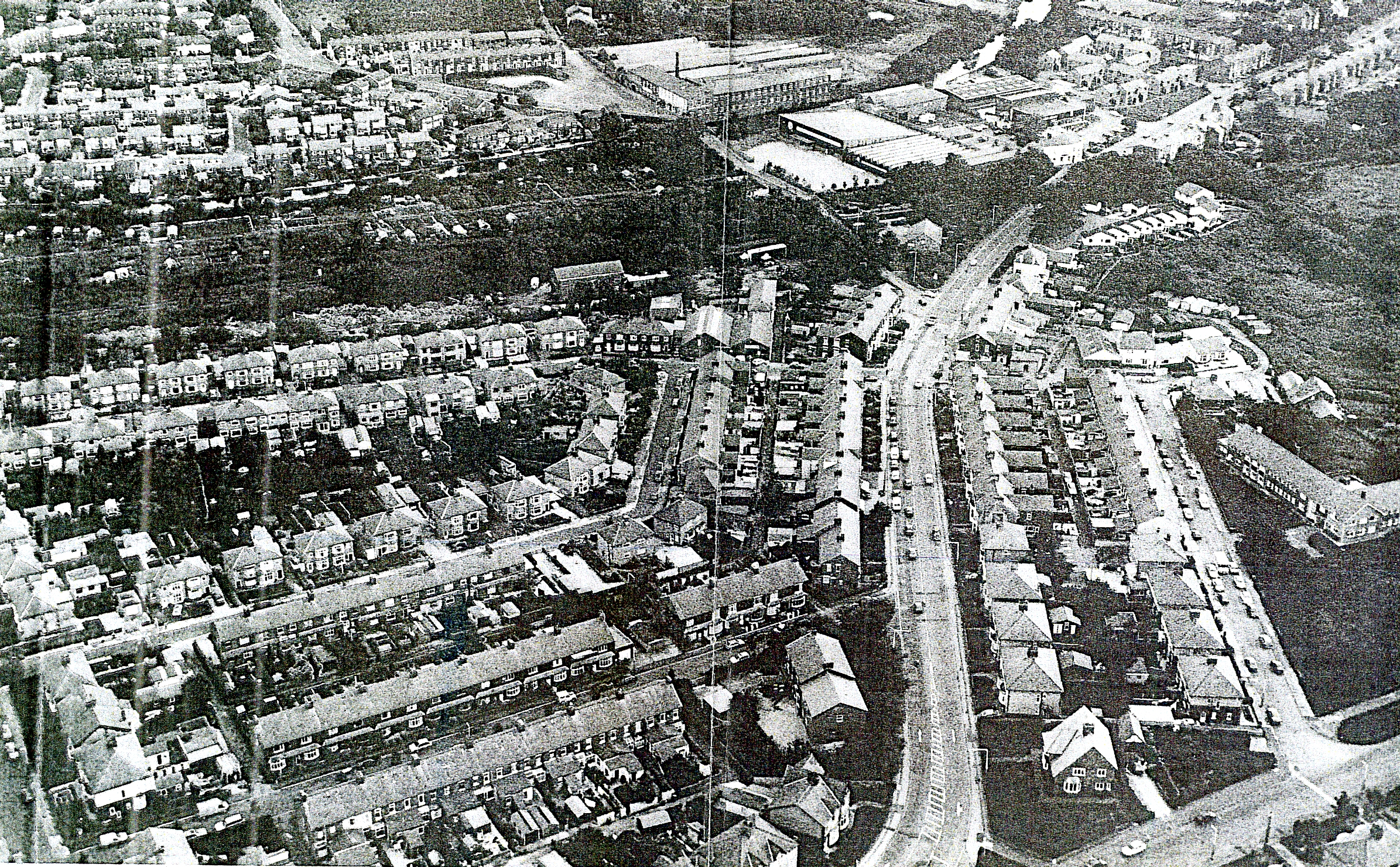
An Aerial
Photograph of the Feniscliffe and Cherry Tree Areas in 1992
The photograph above is dominated by the 1950’s estate in the foreground with St. Francis Road and Feniscliffe Drive to the left of Preston Old Road and to the right Hillcrest road off Tower Road and the now disused Council Care Home. In the upper left corner is the Green Lane Council Estate with the newer Dalby Crescent estate along the canal side. In the upper centre can be seen the Cherry Machine Company site and below this the re-developed Cherry Tree Mill as Q.S. with the two engineering sites behind alongside Leo’s Carpets with the newly built sheltered accommodation of Hunters Lodge On the opposite side of Preston Old Road on the site of Cherry Tree House can be seen the newly built row of modern linked houses.