
 Loading more
Pleasington
THE HISTORICAL DEVELOPMENT OF THE PLEASINGTON AREA
BY MIKE SUMNER
The village of Pleasington is located on the western fringes of the town of Blackburn, and its neighbouring areas include Billinge, Cherry Tree, Feniscowles and Houghton. This rural village is mostly situated on an elevated position above the River Darwen on sandy, well-drained soils and is a civil parish in the borough of Blackburn with Darwen.
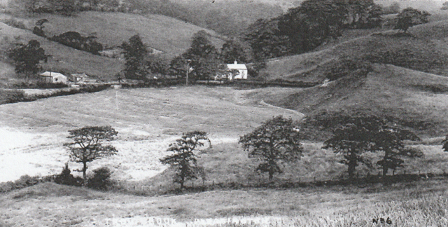
Pleasington village’s looking down on the lower Trout Brook valley area
Pleasington has a population today of around 450, which is below its 19th‑century population, and which over time has greatly fluctuated. On the north side of the township it is separated from the Mellor and Billinge areas of Blackburn by a stream passing through the glen below Alum Scar to a confluence with the River Darwen within an extensive wooded area, before rising to the Yellow Hill area.
EARLY HISTORY
Evidence of early settlement in the Pleasington area from Bronze Age relics is not surprising, as early civilisation would have been attracted to the site due to its elevated position and dry routes towards the Blackburn area, with well‑drained soils for cultivation and nearby woodland for timber and local water supplies. By the 10th century Pleasington had emerged as a distinct township (manor) following the Norman Conquest and was mentioned in the Domesday Book as evidence that the land had been bequeathed to a Norman knight’s family by the name of De Plesynton/De Plesyngton. The word Pleasington first occurs in an early charter of 1196 and was spelt Plesingtuna, derived from an Old English personal name and literally meaning “the tun or enclosure of Plesa’s people”.
Pleasington Manor has been the home of a number of key families and still attracts new people to the area today. The first mention of the ancient family of De Plesyngton was in the charters of Stanlow, Whalley and Kirkstall Abbeys, as the family gave gifts of timber, pasturage and land to the monks. Henry De Plesyngton, in Henry III’s reign, married Diana and had three sons, and Henry’s two brothers Robert and Richard are mentioned in 1273/4, with Robert’s son John appearing in 1299/1300. In 1303 Elias De Plessington held three messuages, two bovates, 20 acres of land, four acres of meadow, 100 acres of woodland and four acres of pastureland, paying eight shillings in rent. Central to this early family was Pleasington Old Hall, the manor house built in the 13th century, with evidence that it was originally used as a monastery. The family continued through the 13th and 14th centuries, with Robert De Plesyngton acting as the abbot’s attorney.
At the end of the 14th century the manorial estate passed, via marriage of a De Plesyngton heiress, into the De Aynesworth family in 1396/7, who then held it for about another 400 years. John De Aynesworth became the Lord of Pleasington and had three sons, and, by 1523, Lawrence Ainsworth held lands at Pleasington valued at £5 per annum. Lawrence’s son Thomas, in 1618, held one messuage, ten cottages, 50 acres of arable land, meadow, pasture and woodland, plus an additional 13 messuages, 13 gardens, 200 acres of arable land, meadow, pasture and 100 acres of moorland obtained from John Winchton. The original manor hall was replaced with an Elizabethan hall in 1587 by Lawrence Ainsworth and is now a Grade II listed building and farmhouse owned privately today.
During this time the Ainsworths, Houghtons, Southworths and Salmesburys all held lands in the Pleasington area, and their initials were put in Pleasington Hall when it was built. It faced south on its farmland, including what is now Pleasington Playing Fields, with its site passed on the lane going up to the present Blackburn Cemetery and Crematorium.
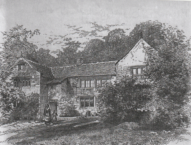
Pleasington Old Hall, which was rebuilt in 1587 by the Aynsworth family
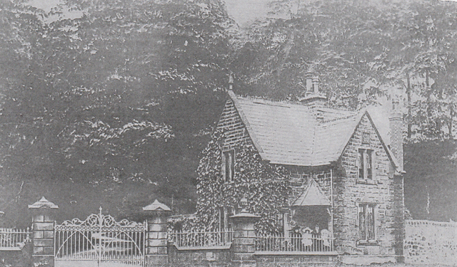
Pleasington Old Hall Gatehouse, at the lane leading up past the Hall to what is now Blackburn Cemetery
During the 1600s the Ainsworth family held the manor via John, Thomas and Edward Ainsworth, who was the last direct descendant holding the manor, which in 1777 contained 738 acres. In 1779, the manor and Hall were bought by Richard Butler, who also obtained 620 acres of land. Richard died the same year, and his only son John Francis Butler, born in 1774, took over the manor. Later John Francis built Pleasington New Hall at a cost of £20,000 on another site between 1805–7. He died in 1840, leaving the estate to John Butler‑Bowden, a cousin born in 1815.
Pleasington Old Hall, built in 1587, stood in a sheltered position and consisted of a central block with gabled wings and mullioned windows (see picture above). It had a fireplace at the end of the main hall; the dining room had heavy stone window frames, and the front entrance had an unusual porch that was enlarged by John Butler‑Bowden. Throughout the hall there were large chimney stacks, and its rooms had low ceilings with great oak beams.
Pleasington New Hall was built with stone from John Francis Butler’s quarry at nearby Butler’s Delph. It was sited on land now occupied by the Garden of Rest at Pleasington Cemetery. The Hall was occupied by the Lords of the Manor and was a large, imposing manor house with stone steps down through stepped lawns and extensive gardens. When occupied, the Hall had a large staff of servants. In 1894 Sir Harry Hornby (textile baron) leased the Hall, which then regularly housed large, elegant garden parties. However, by 1932 it had been derelict for some time, and its remains were taken apart for scrap just 125 years after it had been built. At the entrance to the New Hall’s driveway there was originally a grand lodge house. The main hall had shuttered windows, a balcony, and inside was a great staircase and a large fireplace.
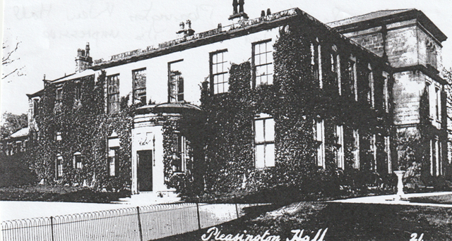
Pleasington New Hall, which was ivy‑clad around its impressive front porch
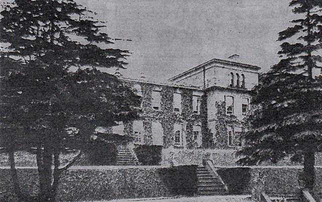
the side elevation and extensive gardens of the New Hall
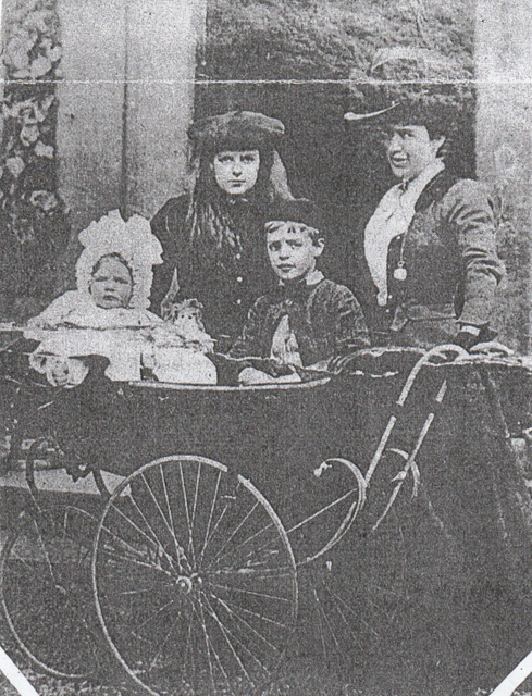
John Butler‑Bowden’s wife and children taken in front of the New Hall
During the early days, transport links from Blackburn to Preston passing Pleasington were tracks, with one from the Billinge area of Blackburn passing along the dry ridge (now Billinge End Road), which then dropped before rising to Pleasington village (Priory End) via what became Sandy Lane. Alternatively, the main track to Preston through Witton, Cherry Tree and Feniscowles provided access via a narrow track down to the River Darwen, originally crossed by a ford or early bridge, and then rising up to the village via Enoch Brow before passing through the village to join route 1 along what is now Victoria Road. These early tracks were earthen, taking horses, carts and carriages, and were difficult in winter. The Preston to Blackburn route was improved when the Turnpike System was introduced, with tolls taken at toll houses to raise finance to maintain the route with more solid materials, eventually covered by tarmac after John McAdam’s invention. Preston Old Road has been improved many times in modern times and was succeeded by a newer Preston New Road. The old route from Billinge to Pleasington took much longer to be upgraded. Leaving Feniscowles on Preston Old Road to travel to Pleasington village, you first pass Immanuel Church with its distinctive spire.
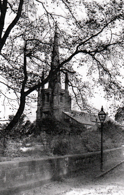
Immanuel Church with its distinctive spire
Beyond the church, at a lower point, you reach the bridge over the River Darwen and the site alongside the river of another ancient hall called Feniscowles Hall. The original hall, called Feniscowles Old (Higher) Hall, was situated on higher ground on flat land above the River Darwen valley, accessed by a track (later Links Lane) off the main track (later Victoria Road) that passed through the centre of the village. Thomas Livesey de Feniscowles (a branch of the Lords of Livesey family) held this Old Hall and grounds in 1404, and the Liveseys continued their tenure for the next 400 years. By 1877 Feniscowles Old Hall, with 47.5 acres, was owned by Mrs Harriet Openshaw and in more recent times was converted into a farmhouse sited close to Pleasington Golf Club. In 1796 Sir William Feilden of Witton Hall bought the hamlet of Feniscowles from Thomas Ainsworth and in 1812 built Feniscowles Hall, a new hall at the foot of the steep bank above which the old hall was sited close to the River Darwen. This was taken over by his son, Sir William Henry Feilden, who, due to pollution in the nearby River Darwen, left the hall in 1879.
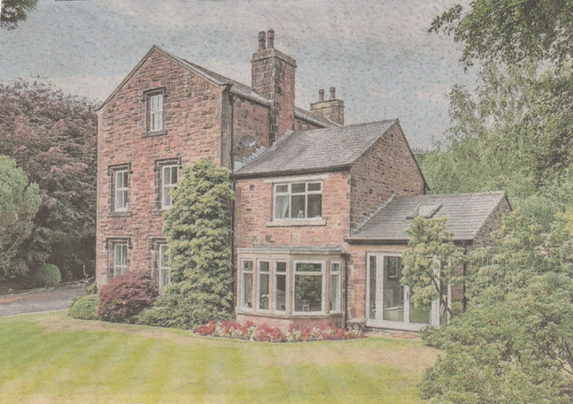
Higher Feniscowles Hall, rebuilt in the 1860s with modern additions, now a private dwelling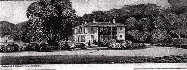
Feniscowles Hall built by Sir William Henry Feilden on land close to the River Darwen
The property was later abandoned, and, in 1903, was auctioned but failed to attract a buyer. In the early 1920s its grounds were used as a popular pleasure ground with rides for local people, but this did not last and the property fell into disrepair by the 1930s and is presently still a ruin.
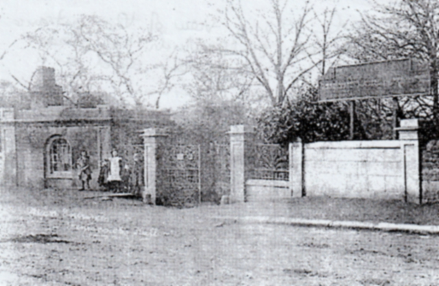
The entrance to Feniscowles Hall on Enoch Brow a sign advertises its gardens as pleasure‑grounds
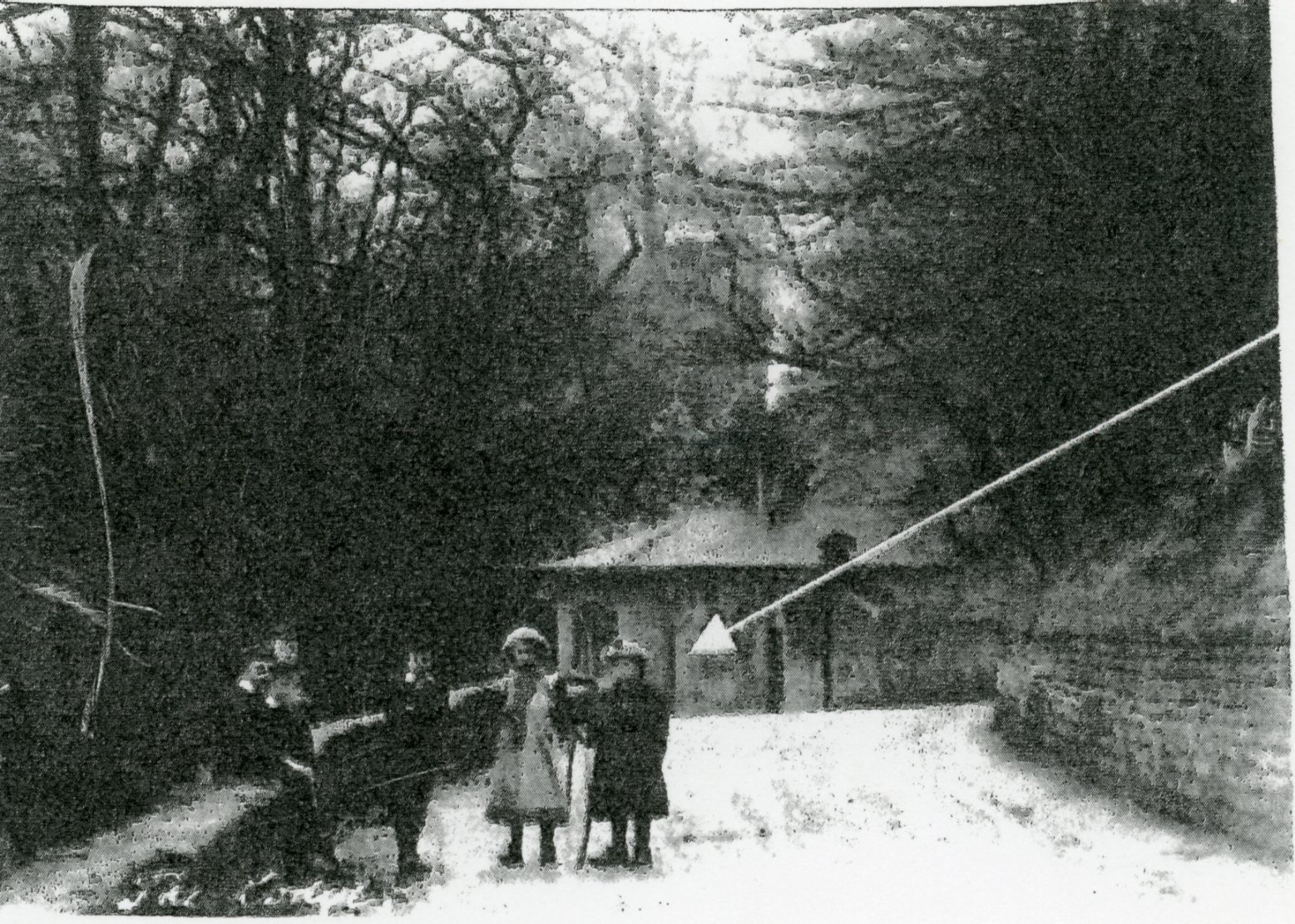
A view of the lower part of Enoch Brow looking towards the gatehouse of Feniscowles Hall
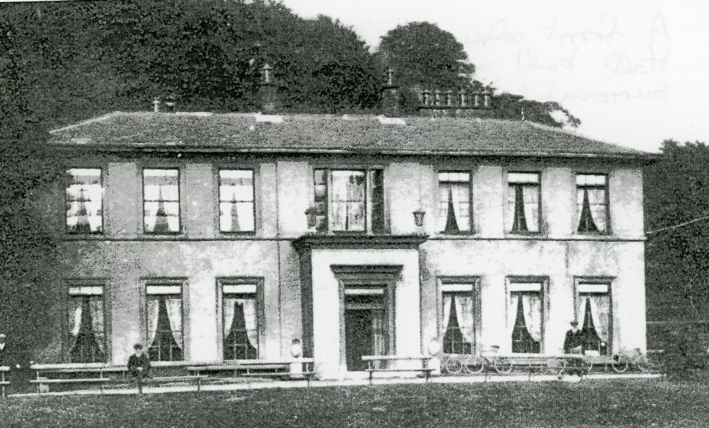
Feniscowles Hall its being grounds used as pleasure gardens, customers’ bicycles
are parked against the hall with bench seats alongside the lawn
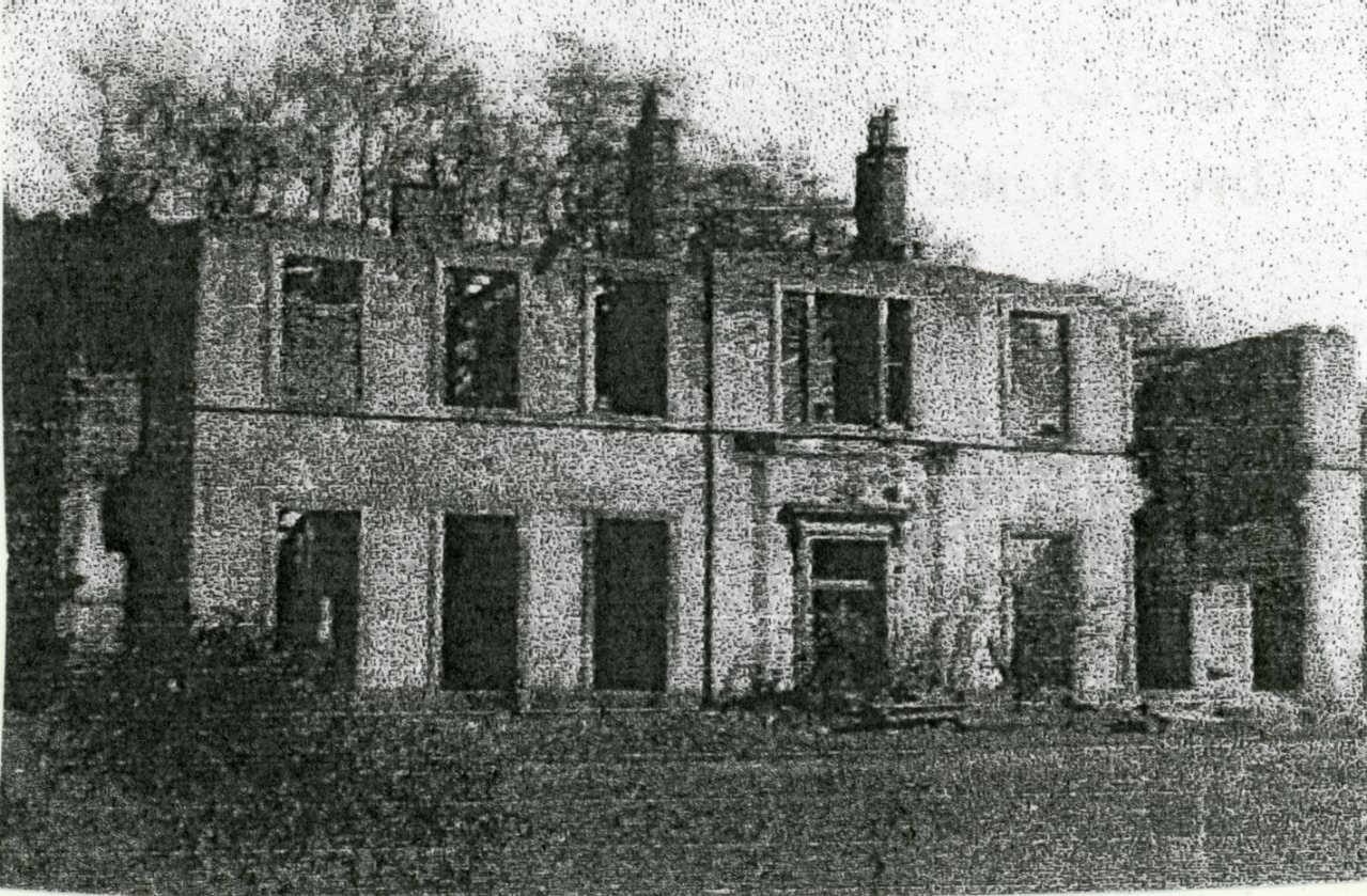
The ruins Feniscowles Hall
OTHER ANCIENT FAMILIES OF PLEASINGTON
The Cunliffes of Tongue Hall can be traced back to the reign of James I via Thomas Cunliffe, who died in 1612, and whose son James held one messuage, three acres of land and pasture. He was designated a gentleman and freeholder in 1621. The hall later became a farmhouse and working farm and is shown on recent O.S. maps.
The Ellingthorpe family, with Richard, a yeoman, lived in the village during the 1700s.
THE OLD ALUM MINE AT ALUM SCAR
This was located beyond the main village and passed by Billinge End Road in the north of the Pleasington area. It was situated in deep woods and a glen below the Woodfold Park Estate. At this location there was a lofty cliff named Alum Scar, which contained aluminous shale. The ancient mine was opened by Sir Richard Houghton and proved very profitable, and Sir Richard took James I to it whilst he was visiting his estate in 1617, during which period he famously knighted a loin of beef (“sirloin”). The extracted material was used by clothiers, glove makers and textile dyers, with the mine continuing until the late 1700s.
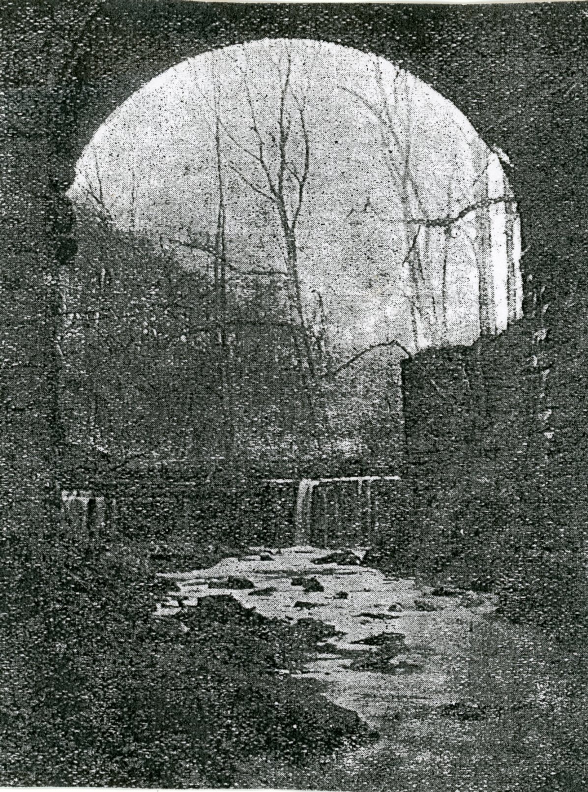
A view of Alum Scar with the local stream passing through it
An old property at the entrance to the track leading down from Billinge End Road on a sharp bend was called Alum House.
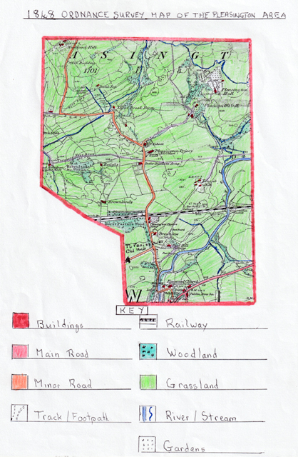
The 1848 Ordnance Survey Map of the Pleasington Area
This map shows that the rural setting of Pleasington Manor had no real centre at this time, as the tiny settlement was very scattered, although a few isolated buildings are found laterally along the main lane through the area from the north (Billinge End Road) to Enoch Brow in the south. These early buildings would mostly date from the 17th century and would be constructed from sandstone taken from local quarries, with the cottages being low buildings.
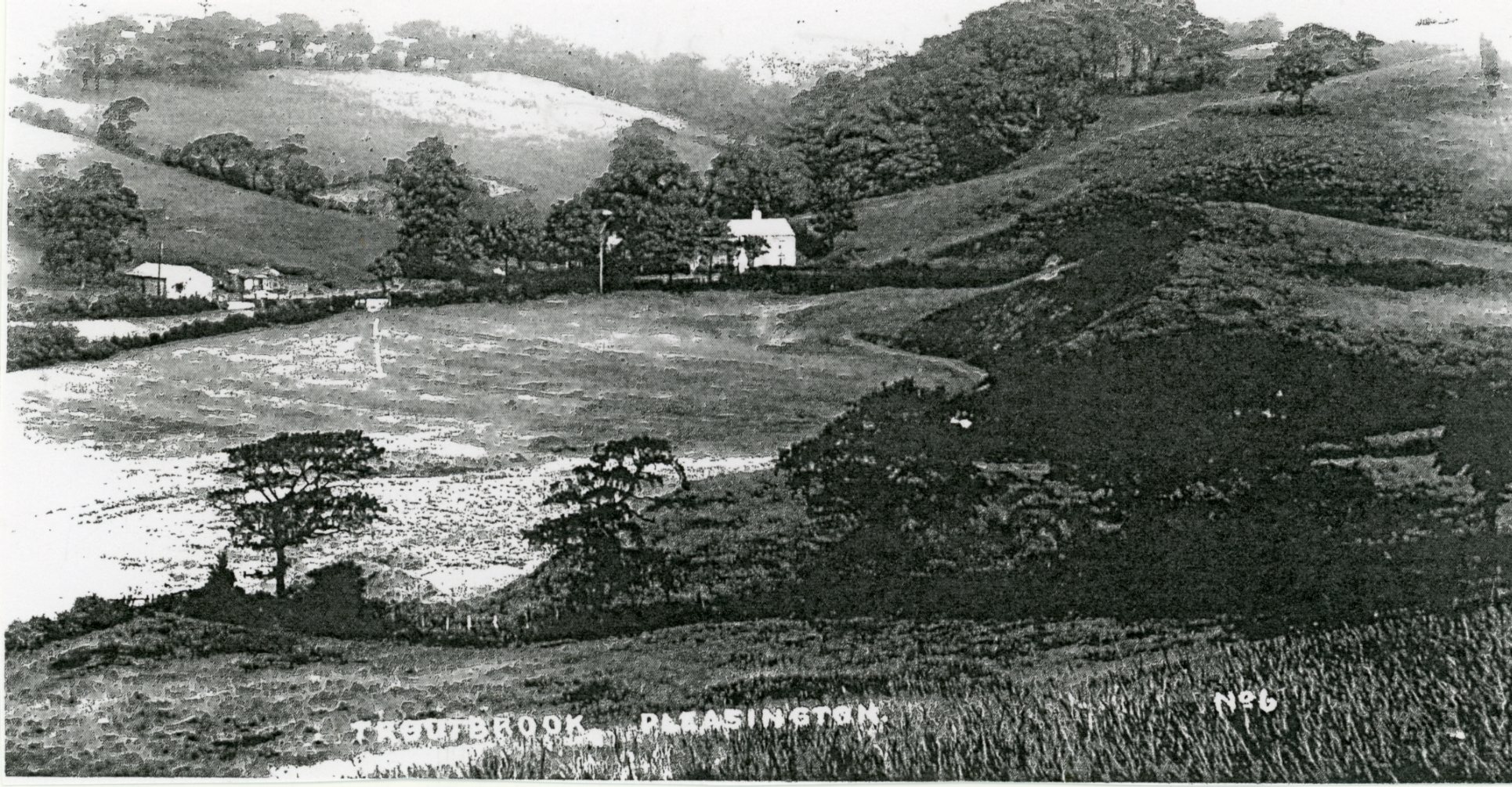
Trout Brook Valley taken from the village
By 1848 the area had two inns: the Butler‑Bowden Arms, named after the Lord of the Manor, and Pleasington Station Hotel, which was situated next to the Blackburn to Preston railway line, operated by the East Lancashire Railway. The line and station were completed in 1846, with the station having a single platform as there was only one line. This new transport link took the flattest route possible but still required the Pleasington Viaduct to cross the River Darwen.
The two inns were probably needed because they stood next to the main track/lane passing through the centre of Pleasington village and the newly built railway and station, which would provide customers, some of whom might require overnight accommodation. They would also likely have had stables to cater for horse and carriage travellers.
As mentioned earlier, Pleasington Old and New Halls are visible on the map, with the Old Hall surrounded by woodland and the New Hall with extensive gardens. Both halls had tracks leading to Sandy Lane, Billinge End Road and the new railway link. The area also had many scattered farms, most of which would be leased from the Lord of the Manor or other landowners such as the De Houghtons and Ainsworths. These included Roughs, Brownlands, Trout Beck, Woodcock Hill, Bank Top, Tongue Hill, and the farms based at the two halls. At this time farming would mostly be pastoral, with sheep on the higher slopes and cattle on the lower pastures and meadows. Tongue Hall Farm would relate to the former Cunliffe family mentioned earlier as landowners in the area.
The presence of a water mill in the extreme south next to the River Darwen indicates an early water‑wheel mill, probably used to convert grain into flour, so some crops must have been cultivated on flatter land with its well‑drained sandy/loamy soils.
Also visible is the new Catholic Priory Church, opened in 1819, with its burial ground. This was not a parish church but a Roman Catholic church dedicated to St John the Baptist, which is why it was referred to as a Priory. Its dominant feature is the magnificent rose window over the entrance, fine enough to be found in any cathedral.
The building is historic in the sense that it was constructed at a time when the religious laws passed against Roman Catholics in the reign of Queen Elizabeth I were only just being relaxed, and all their original places of worship had been taken over as parish churches by the Church of England. The design of the west doorway was copied from that of the chapter house at Whalley Abbey, using moulds of heads, flowers and leaves set in plaster by the architect John Palmer, who used both Early English and Regency Gothic styles in his design for the church.
John Francis Butler, the Lord of Pleasington Manor, sold seven acres of land called Moss Meadow, which formerly belonged to Sweet Withan Farm, to the Reverend William Gibson, the Roman Catholic Bishop for the Northern District of England, to allow for the building of the Roman Catholic chapel and priests’ house. The foundation stone was laid on 16 June 1816 and the building opened on 24 August 1819.
J.F. Butler, the son of Richard Butler, had a bad accident while hunting close to where the church (Priory) was built and resolved to build a church there in gratitude for his recovery. He provided approximately £20,000 for the church to be built, and Palmer used three stonemasons, four builders, two labourers and two carters, which was a small workforce for such a large project. The church was opened on the feast of St Bartholomew and was attended by many distinguished families of the area and prominent members of other churches. After the opening ceremony J.F. Butler provided hospitality at Pleasington Hall for the ladies present, and the gentlemen travelled to the Old Bull Inn in Blackburn, where 60 men had dinner followed by toasts.
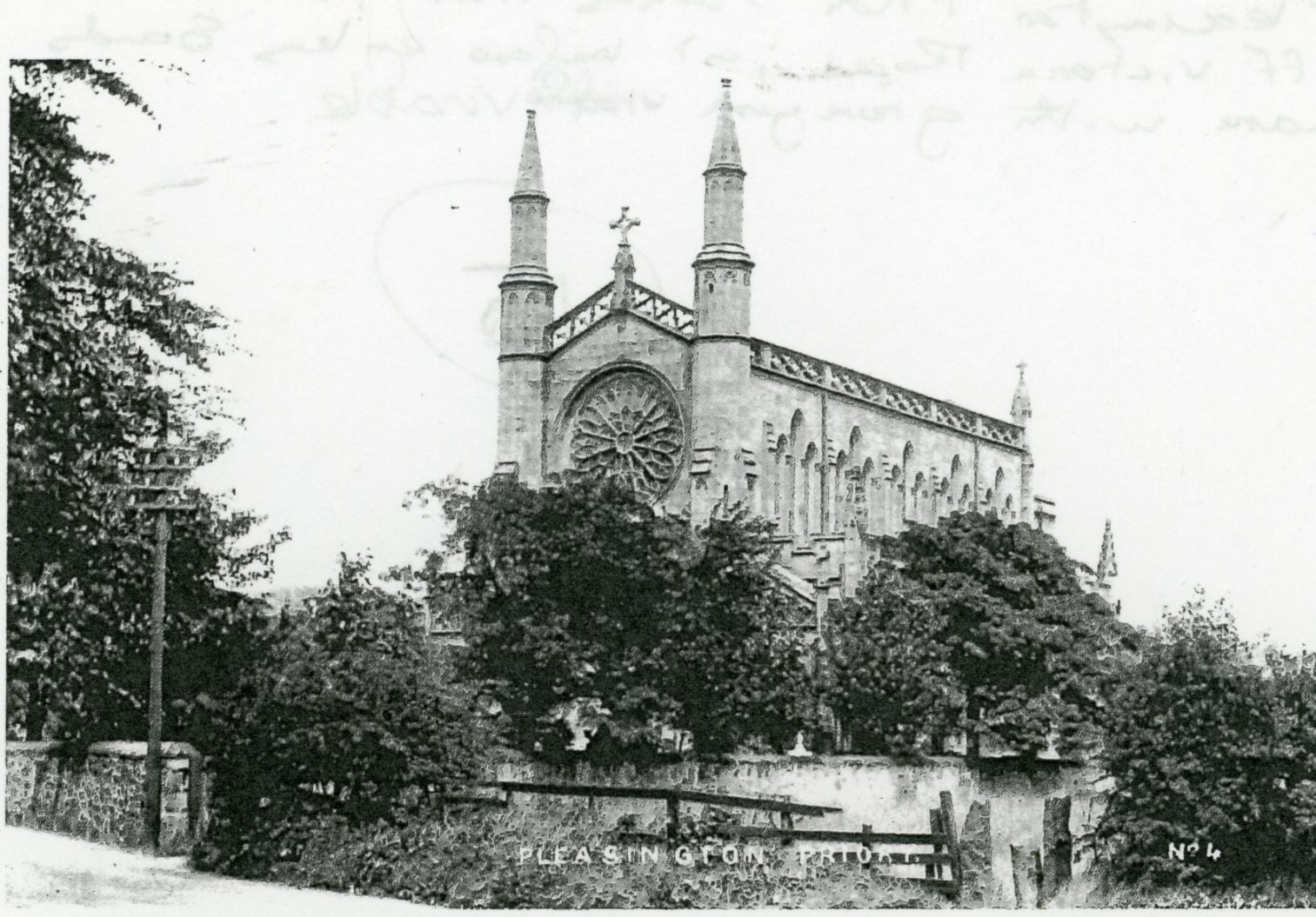
The Priory from Victoria Road just before its junction with Sandy Lane
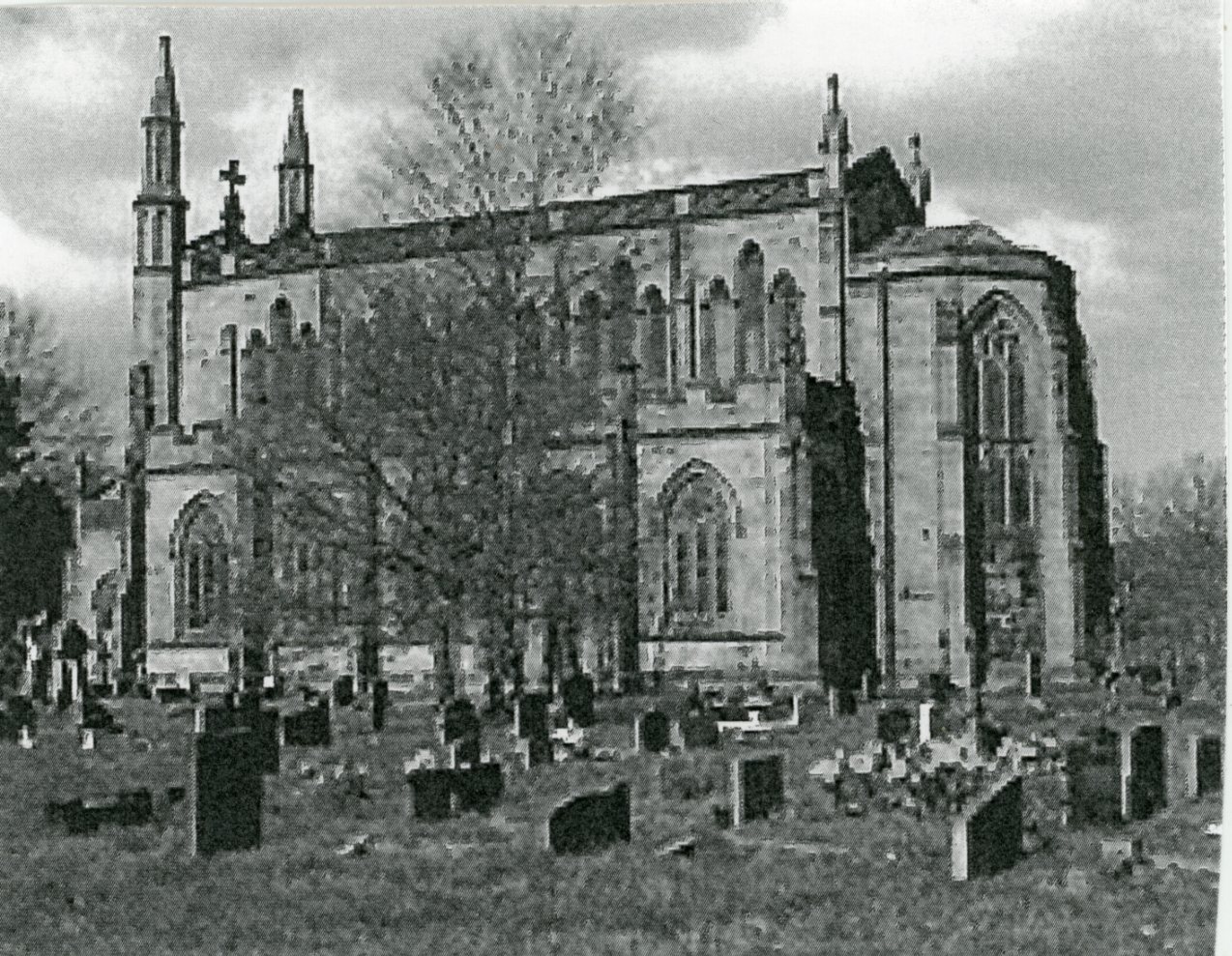
The side of the Priory and its graveyard
PLEASINGTON SCHOOL
Next to the Priory was Pleasington School, whose origins are thought to go back to the 1600s. Originally the school building was a primitive low structure sited on the edge of the hill above the site of Pleasington Old Hall in the 1700s. It was maintained using money provided by interest from wills, mainly to pay the schoolmaster, by both the Ainsworths and Butler‑Bowden families, along with rents from cottages in Blackburn and interest from a donation made by Dowager Lady Feilden.
These finances were also used to run the school‑house built in 1796 for the schoolmaster. The school‑house stood on a half‑acre plot of land called the School Green, and its master had to teach Pleasington children reading, writing and accounts. From 1836 to 1874 the schoolmaster was John Ward, who partway through his tenure moved into a new stone‑built school erected in 1850, which eventually became unsuitable for village pupils due to its narrow passages and worn stone floors. Part of the building was shared by Pleasington police after the 1860s, when they also took over the schoolmaster’s house.
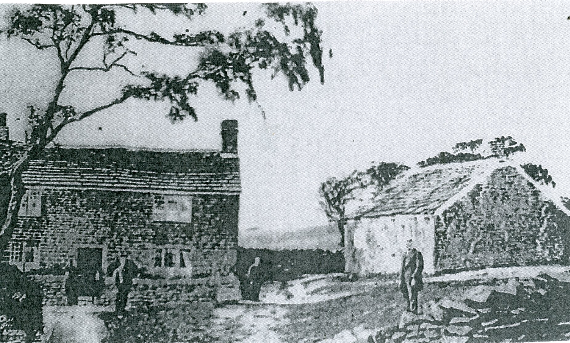
Pleasington School to the right of the farmhouse
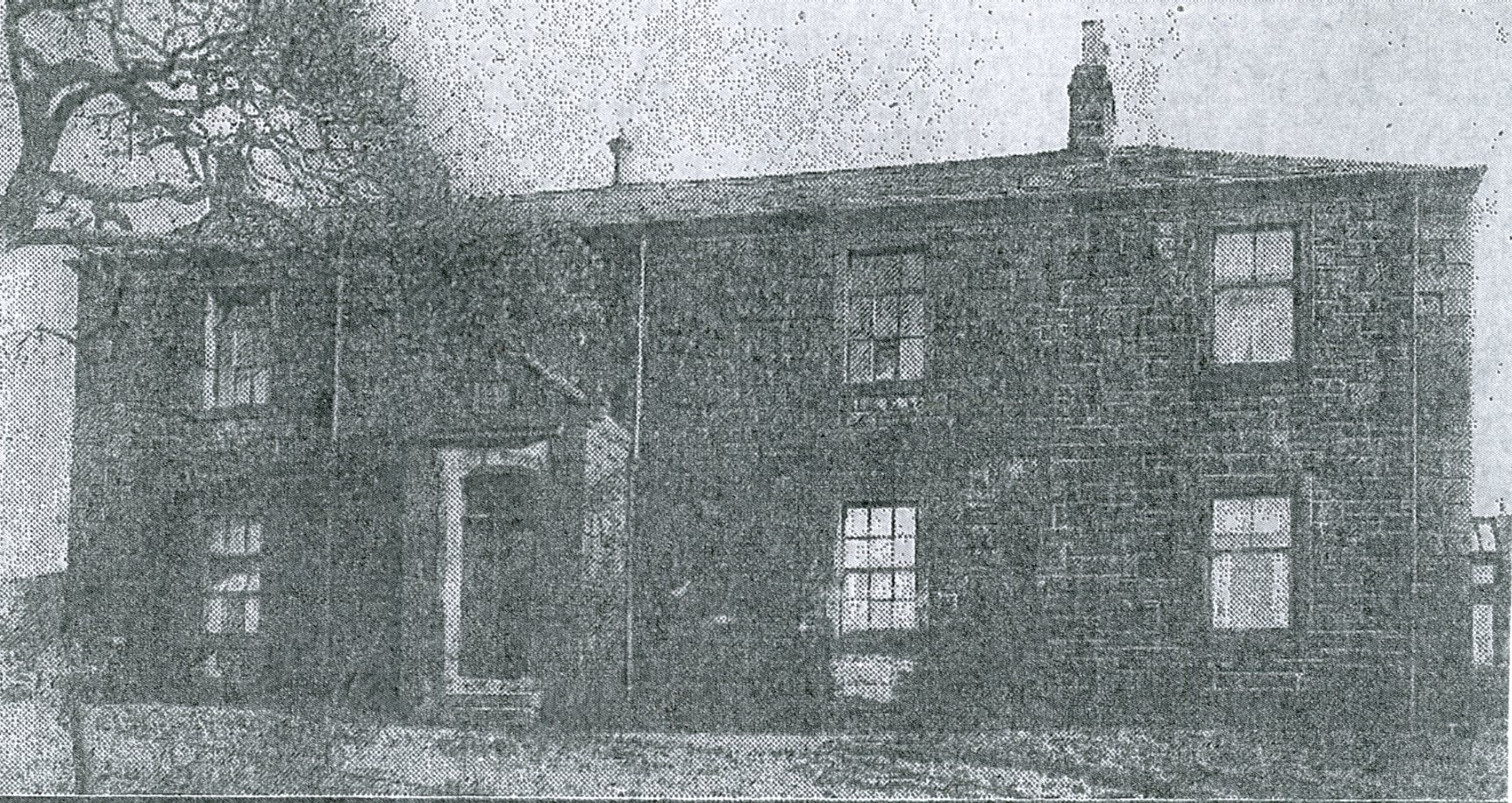
Pleasington Catholic School built by the Priory and later shared by the local police force,
who occupied the building until 1926 when a new school was built
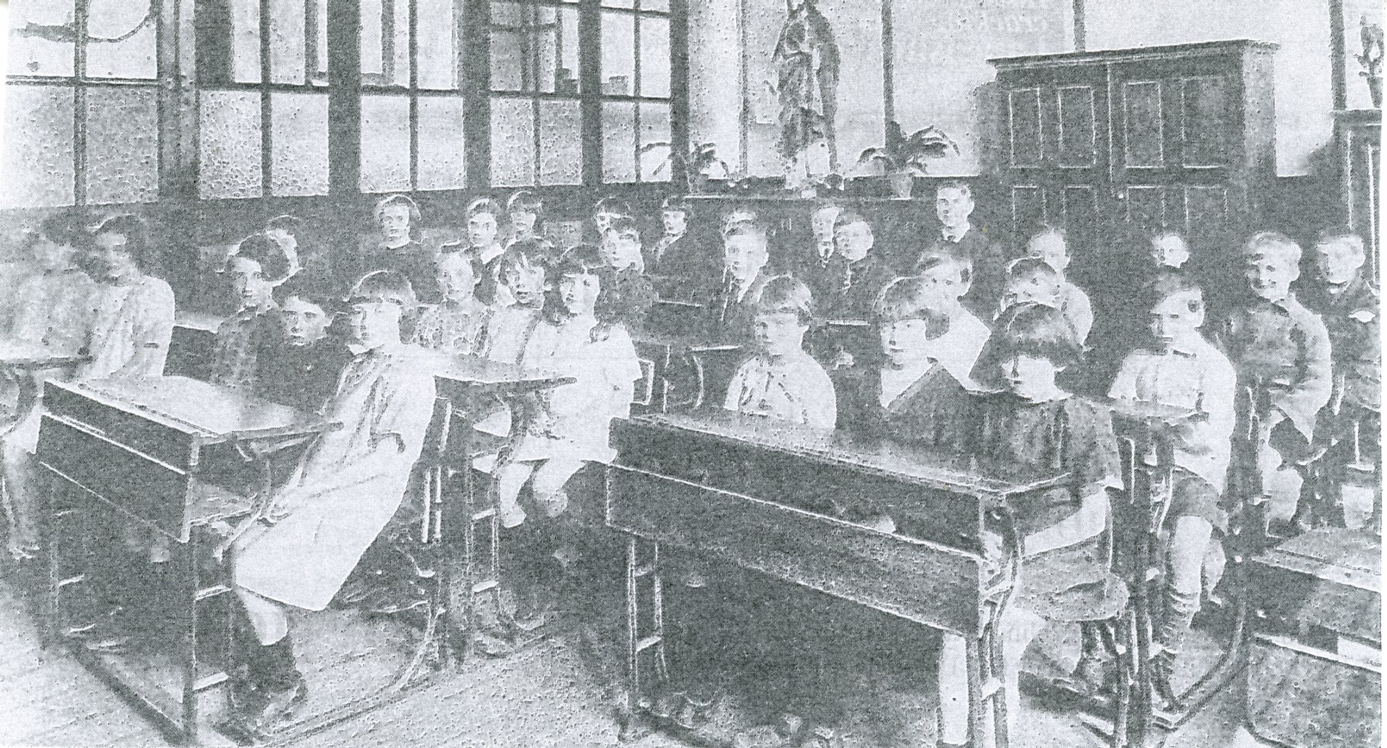
A 1900s classroom in Pleasington School with all the children sitting attentively on their benches
POPULATION CHANGES AND SOCIAL HISTORY
By 1831 the Pleasington area had a population of 633, but this fell to 517 in 1841, 428 in 1851 and 336 in 1871, evidence of population migration to the industrial centres of Blackburn and Preston with the fast‑growing cotton textile mills, and at a time when the Agricultural Revolution via steam power meant more machinery was used on the land, reducing the need for farm workers. In the early 1800s some mill owners bought up cottages in nearby rural hamlets like Pleasington during times of depression, then evicted hand‑loom weavers and offered alternative employment in Blackburn mills, along with rented accommodation in terraced houses they had built.
At this time the middle classes attempted to mould the working class into leisure habits focused on healthy sports. During the 1830s and 1840s Blackburn Harriers held paper chases for young men to this aim. This involved two young men setting off with bags full of paper which they dropped to create a trail, then 15 minutes later a group of runners would follow the trail in a race. In 1839 one such trail started on Revidge in Blackburn, then moved on to Mellor, Woodfold Park, Alum Scar, then passed through Pleasington and the nearby Yellow Hills, taking two hours.
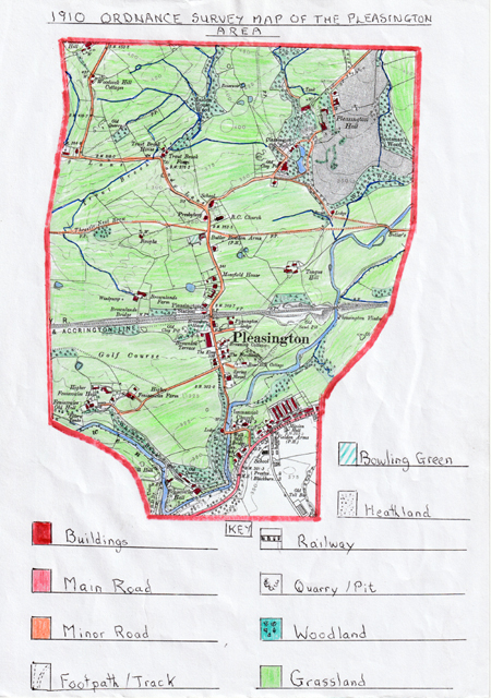
The 1910 Ordnance Survey Map of the Pleasington Area
During the 62 years that had passed since 1848, settlement in the area had increased as we entered the Edwardian period. Although the settlement remained scattered in the north, with individual farms, there was now a nucleus of houses in the centre of the village running laterally along Victoria Road. This shows an infill of properties, including Victorian Brownlow Terrace, named after the ancient farm buildings shown on the 1848 map.
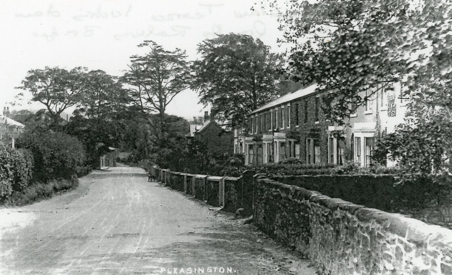
Brownlow Terrace from the railway bridge in the early 1900s
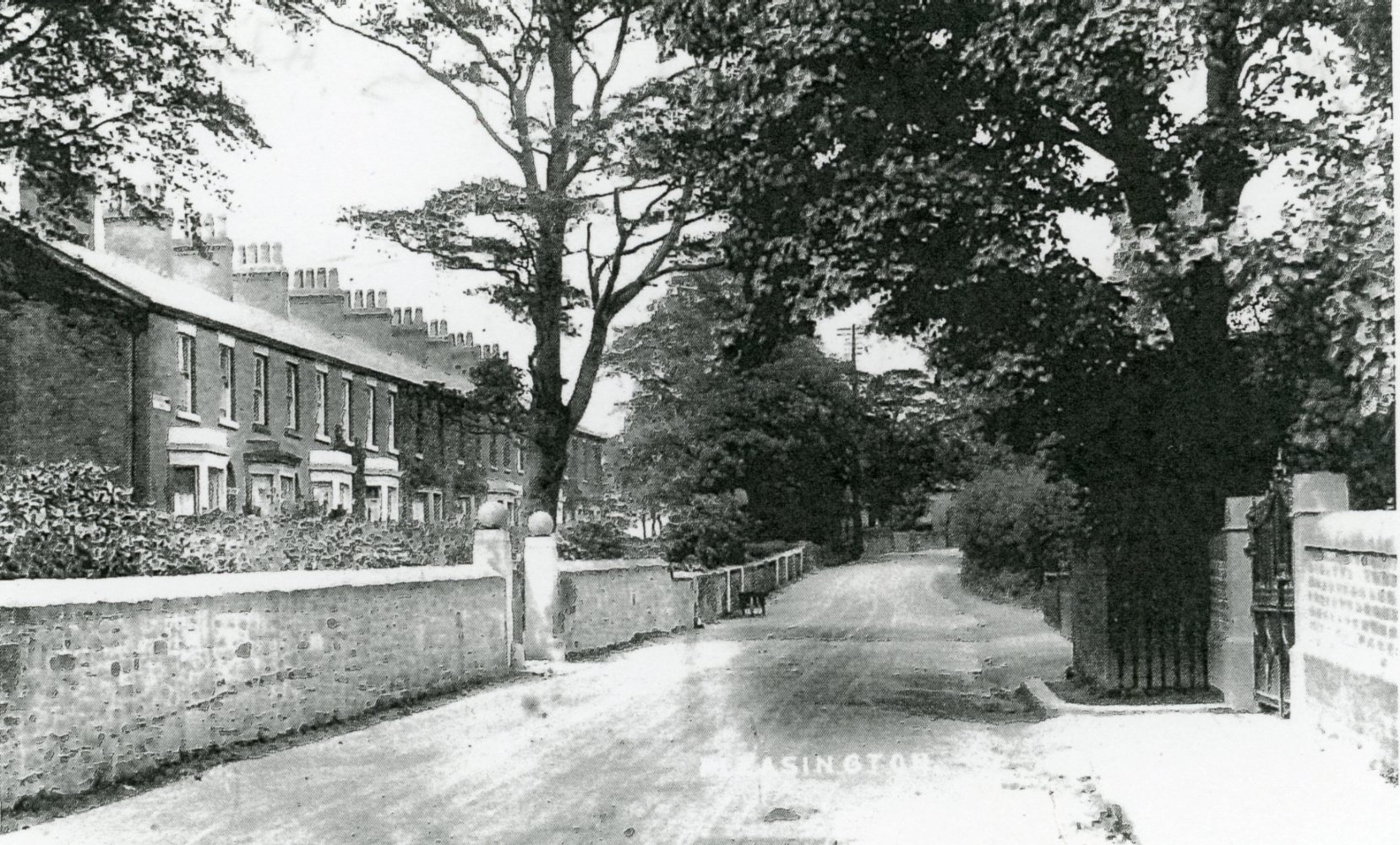
Brownlow Terrace towards the railway bridge and the Railway Hotel in the early 1900s
To the south of the area there was a cluster of farm buildings around Feniscowles Old Hall and around Feniscowles Hall by the River Darwen. To the east of Immanuel Church a new group of Victorian/Edwardian terraced streets had developed. To the north of the railway there were some larger detached properties, probably of the Edwardian period, as more prosperous people from Blackburn moved out into quieter and more attractive rural locations.
Linked to the increase in buildings was the number of old clay and sand pits visible on the map, which would have provided local building materials along with stone from Alum Scar. Farms in the area now had extra buildings to house farm machinery and provide winter quarters for cattle, e.g. Higher Feniscowles Farm, Brownlands Farm, Feniscowles and the farms belonging to Pleasington Hall.
Since 1848 Pleasington Old Hall had been upgraded by the Butler‑Bowden family, and an imposing lodge/gatehouse built at the entrance to the driveway up to the hall from the lowland fields, which later became Pleasington Fields. The lodge was a two‑storey stone‑built detached property with impressive gates at the entrance. At the same time Pleasington New Hall (Pleasington Hall) had also been rebuilt in 1887 on 60 acres of land by William Henry Hornby, a textile magnate who had previously rented the earlier property and held society parties and garden fetes for the local gentry. However, in time the property declined and was eventually demolished.
By 1887 the families of Ainsworth, Houghton and Southworth of Salmesbury Hall were the chief landowners in the Pleasington area. The map also shows that much of the rising land to the east of the halls was rough pasture or heathland. At this time Feniscowles Hall had been abandoned by the Feilden family and its grounds used as a pleasure park up to the First World War.
On the transport front, the Preston to Blackburn railway line was upgraded in the 1910s/1920s with two tracks, and the station therefore acquired a second platform as more regular services were introduced, allowing locals to commute to work.
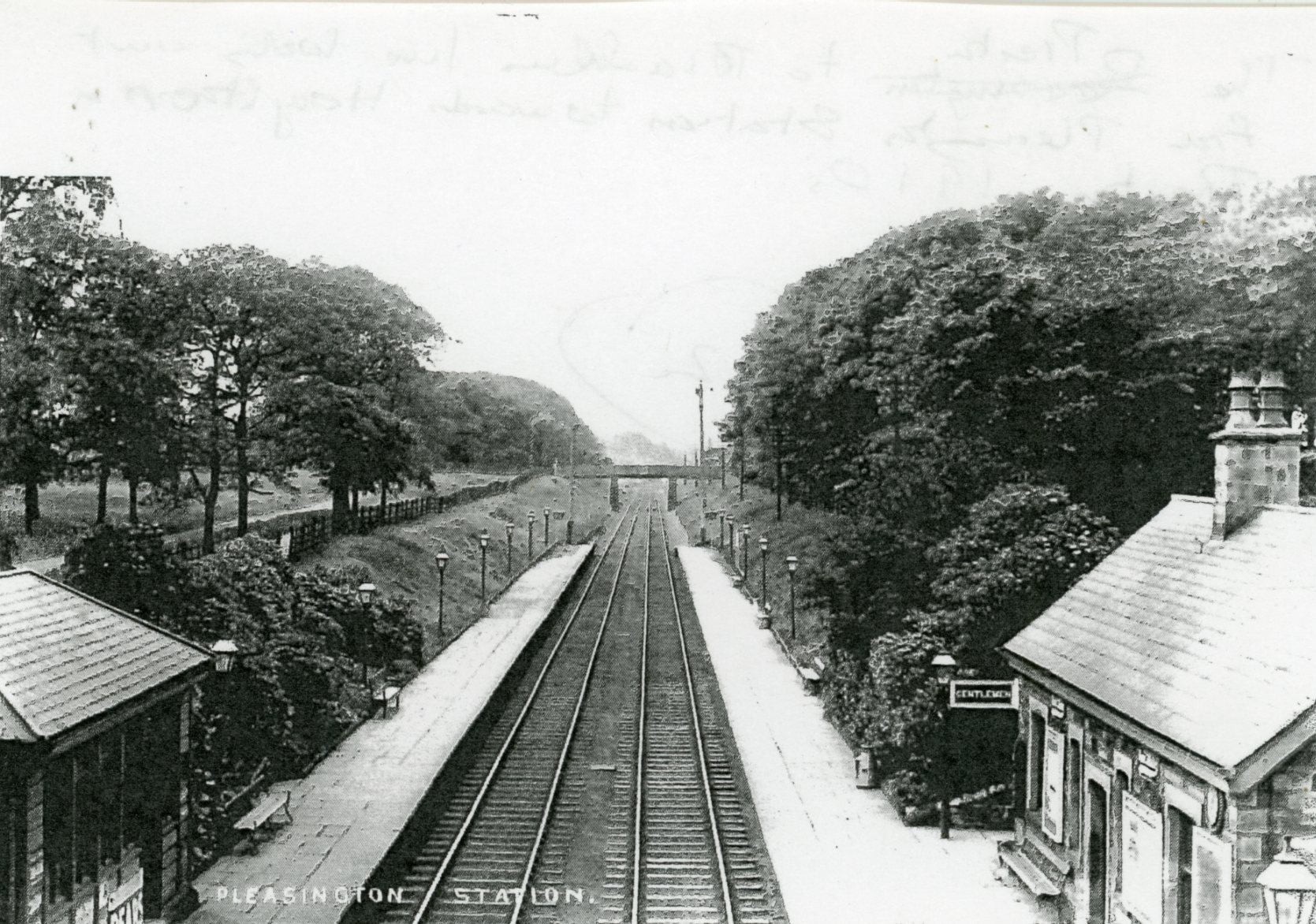
The Preston to Blackburn railway line looking from Pleasington Station
towards Houghton and Preston in c 1910
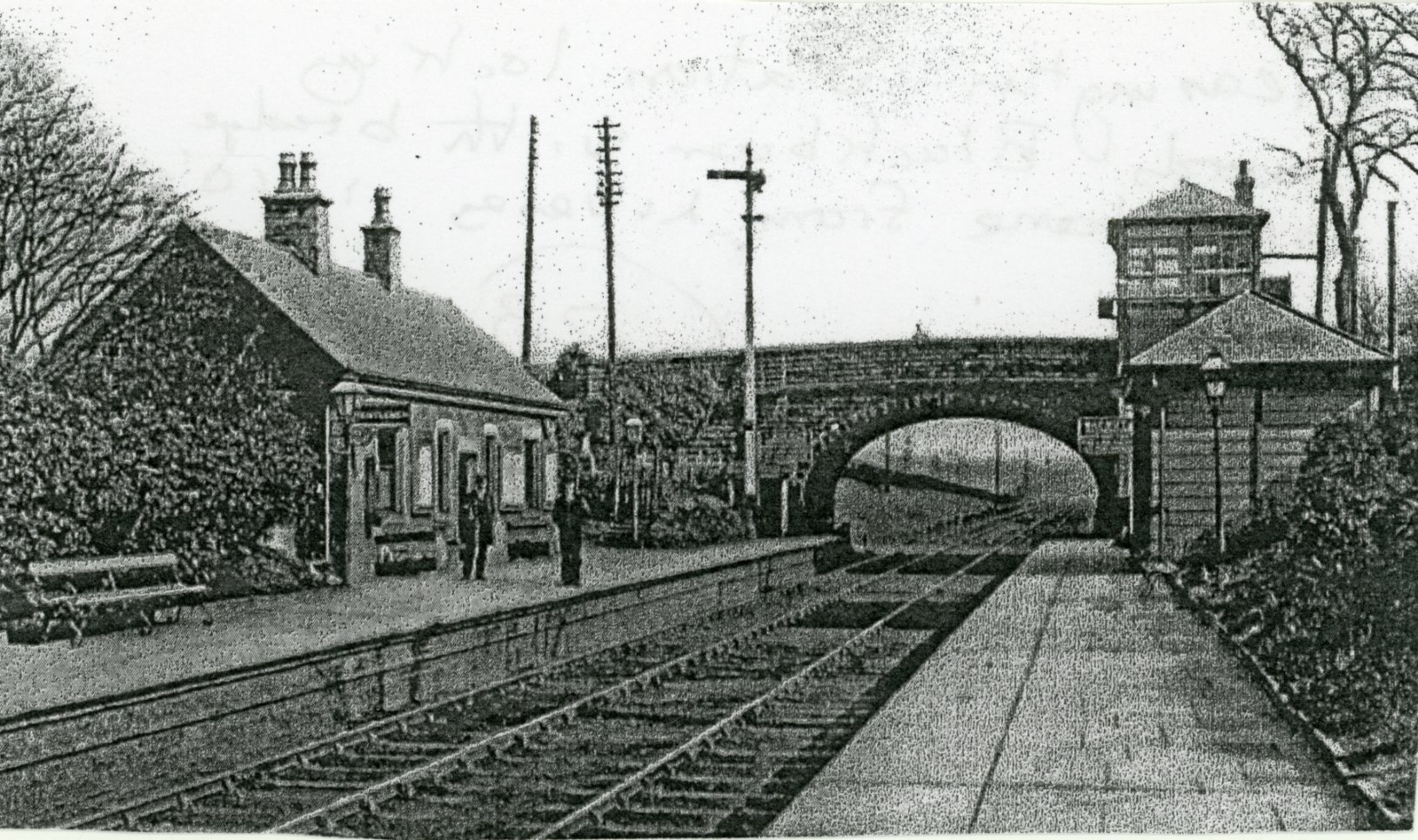
Pleasington Railway Station looking towards Blackburn, with the railway bridge
taking the lane from Livesey over to Cherry Tree c 1910s
By 1910 the roads had been greatly upgraded with better surfaces, and former tracks to outlying farms were now minor lanes. Little motorised transport had yet been introduced, so horse transport remained important.
The field pattern of the area had changed little, although some farmland had been lost adjacent to Victoria Road where new houses had been built. Woodland in the area had also reduced by 1910, especially around Roughs Farm, due to the building of Brownlow Terrace and two other properties, and where Pleasington Golf Club had been established from 1891, first as a nine‑hole course taking up land previously belonging to Brownlands Farm. At this time Pleasington Golf Club did not yet have a designated clubhouse.
By 1910 workers had more leisure time as working hours had been reduced, leading to the development of new sports facilities. This can be seen on the map with two crown green bowling greens established at both the Butler‑Bowden Arms and the Railway Hotel, providing them with more trade opportunities, especially as the bowling clubs at both establishments joined local crown green bowling leagues.
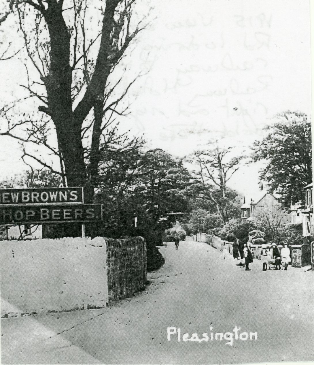
A view along Victoria Road looking towards the railway bridge with the Railway Hotel
on the right and a sign for ales sold at the hotel on the left
In 1910 Pleasington Priory celebrated its centenary with a garden party in Pleasington Hall’s grounds, which over time had been extended. By 1910 Blackburn Cemetery had been transferred to Pleasington by Blackburn Borough Council, on land in a natural hollow above a steep‑sided ravine known as Scotsman’s Wood, sited to the east of Pleasington Hall’s grounds. Over time it was extended onto land owned by the authority. The cemetery was moved here as Blackburn’s original cemetery on Whalley New Road had closed when it became full.
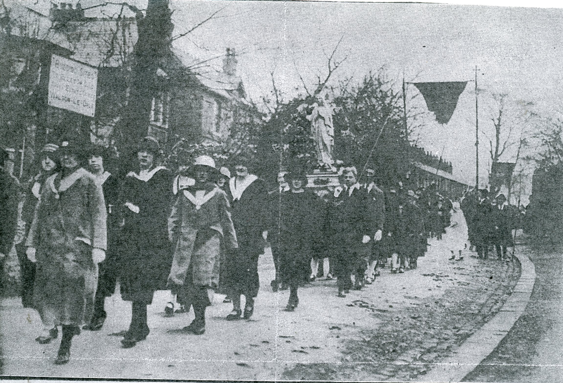
A church parade from Pleasington Priory travelling along Victoria Road in the 1920s
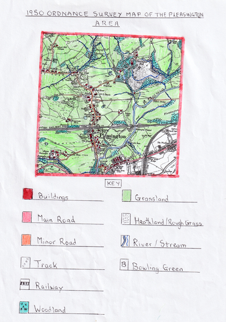
The 1950 Ordnance Survey Map of the Pleasington Area
This map indicates that the Pleasington area had not changed greatly over the preceding 40 years, except for the village beginning to expand after the two world wars, which had limited growth. By 1950 there had been an increase in house building along Victoria Road, Sandy Lane and Enoch Brow, extending the earlier lateral growth. This was particularly evident on the stretch of Victoria Road north of the railway to the Priory and along Sandy Lane, where spaces were infilled with new houses, some of which were large Edwardian semi‑detached and detached properties with extensive gardens. These were taken up by middle‑class families moving out of Blackburn centre for more attractive nearby rural settings.
Housing of a more mixed type, including bungalows, was built in elevated positions along Sandy Lane during the late 1940s. Pleasington New Hall (Pleasington Hall) was now abandoned, with the last occupant being Sir Henry Hornby, who left in 1914. Pleasington Old Hall was still owned by the Butler‑Bowdens and had been continually upgraded as a working farm. By 1938 Blackburn Council, who had purchased the lands of Pleasington Hall, agreed to establish a new cemetery on the land, which opened in 1943. Shortly afterwards the Council agreed to build a crematorium in the cemetery, which finally opened in 1955.
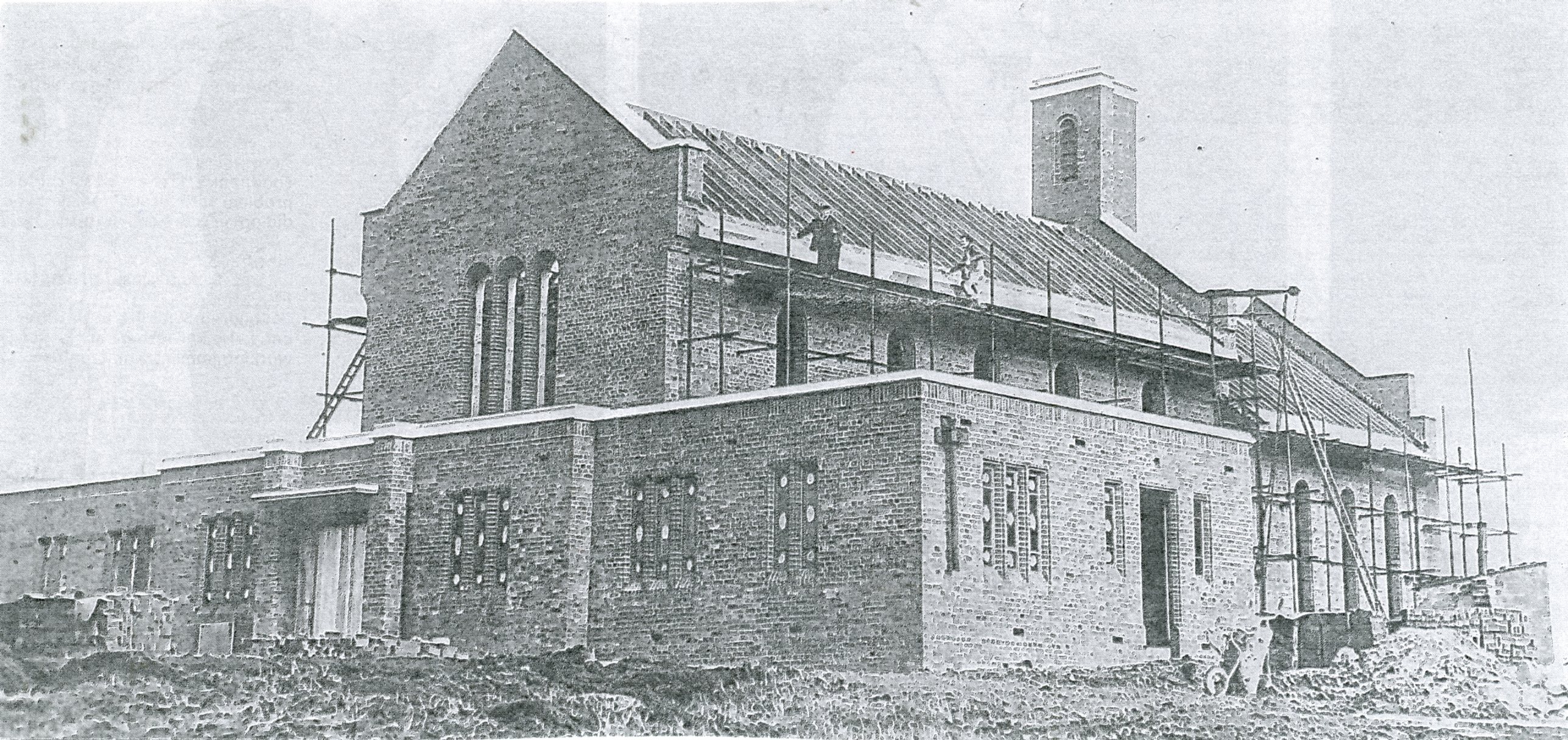
Pleasington Crematorium under construction in 1956
Access to the cemetery was from the lowland farmland (later Pleasington Playing Fields) via a long driveway extended from the one formerly used to access Pleasington Old Hall. Feniscowles New Hall was now derelict, having been abandoned for some time. The village of Pleasington had earlier been connected to the main line telephone system and had its exchange updated in 1955 to become automatic.
On 9 June 1910 Pleasington Golf Club opened its impressive clubhouse for its members.
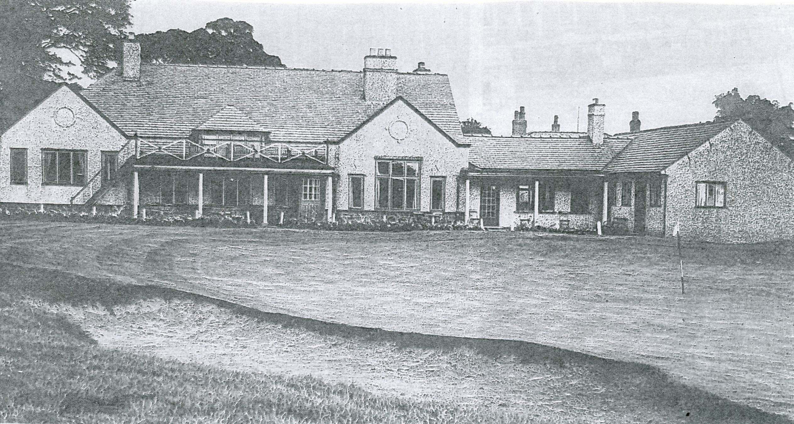
Pleasington Golf Club’s clubhouse in the 1940s the 18th‑hole putting green
is in front with excellent views from the building over the course
At the same time the course was extended to 18 holes, with eight new holes developed on the north side of the railway, reached by a wooden bridge across the lines, and an extra hole added on the existing side. By 1950 the golf club had seen additional changes to upgrade its quality. The bowling clubs at the Railway Hotel and the Butler Arms continued to grow and increase their involvement in local leagues. Like the golf club, the bowling clubs after 1910 allowed lady members to join and take part, eventually forming local leagues.
The Pleasington area still had no industry, although farming families now used increased automation and fewer labourers. In the 1920s a railway branch line was created to merge into the Preston to Blackburn line from Chorley and had its own goods yard at Feniscowles.
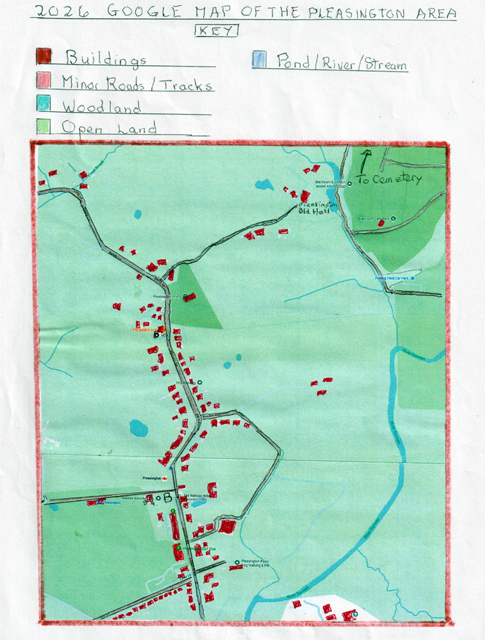
The 2026 Ordnance Survey Map of the Pleasington Area
Over the last 76 years the village of Pleasington has seen some growth in housing, especially with semi‑detached and detached properties along Links Lane alongside the golf course, and further houses along Bowden Avenue and Rose Hill Road. Pleasington Golf Clubhouse was demolished and rebuilt as a large modern clubhouse in 1997 via a benefactor. A number of existing older properties, including farmhouses, have been modernised or renovated, with several former farmhouses now private homes.
Feniscowles Old Hall (Higher Feniscowles Hall), with its outbuildings, has been divided and redesigned into a number of exclusive detached properties on the outskirts of the golf course. Pleasington Old Hall still exists and is now a private period detached home, and Pleasington Hall was demolished in the 1960s, with some of its outbuildings converted into modern detached properties.
Other modern changes include the Butlers Arms, now a restaurant with a large external verandah built out into the bowling green. The Railway Hotel also developed an outdoor seating area around the side of the bowling green. Both establishments have seen major internal upgrades to attract customers from outside Pleasington.
The golf course saw a major alteration in 2014 when Network Rail completed a million‑pound project to construct a new bridge over the railway, as the old wooden bridge had been removed in the early 1960s and replaced with an unmanned crossing to access the extra holes. In October 2017 the top floor of the golf clubhouse was converted to take business tenants, with car parks extended earlier to cater for increased motor vehicles. Today the golf course continues to attract golfers from afar and in 2026 will be the Open Golf Club for the North‑West.
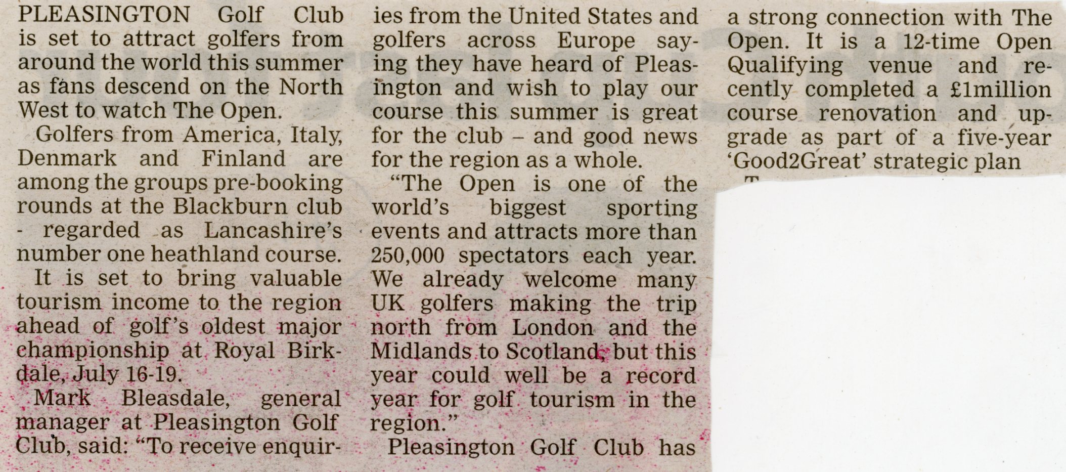
A newspaper article from 2026 in respect of attracting golfers coming to watch The Open and picture of the golf course
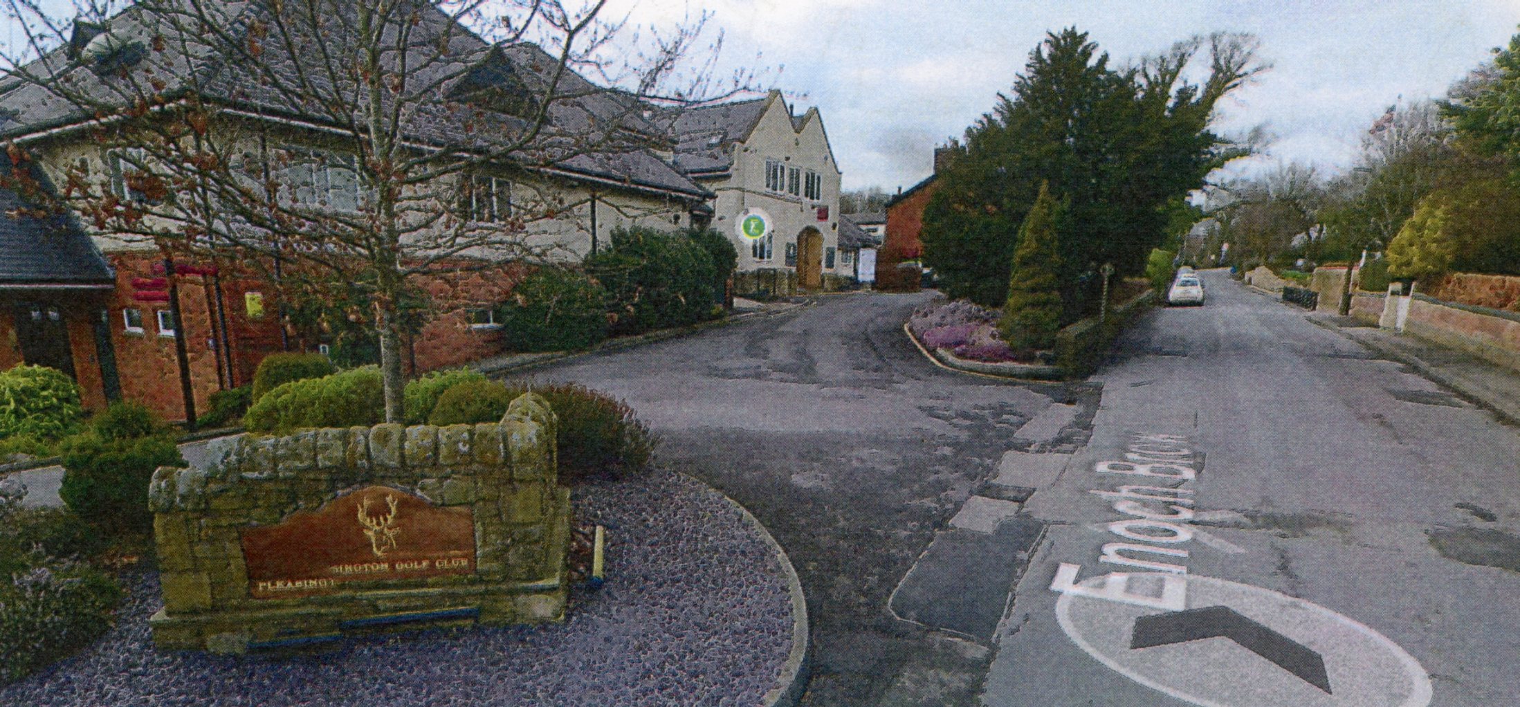
Pleasington Golf Course clubhouse and entrance from Victoria Road
Blackburn Borough Council took over the lower farmland of Pleasington Old Hall and developed it into the extensive Pleasington Playing Fields, opened in 1963 by Prince Philip, Duke of Edinburgh, who named them King George’s Fields. These are used extensively for the Borough’s football and cricket teams, who make use of the modern changing facilities which have been continually upgraded. Witton Country Park in modern times has been upgraded with increased leisure facilities and has been connected to Pleasington Playing Fields by a new bridge over the River Darwen.
During the 1960s Pleasington Priory required £30,000 of repairs and almost closed but was saved, and in 1988 had three windows installed from St Mary’s R.C. Church at Islington off Darwen Street, Blackburn, after it was demolished. The Priory’s original organ, which came from the dining room of Pleasington Old Hall, was replaced in 1973 by an organ taken from Lancaster Cathedral. By 2026 the Priory has been given a Grade I listing as a historical edifice.
Pleasington is now on the National Cycle Network 6, one of the main national bicycle routes in the UK. Although Pleasington still has no industry, there is a small number of local service businesses indicated on the Google Map.
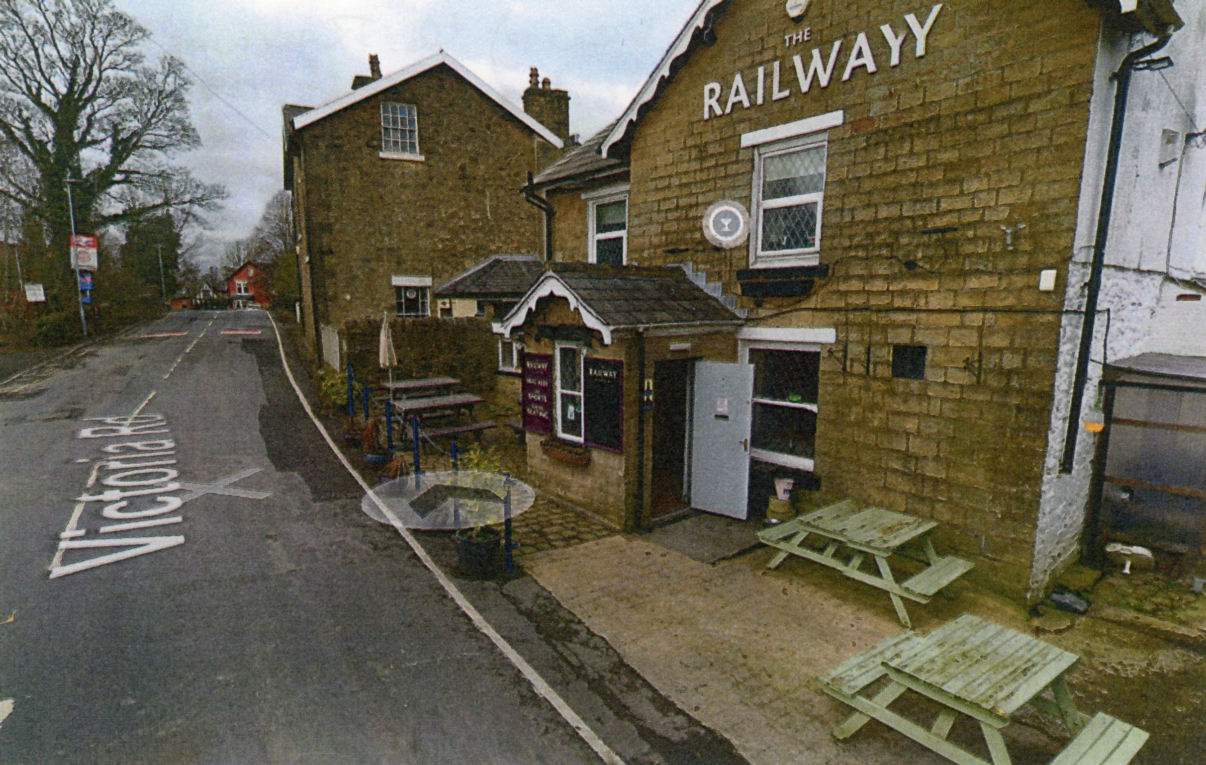
Railway public house on Victoria Road with the railway bridge beyond

The Railway public house bowling green and car park
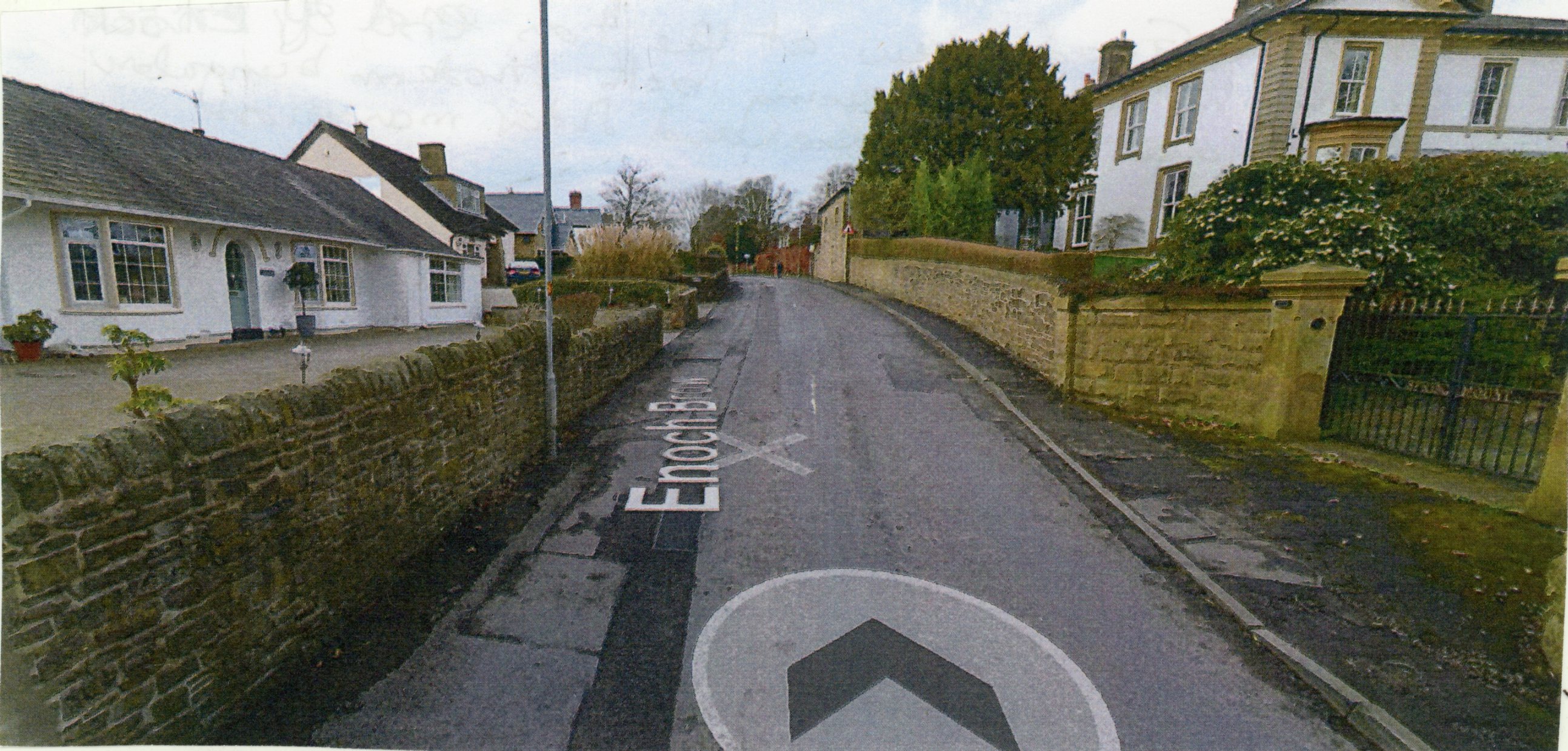
Old and new property on Enoch Brow
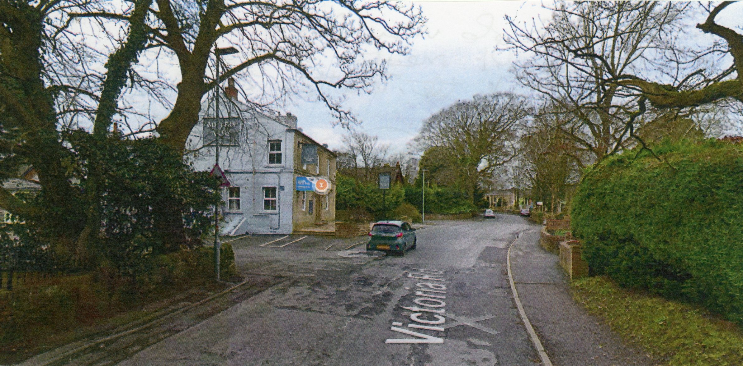
Victoria Road today with the Butlers Arms on the left
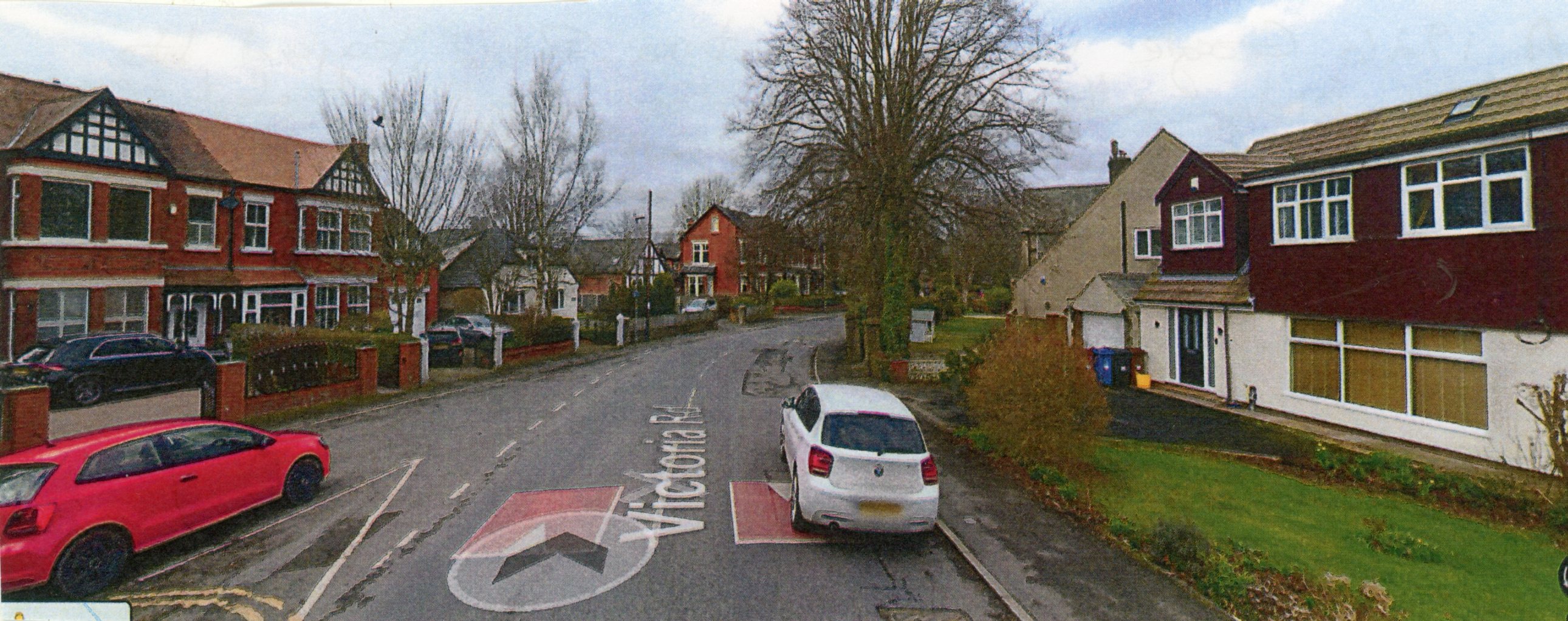
Victoria Road beyond the railway with large Edwardian semi‑detached house
on the left and modern detached houses on the right.
Today Pleasington is an attractive rural village which is purely residential, with a population in 2011 of 446, little changed from the past, and a place which provides attractive amenities for new families and visitors to enjoy.
Resources
The author's own local history collection
Abram, W. J., History of Blackburn,Town and Parish
Barrett’s Trade Directories – various years held in Blackburn Library
Beattie, Derek, Blackburn: A History, Carnegie Publishing, 2007
Child, Stephen Martin, A History of Pleasington Priory, 2010
Ordnance Survey Maps (Blackburn Central Library) plus Google Maps
The Victoria County History of Lancashire (A History of the County of Lancaster, Volume 6)